Inicio » Projects » Road Intersection at Lincoln and Kennedy Streets
Road Intersection at Lincoln and Kennedy Streets
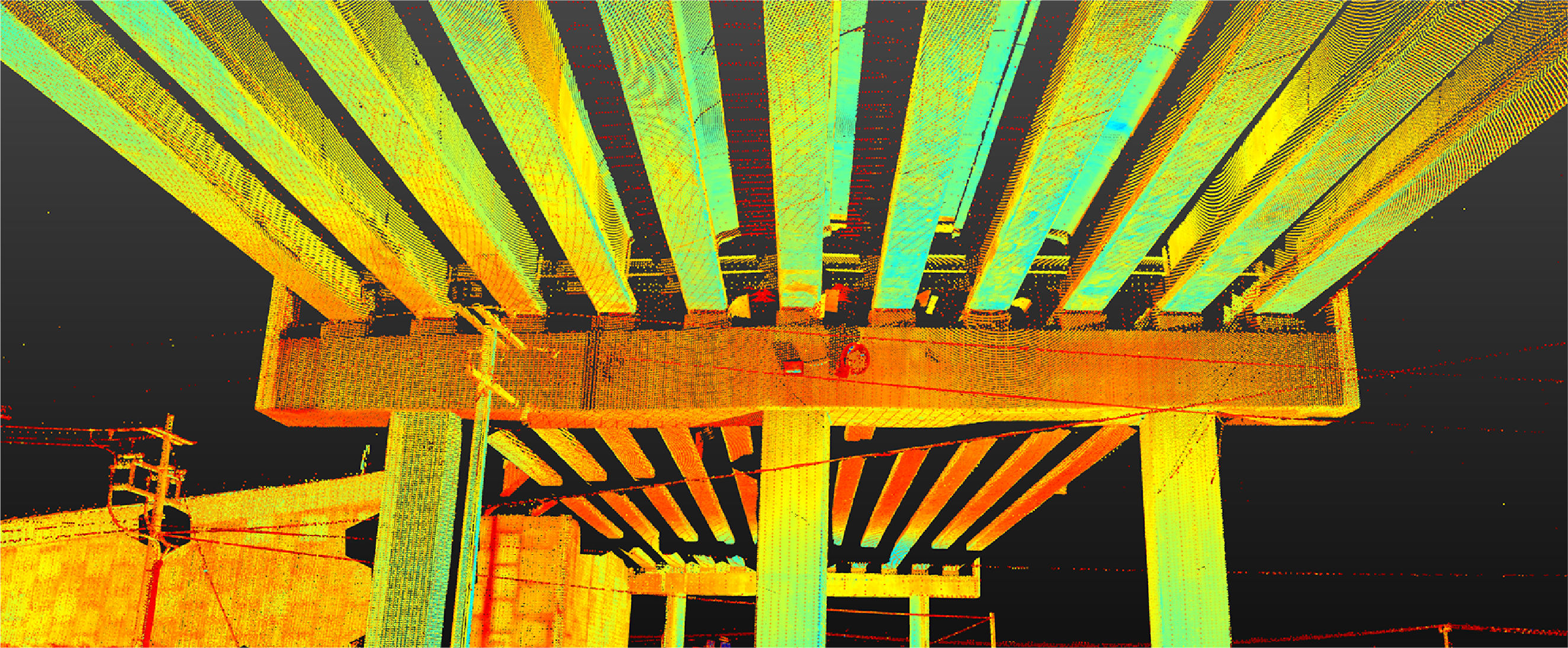
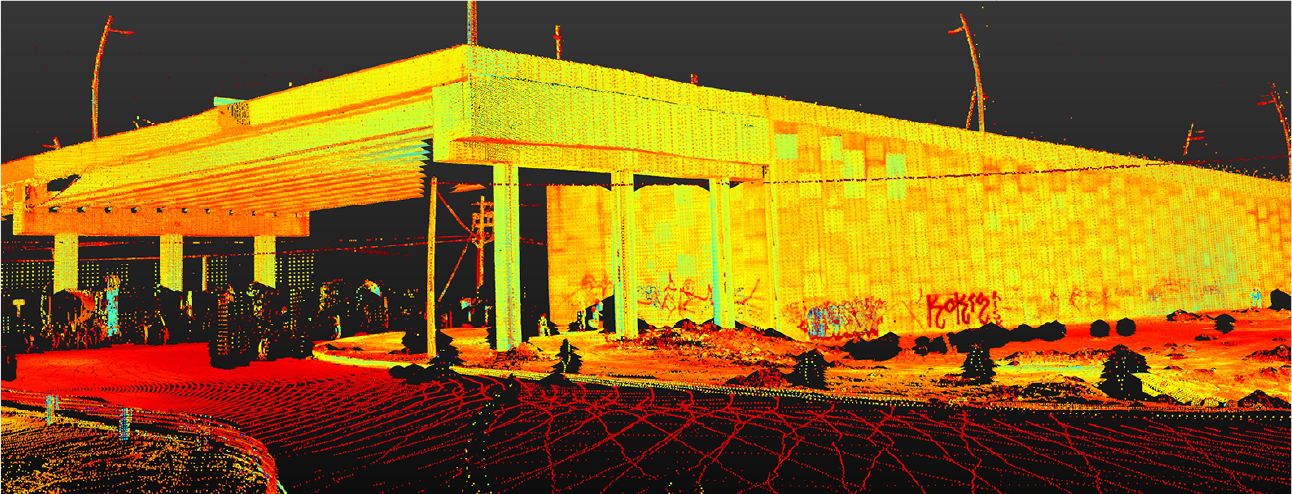
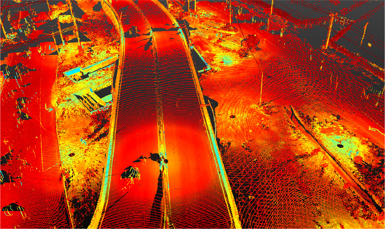
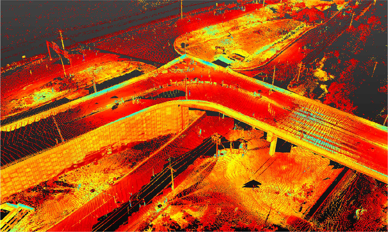
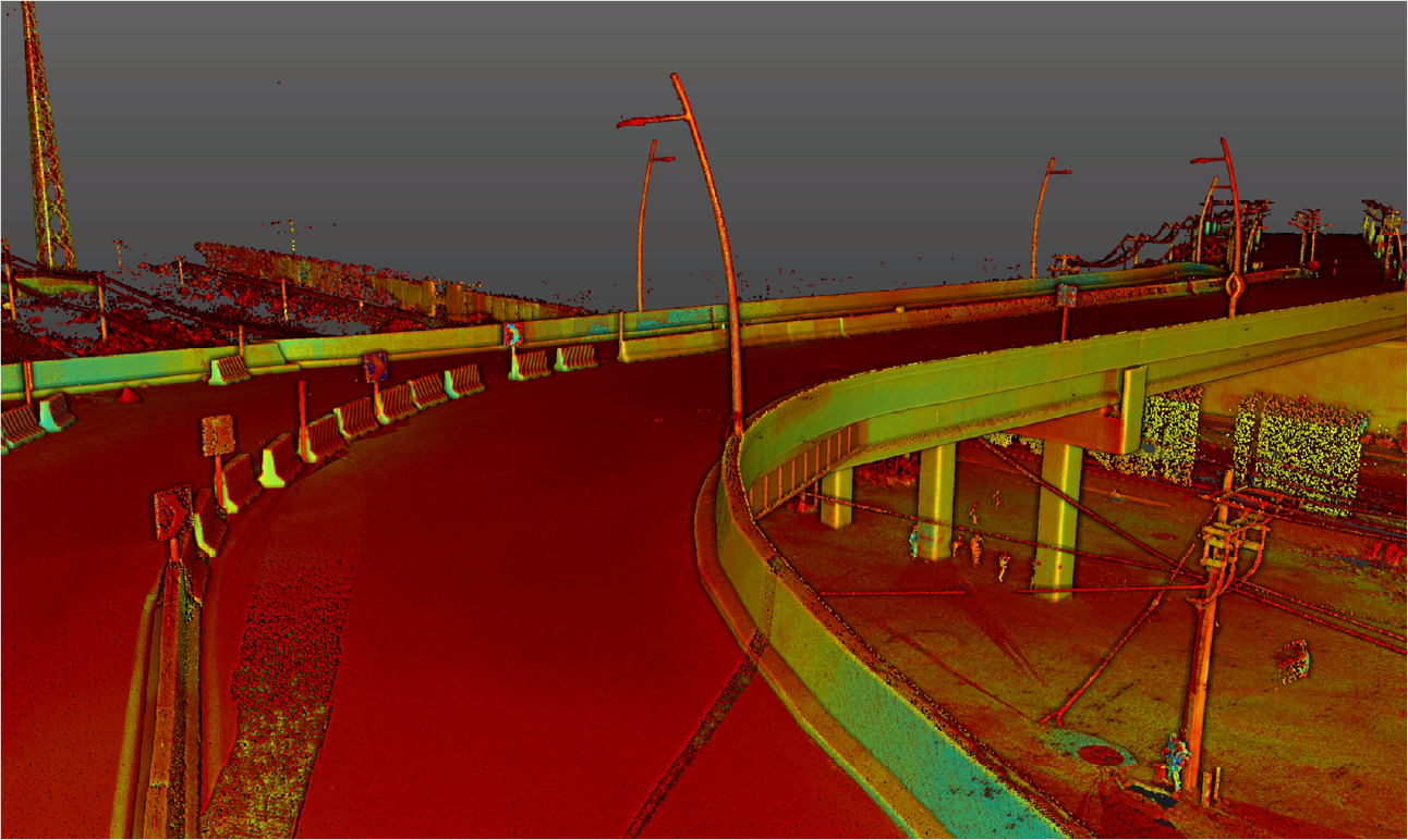
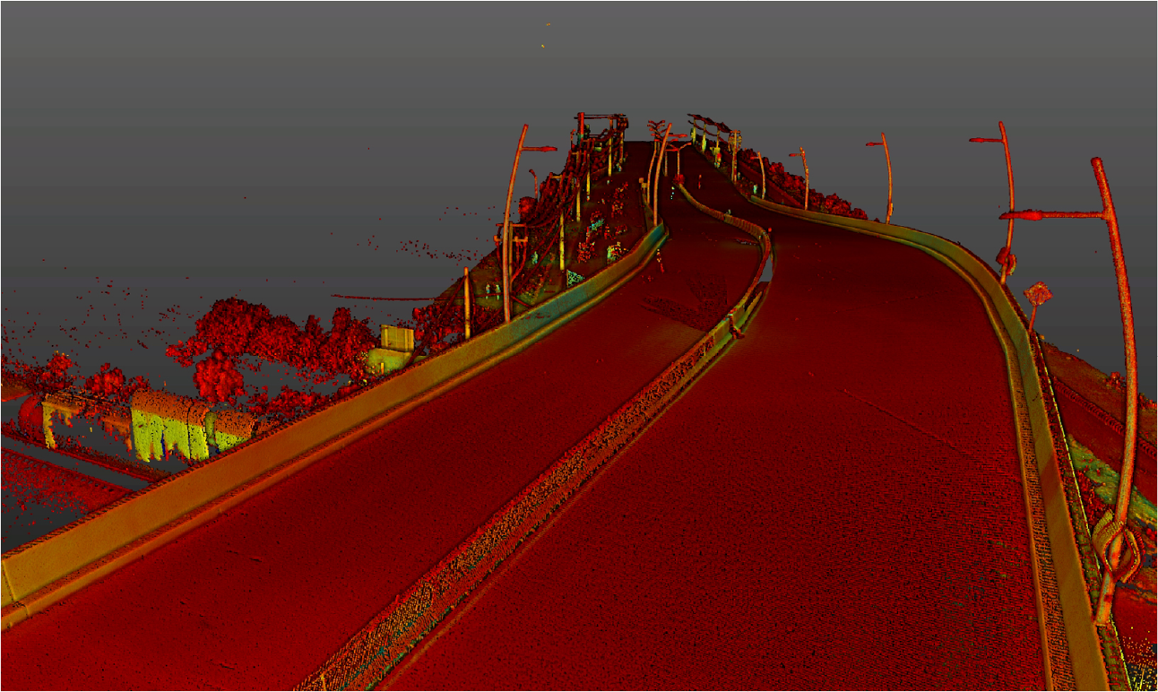
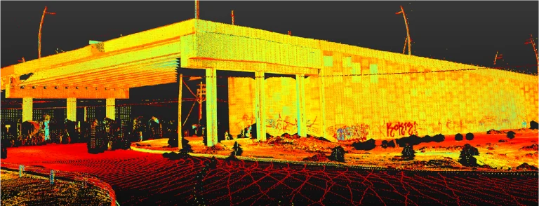
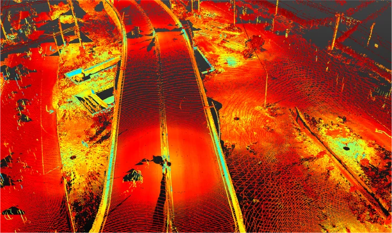
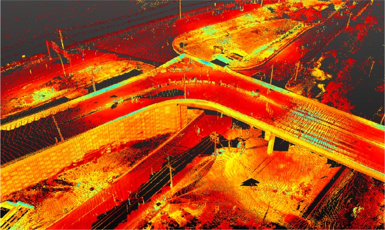
A point cloud survey was carried out using laser scanning for construction monitoring at a road intersection, accurately documenting progress and the current conditions of the civil structure. This process ensured execution aligned with the project plans and specifications.
Client:
Vidusa
Location:
García, México
Year:
2019
REALITY CAPTURE
Terrestrial laser scanning
Terrestrial laser scanning captured precise data on the terrain and existing structures, providing a solid foundation for the intersection’s design. It facilitated progress monitoring, the detection of deviations, and risk analysis in critical areas, optimising resources and ensuring accuracy at every stage of the road project.
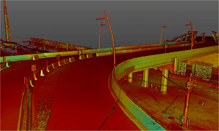
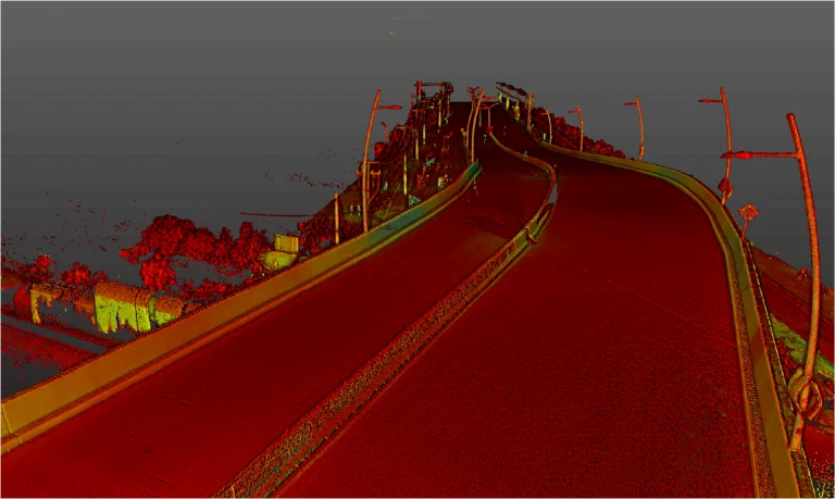
A point cloud survey was carried out using laser scanning for construction monitoring at a road intersection, accurately documenting progress and the current conditions of the civil structure. This process ensured execution aligned with the project plans and specifications.
REALITY CAPTURE
Terrestrial Laser Scanning
Terrestrial laser scanning captured precise data on the terrain and existing structures, providing a solid foundation for the intersection’s design. It facilitated progress monitoring, the detection of deviations, and risk analysis in critical areas, optimising resources and ensuring accuracy at every stage of the road project.