In this project, Reality Capture was carried out using terrestrial laser scanning and 360° photography in order to document the existing conditions and ensure accuracy in the project’s development.
Subsequently, this information was used as the basis for the creation of a detailed BIM model, oriented both to room design and machinery movement analysis. In this way, planning was optimized, and site activities were executed more effectively, reducing risks and increasing operational efficiency.
Client:
Grupo Vidanta
Location:
Playa del
Cármen, México
Year:
2019
REALITY CAPTURE
digital photography
DIGITAL MODELS
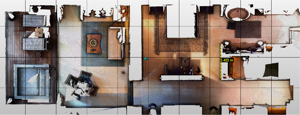
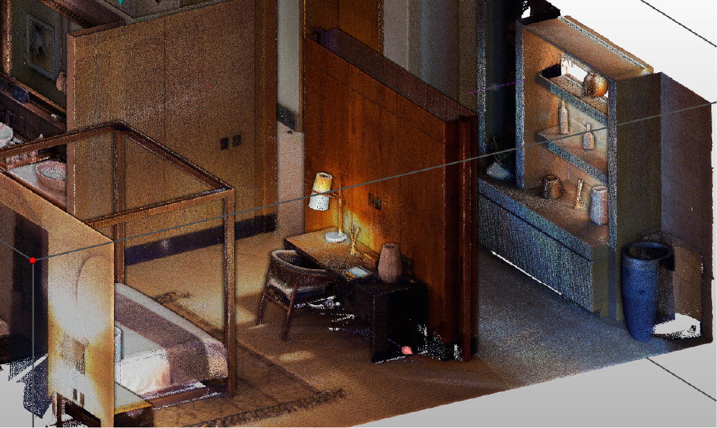
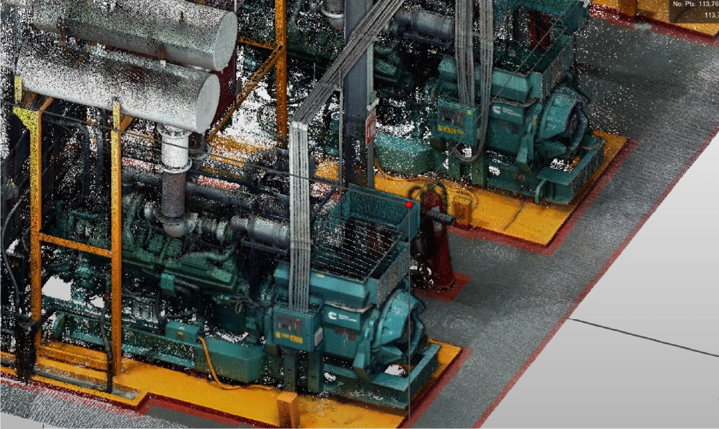
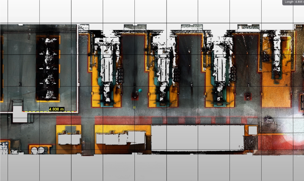
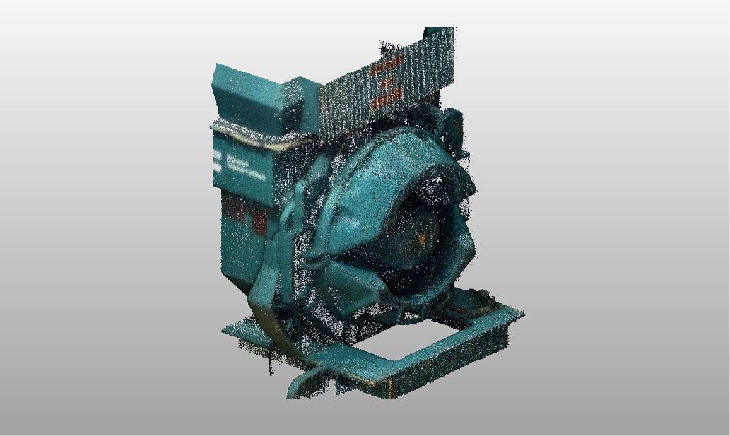
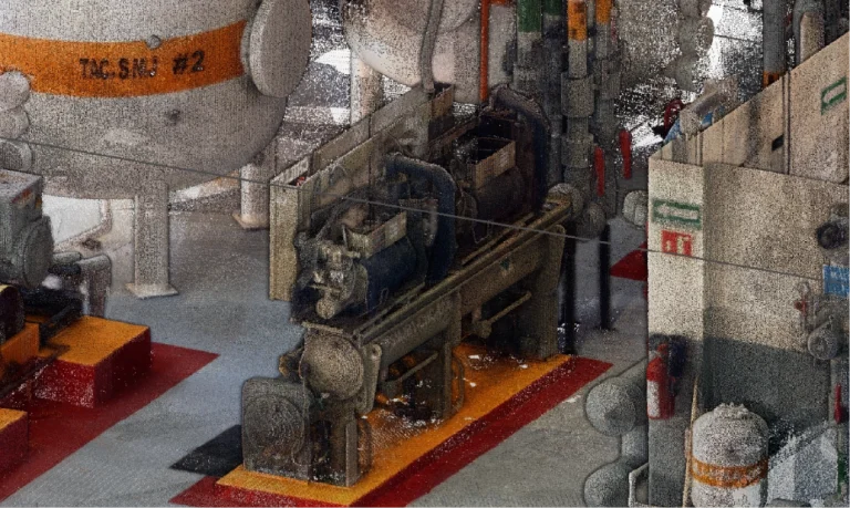
Laser scanning
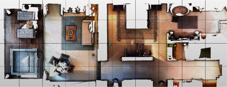
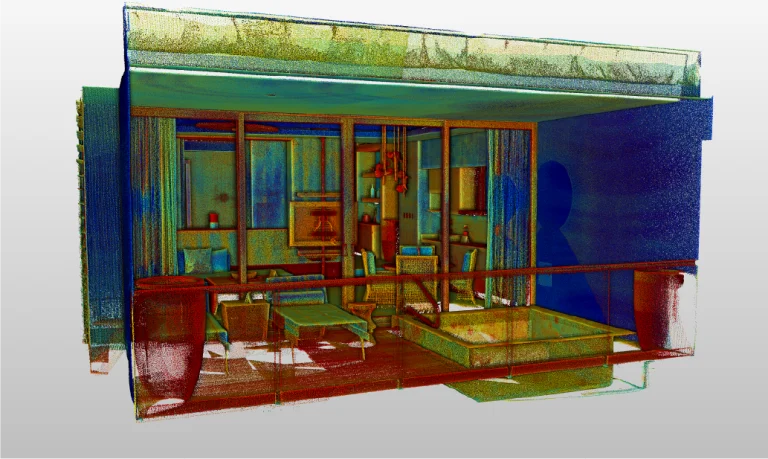
In this case, laser scanning made it possible to capture high-precision data of the environment, generating a point cloud that documented the existing conditions in great detail.
Thanks to this technology, it was possible to accurately model both interior and exterior spaces, which facilitated the identification of clashes and ensured the feasibility of the proposed design solutions.
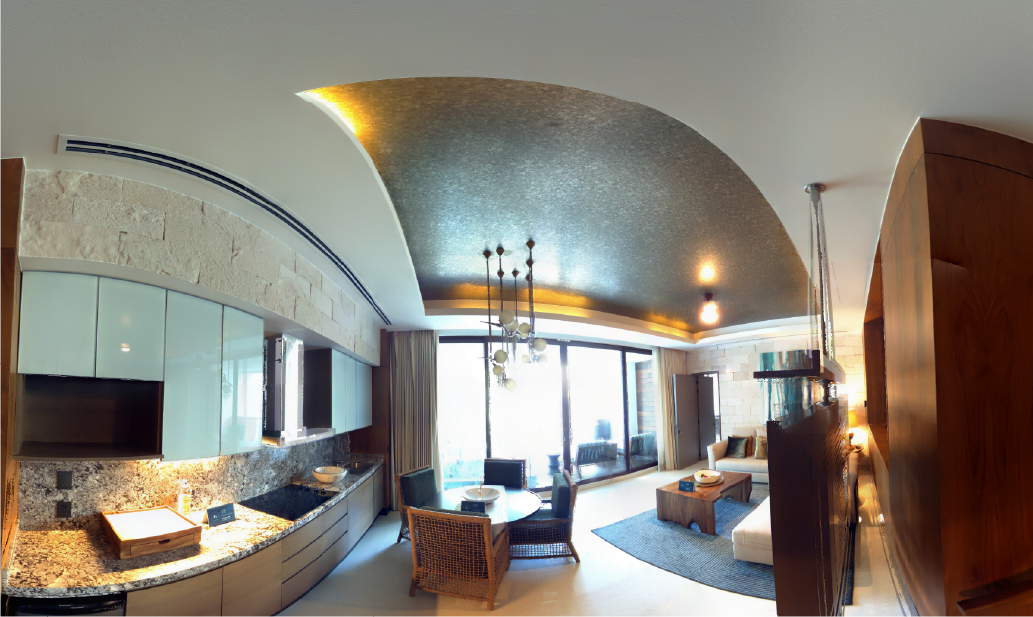
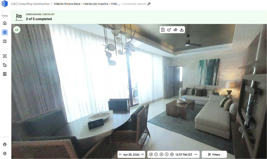
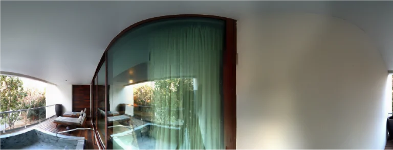
360 photography
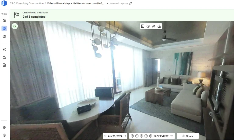
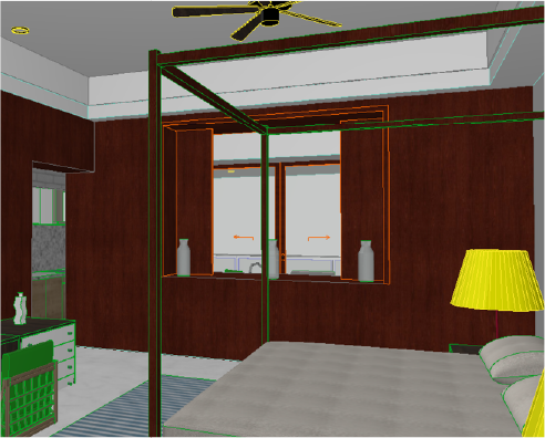
In this project, 360° photography was used to obtain a complete visual representation of the existing spaces.
In addition, these images complemented the point cloud, providing detailed visual context that facilitated remote review and enhanced the overall understanding of the environment.
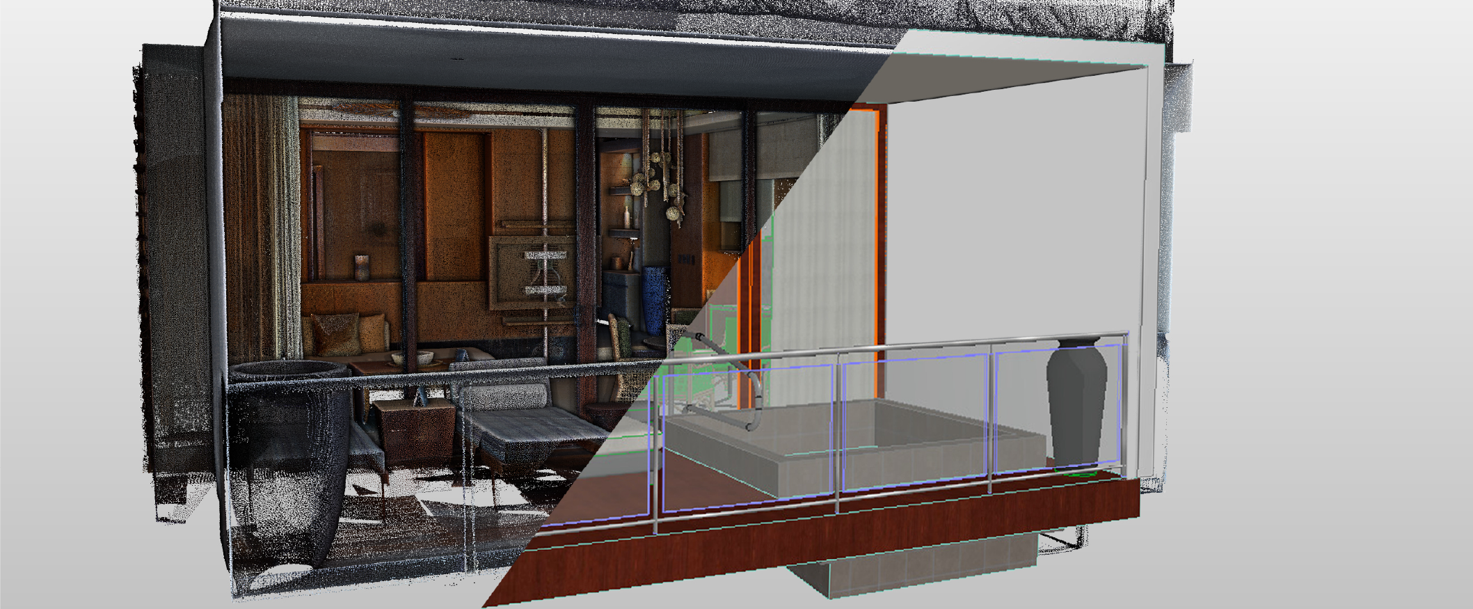
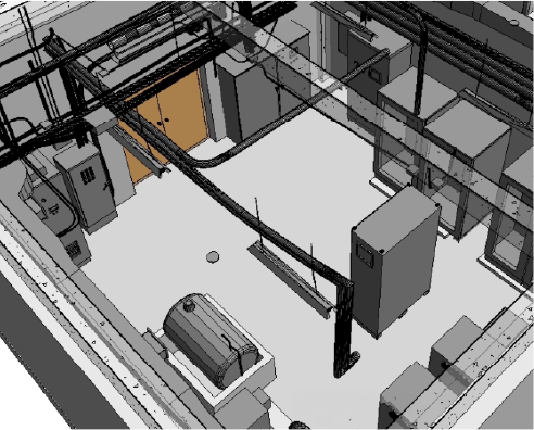
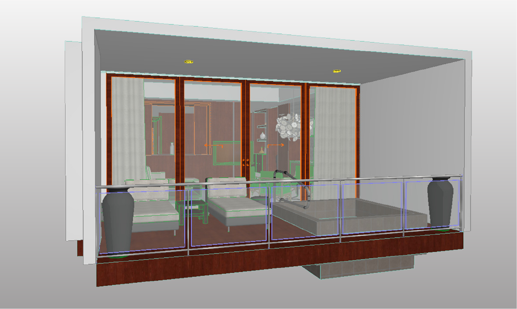
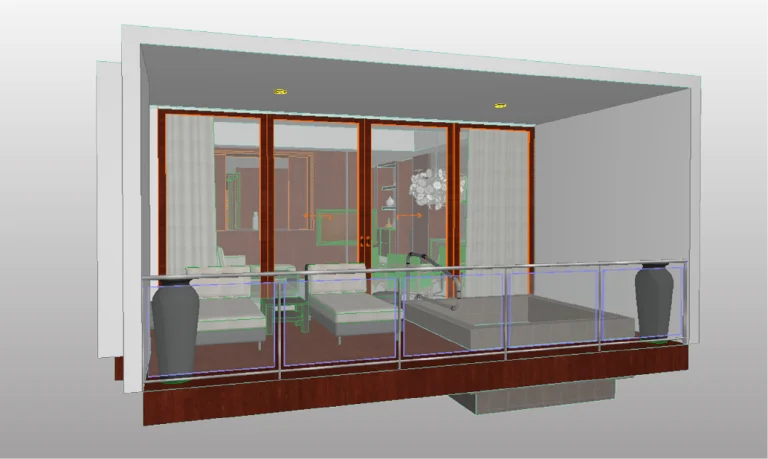
BIM (Building Information Modeling)
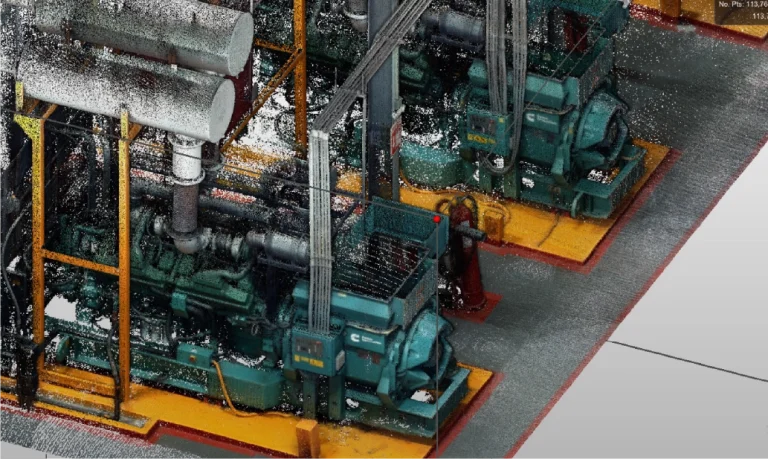
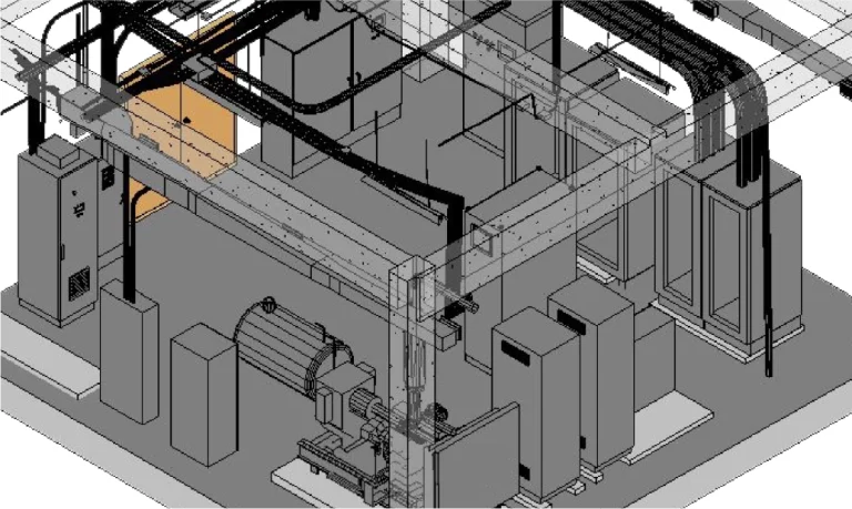
Based on the captured data, a BIM model was developed to integrate all relevant project information.
Thanks to this model, it was possible to accurately design the rooms and simulate machinery movements, which facilitated more efficient planning and optimized construction processes at every stage.
Reality Capture was carried out using laser scanning and 360 photography to document existing conditions and ensure precision in the project’s development. This information served as the foundation for creating a detailed BIM model, focusing on both room design and machinery movement analysis, optimising planning and execution on-site.
reality capture
Laser scanning
Laser scanning enabled the capture of precise environmental data, generating a point cloud that meticulously documented existing conditions. This technology was key to accurately modelling both interior and exterior spaces, identifying clashes, and ensuring the feasibility of proposed design solutions.
digital photography
360 photography
360 photography was used to obtain a comprehensive visual representation of the existing spaces. These images complemented the point cloud, providing a detailed visual context that facilitated remote review.
digital models
BIM (Building Information Modeling)
Based on the captured data, a BIM model was developed to integrate all relevant project information. This model would be used to precisely design the rooms and simulate machinery movements, enabling efficient planning and optimising construction processes.