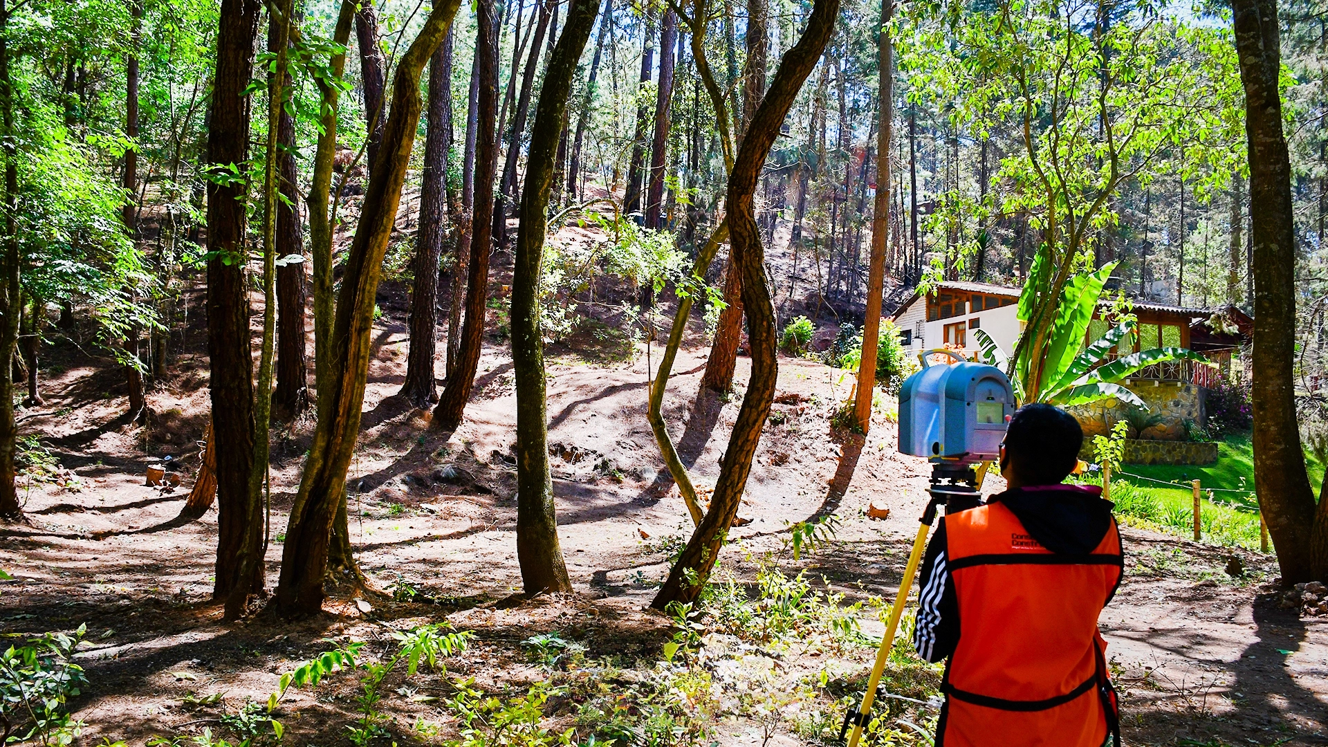
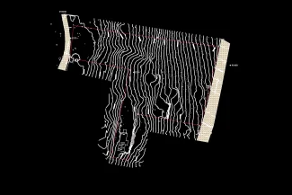
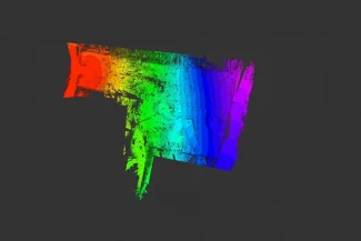
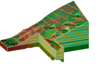
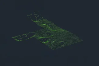
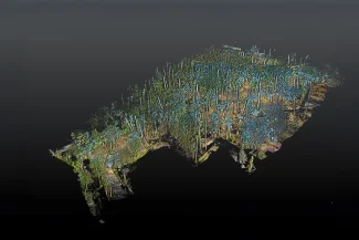
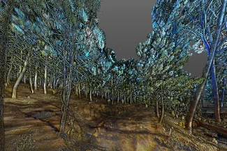
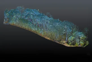
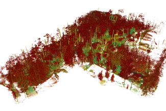
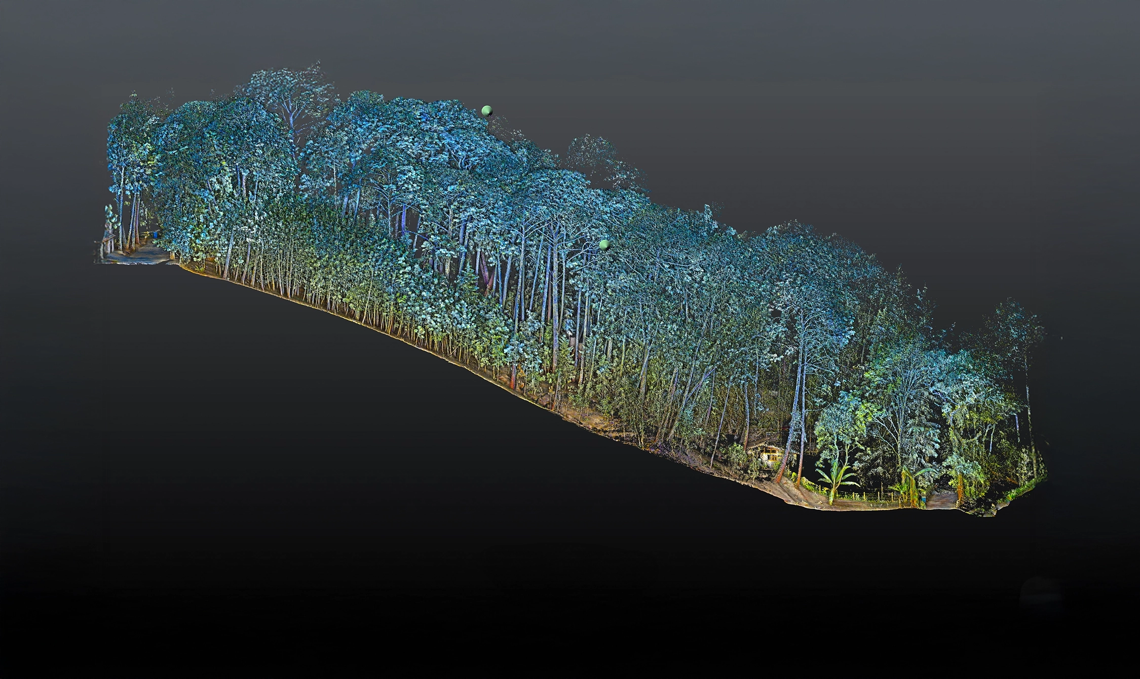
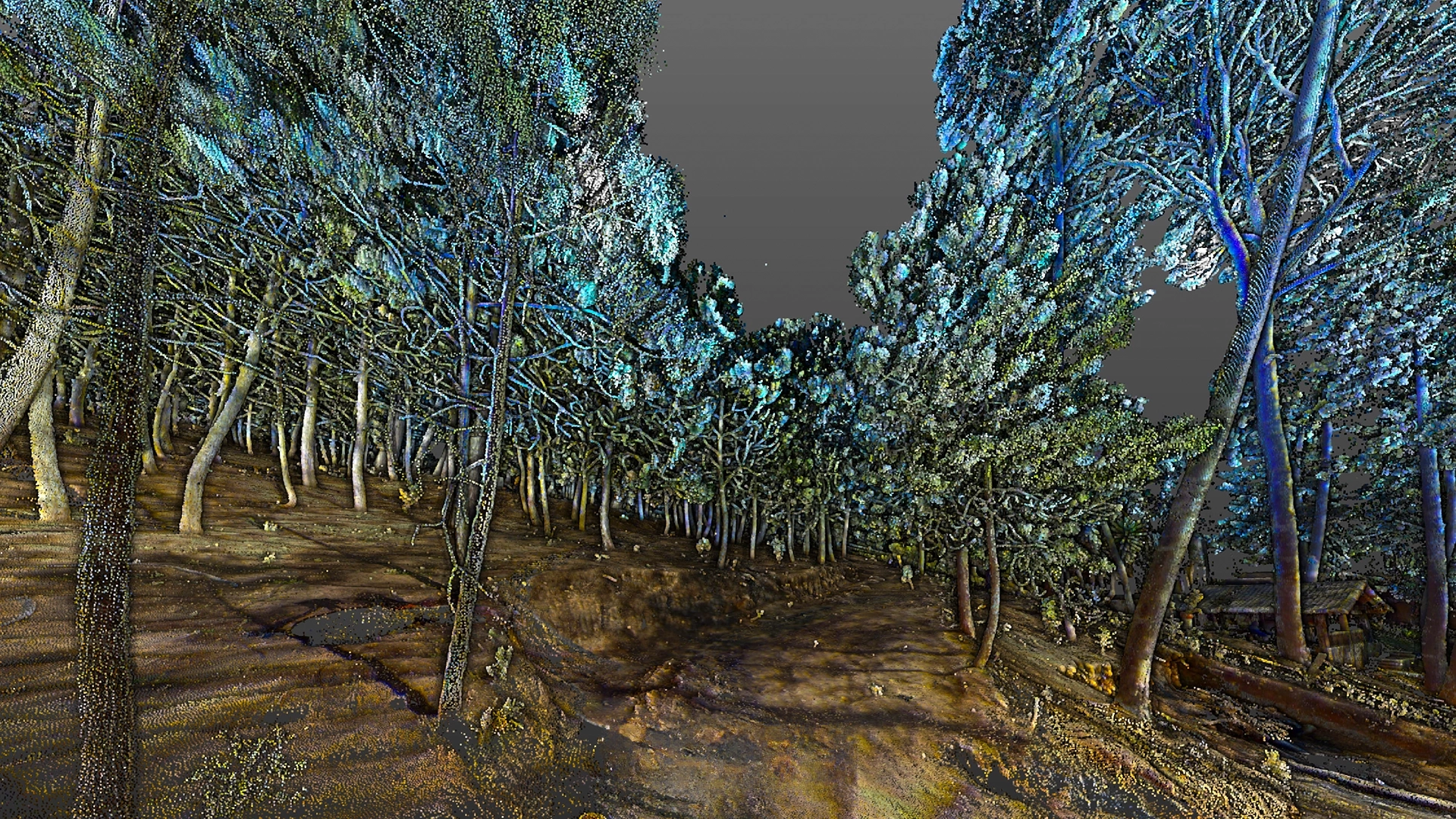
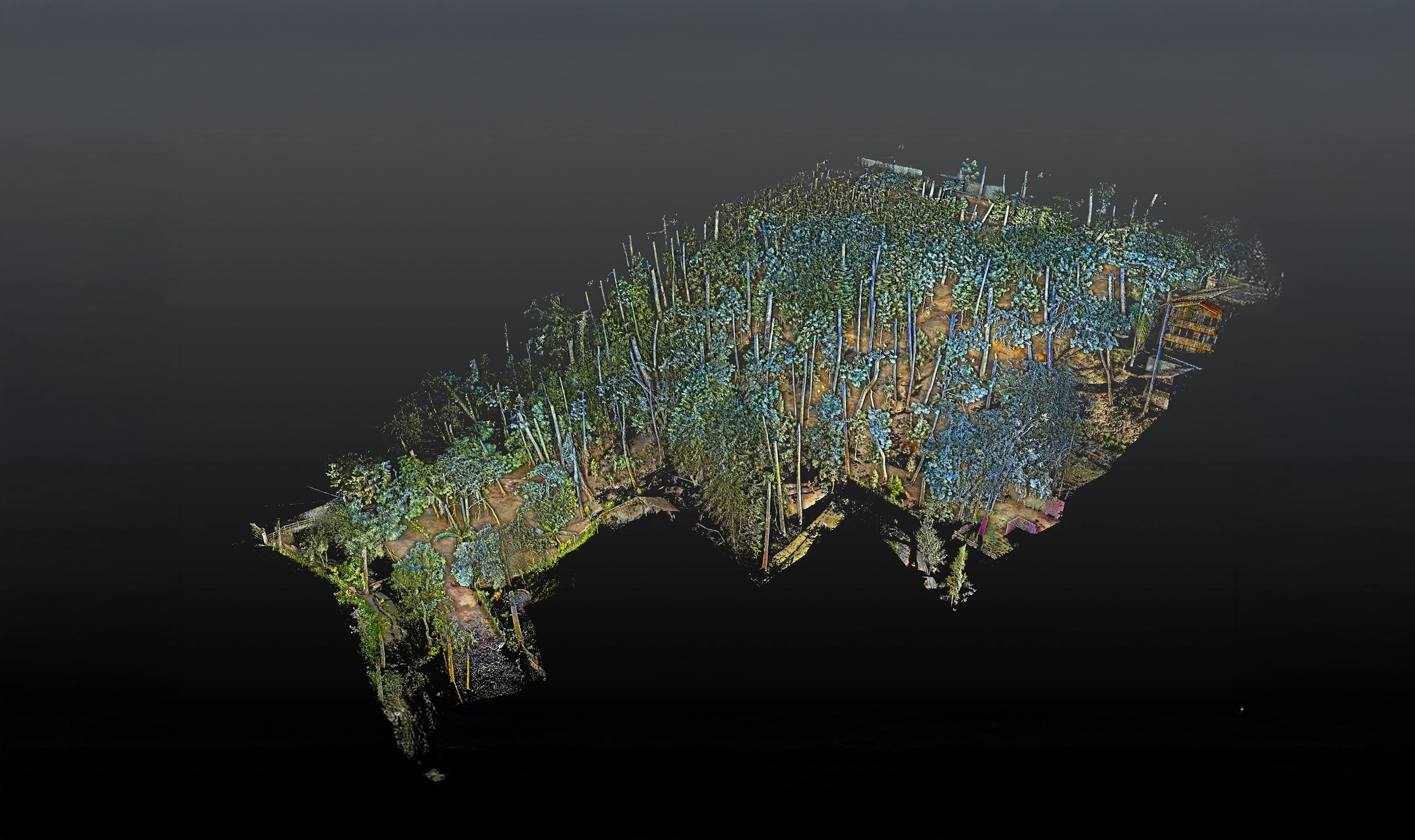
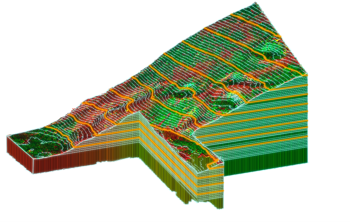
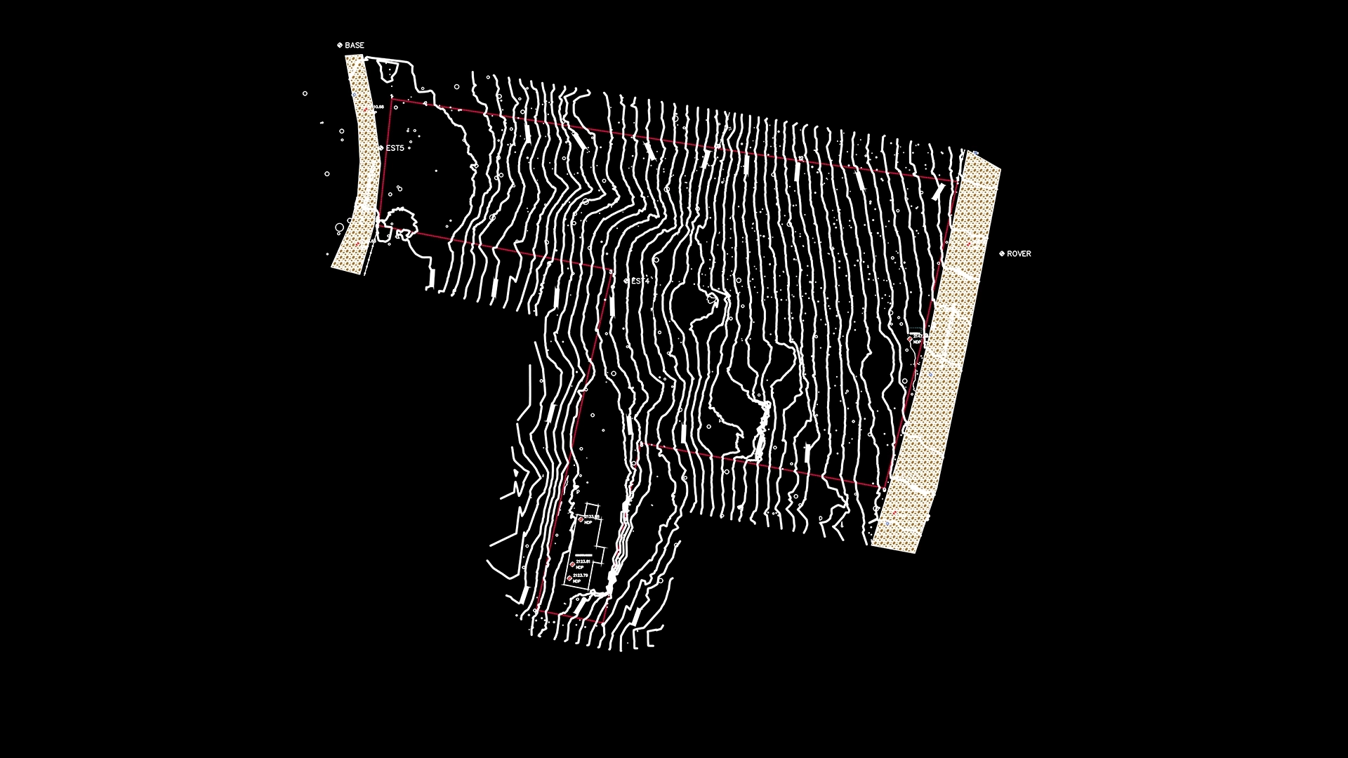
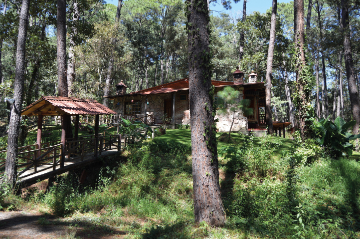
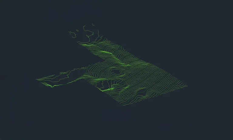
In this project, a topographic survey was carried out using terrestrial laser scanning, which generated contour lines, slope analysis, volume calculations, and a 3D model capable of representing the terrain even under dense vegetation.
Subsequently, the data was integrated into a GIS system, enabling a detailed site analysis and facilitating the planning of activities based on a solid foundation of geospatial information.
Client:
Particular
Location:
Mazamitla,
México
Year:
2019
REALITY CAPTURE
TERRESTRIAL LASER SCANNING
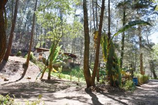
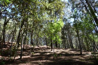
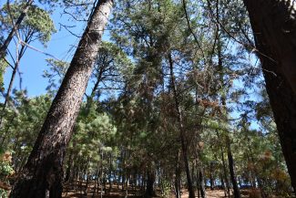
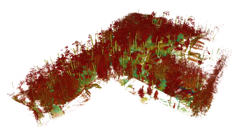
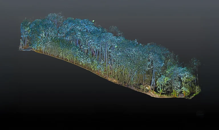
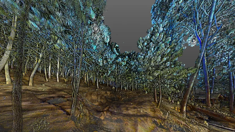
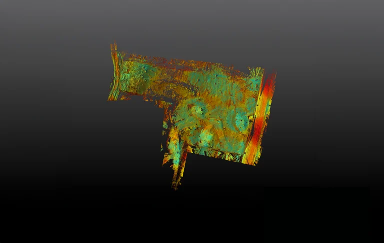
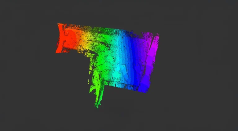
Millions of high-precision points were captured, accurately representing the terrain in great detail even under areas covered with dense vegetation.
In addition, the 360-degree recording made it possible to identify elevation changes, depressions, and tree distribution, providing a comprehensive view of the natural environment. Finally, the integration of this information with GIS systems facilitated a complete site assessment and supported the planning of specific interventions for the project.
A topographic survey was carried out using terrestrial laser scanning, generating contour lines, slope analysis, volume calculations, and a 3D model representing the terrain beneath dense vegetation. The data were integrated into a GIS system, enabling a detailed site analysis and facilitating activity planning with a solid geospatial information base.
REALITY CAPTURE
Terrestrial Laser Scanning
Millions of high-precision points were captured, accurately representing the terrain even beneath dense vegetation. The 360-degree recording allowed for the identification of level changes, depressions, and tree distribution. Integration with GIS systems facilitated site evaluation and the planning of specific interventions for the project.