Inicio » Projects » Sentura Shopping Center, Tlalnepantla
Sentura Shopping Center, Tlalnepantla
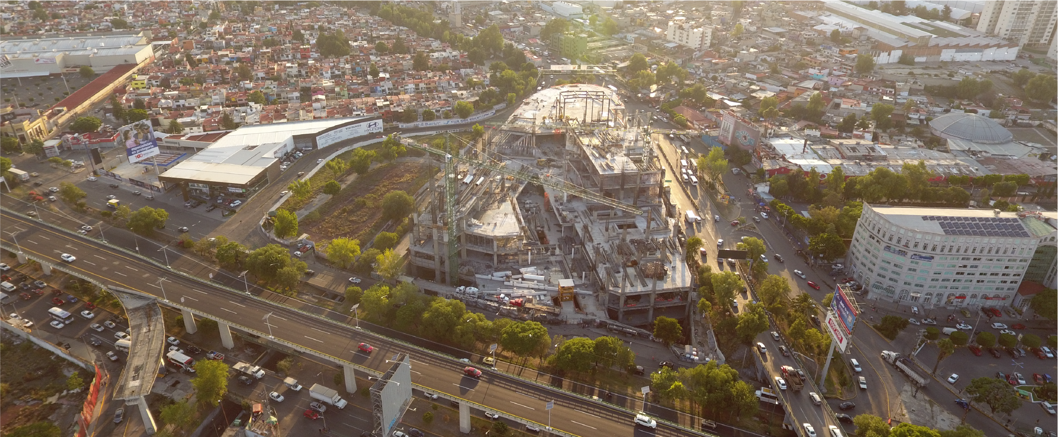
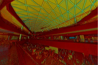
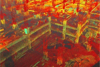
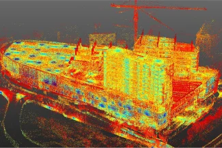
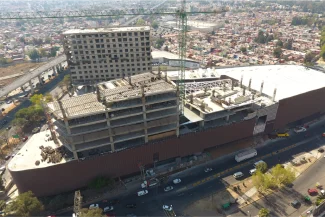
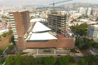
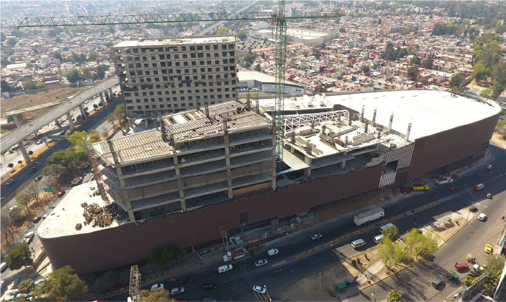
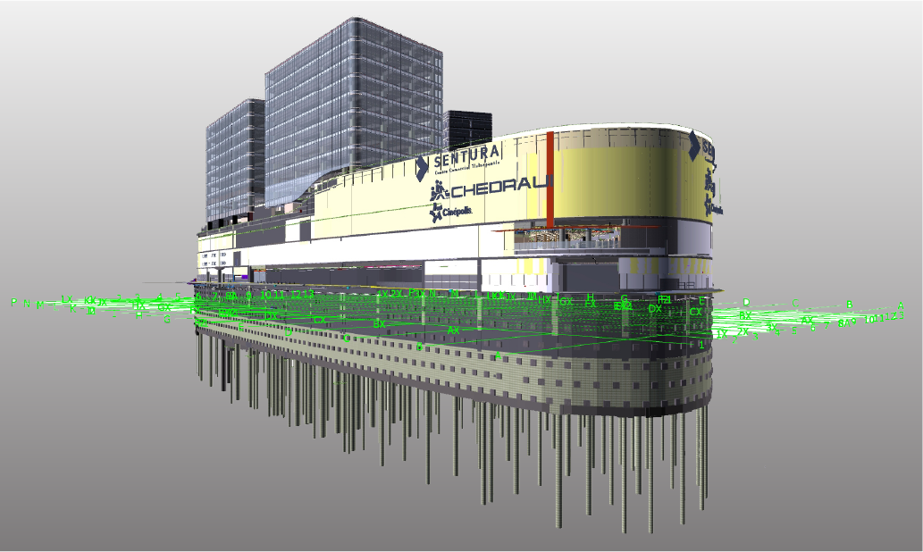
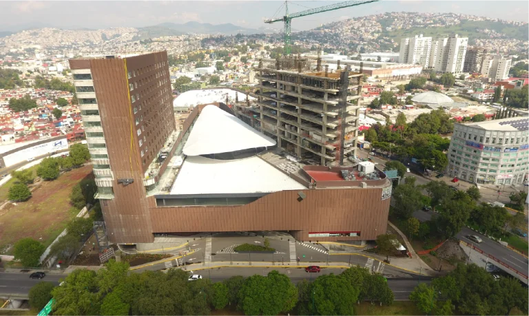
In this project, terrestrial laser scanning and aerial photography were carried out to accurately capture the existing conditions of the construction site.
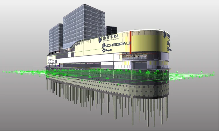
The data was integrated into a BIM model for planning and coordination, complemented by robotic layout with a total station to ensure the exact installation of on-site elements, and mixed reality to visualize and interact with the designs.
All project information was managed within a Common Data Environment (CDE), ensuring efficient collaboration and technical control at every stage.
Client:
Urbana
Location:
Tlalnepantla,
México
Year:
2019
REALITY CAPTURE
PHOTOGRAPHY DIGITAL
DIGITAL MODELS
FIELD TECHNOLOGY
EXTENDED REALITY
DATA SCIENCE
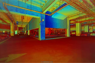
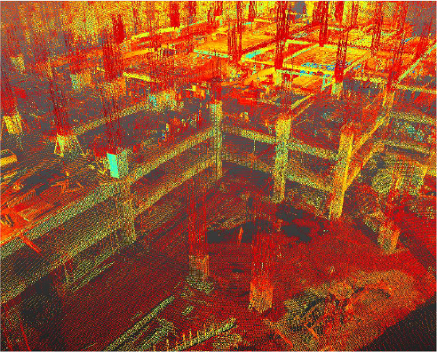
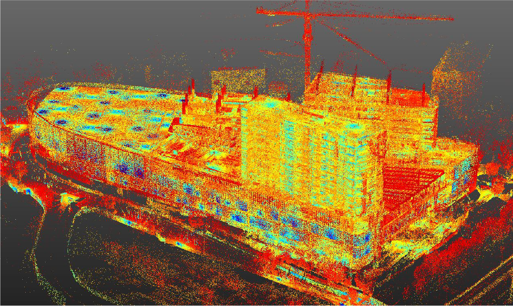
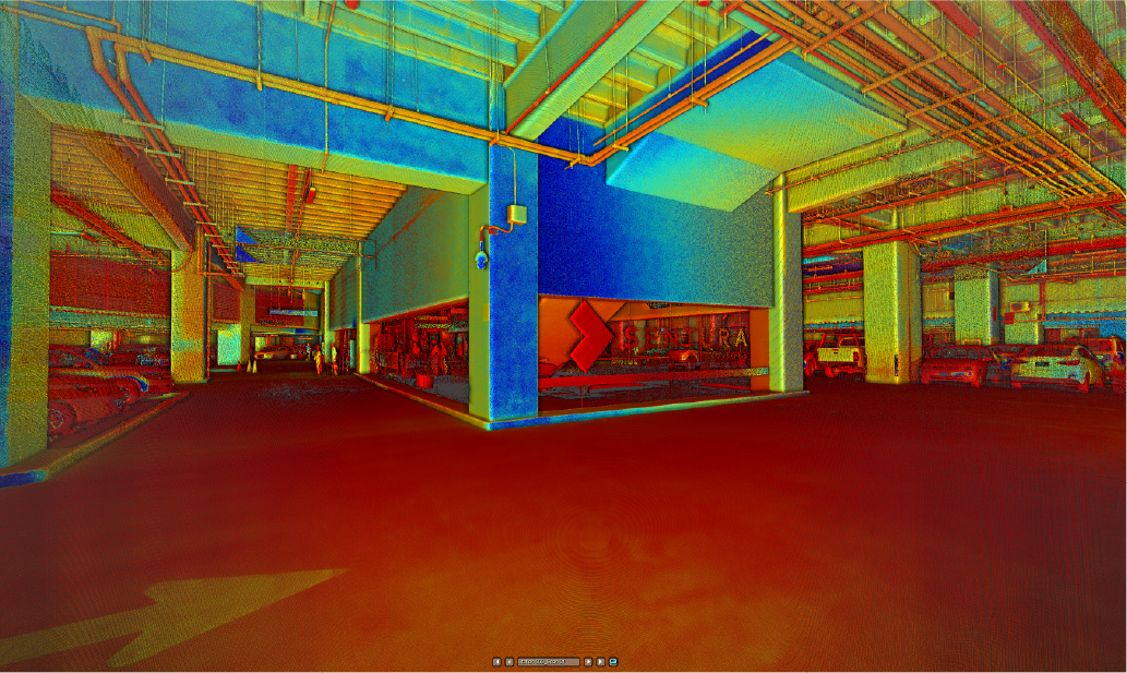
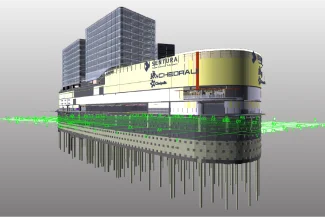
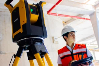
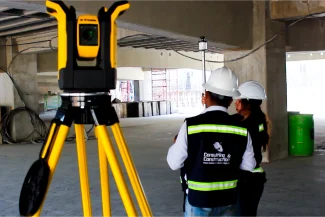
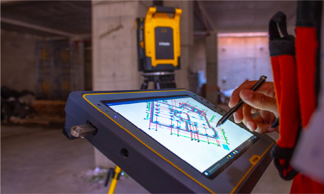
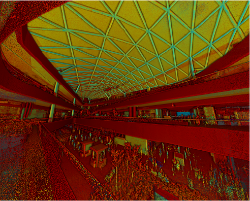
terrestrial laser scanning
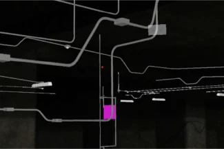
Reality capture was implemented through terrestrial laser scanning to support project management. This technology enabled the generation of a detailed three-dimensional model of the shopping mall, optimizing design accuracy, reducing errors, and ensuring that the construction progressed in line with the highest quality standards.
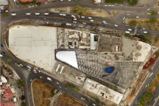
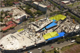
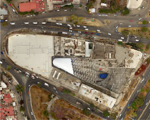
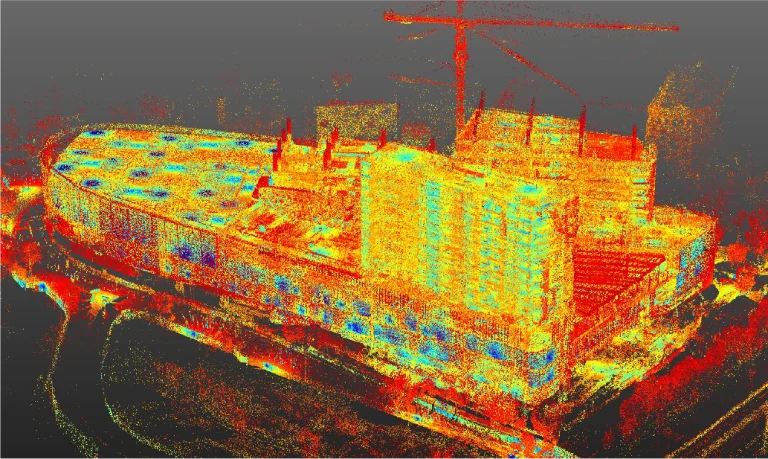
Aerial photography
Aerial photography provided a comprehensive perspective of the project, offering a clear view of the progress in the shopping mall construction. The aerial images facilitated the detection of potential adjustments and optimized resource management throughout the entire construction process.
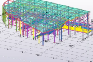
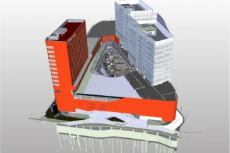
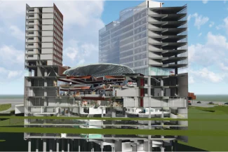
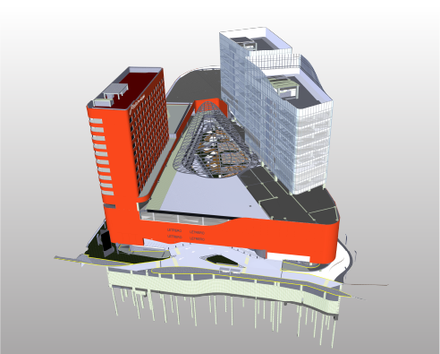
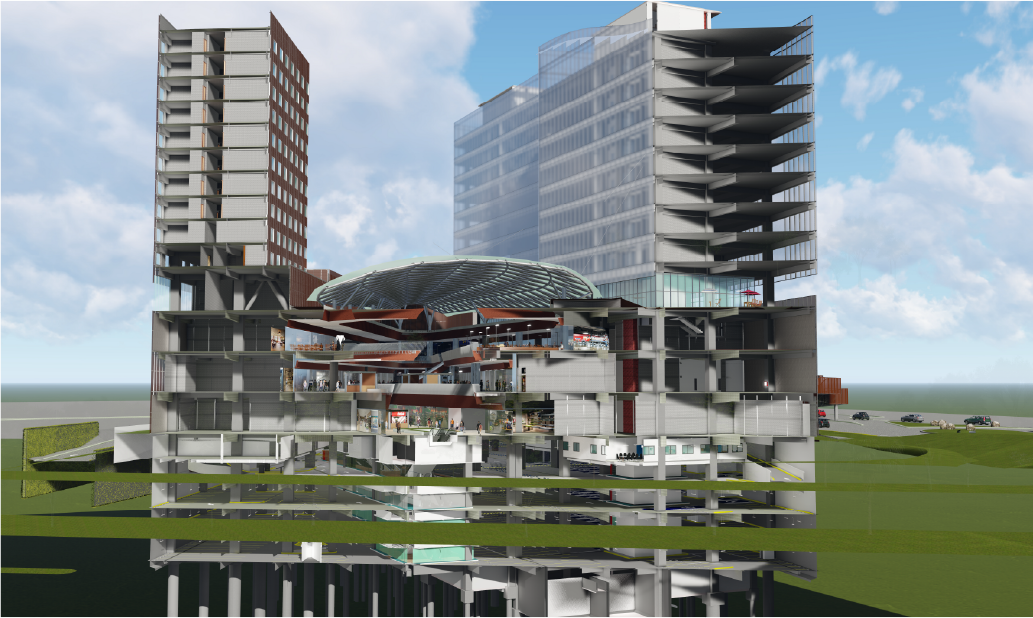
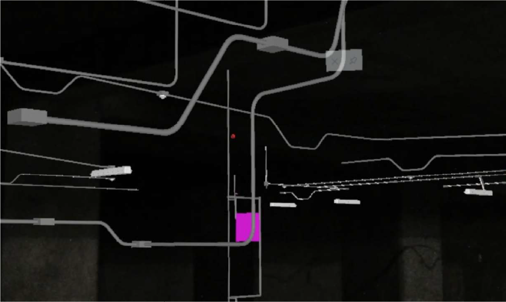
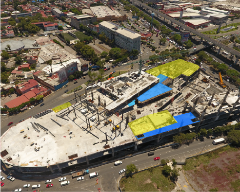
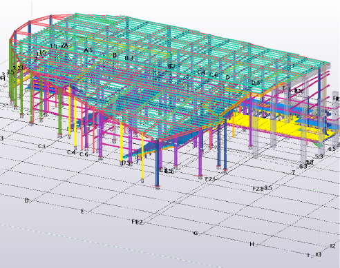
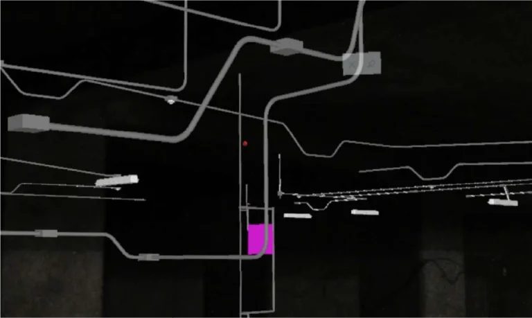
BIM (Building Information Modeling)
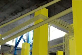
The use of BIM (Building Information Modeling) models provided a detailed digital representation of the shopping mall, facilitating the supervision of construction progress. This technology made it possible to identify potential issues, support informed decision-making, and ensure that each phase of the project developed according to plan.
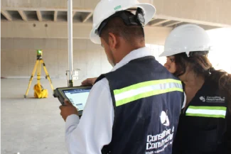
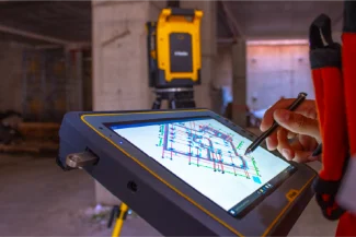
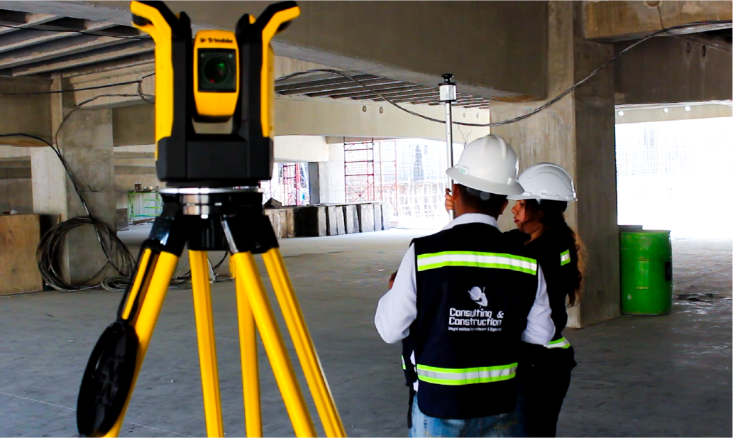
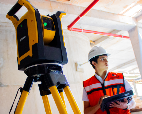
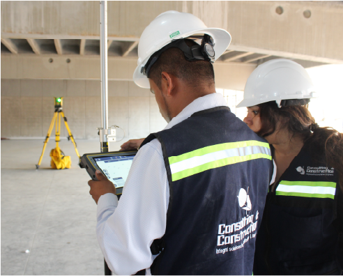
robotic layout
With robotic layout, millimetric precision was achieved in the project execution. This service allowed for the exact marking of points and boundaries of the shopping mall, reducing work time and preventing errors that could affect construction quality.
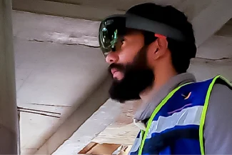
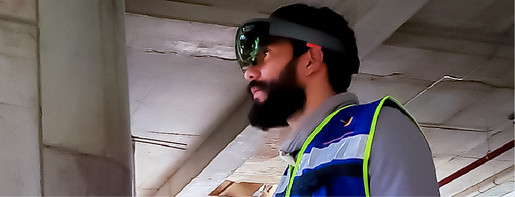
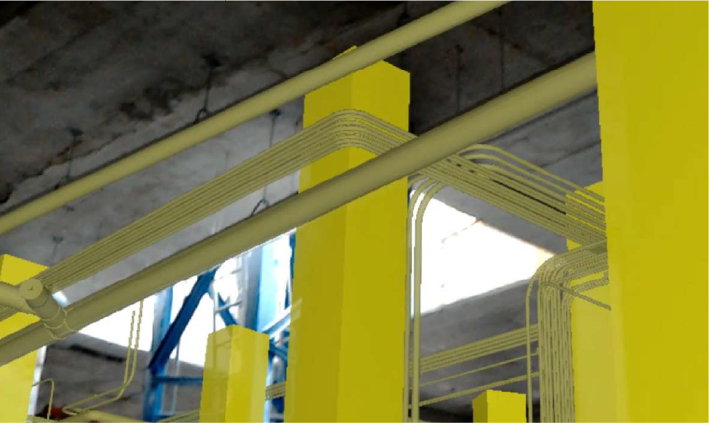
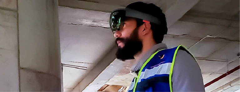
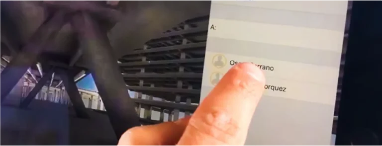
Mixed reality
Mixed reality combined the digital models with the real environment, offering an immersive experience during the construction of the shopping mall. This service facilitated the interactive visualization of the project, enabling a better understanding of the construction phases.
CDE (Common Data Environment)
With the CDE (Common Data Environment), all documentation and design of the shopping mall were accessible in a centralized manner, allowing greater efficiency in information management. This improved project traceability and enhanced real-time collaboration.
In this project, terrestrial laser scanning and aerial photography were carried out to accurately capture the existing conditions of the construction. The data were integrated into a BIM model for planning and coordination, complemented by robotic layout with a total station for the precise installation of elements on-site and mixed reality to visualise and interact with the designs.
All information was managed within a Common Data Environment (CDE), ensuring efficient collaboration and technical control at every stage.
REALITY CAPTURE
Terrestrial Laser Scanning
Reality capture was implemented through terrestrial laser scanning to support project management. This technology enabled the creation of a detailed three-dimensional model of the shopping centre, enhancing design accuracy, reducing errors, and ensuring that construction progressed in line with the highest quality standards.
PHOTOGRAPHY DIGITAL
Aerial Photography
Aerial photography provided a comprehensive perspective of the project, offering a clear view of the shopping centre’s construction progress. The aerial images facilitated the identification of potential adjustments and optimised resource management throughout the entire construction process.
DIGITAL MODELS
BIM (Building Information Modeling)
The use of BIM (Building Information Modelling) models provided a detailed digital representation of the shopping centre, aiding in monitoring the project’s progress. This technology enabled the identification of potential issues, informed decision-making, and ensured that each phase of the project proceeded as planned.
FIELD TECHNOLOGY
Robotic Layout
With robotic layout, millimetre precision was achieved in the project’s execution. This service allowed for the exact marking of points and boundaries of the shopping centre, reducing work time and preventing errors that could impact construction quality.
EXTENDED REALITY
Mixed Reality
Mixed reality combined digital models with the real environment, offering an immersive experience during the construction of the shopping centre. This service facilitated an interactive visualisation of the project, enabling a better understanding of the construction phases.
DATA SCIENCE
CDE(Common Data Environment)
With the CDE (Common Data Environment), all documentation and designs for the shopping centre were centrally accessible, allowing for greater efficiency in information management. This improved project traceability and enhanced real-time collaboration.