In this project, Reality Capture was carried out using laser scanning to generate a detailed BIM model that documented the initial conditions of the land and existing structures. This information provided an accurate foundation for the design and development of vertical housing, ensuring that each stage of the project was supported by reliable and up-to-date data. Additionally, aerial photography was used to complement the documentation and provide a comprehensive view of the project’s surroundings.
Client:
Gran Vivir
Location:
León, México
Year:
2019
REALITY CAPTURE
PHOTOGRAPHY DIGITAL
DIGITAL MODELS
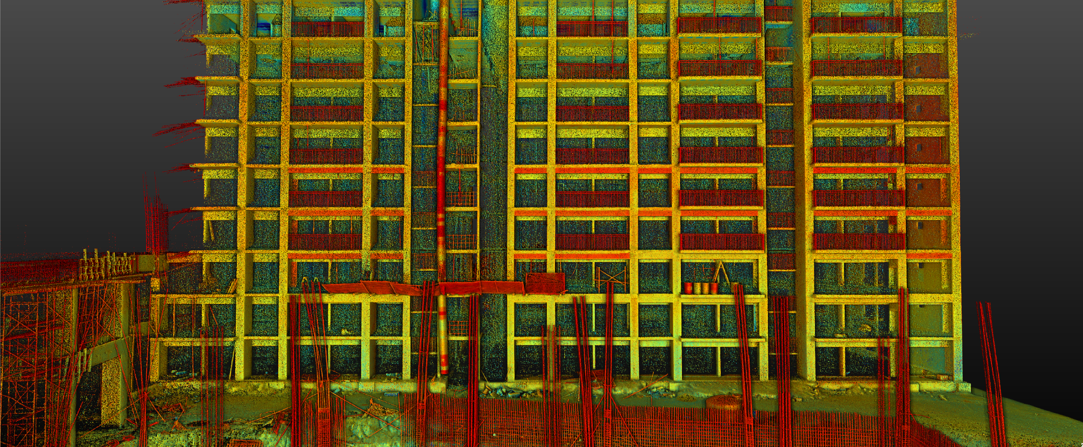
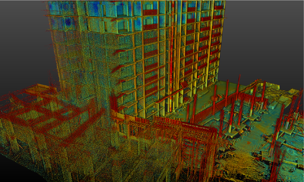
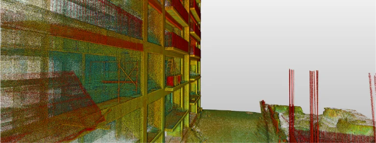
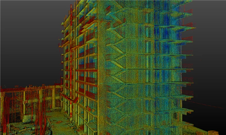
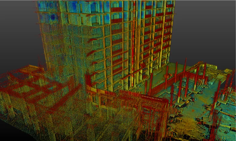
Laser scanning
Laser scanning enabled the capture of a precise point cloud that thoroughly documented the terrain characteristics and existing structures. These data facilitated the identification of critical conditions and ensured accuracy in the planning and design of the vertical housing development.
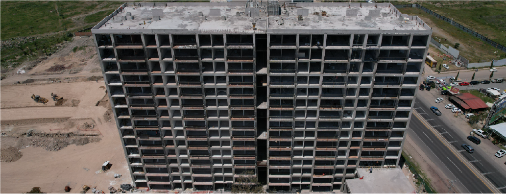
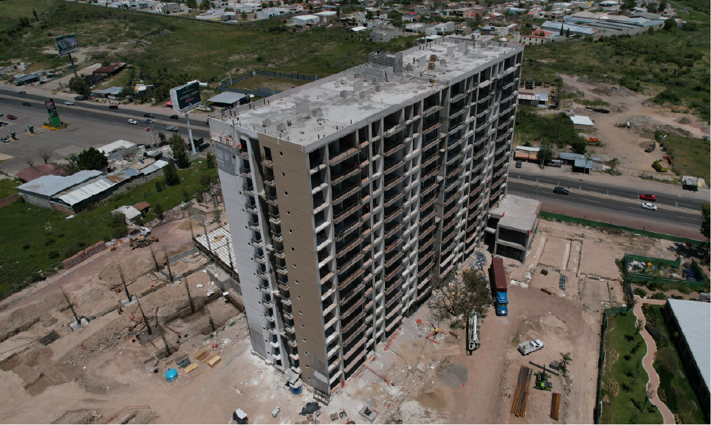
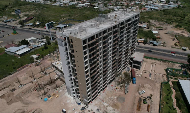
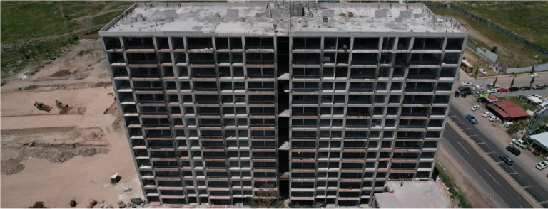
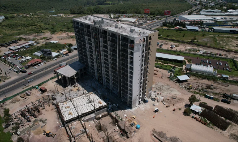
Aerial photography
Aerial photography was used to capture detailed images of the surroundings and adjacent areas of the land. These images complemented the technical data, providing key visual context for planning the vertical housing development and assessing the overall project environment.
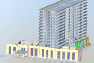
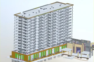
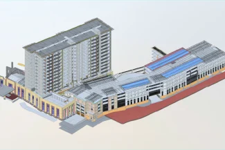
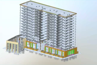
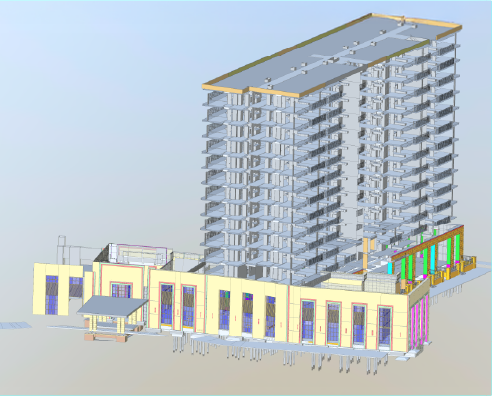
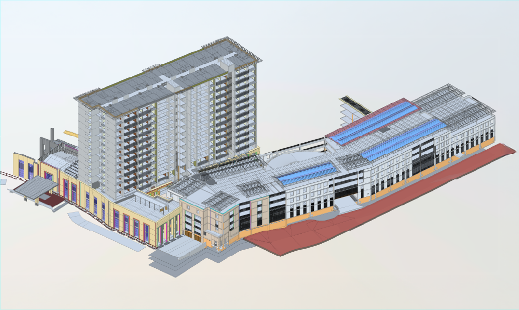
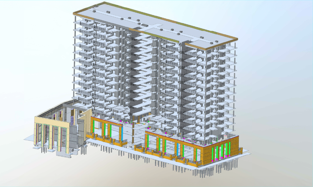
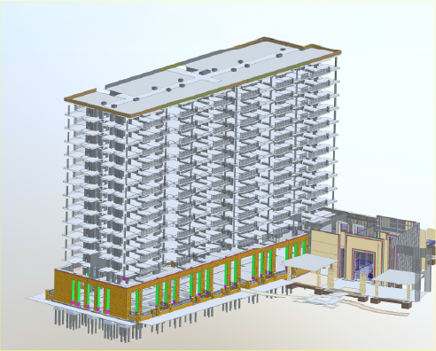
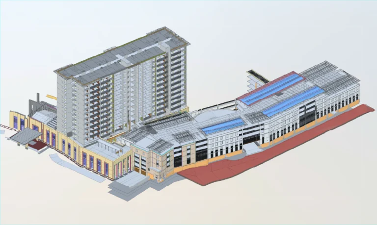
BIM (Building Information Modeling)
Based on the laser scanning data, a detailed BIM model was developed, integrating the site’s characteristics and existing structures. This model was used to plan the architectural design, optimise coordination between disciplines, and ensure the efficient execution of the project.
In this project, Reality Capture was carried out using laser scanning to generate a detailed BIM model that documented the initial conditions of the land and existing structures. This information provided an accurate foundation for the design and development of vertical housing, ensuring that each stage of the project was supported by reliable and up-to-date data. Additionally, aerial photography was used to complement the documentation and provide a comprehensive view of the project’s surroundings.
REALITY CAPTURE
Laser Scanning
Laser scanning enabled the capture of a precise point cloud that thoroughly documented the terrain characteristics and existing structures. These data facilitated the identification of critical conditions and ensured accuracy in the planning and design of the vertical housing development.
PHOTOGRAPHY DIGITAL
Aerial Photography
Aerial photography was used to capture detailed images of the surroundings and adjacent areas of the land. These images complemented the technical data, providing key visual context for planning the vertical housing development and assessing the overall project environment.
DIGITAL MODELS
BIM (Building Information Modeling)
Based on the laser scanning data, a detailed BIM model was developed, integrating the site’s characteristics and existing structures. This model was used to plan the architectural design, optimise coordination between disciplines, and ensure the efficient execution of the project.