AEC Technology Blanco-02

GIS

GEOGRAPHIC INFORMATION SYSTEM

MANAGING GEOSPATIAL DATA, CRUCIAL FOR URBAN PLANNING, INFRASTRUCTURE, AND ENVIRONMENTAL ANALYSIS.

WE BOOST THE TRANSFORMATION TO CONSTRUCTION 4.0

GIS SYSTEM: A KEY TOOL IN OPTIMISING CONSTRUCTION PROJECTS

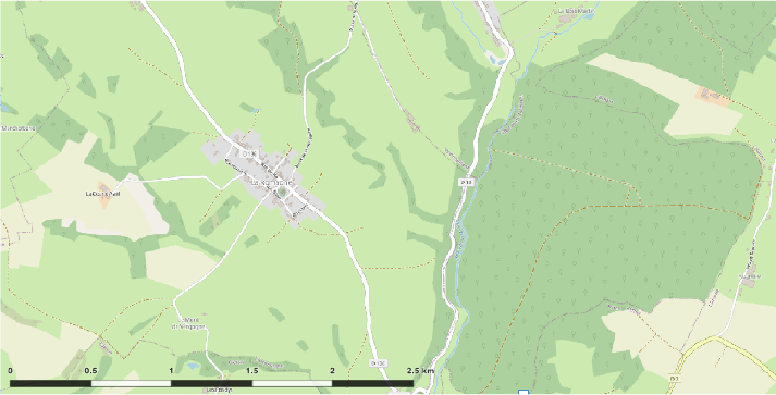
The Geographic Information System (GIS) is a technological tool that enables the capturing, storage, analysis, management, and visualisation of spatial data. In construction, GIS is used for planning, design, and project management, providing accurate information about terrain, existing infrastructure, and urban elements, which improves decision-making and optimises resource use.

THE IMPACT OF GIS ON CONSTRUCTION PROJECTS

In the later stages of development, several construction projects have demonstrated how GIS improves outcomes. Key examples include:
 
Road and bridge construction: Analyses terrain to design more efficient transport infrastructure.

Urbanisation projects: Optimises the distribution of housing, services, and infrastructure in new urban areas.

Resilient infrastructure: Assesses risks and assists in designing solutions resistant to natural disasters.

ADVANCED CONSTRUCTION SECTORS EMPLOYING GIS FOR PRECISE PLANNING

Analyses terrain, evaluates project feasibility, and optimises the design of infrastructure such as roads, bridges, and transport systems, ensuring sustainability.
 
Generates detailed topographic maps by integrating altitude and coordinate data, facilitating the precise representation of terrain for construction and planning projects.
 

Evaluates urban patterns, analyses population growth, and plans land use, promoting sustainable and efficient development in cities and metropolitan areas.

Studies terrain characteristics, conducts visual impact analyses, and selects strategic locations for buildings that integrate functionality, aesthetics, and environmental context.
 
Analyses spatial data to understand the physical and human characteristics of an area, contributing to territorial planning and mitigating environmental impacts in projects.
 

Uses GIS to manage schedules, budgets, and resources in real time, ensuring process optimisation and the achievement of construction project goals.

BENEFITS OF GIS IN DATA INTEGRATION AND ANALYSIS FOR PROJECTS

1. Improved decision-making:

GIS provides precise, up-to-date geospatial data on terrain, infrastructure, and environmental factors, enabling more informed and effective strategic decisions.
 

2. Cost optimisation:

By delivering detailed analyses of terrain and potential challenges, GIS helps anticipate unforeseen issues, improve planning, and reduce expenses related to errors or changes during construction.
 

3. Project management efficiency:

GIS facilitates real-time project monitoring, optimises team coordination, and ensures a consistent flow of information to avoid delays and misunderstandings.

4. Risk reduction:

Identifies areas prone to natural disasters or environmental problems, enabling teams to take preventive measures to minimise risks and protect both the environment and people.
 

5. Data integration:

Combines information from various sources, such as maps, sensors, and historical data, enhancing collaboration between disciplines and enabling a comprehensive analysis of project conditions.
 

6. Sustainability:

Allows for the assessment of environmental impacts, optimises land use, and designs infrastructure that respects the environment and promotes responsible and sustainable development.

HOW GIS CONTRIBUTES TO THE GROWTH OF SMART INFRASTRUCTURE

GIS has transformed the way construction projects are managed, providing tools that optimise the planning and execution process. From site selection to maintenance, GIS supports more precise and efficient management, contributing to the creation of smart infrastructure. As GIS technology continues to advance, its impact on construction will become increasingly significant.
 

GIS

GEOGRAPHIC INFORMATION SYSTEM

MANAGING GEOSPATIAL DATA, CRUCIAL FOR URBAN PLANNING, INFRASTRUCTURE, AND ENVIRONMENTAL ANALYSIS.

WE BOOST THE TRANSFORMATION TO CONSTRUCTION 4.0

GIS SYSTEM: A KEY TOOL IN OPTIMISING CONSTRUCTION PROJECTS

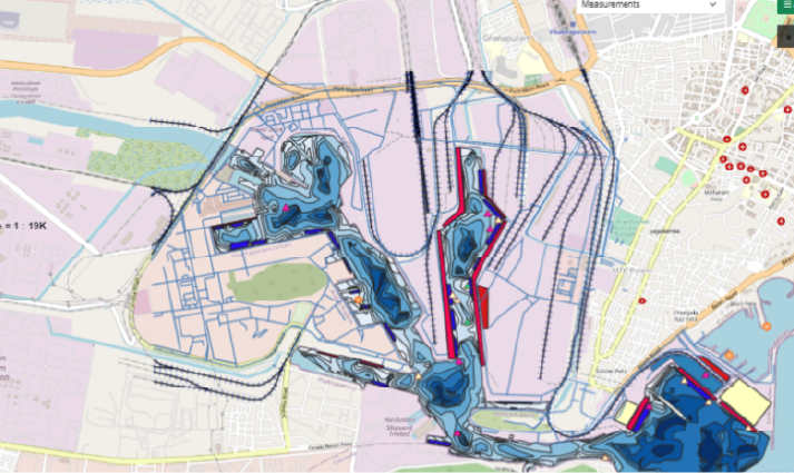
The Geographic Information System (GIS) is a technological tool that enables the capturing, storage, analysis, management, and visualisation of spatial data. In construction, GIS is used for planning, design, and project management, providing accurate information about terrain, existing infrastructure, and urban elements, which improves decision-making and optimises resource use.
THE IMPACT OF GIS ON CONSTRUCTION PROJECTS

In the later stages of development, several construction projects have demonstrated how GIS improves outcomes. Key examples include:
 
Road and bridge construction: Analyses terrain to design more efficient transport infrastructure.

Urbanisation projects: Optimises the distribution of housing, services, and infrastructure in new urban areas.

Resilient infrastructure: Assesses risks and assists in designing solutions resistant to natural disasters.

ADVANCED CONSTRUCTION SECTORS EMPLOYING GIS FOR PRECISE PLANNING

Analyses terrain, evaluates project feasibility, and optimises the design of infrastructure such as roads, bridges, and transport systems, ensuring sustainability.
 
Generates detailed topographic maps by integrating altitude and coordinate data, facilitating the precise representation of terrain for construction and planning projects.
 

Evaluates urban patterns, analyses population growth, and plans land use, promoting sustainable and efficient development in cities and metropolitan areas.

Studies terrain characteristics, conducts visual impact analyses, and selects strategic locations for buildings that integrate functionality, aesthetics, and environmental context.
 
Analyses spatial data to understand the physical and human characteristics of an area, contributing to territorial planning and mitigating environmental impacts in projects.
 

Uses GIS to manage schedules, budgets, and resources in real time, ensuring process optimisation and the achievement of construction project goals.
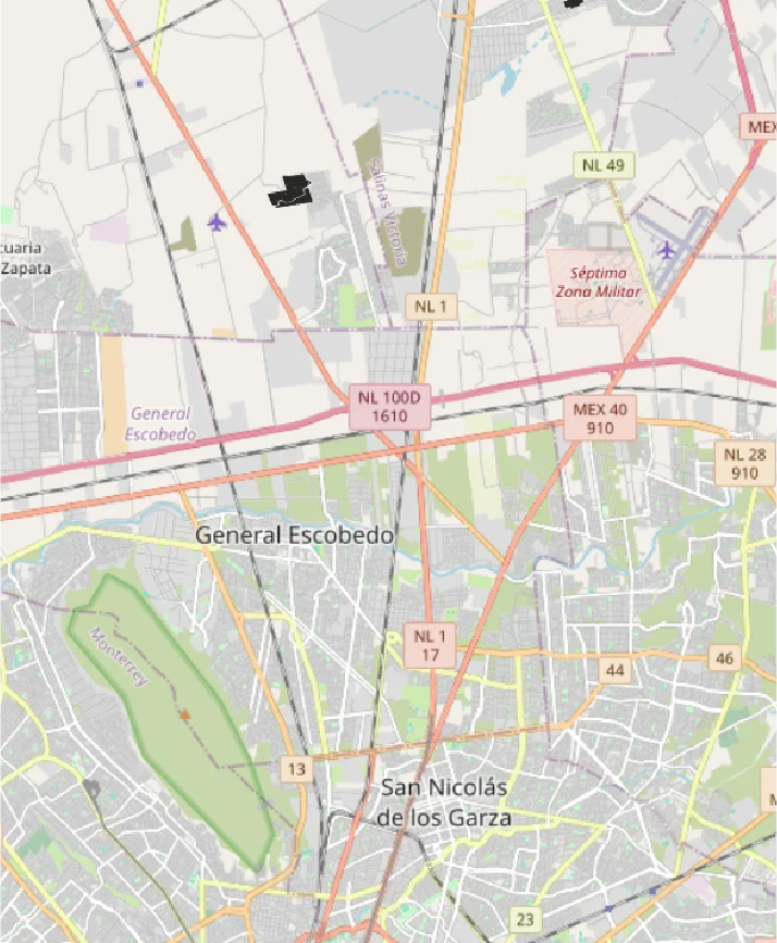
BENEFITS OF GIS IN DATA INTEGRATION AND ANALYSIS FOR PROJECTS

1. Improved decision-making:

GIS provides precise, up-to-date geospatial data on terrain, infrastructure, and environmental factors, enabling more informed and effective strategic decisions.
 

2. Cost optimisation:

By delivering detailed analyses of terrain and potential challenges, GIS helps anticipate unforeseen issues, improve planning, and reduce expenses related to errors or changes during construction.
 

3. Project management efficiency:

GIS facilitates real-time project monitoring, optimises team coordination, and ensures a consistent flow of information to avoid delays and misunderstandings.

4. Risk reduction:

Identifies areas prone to natural disasters or environmental problems, enabling teams to take preventive measures to minimise risks and protect both the environment and people.
 

5. Data integration:

Combines information from various sources, such as maps, sensors, and historical data, enhancing collaboration between disciplines and enabling a comprehensive analysis of project conditions.
 

6. Sustainability:

Allows for the assessment of environmental impacts, optimises land use, and designs infrastructure that respects the environment and promotes responsible and sustainable development.

GALLERY

HOW GIS CONTRIBUTES TO THE GROWTH OF SMART INFRASTRUCTURE

GIS has transformed the way construction projects are managed, providing tools that optimise the planning and execution process. From site selection to maintenance, GIS supports more precise and efficient management, contributing to the creation of smart infrastructure. As GIS technology continues to advance, its impact on construction will become increasingly significant.
Â