Inicio » Projects » Tecnológico de Monterrey – Monterrey
Tecnológico de Monterrey – Monterrey
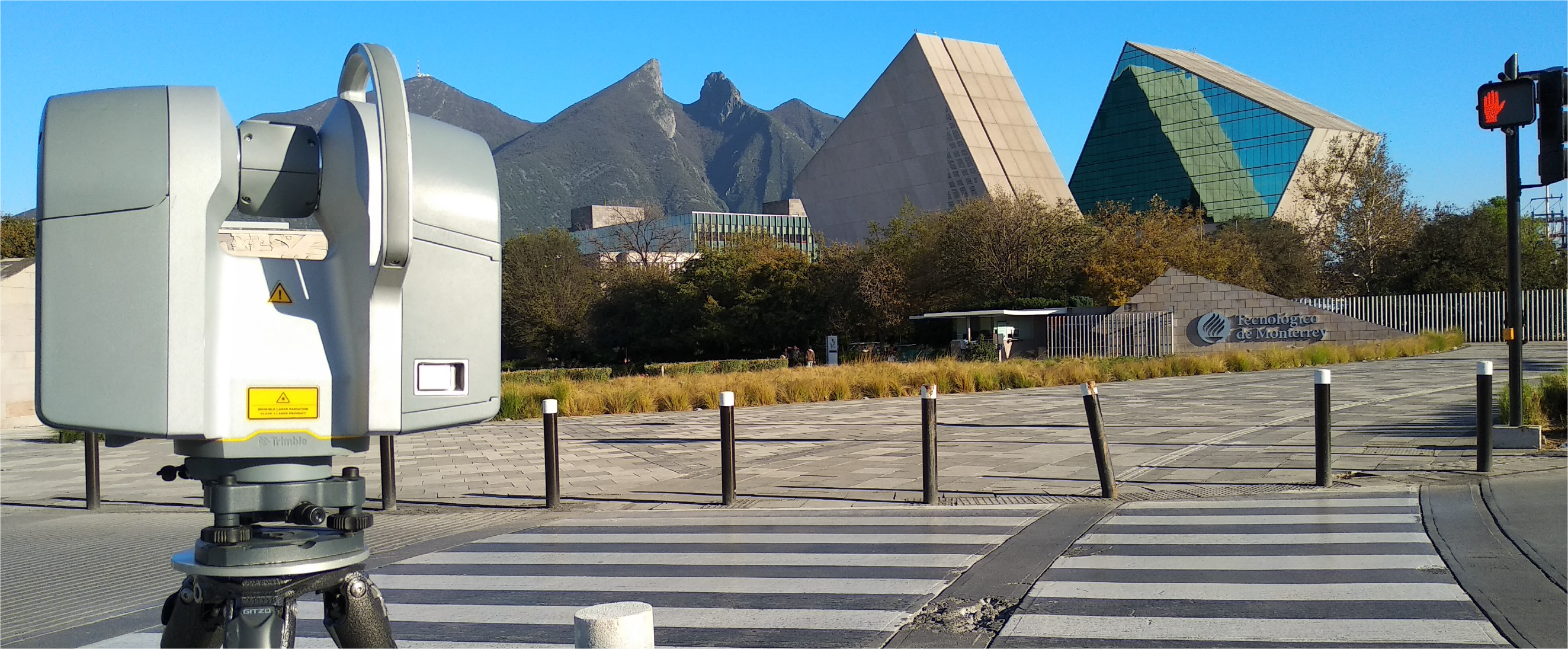
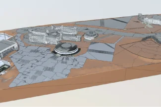
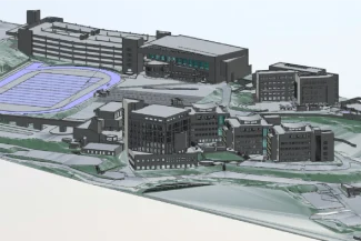
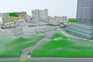
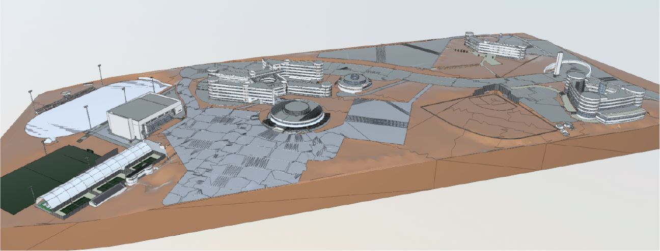
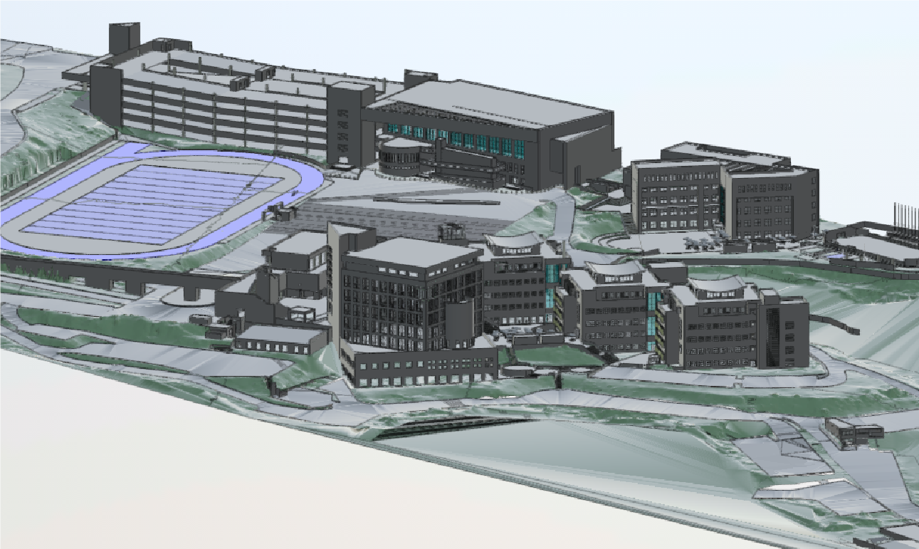
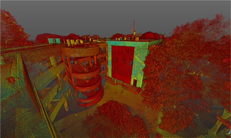
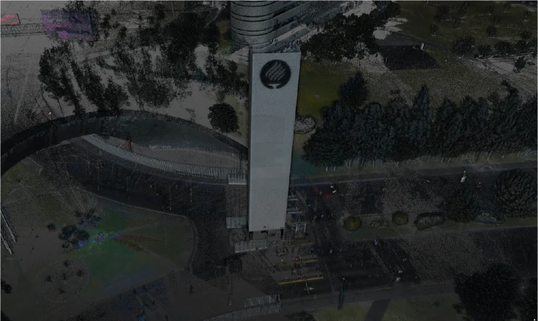
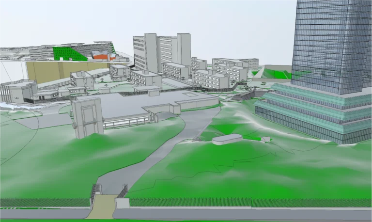
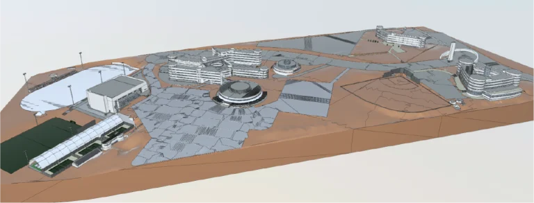
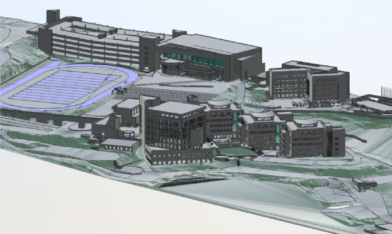
In the project for Tec de Monterrey, Monterrey campus, Reality Capture using laser scanning was carried out to accurately document the buildings and infrastructure of the campus. This Reality Capture recorded structural details with high precision, providing key data for detailed BIM models, which served as the foundation for planning, efficient management, and the design of future interventions.
Client:
Tecnológico de Monterrey – Monterrey
Location:
Monterrey,
México
Year:
2019
REALITY CAPTURE
DIGITAL MODELS
Terrestrial laser scanning
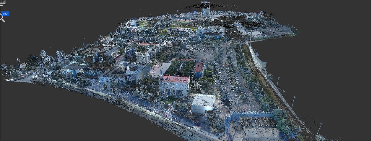
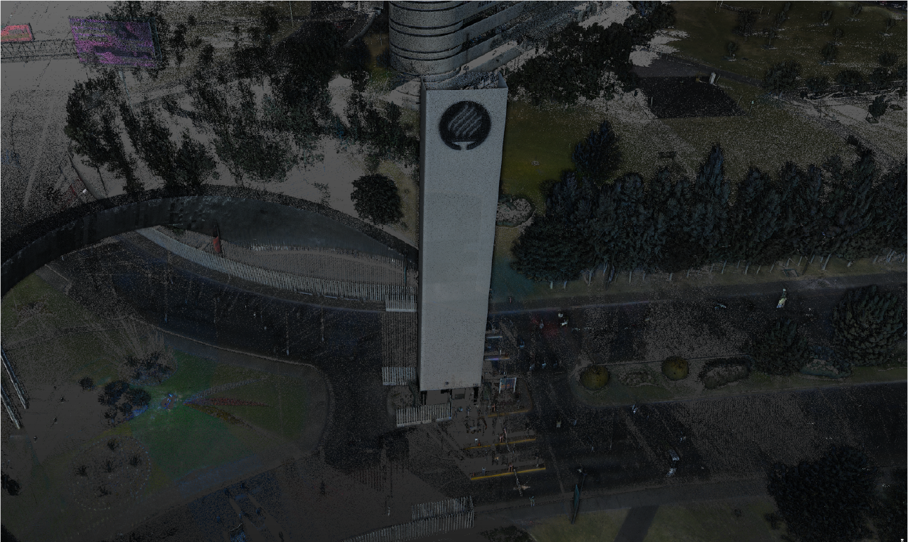
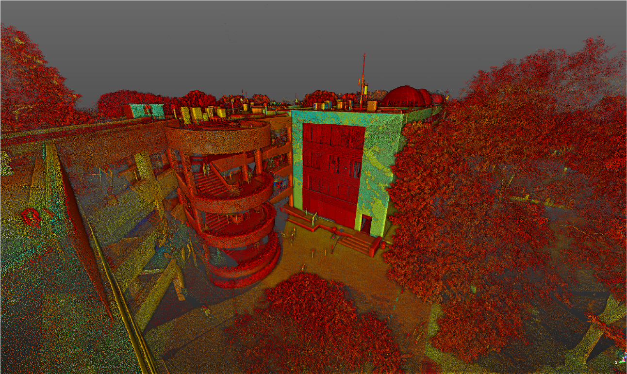
Terrestrial laser scanning captured precise three-dimensional data, generating a point cloud that reflected the current conditions of the campus buildings and infrastructure. This service enabled the identification of exact dimensions, structural details, and key characteristics, providing reliable documentation for analysis, planning, and decision-making.
BIM (Building Information Modeling)
Based on the generated point cloud, BIM models were developed to integrate all relevant information about the campus buildings and infrastructure. These models facilitated interdisciplinary coordination, optimized design processes, and supported the planning of future interventions, ensuring efficient management and well-informed decisions.
In the project for Tec de Monterrey, Monterrey campus, Reality Capture using laser scanning was carried out to accurately document the buildings and infrastructure of the campus. This Reality Capture recorded structural details with high precision, providing key data for detailed BIM models, which served as the foundation for planning, efficient management, and the design of future interventions.
REALITY CAPTURE
Terrestrial Laser Scanning
Terrestrial laser scanning captured precise three-dimensional data, generating a point cloud that reflected the current conditions of the campus buildings and infrastructure. This service enabled the identification of exact dimensions, structural details, and key characteristics, providing reliable documentation for analysis, planning, and decision-making.
DIGITAL MODELS
BIM (Building Information Modeling)
Based on the generated point cloud, BIM models were developed to integrate all relevant information about the campus buildings and infrastructure. These models facilitated interdisciplinary coordination, optimized design processes, and supported the planning of future interventions, ensuring efficient management and well-informed decisions.