Inicio » Projects » Tecnológico de Monterrey – Querétaro
Tecnológico de Monterrey – Querétaro
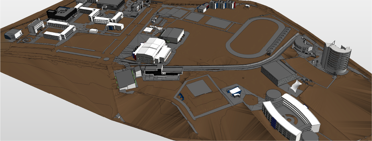
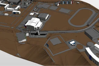
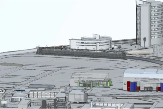
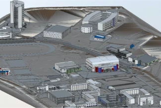
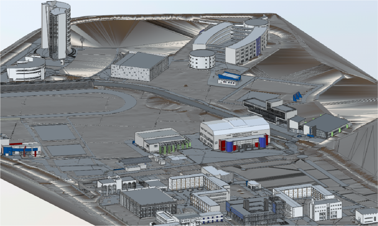
In the project for Tecnológico de Monterrey, Querétaro campus, Reality Capture was carried out using laser scanning, accurately documenting the campus buildings and infrastructure. This process was complemented by high-resolution orthophotos, providing a comprehensive view of the surroundings. The data was used to create detailed BIM models, which served as the foundation for strategic planning, facilities management, and the design of future interventions.
Client:
Tecnológico
de Monterrey
Qurétaro
Location:
Querétaro,
México
Year:
2019
REALITY CAPTURE
PHOTOGRAPHY DIGITAL
DIGITAL MODELS
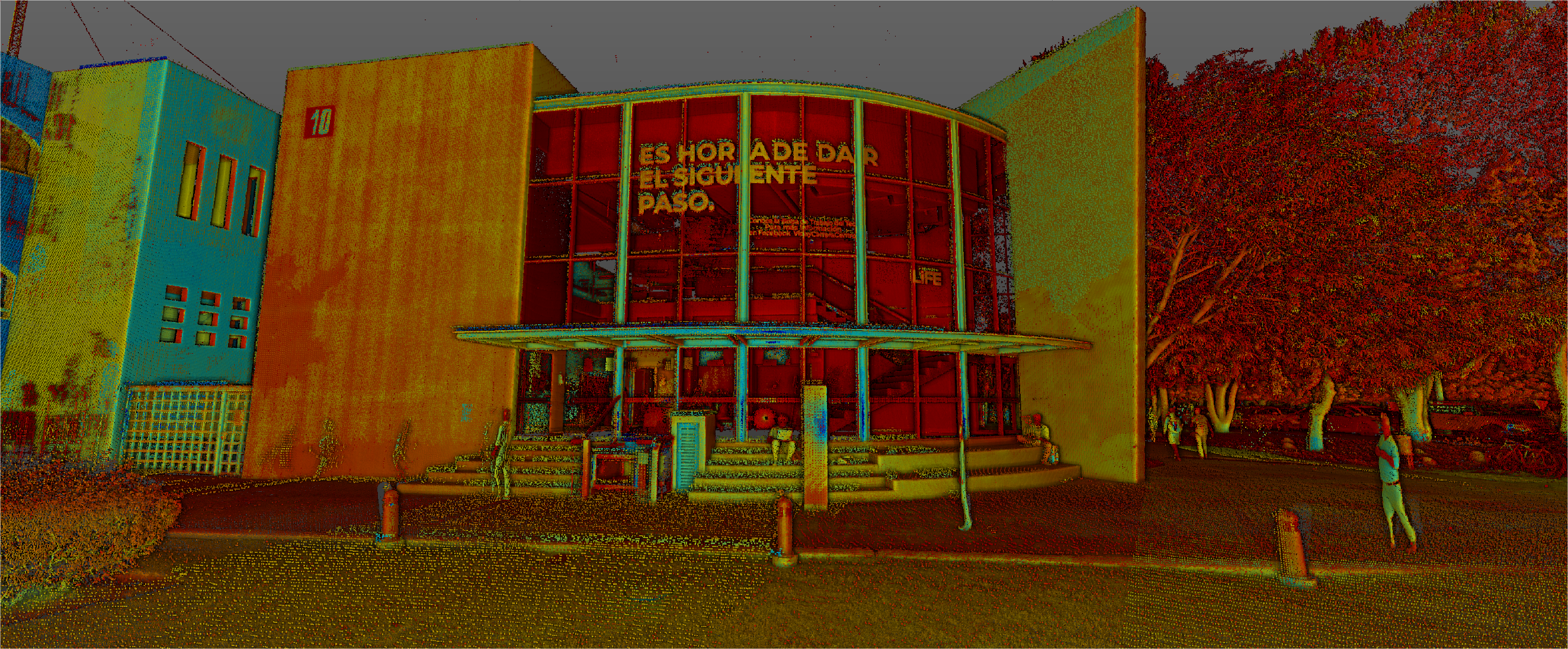
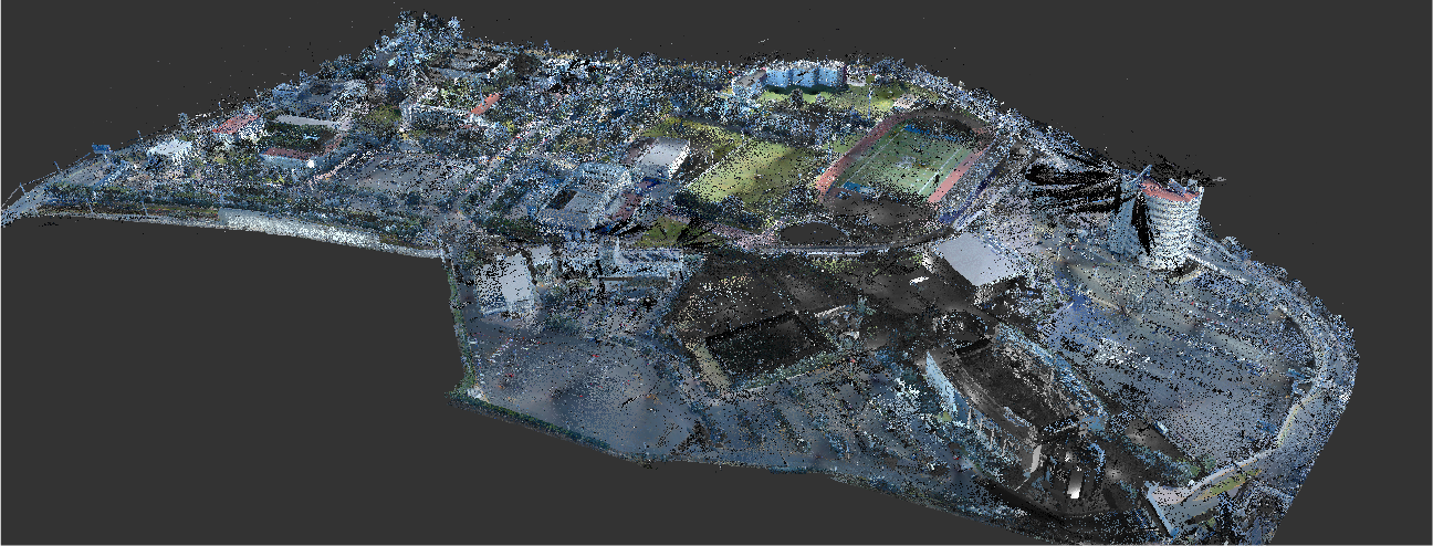
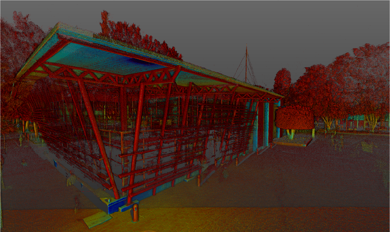
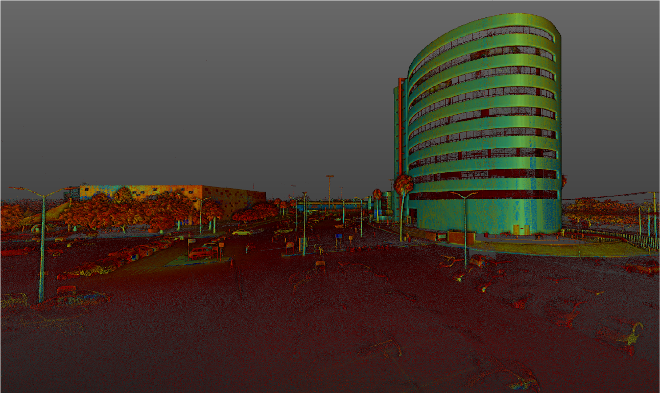
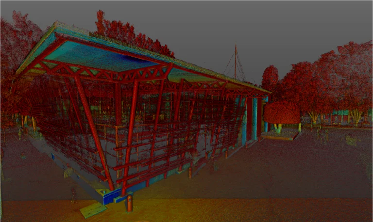
Terrestrial laser scanning
Terrestrial laser scanning was used to capture high-precision three-dimensional data, generating a point cloud that documented the campus buildings and infrastructure in detail. This survey allowed for the recording of exact dimensions and key characteristics of the spaces, providing a solid foundation for analysis and planning.
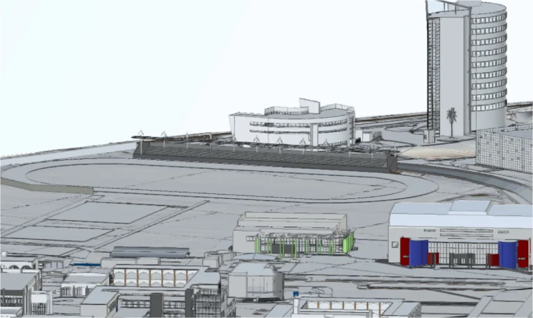
BIM (Building
Information
Modeling)
With the information obtained from the laser scanning and orthophotos, detailed BIM models were developed that integrated the campus’s existing conditions. These models enabled strategic planning, inter-disciplinary coordination, and the projection of future interventions, ensuring informed decision-making and resource optimisation.
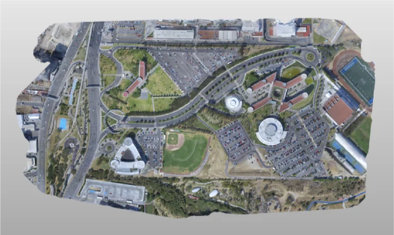
PHOTOGRAMETRY
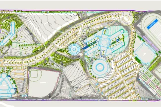
High-resolution orthophotos were generated using drones, capturing detailed images of the campus’s exterior areas and surroundings. These images complemented the point cloud, providing a comprehensive perspective and facilitating the analysis of the terrain and its context.
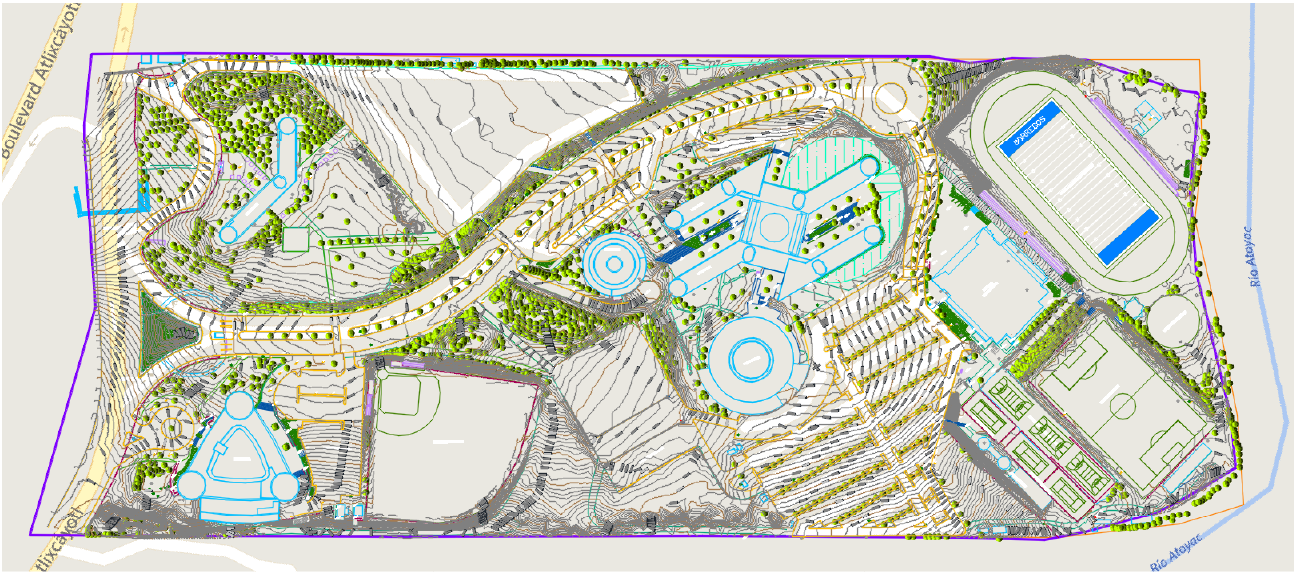
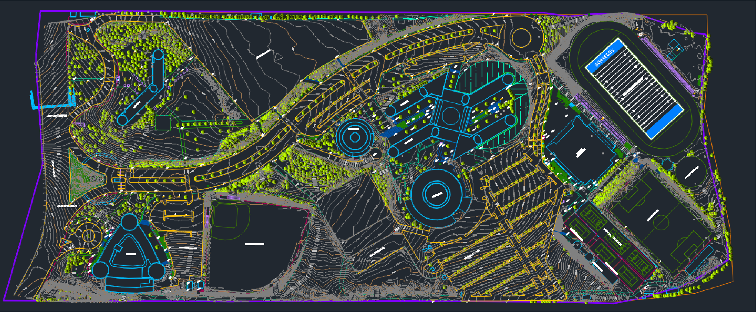
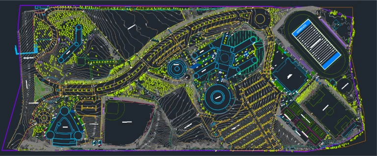
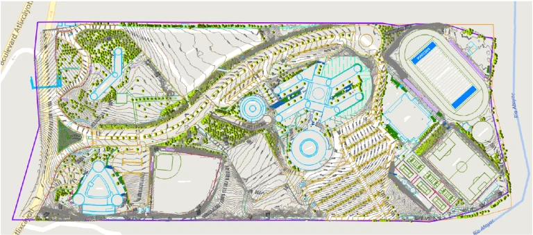
CAD
(Computer Aided Drawing)
From the laser scanning point cloud, precise CAD drawings were produced documenting the current conditions of the campus, providing reliable technical information for design, planning, and future modifications.
In the project for Tecnológico de Monterrey, Querétaro campus, Reality Capture was carried out using laser scanning, accurately documenting the campus buildings and infrastructure. This process was complemented by high-resolution orthophotos, providing a comprehensive view of the surroundings. The data was used to create detailed BIM models, which served as the foundation for strategic planning, facilities management, and the design of future interventions.
REALITY CAPTURE
Terrestrial Laser Scanning
Terrestrial laser scanning was used to capture high-precision three-dimensional data, generating a point cloud that documented the campus buildings and infrastructure in detail. This survey allowed for the recording of exact dimensions and key characteristics of the spaces, providing a solid foundation for analysis and planning.
DIGITAL MODELS
BIM
(Building Information Modeling)
With the information obtained from the laser scanning and orthophotos, detailed BIM models were developed that integrated the campus’s existing conditions. These models enabled strategic planning, inter-disciplinary coordination, and the projection of future interventions, ensuring informed decision-making and resource optimisation.
PHOTOGRAPHY DIGITAL
Photogrametry
High-resolution orthophotos were generated using drones, capturing detailed images of the campus’s exterior areas and surroundings. These images complemented the point cloud, providing a comprehensive perspective and facilitating the analysis of the terrain and its context.
DIGITAL MODELS
CAD
(Dibujo asistido por Computador)
From the laser scanning point cloud, precise CAD drawings were produced documenting the current conditions of the campus, providing reliable technical information for design, planning, and future modifications.