The implementation of advanced technologies such as Reality Capture, Mixed Reality, 360° Photography, and BIM models has made it possible to optimize processes in construction projects.
Thanks to these tools, the coordination of multidisciplinary designs is facilitated, while planning and project management are enhanced through 4D and 5D models. Likewise, integrated control of time and costs is achieved, ensuring greater efficiency and accuracy at every stage of the project.
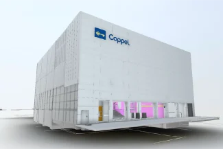
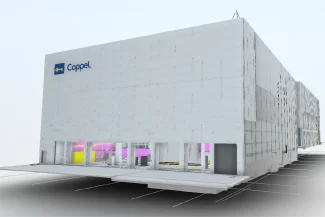
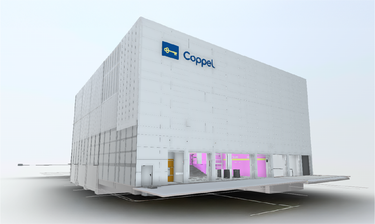
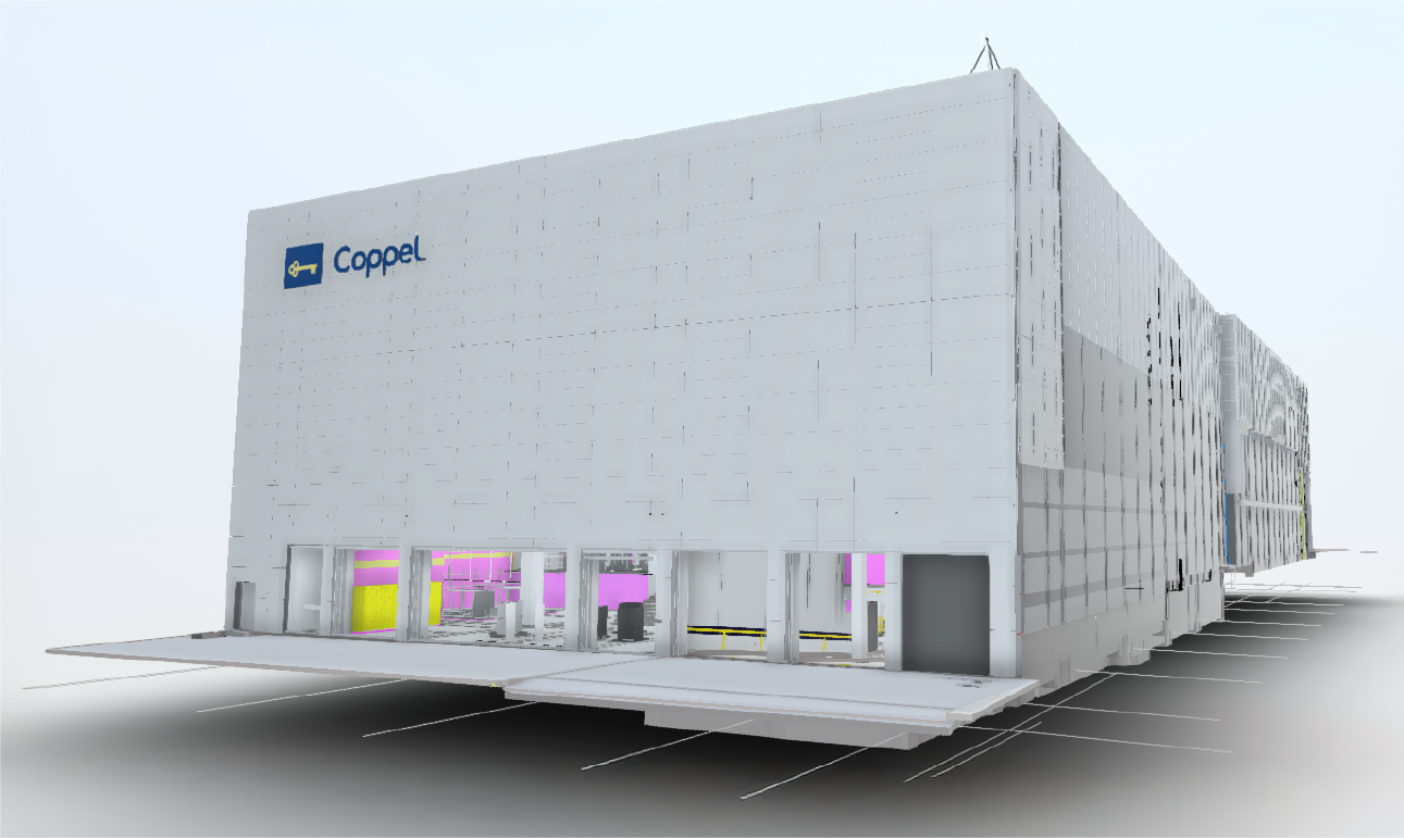
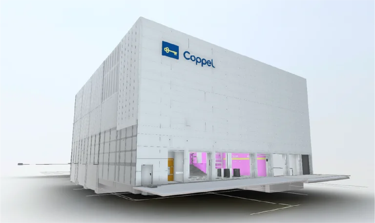
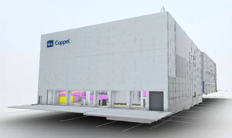
Client:
Coppel
Location:
Culiacán,
México
Year:
2024
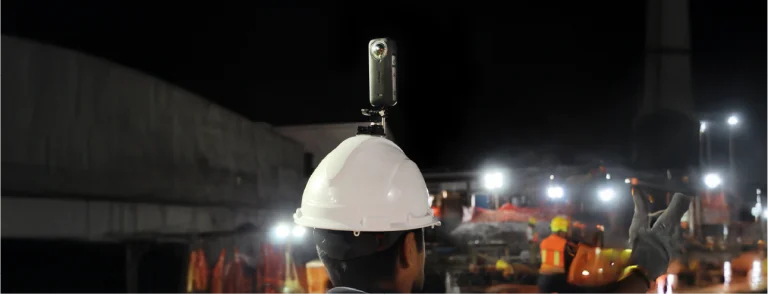
REALITY CAPTURE
DIGITAL PHOTOGRAPHY
DIGITAL MODELS
EXTENDED REALITY
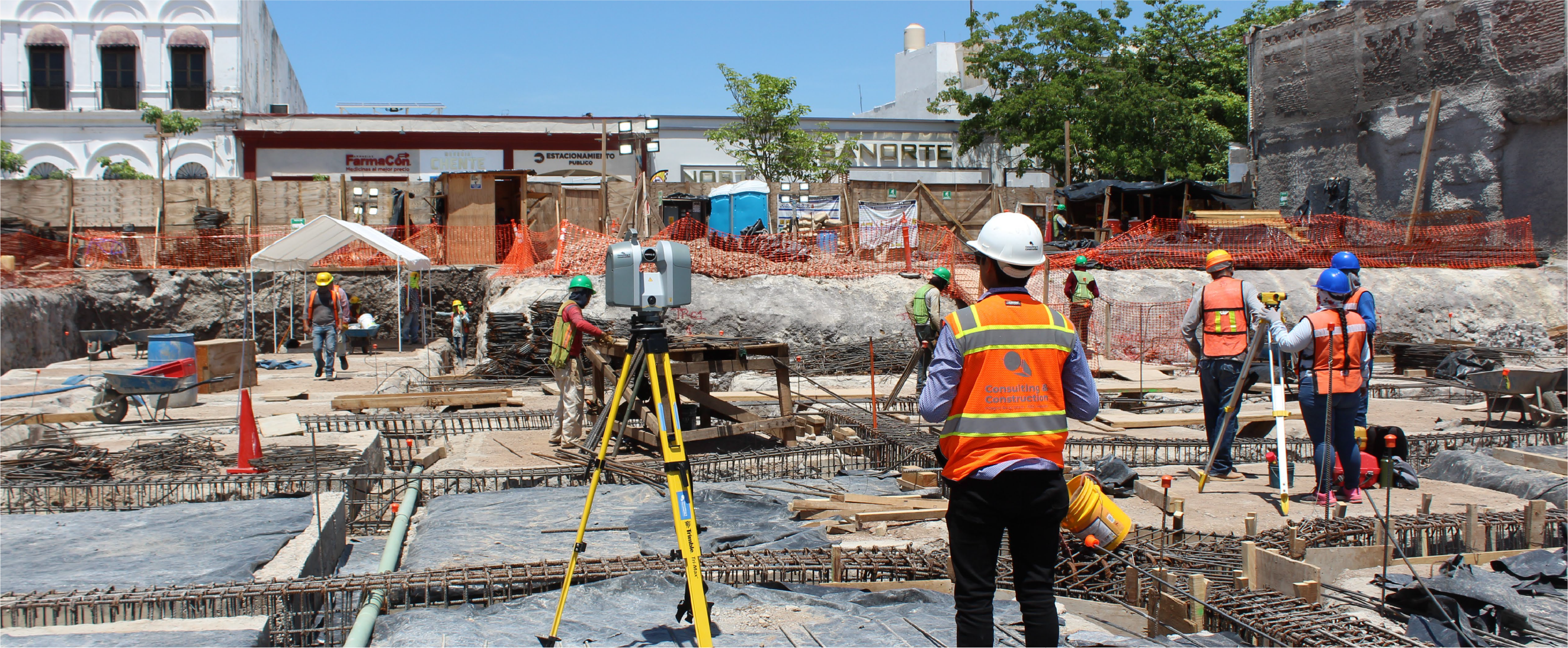
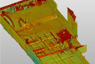
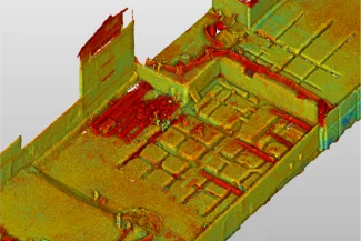
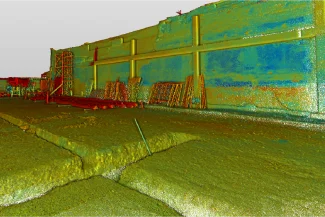
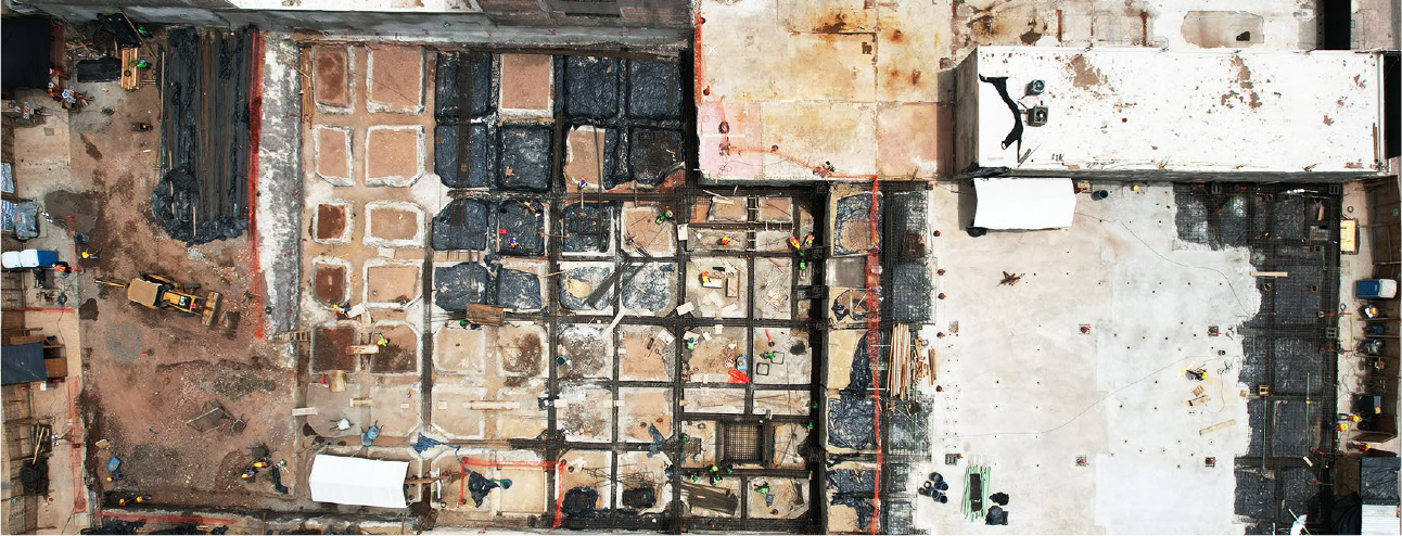
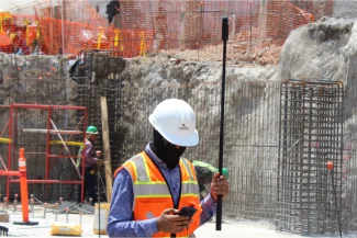
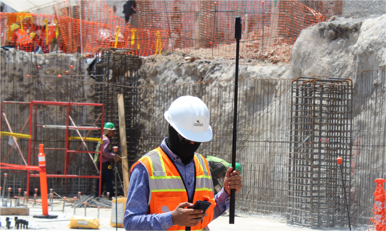
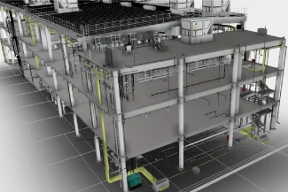
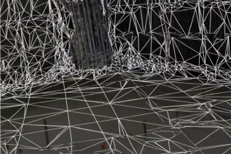
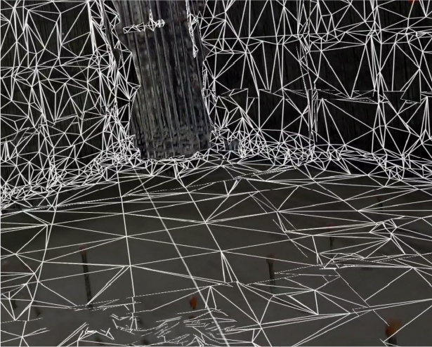
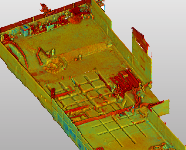
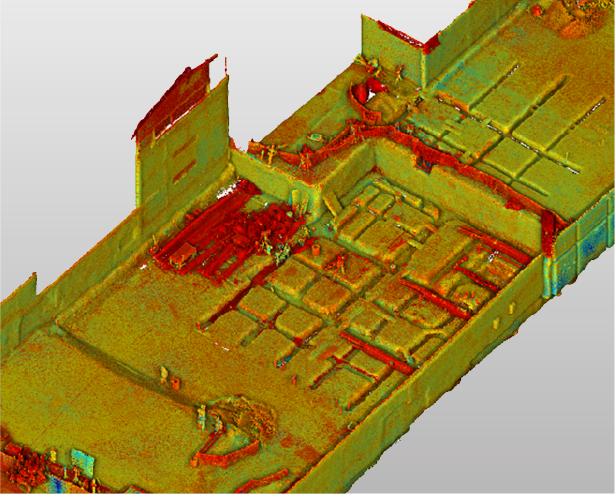
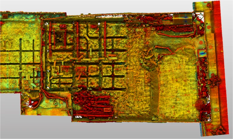
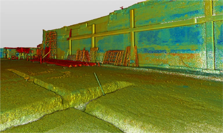
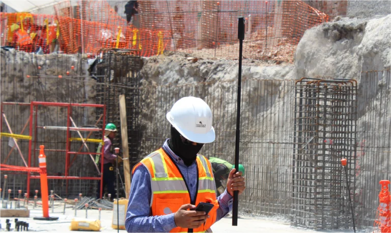
Terrestrial laser scanners
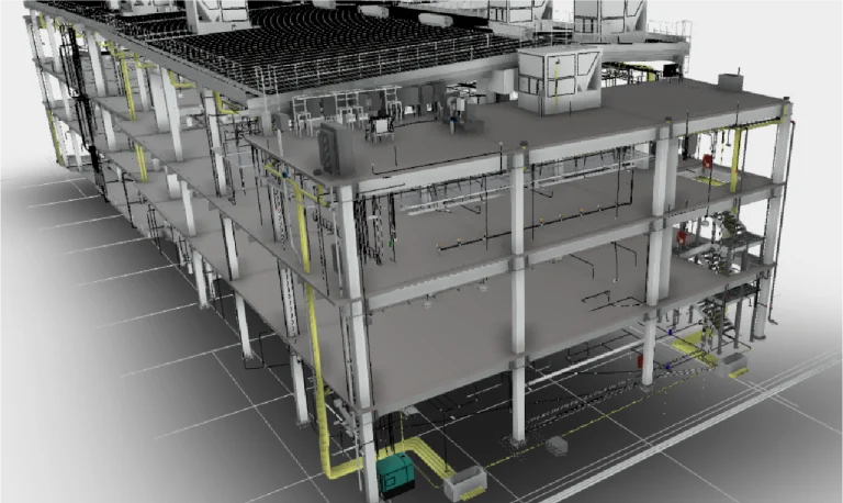
In this case, terrestrial laser scanners were used to capture high-precision data from both the facilities and the terrain, enabling the generation of detailed three-dimensional models.
Thanks to this information, it was possible to identify design clashes and coordinate the involved disciplines more efficiently. As a result, project planning was optimized and errors during construction execution were significantly reduced.
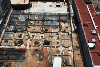
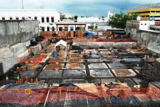
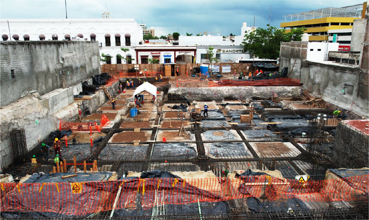
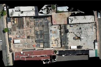
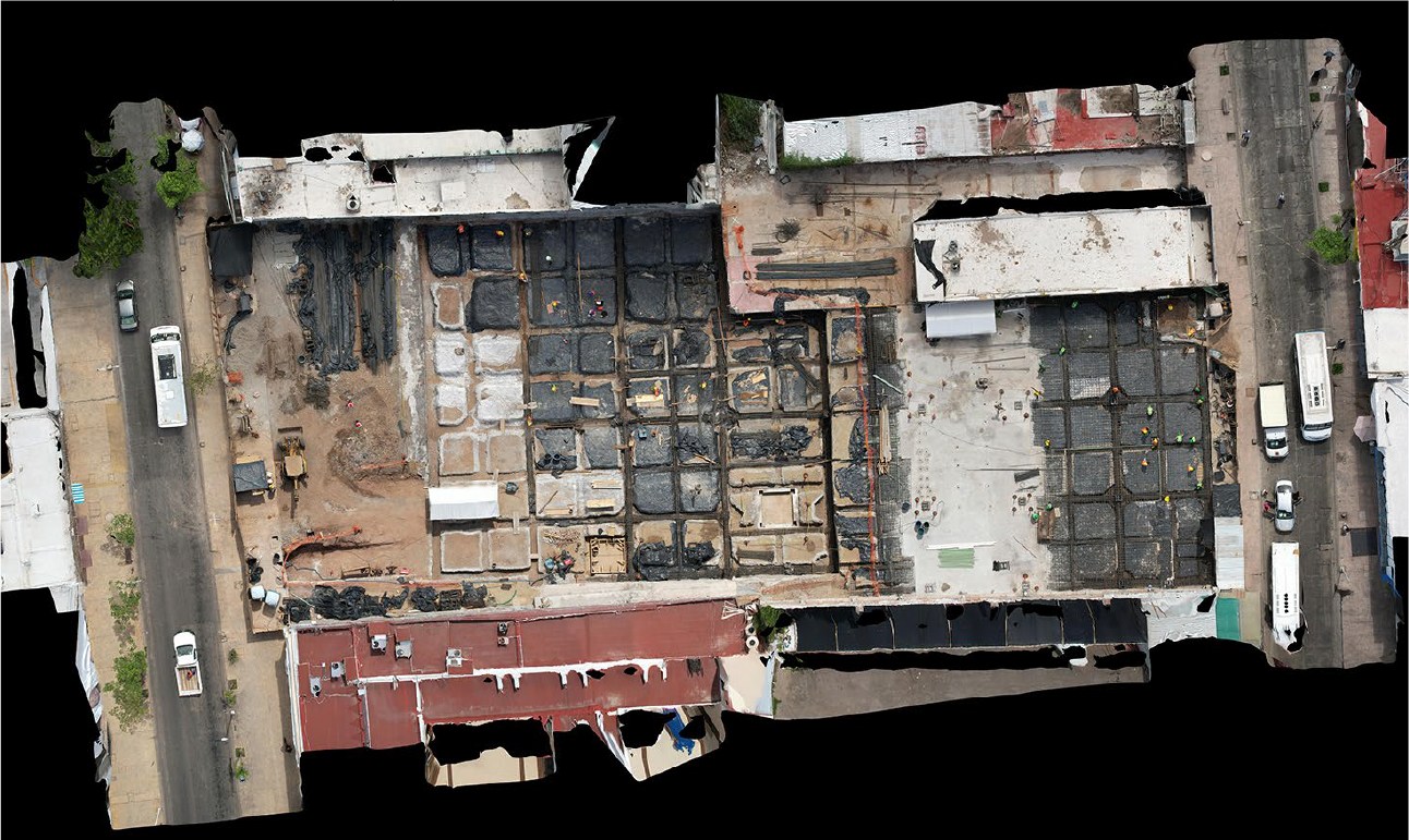
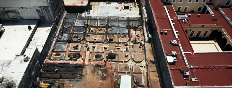
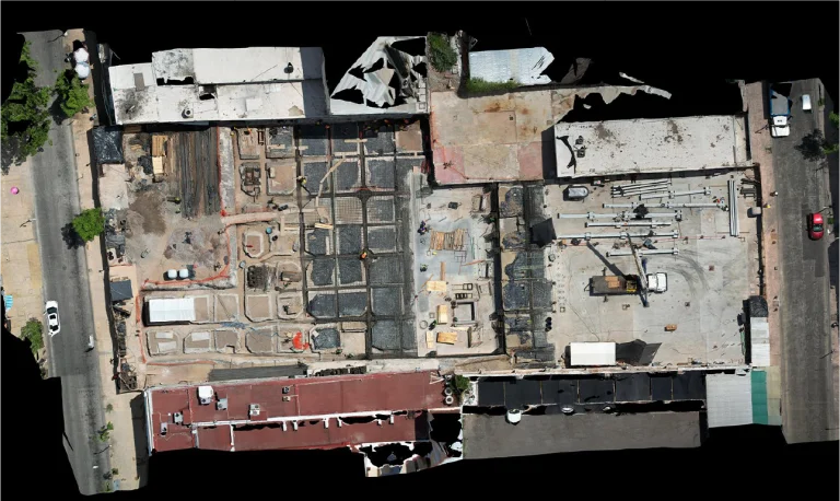
aerial photography
During the construction phase of the department store, aerial photography provided a clear overview of the site and the progress of the work.
Thanks to the images obtained, it was possible to evaluate progress in real time and identify areas with potential for improvement. In this way, a more efficient project execution was ensured along with precise control at every stage.
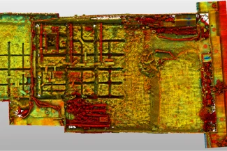
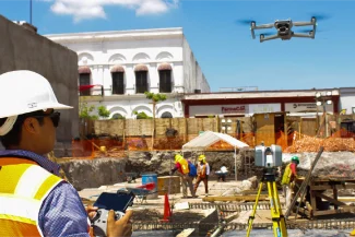
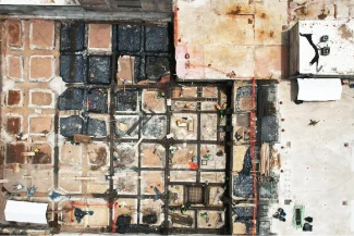
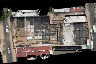
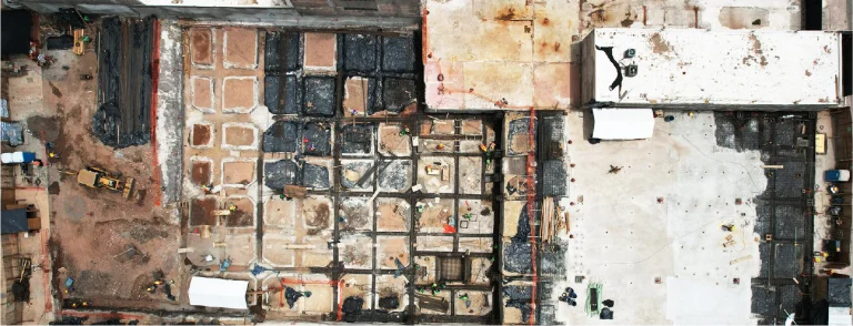
Photogrammetry
In this project, photogrammetry was carried out using drones equipped with high-resolution cameras, which generated detailed orthophotos of the terrain.
Thanks to this technique, it was possible to obtain accurate information about dimensions and features, supporting the initial planning and integrating the data into the BIM model to achieve more effective coordination among disciplines.
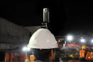
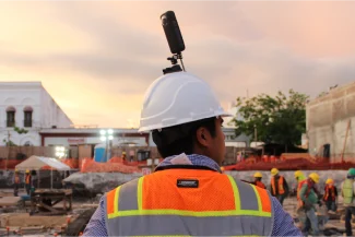
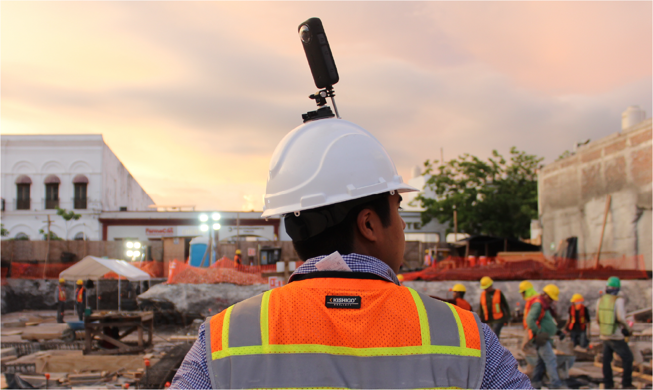
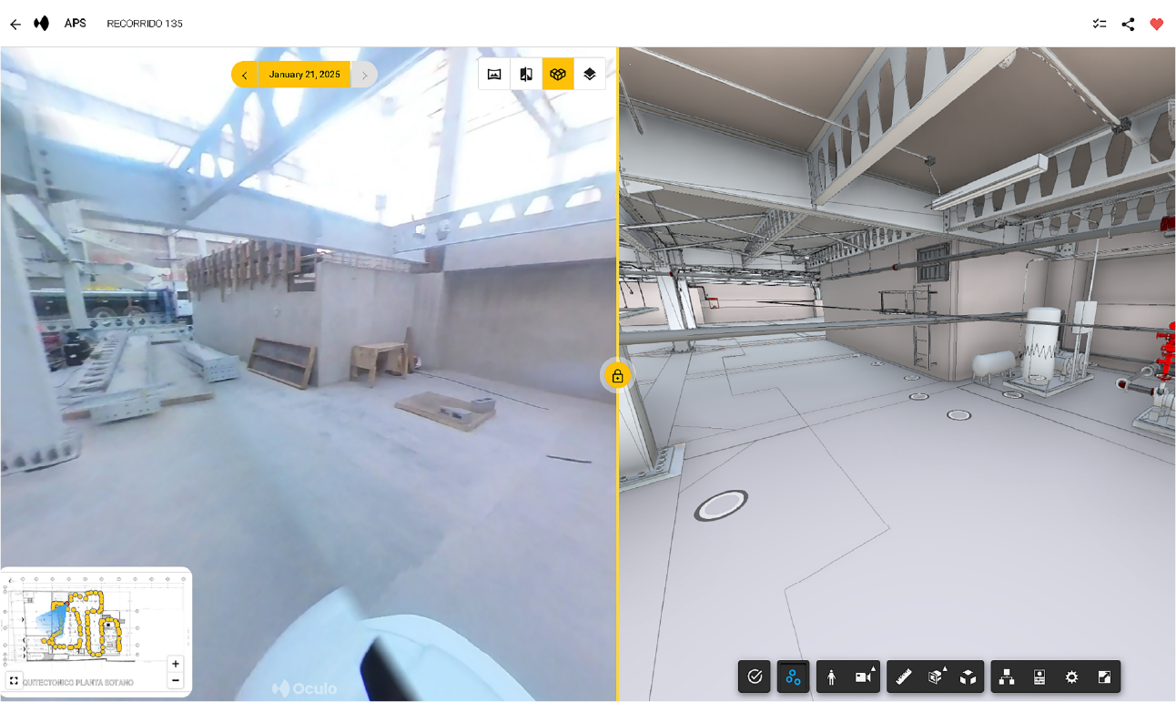
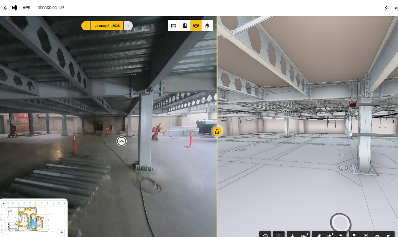
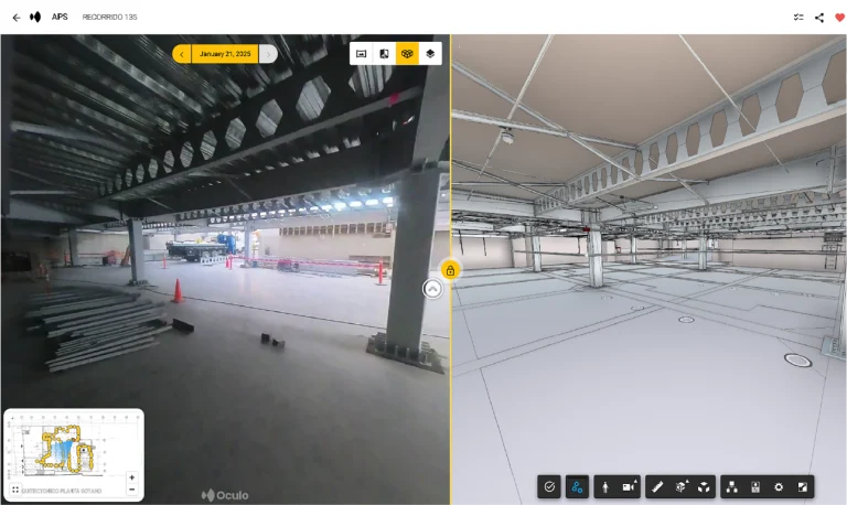
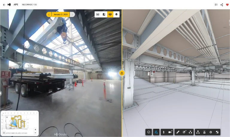
360º PHOTOGRAPHY
The 360-degree captures provided a comprehensive view of the environment, facilitating high-precision remote inspections and enabling continuous progress monitoring.
As a result, this tool became a key resource to ensure efficient communication and comprehensive supervision throughout the entire project.
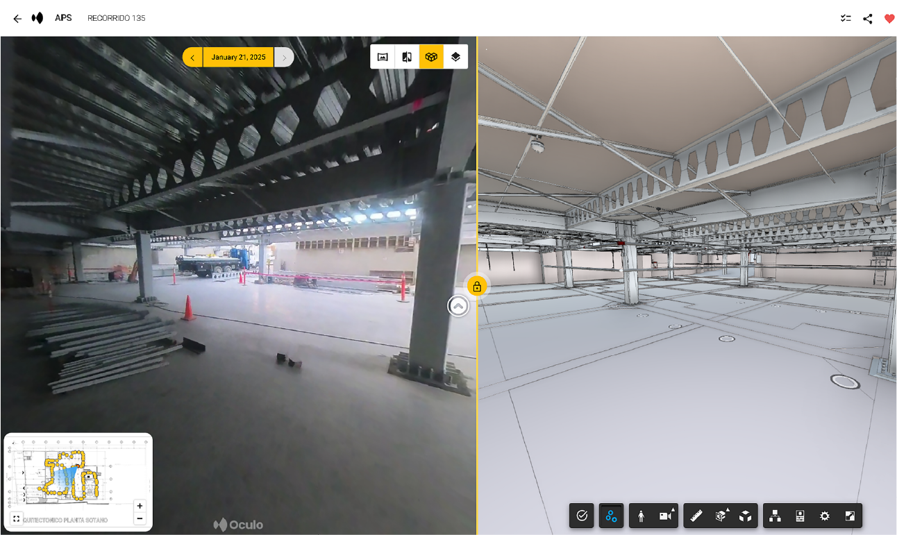
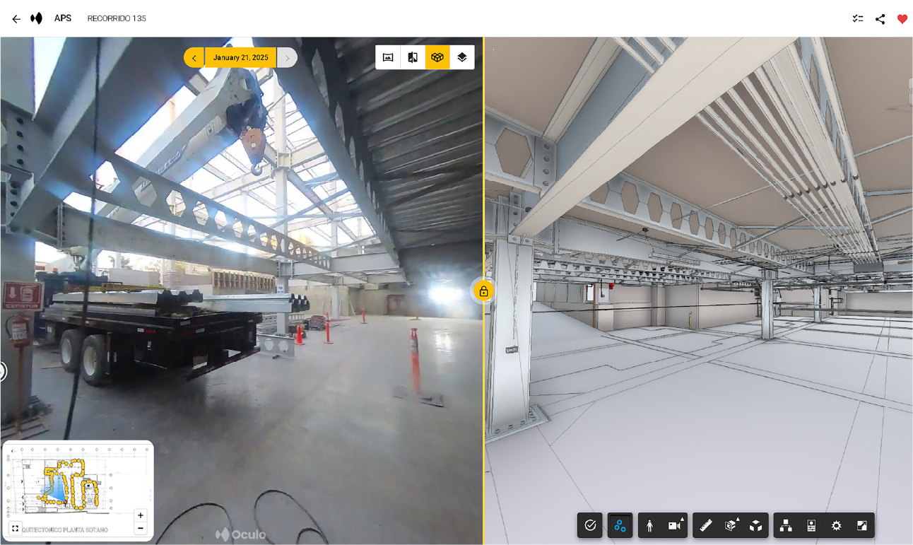
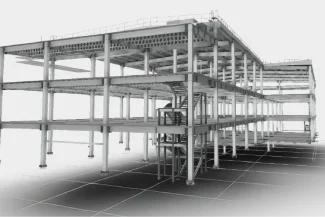
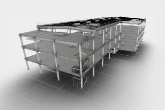
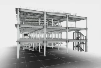
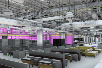
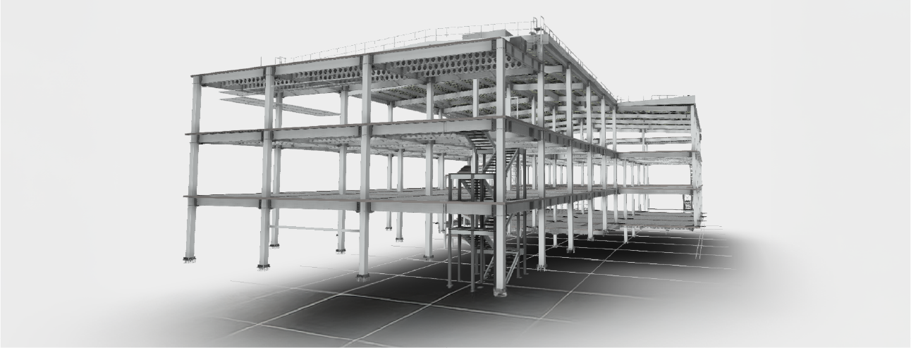
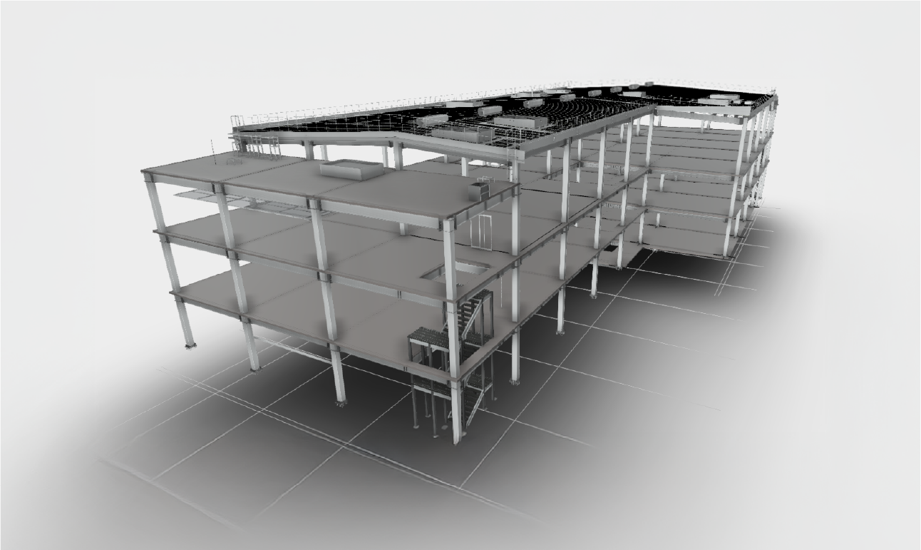
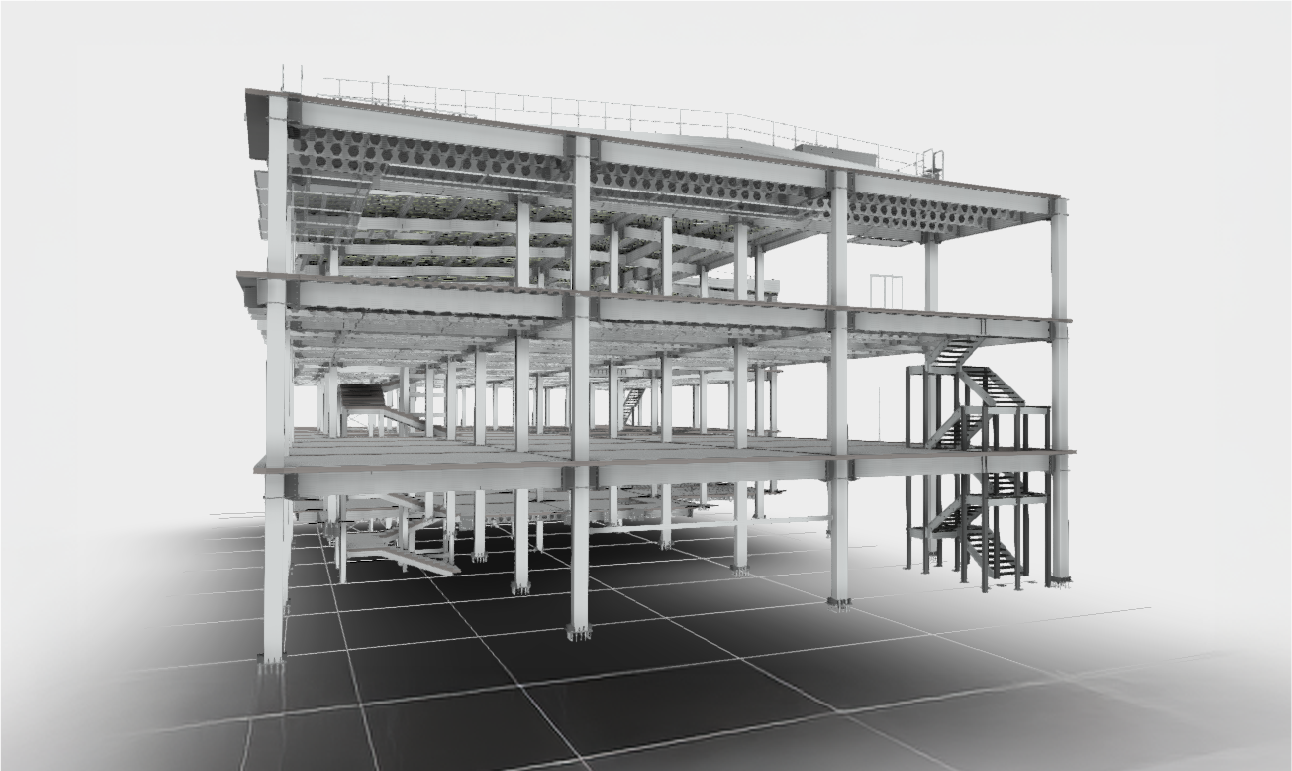
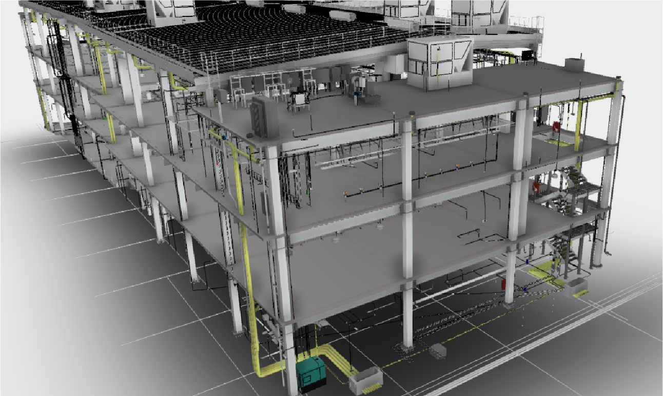
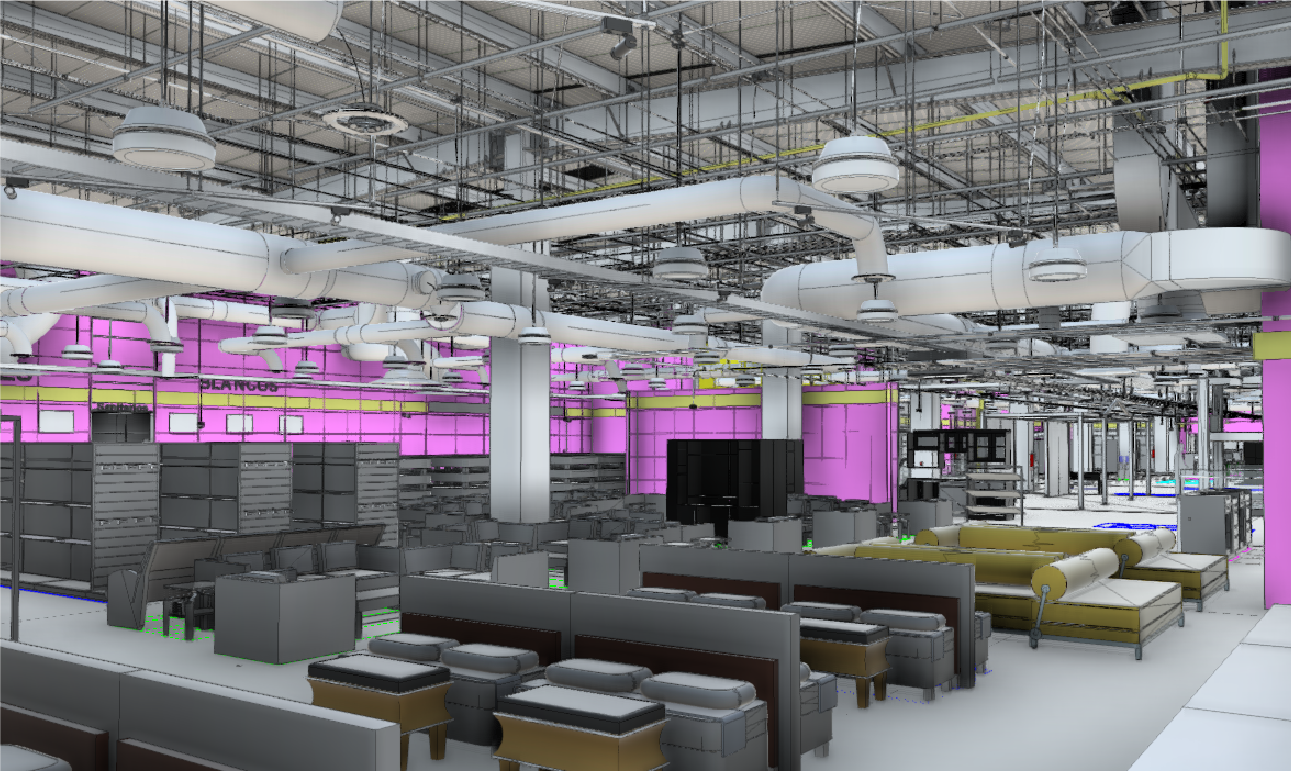
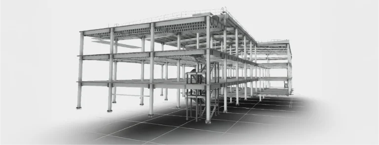
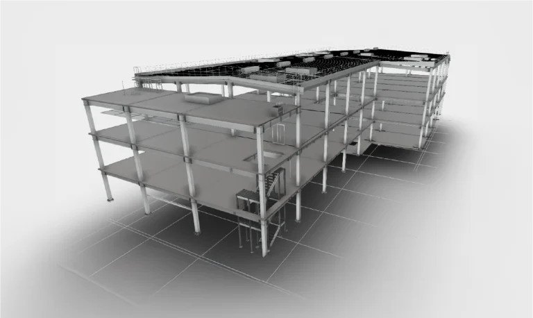
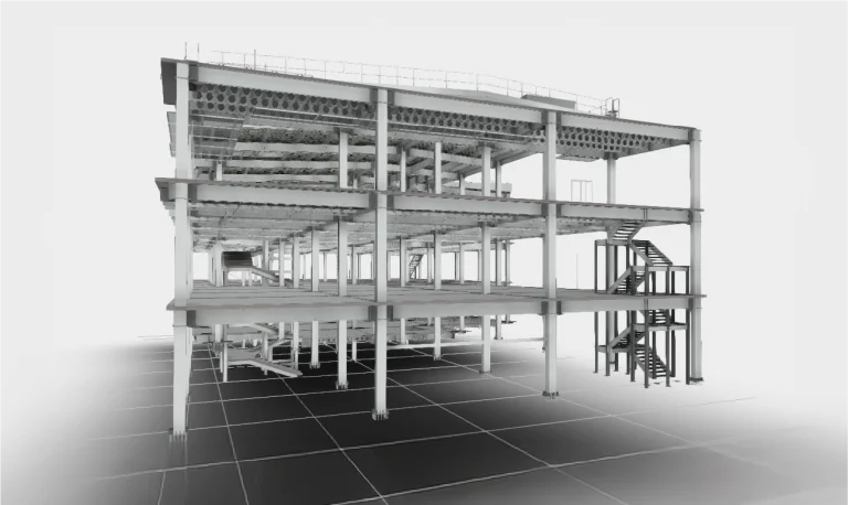
BIM (Building
Information
Modeling)
Multidisciplinary BIM models were created, integrating design, planning, and construction management, which facilitated coordination among disciplines.
In this way, construction processes were optimized, and more efficient management was ensured at every stage of the project.
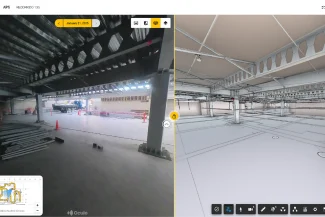
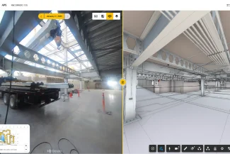
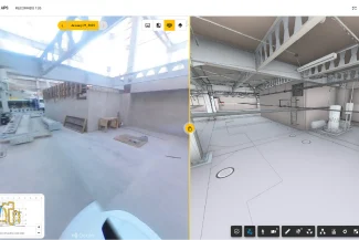
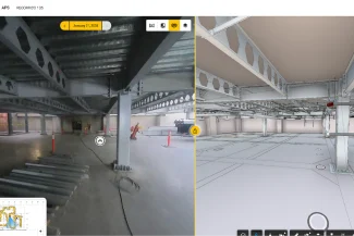
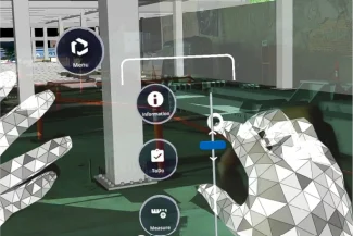
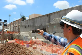
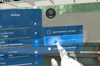
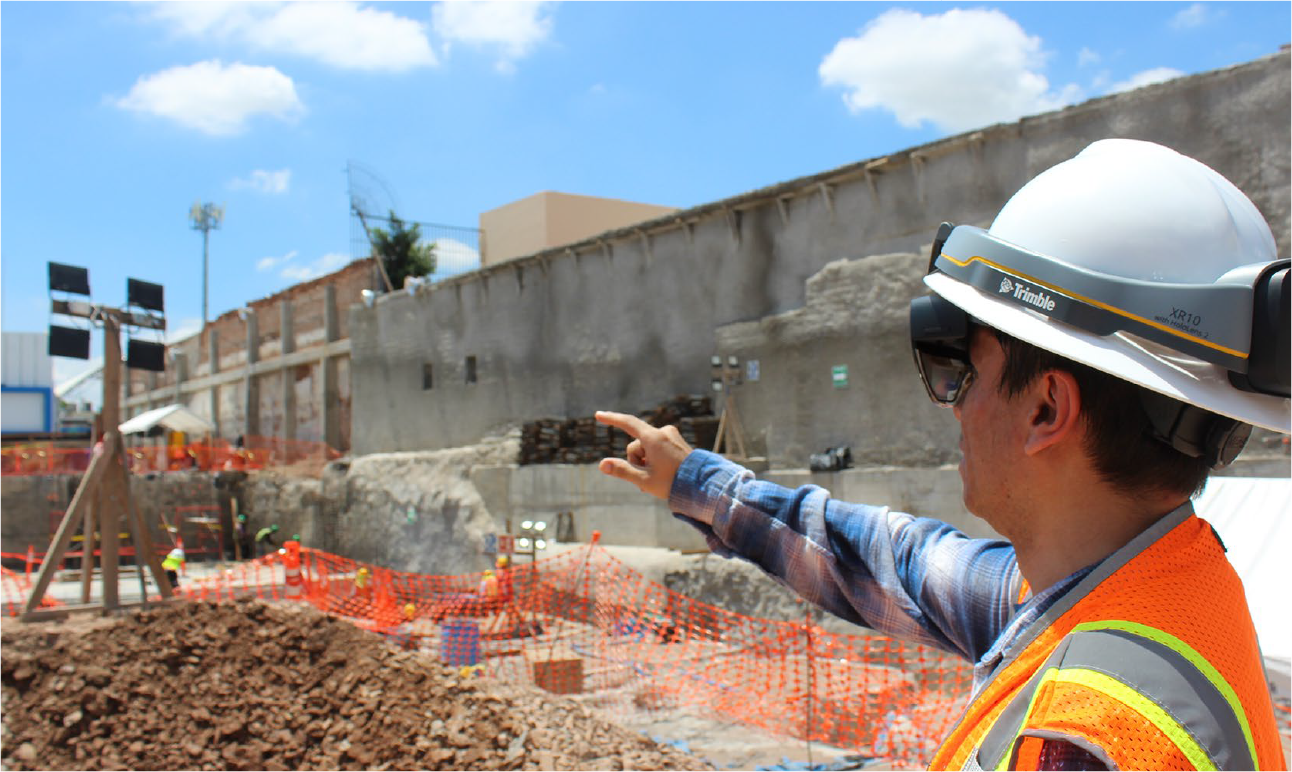
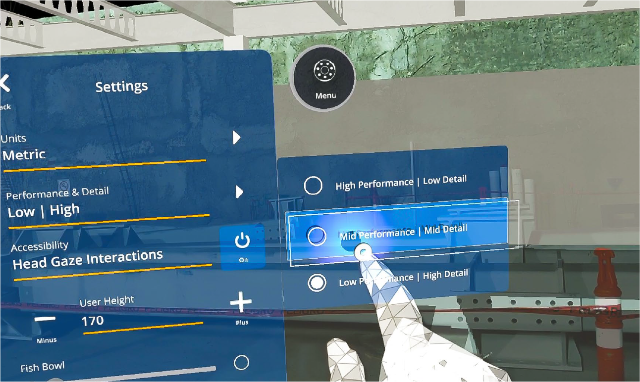
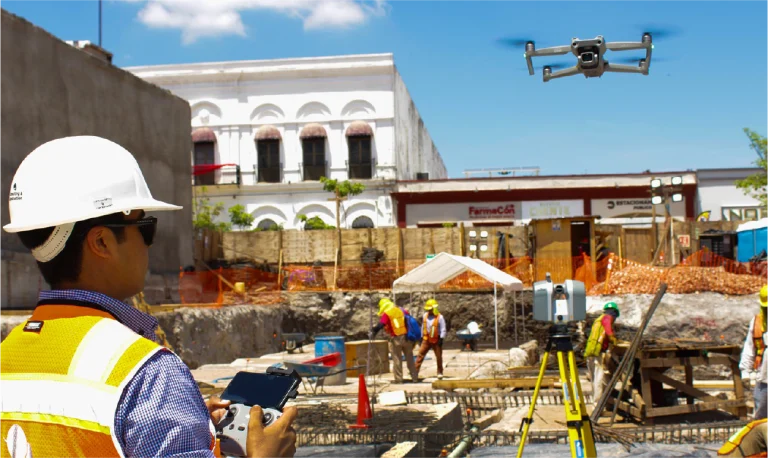
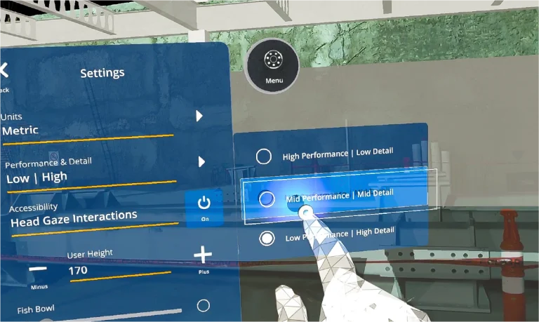
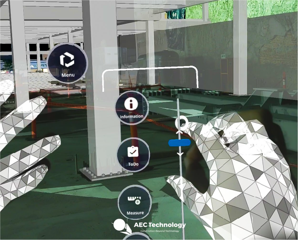
mixed reality
The implementation of mixed reality made it possible to explore the project directly on the construction site.
Thanks to this technology, virtual models were combined with the real environment, facilitating real-time adjustments and improvements, and ensuring a much more efficient execution.
Implementation of Reality Capture, Mixed Reality, 360 Photography, and BIM models to optimise processes in construction projects, including the coordination of multidisciplinary designs, planning and site management through 4D and 5D models, and the integrated control of time and costs.
REALITY CAPTURE
Terrestrial Laser Scanners
Terrestrial laser scanners were used to capture precise data of the facilities and terrain, generating detailed three-dimensional models. These data facilitated the identification of design clashes and helped coordinate the various disciplines involved, improving planning and reducing errors during project execution.
DIGITAL PHOTOGRAPHY
Aerial Photography
During the construction phase of the department store, aerial photography provided a clear overview of the site. The images obtained helped assess progress in real time and identify potential areas for improvement to ensure efficient project execution.
DIGITAL PHOTOGRAPHY
Photogrammetry
Photogrammetry was carried out using drones equipped with high-resolution cameras to generate orthophotos. This technique provided accurate information on terrain dimensions and characteristics, supporting initial planning and integrating data into the BIM model for more effective coordination between disciplines.
DIGITAL PHOTOGRAPHY
360º Photography
360-degree captures enabled a comprehensive view of the environment, facilitating high-precision remote inspections and continuous progress monitoring. This tool was key to ensuring effective communication and comprehensive supervision throughout the project.
DIGITAL MODELS
BIM (Building Information Modeling)
Multidisciplinary BIM models were created, integrating design, planning, and construction management. These models enhanced coordination between disciplines, streamlining construction processes and ensuring more efficient project management across all phases.
EXTENDED REALITY
Mixed Reality
The implementation of mixed reality allowed the project to be explored directly on-site during construction. With this technology, virtual models and the real environment were combined, enabling adjustments and improvements for a more efficient execution.