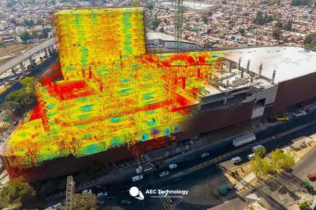
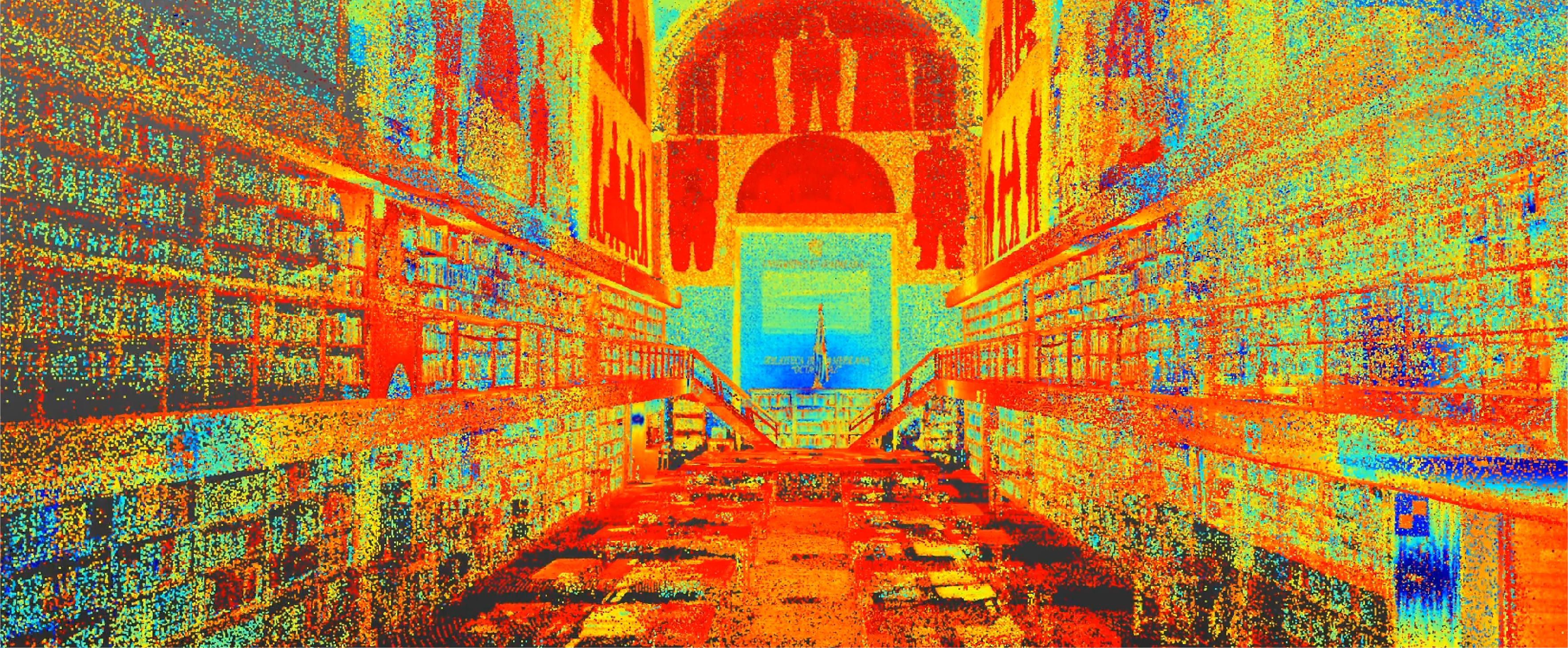
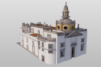
A point cloud survey was conducted using terrestrial laser scanning, complemented by the development of BIM models and the creation of As-Built drawings for an historic library. This work provided precise and detailed documentation, facilitating the planning and execution of the necessary renovations for its remodeling.
Client:
UDG
Universidad
de Guadalajara
Location:
Guadalajara,
México
Year:
2019
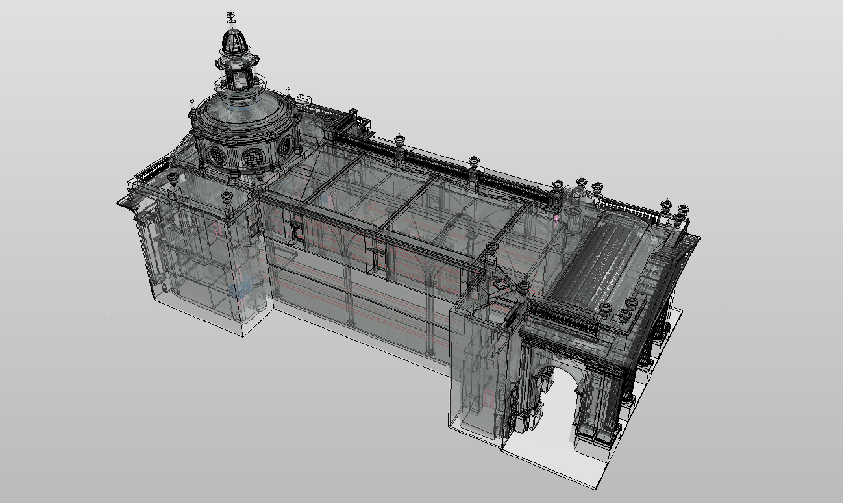
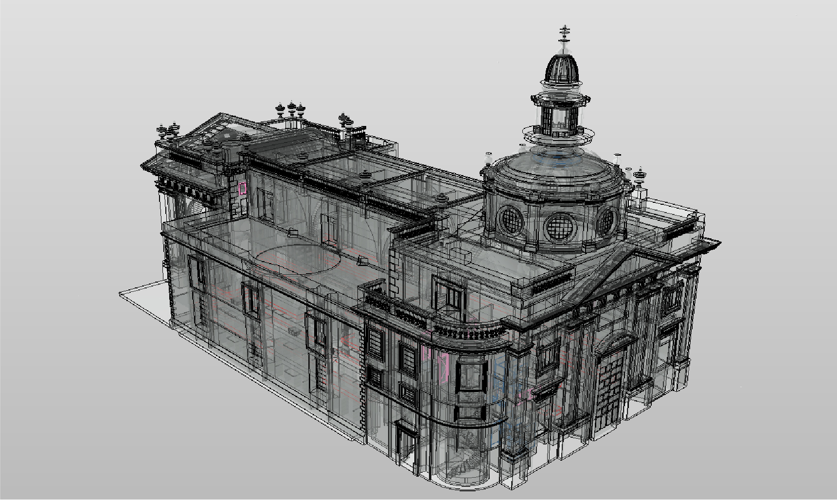
REALITY
CAPTURE
DIGITAL
MODELS
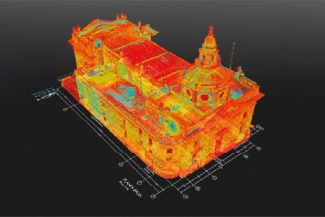
TERRESTRIAL
LASER SCANNING
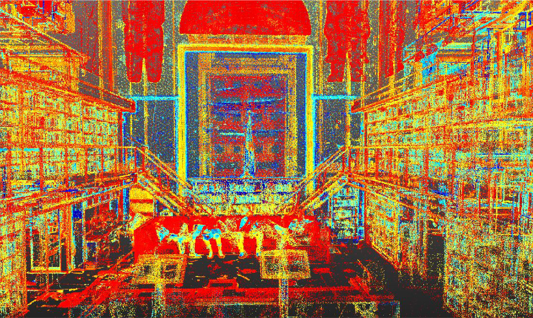
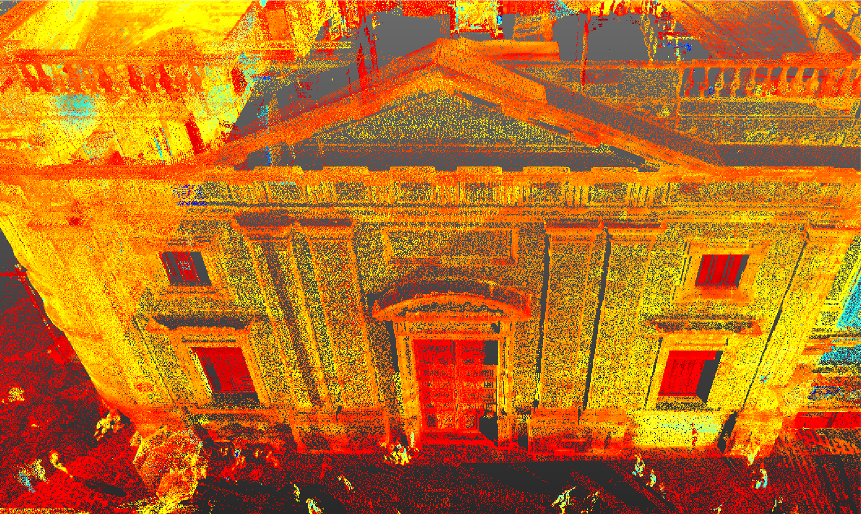
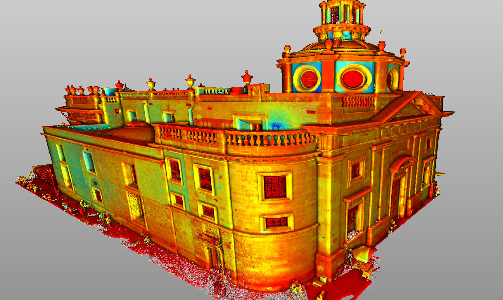
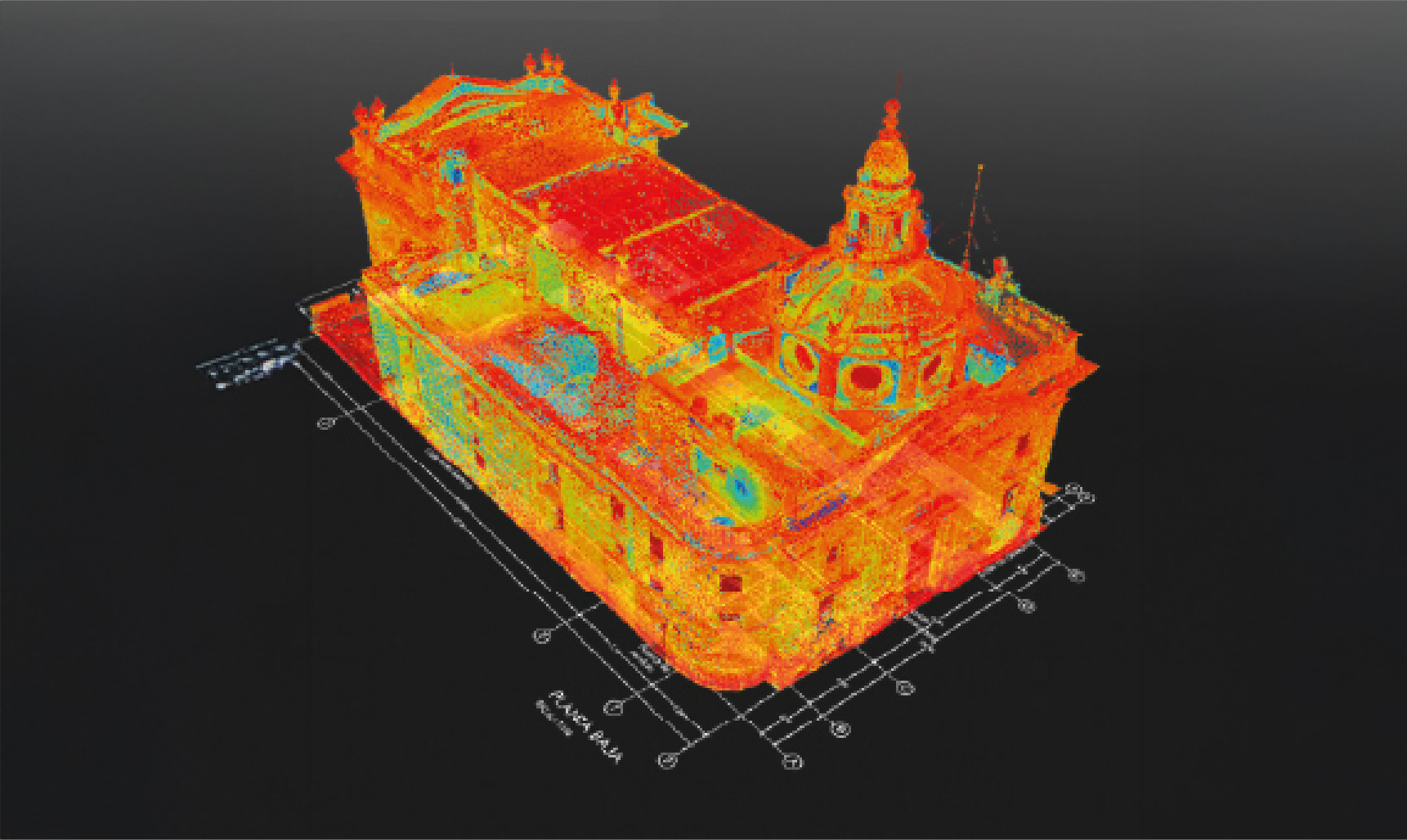
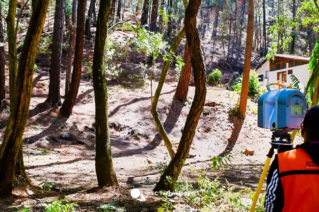
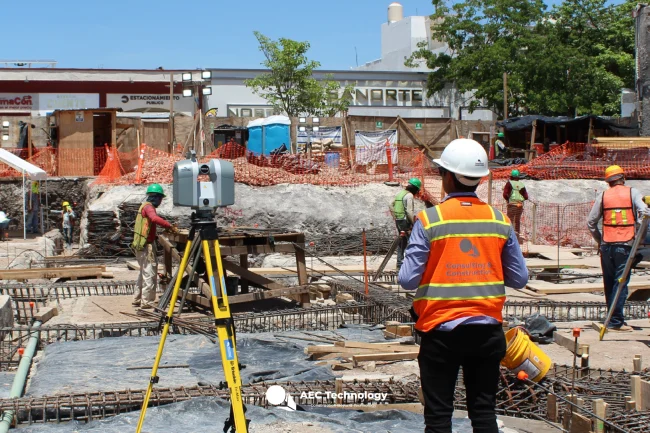
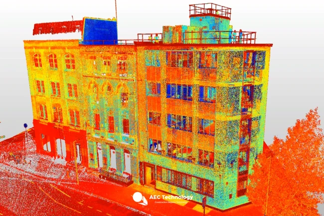
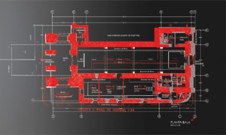
The terrestrial laser scanning captured millions of points with high accuracy, generating a detailed point cloud that documented the current conditions of the library. This information was key to accurately recording the architectural and structural characteristics of the building.
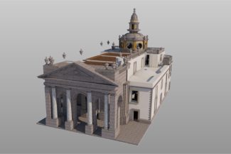
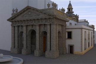
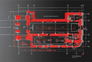
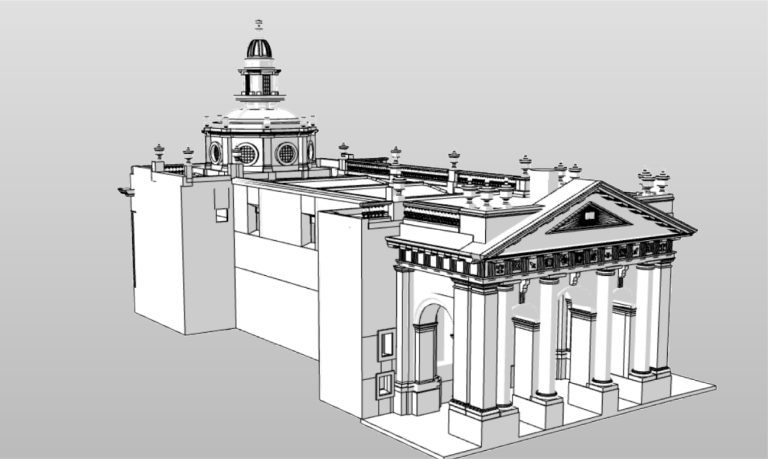
BIM
(Building
Information
Modeling)
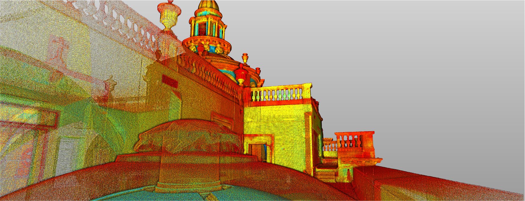
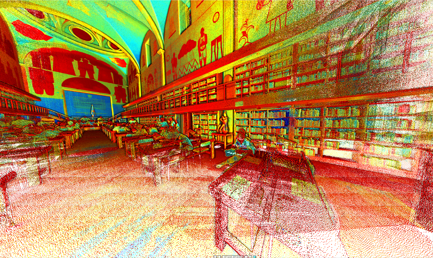
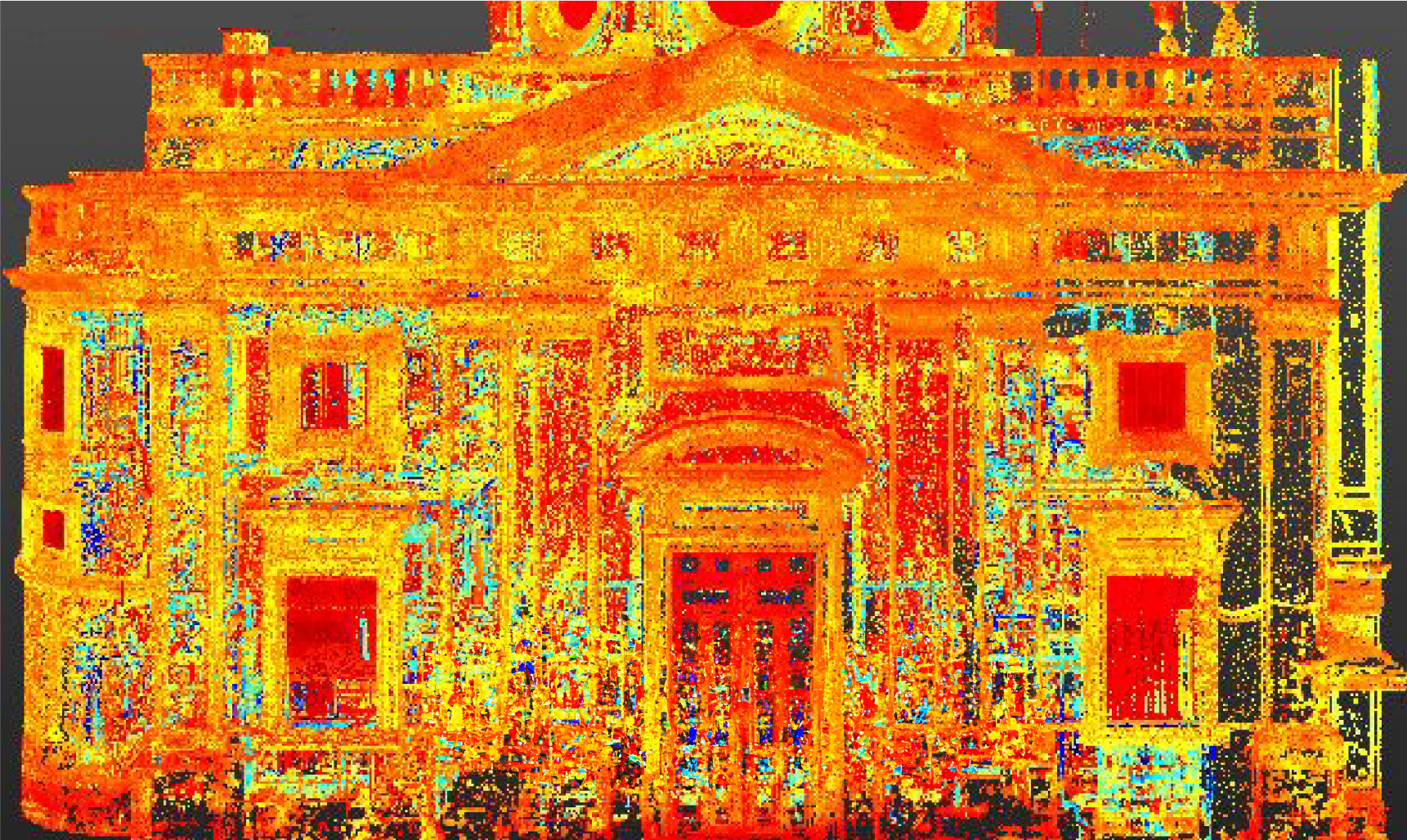
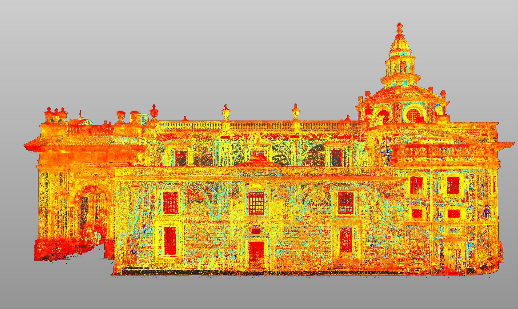
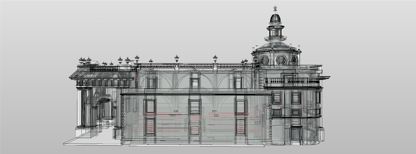
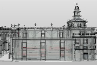
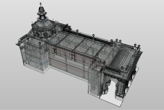
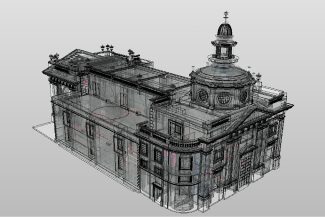
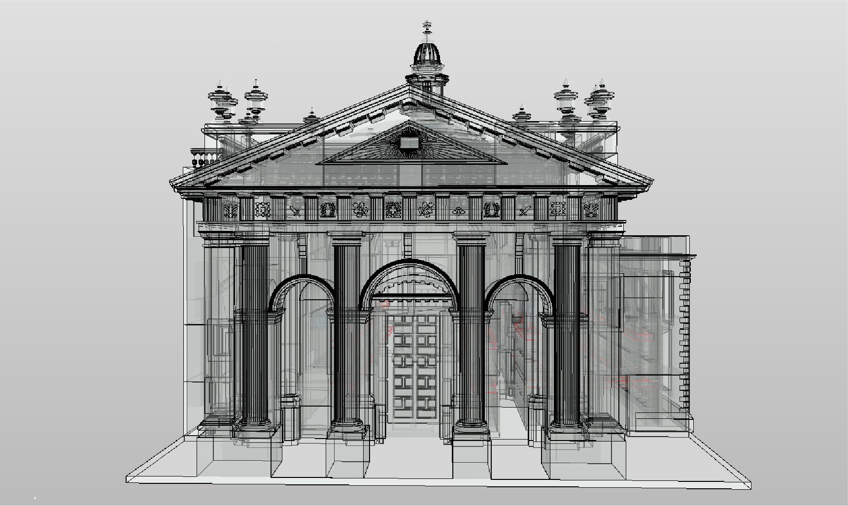
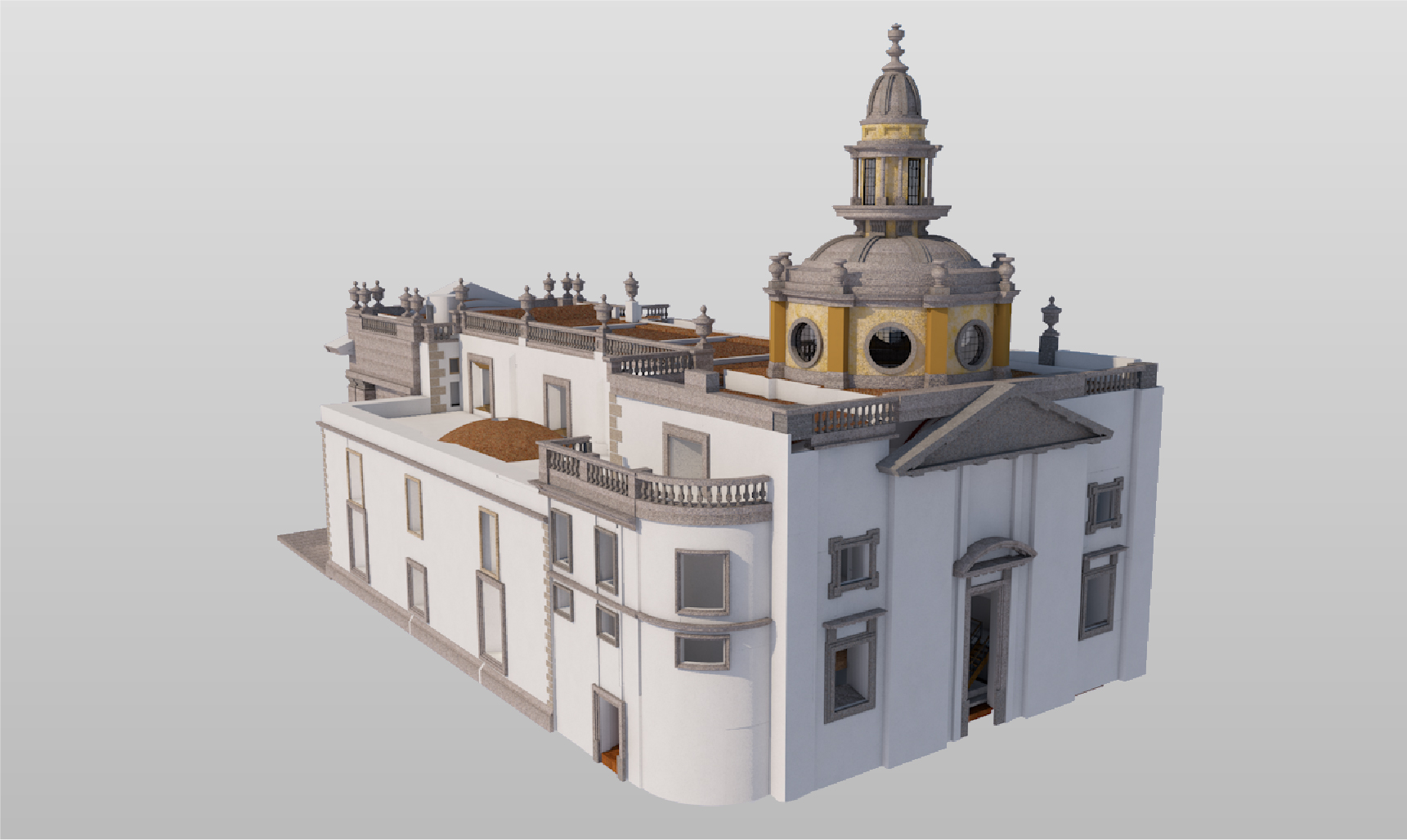
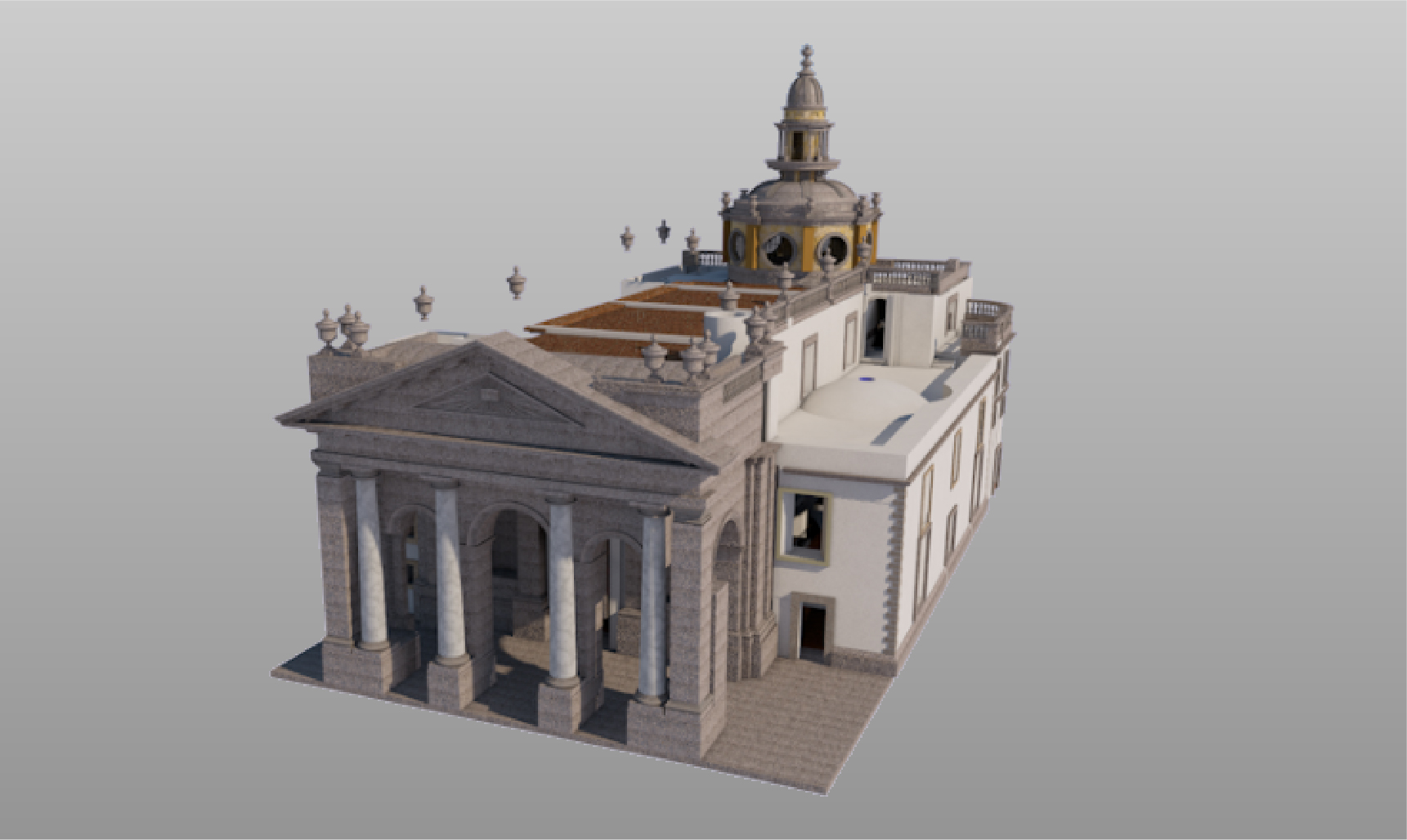
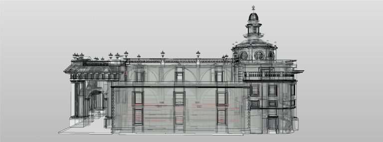
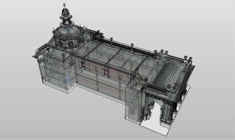
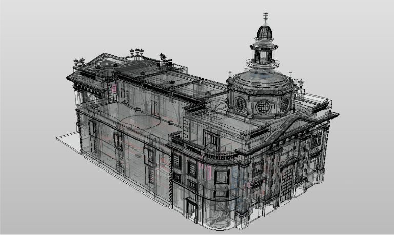
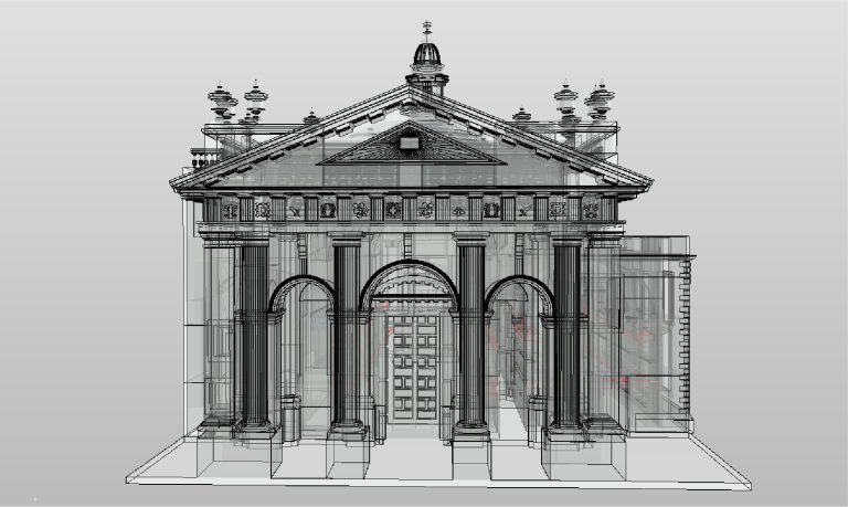
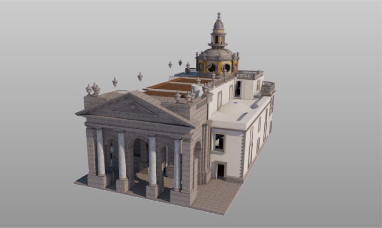
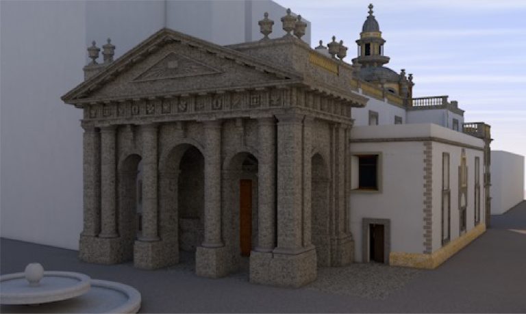
Using the obtained point cloud, BIM models were developed that integrated all relevant information about the library. These models facilitated the planning of the renovations and ensured the efficient coordination of the disciplines involved in the remodeling process.
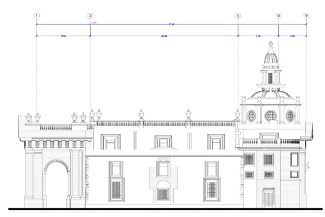
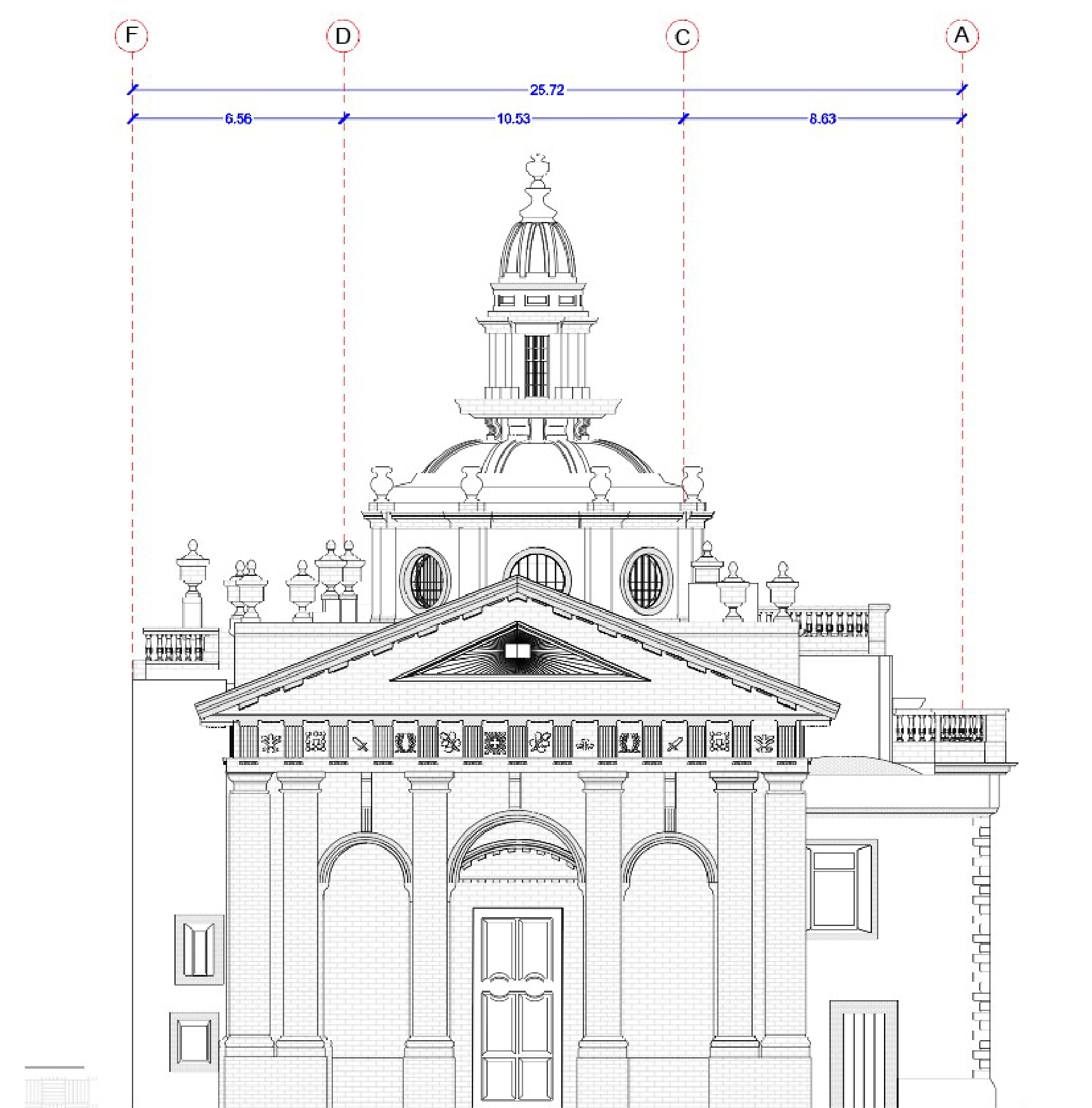
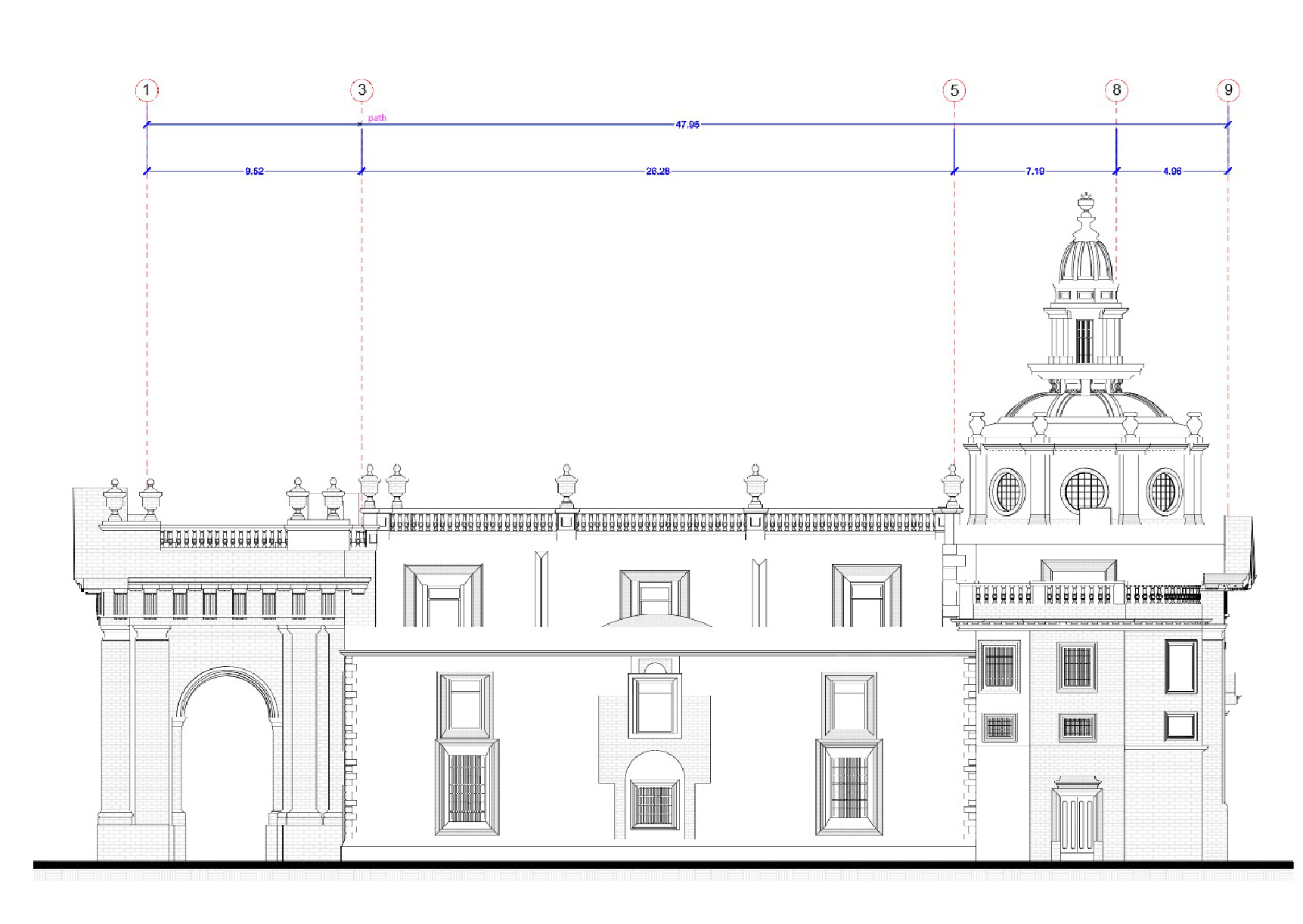
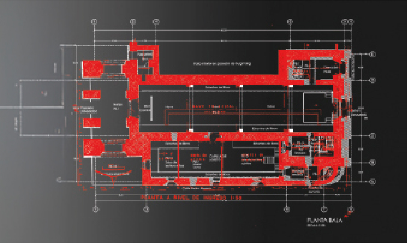
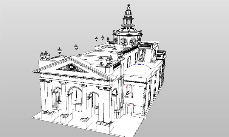
AS-BUILT
DRAWINGS
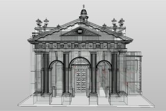
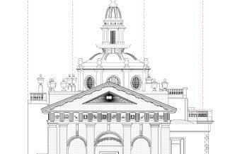
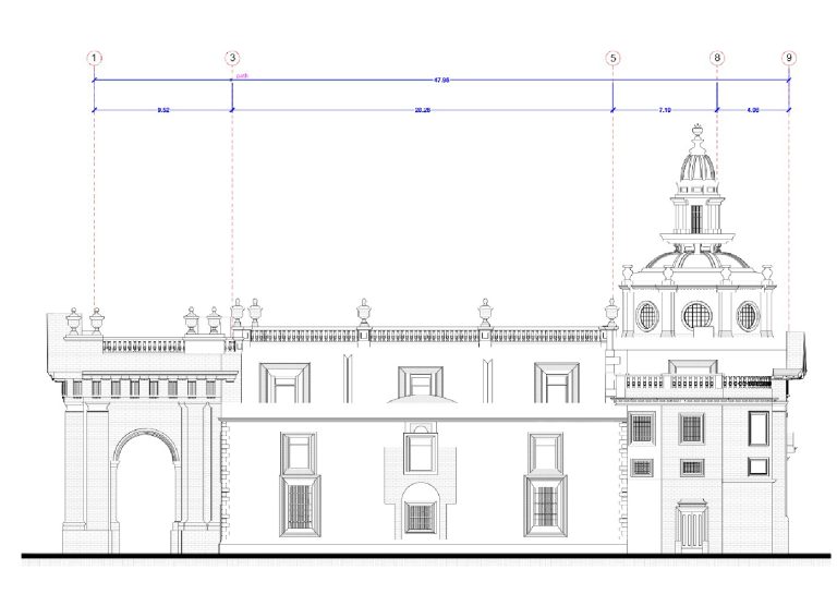
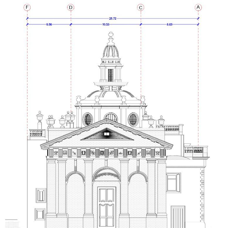
Based on the BIM model, As-Built drawings were generated, faithfully reflecting the existing conditions of the library. These documents were essential for the renovations, enabling design based on precise data and adapted to the building’s original features.
A point cloud survey was conducted using terrestrial laser scanning, complemented by the development of BIM models and the creation of As-Built drawings for an historic library. This work provided precise and detailed documentation, facilitating the planning and execution of the necessary renovations for its remodeling.
REALITY CAPTURE
Terrestrial Laser Scanning
The terrestrial laser scanning captured millions of points with high accuracy, generating a detailed point cloud that documented the current conditions of the library. This information was key to accurately recording the architectural and structural characteristics of the building.
DIGITAL MODELS
BIM
(Building Information Modeling)
Using the obtained point cloud, BIM models were developed that integrated all relevant information about the library. These models facilitated the planning of the renovations and ensured the efficient coordination of the disciplines involved in the remodeling process.
DIGITAL MODELS
AS-BUILT DRAWINGS
Based on the BIM model, As-Built drawings were generated, faithfully reflecting the existing conditions of the library. These documents were essential for the renovations, enabling design based on precise data and adapted to the building’s original features.