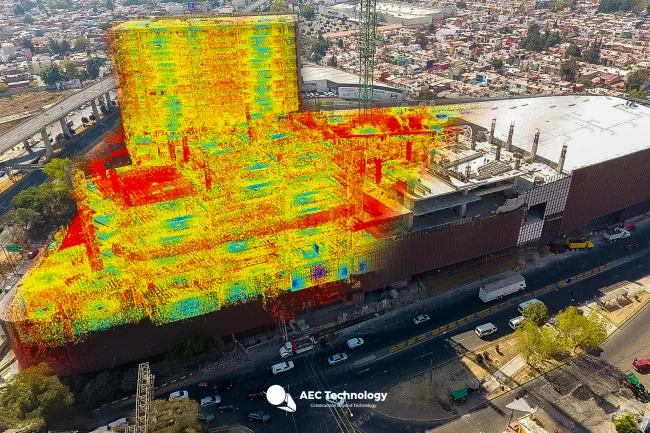
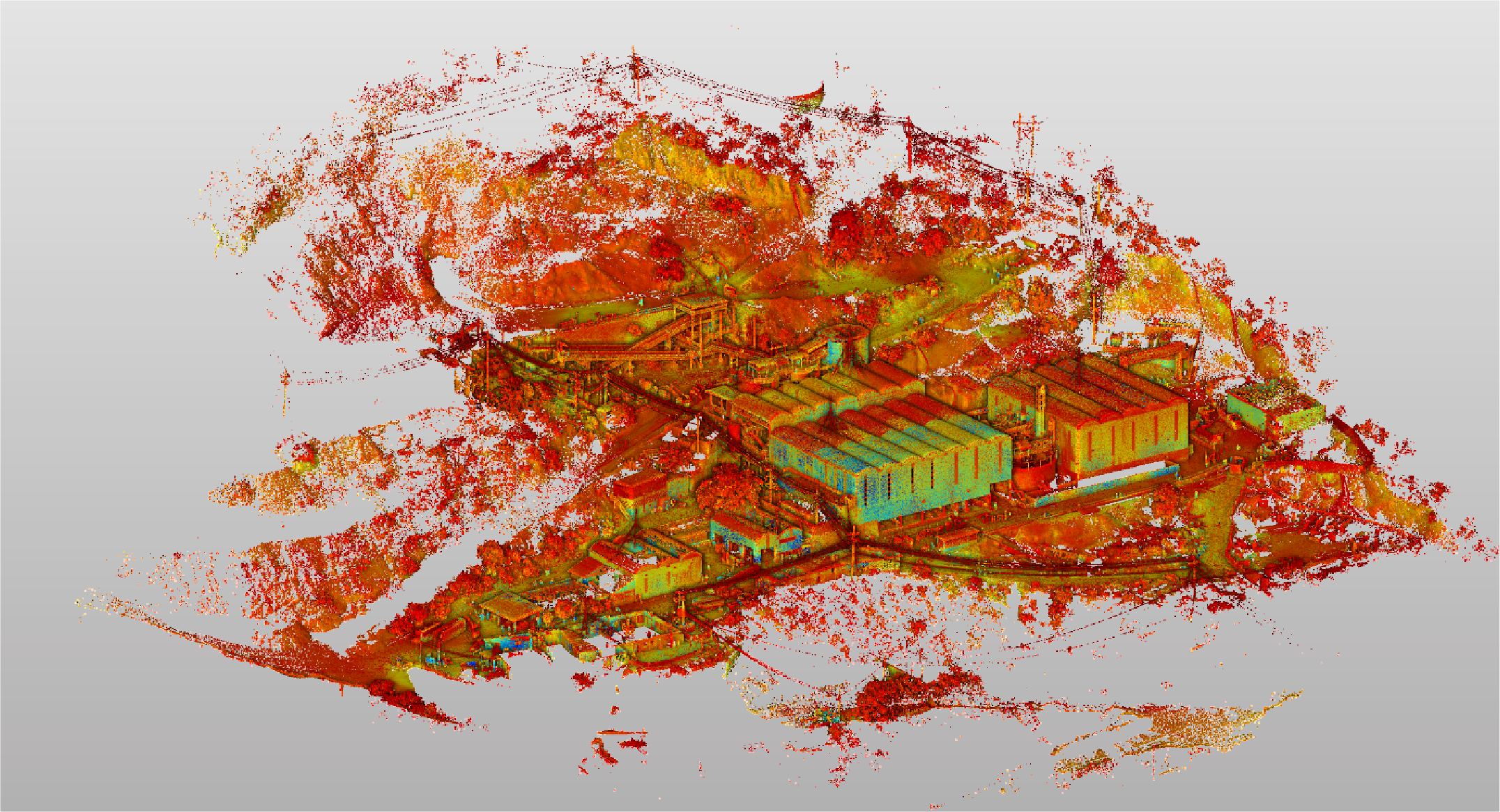
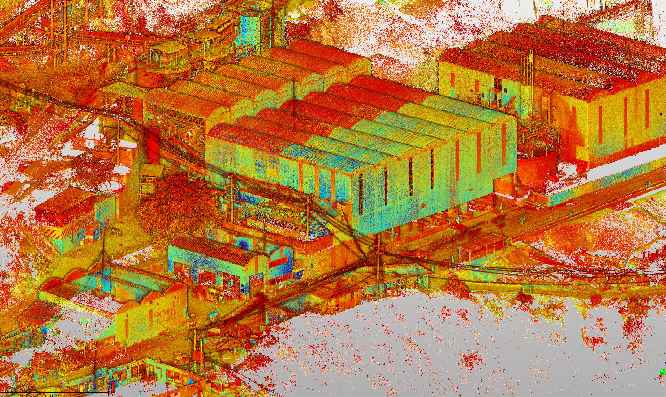
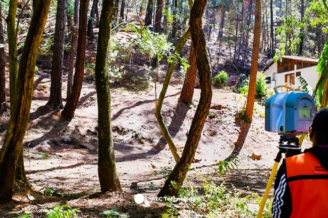
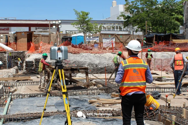
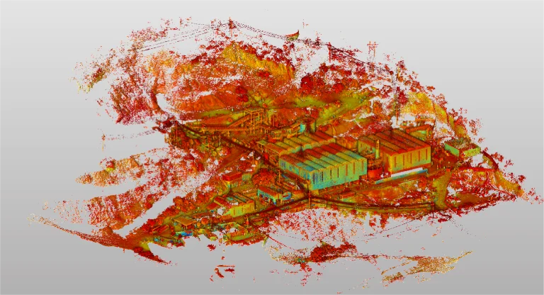
Reality capture was conducted using laser scanning, complemented by photogrammetric surveying and the creation of a topographic plan. This work provided detailed and accurate documentation of the terrain, essential for analysis and efficient project planning.
Client:
DIABRAS
MEXICANA
Location:
Chihuahua,
México
years
Year
Reality capture
DIGITAL PHOTOGRAPHY
TERRESTRIAL
LASER SCANNING
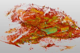
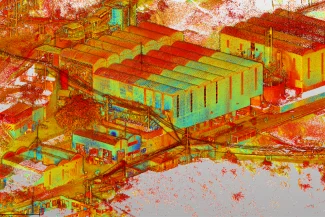
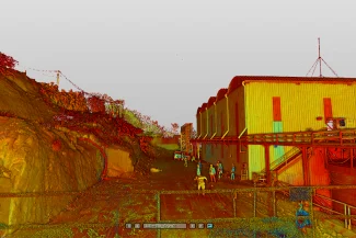
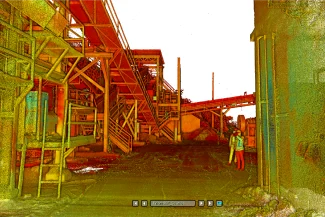
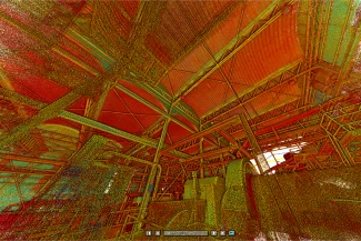
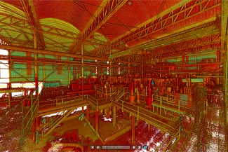
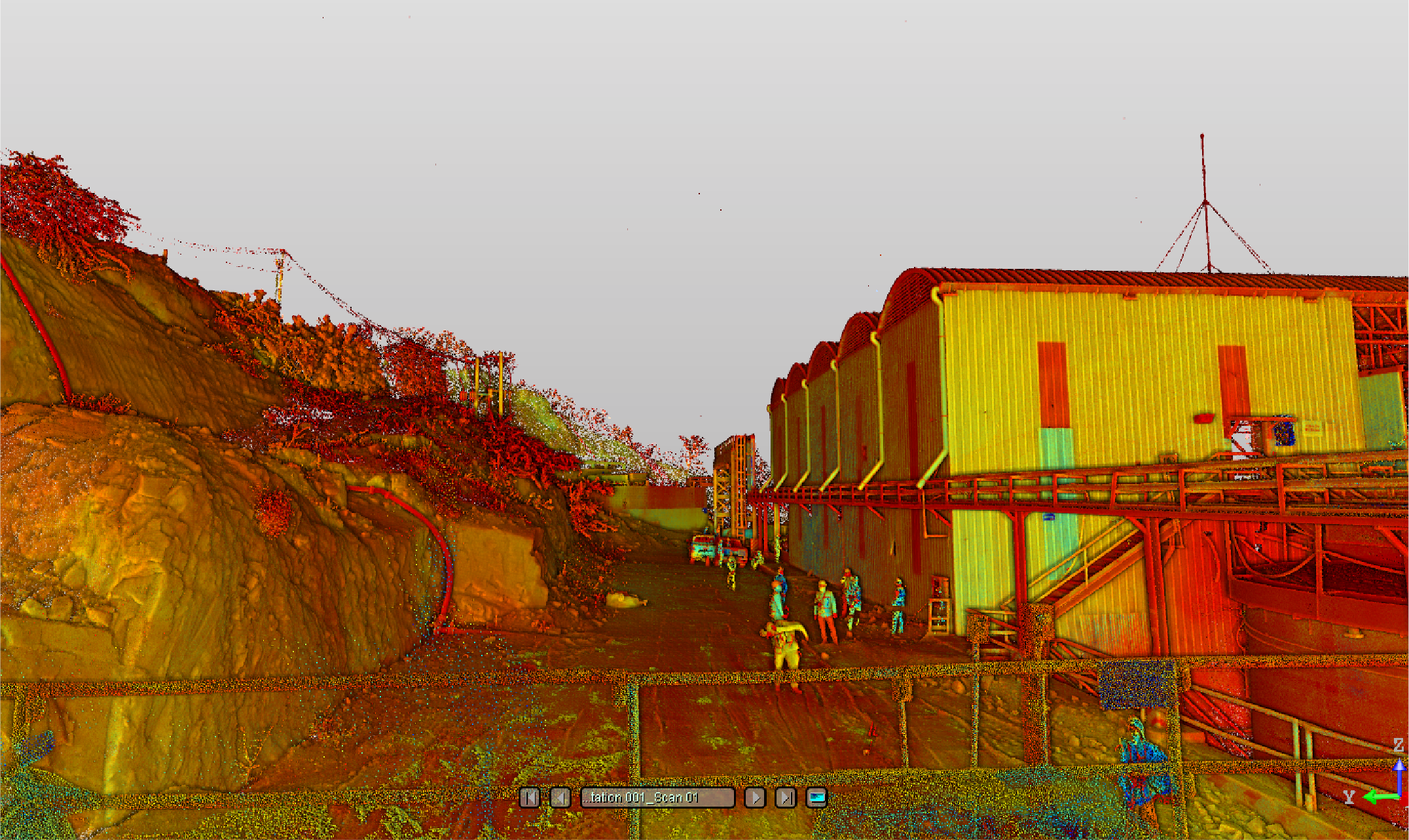
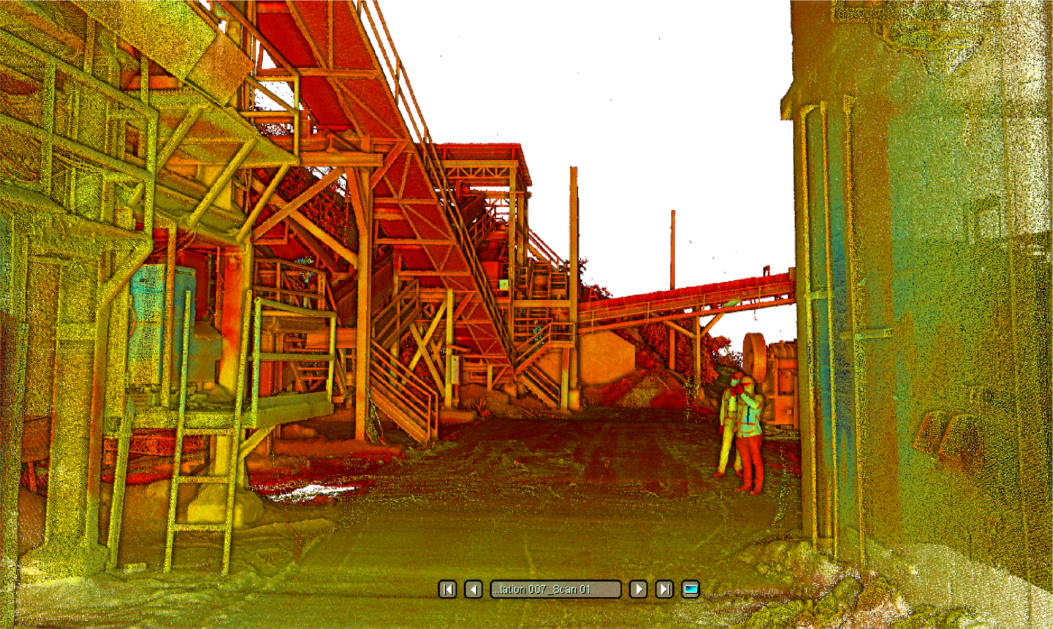
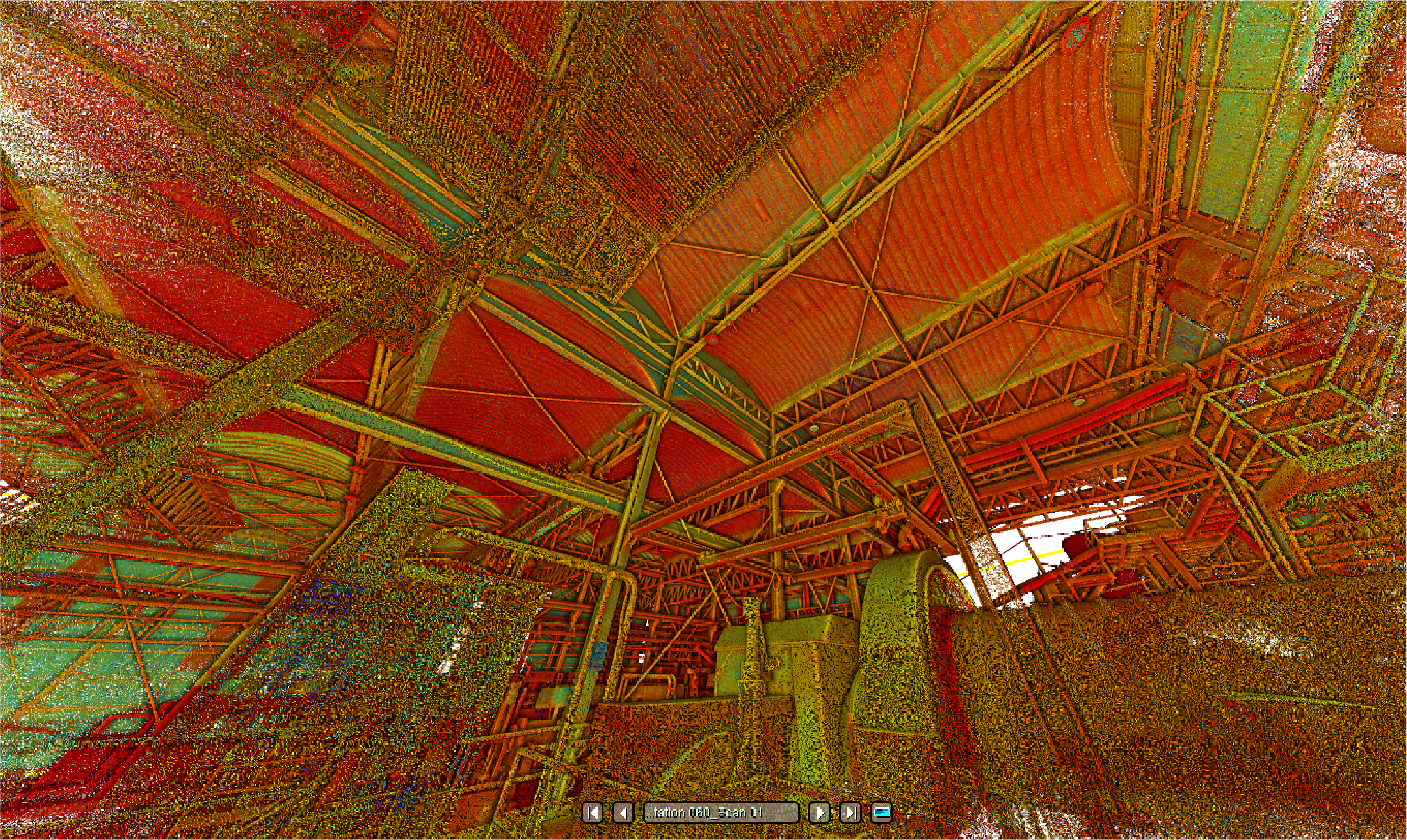
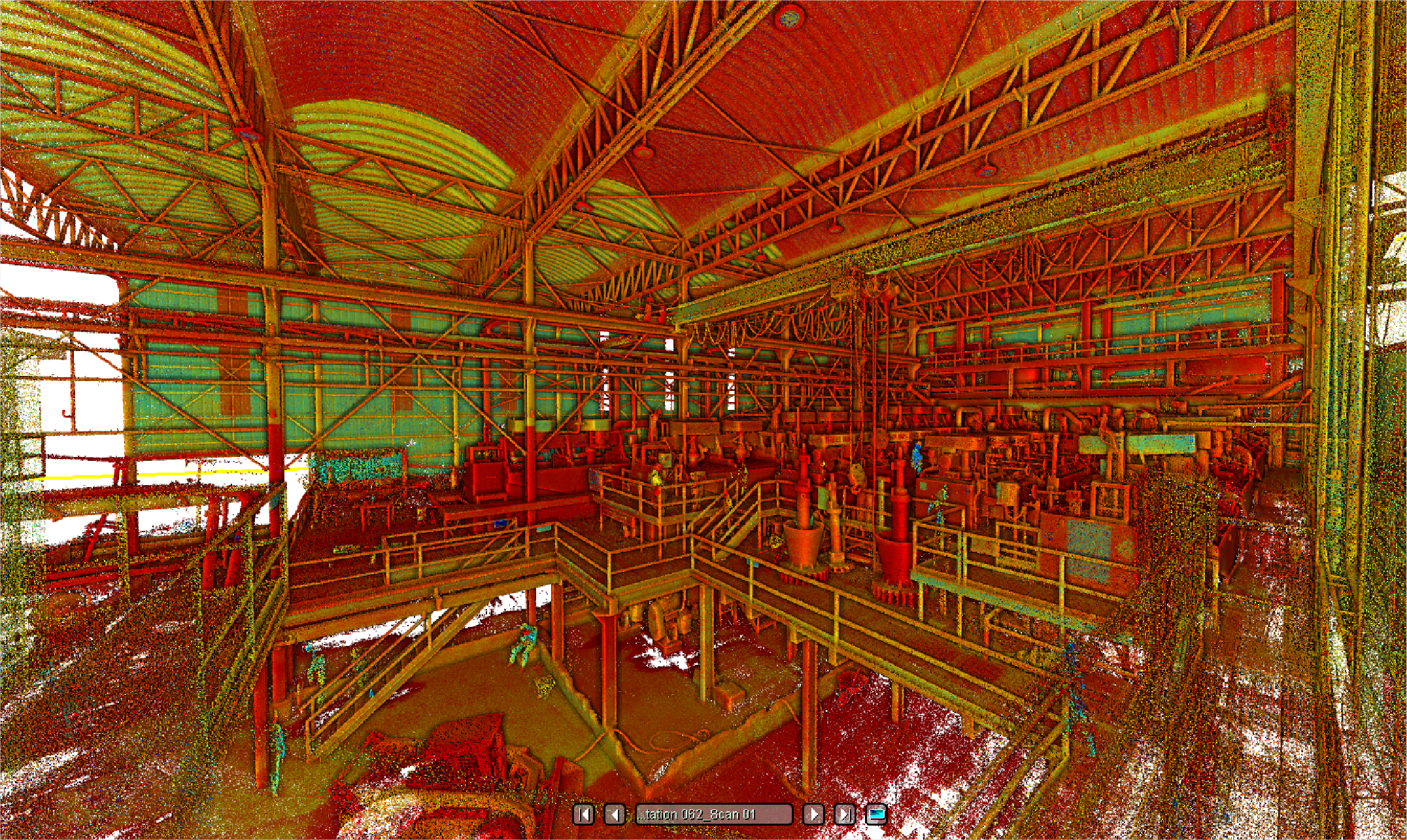
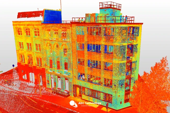
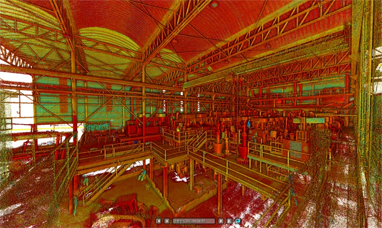
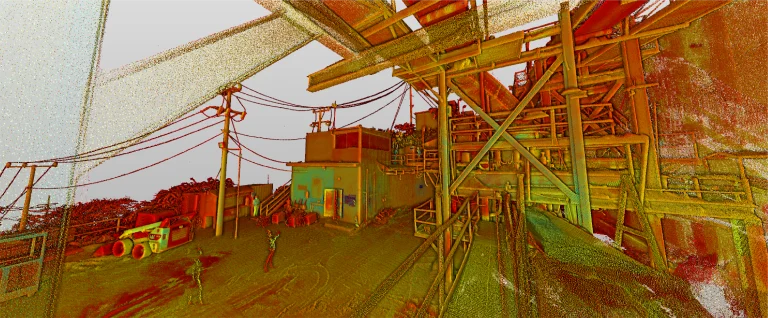
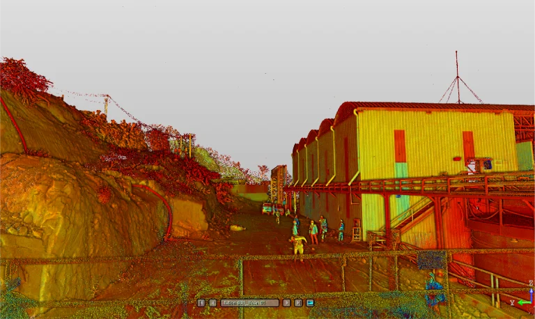
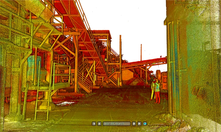
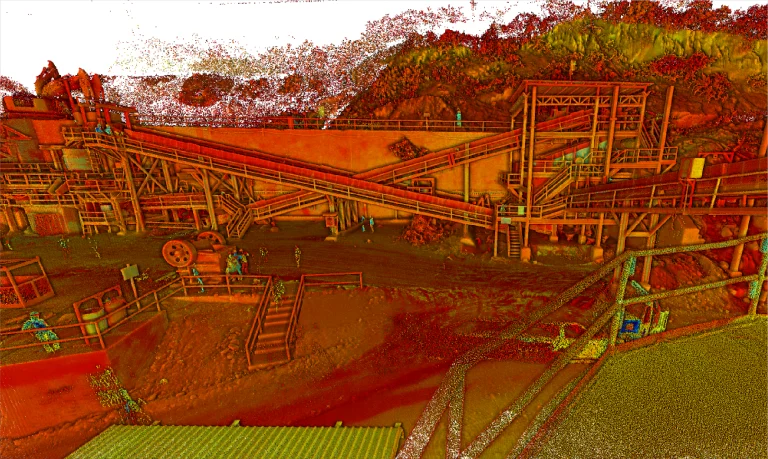
Terrestrial laser scanning generated a high-precision point cloud that accurately documented the topographic and structural features of the terrain. This information was crucial for ensuring reliable technical analysis and detailed planning.
PHOTOGRAMMETRY
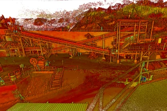
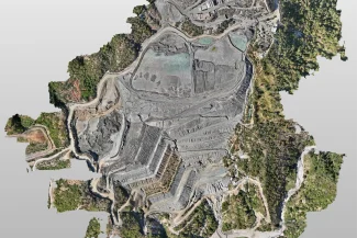
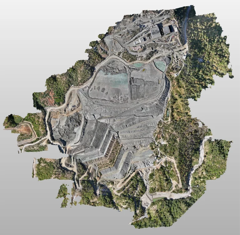
The photogrammetric survey captured high-resolution aerial images that complemented the laser scanning data, providing a clear and comprehensive view of the terrain. These images were key to developing a precise and detailed topographic plan.
Reality capture was conducted using laser scanning, complemented by photogrammetric surveying and the creation of a topographic plan. This work provided detailed and accurate documentation of the terrain, essential for analysis and efficient project planning.
Reality capture
Terrestrial Laser Scanning
Terrestrial laser scanning
DIGITAL PHOTOGRAPHY
Photogrammetric
The photogrammetric survey captured high-resolution aerial images that complemented the laser scanning data, providing a clear and comprehensive view of the terrain. These images were key to developing a precise and detailed topographic plan.