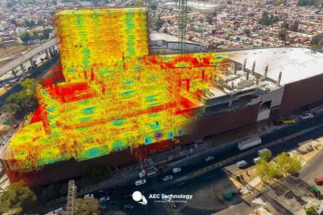
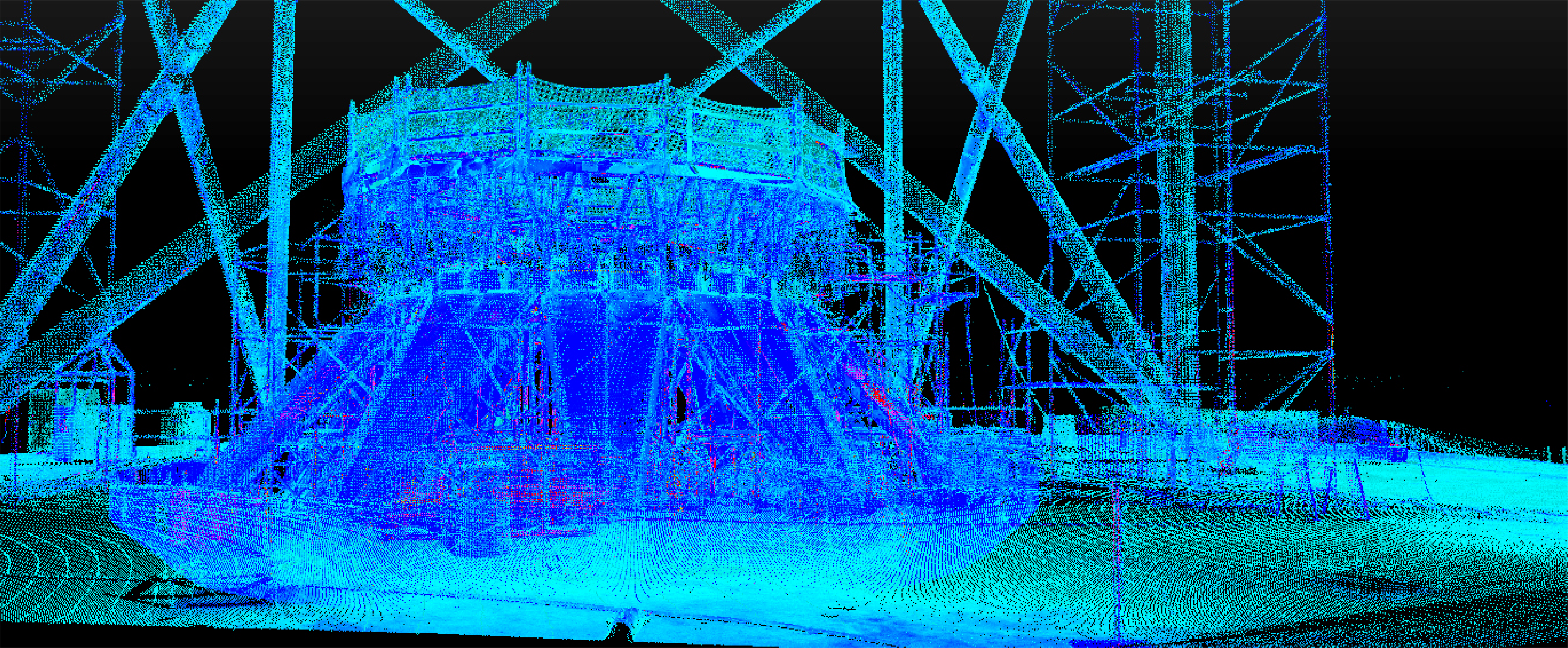
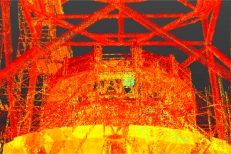
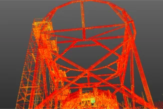
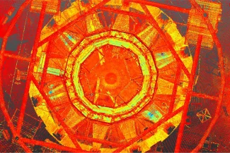
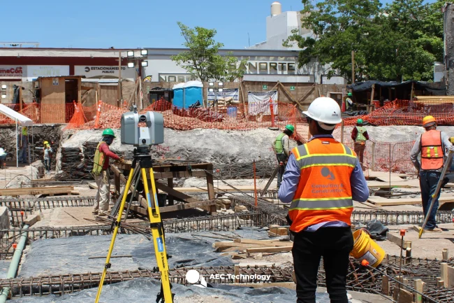
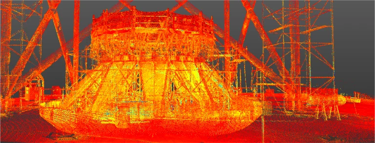
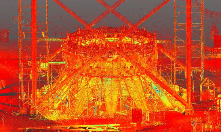
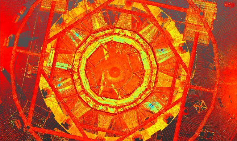
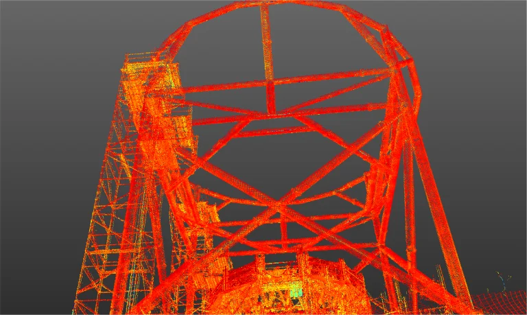
Reality capture was conducted to accurately document the metal structure in the construction of an airport. This process provided detailed data to optimize project planning and execution.
Client:
NAICM
Location:
Texcoco,
México
Year:
2018
CAPTURE
OF REALITY
SCANNING
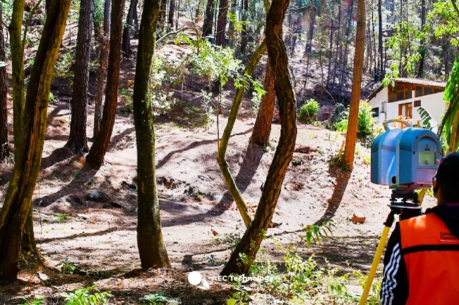
TERRESTRIAL LASER
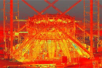
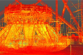
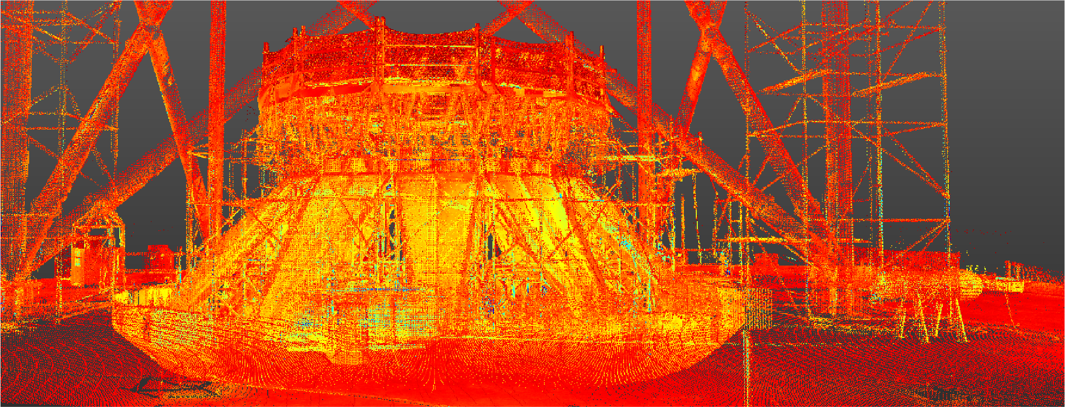
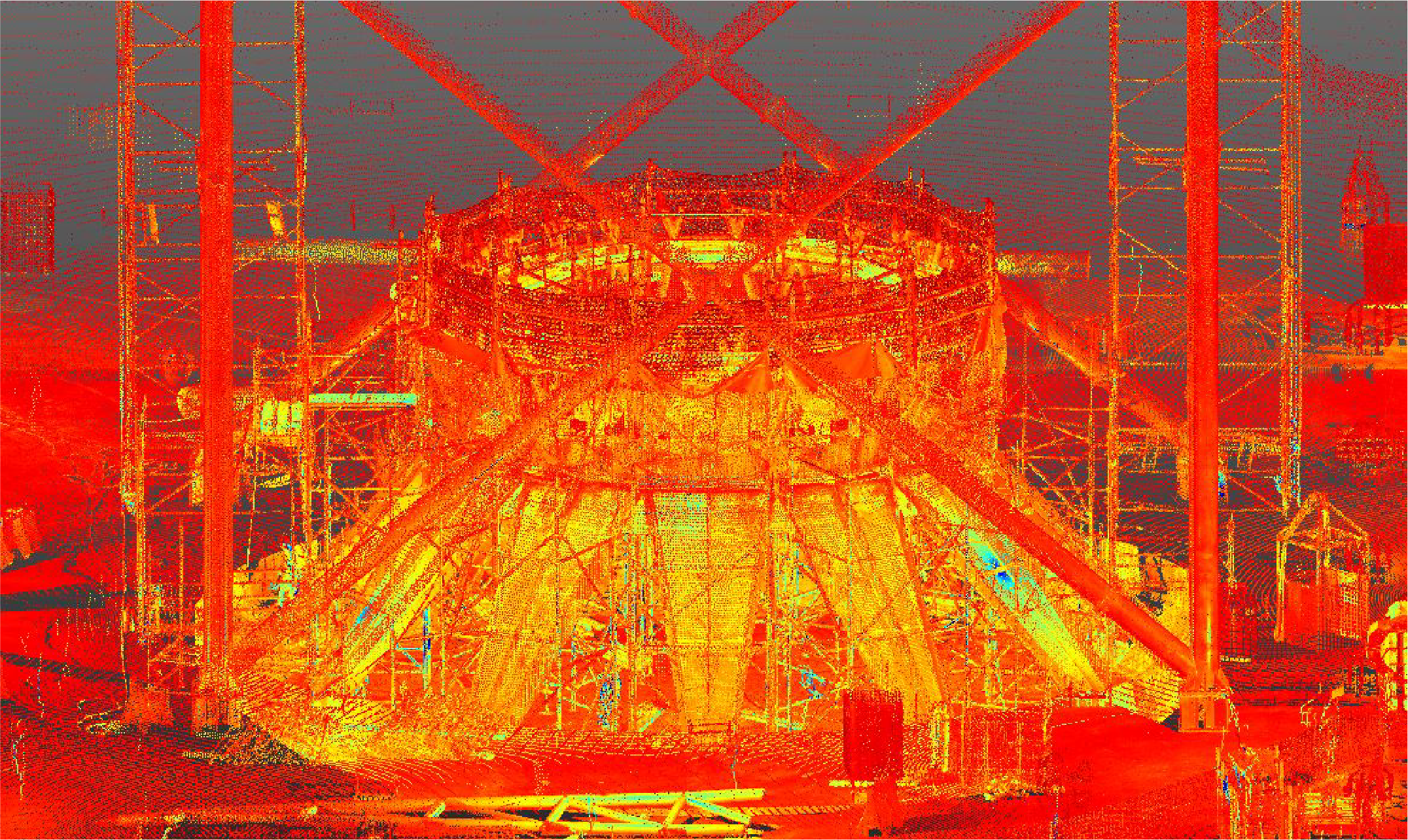
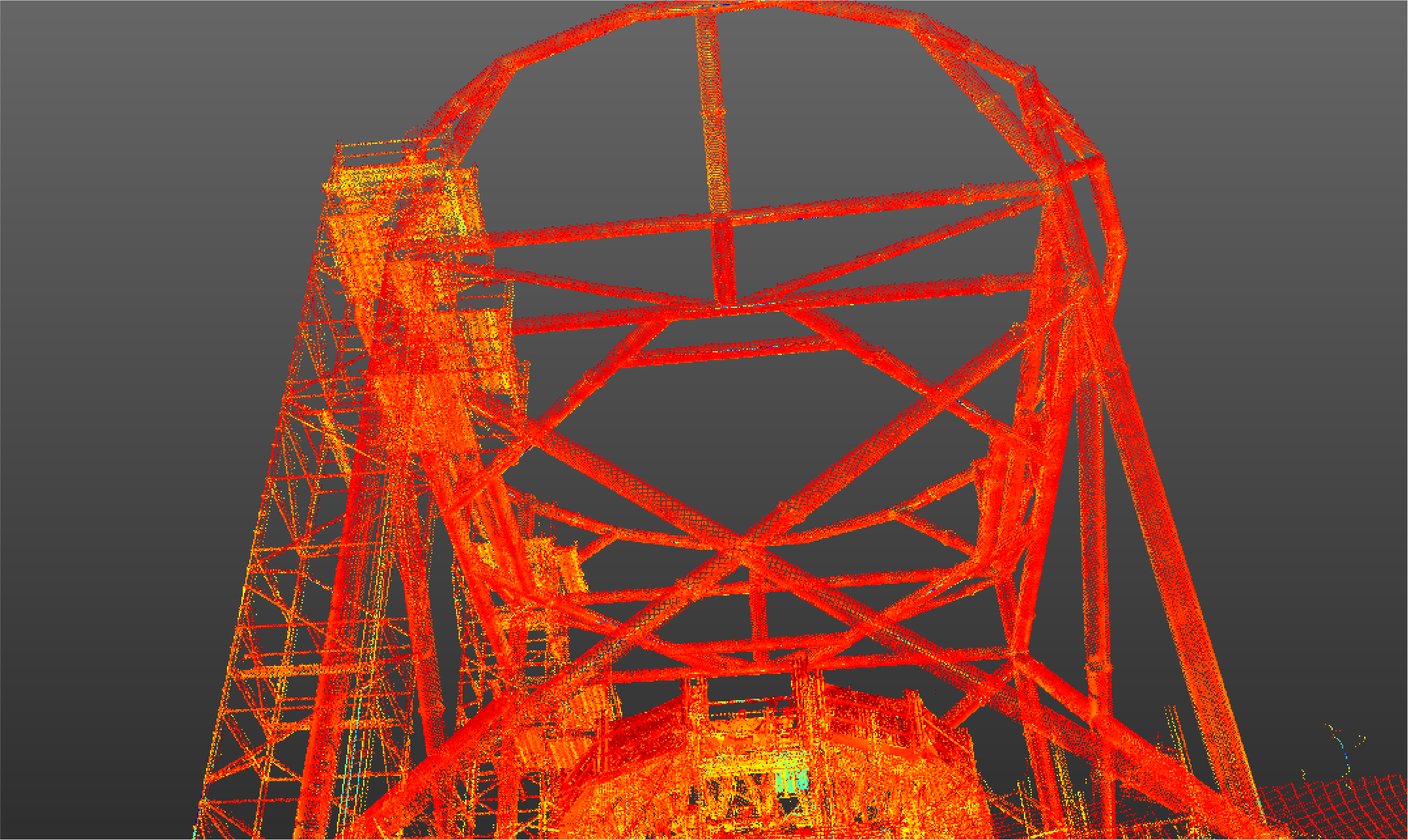
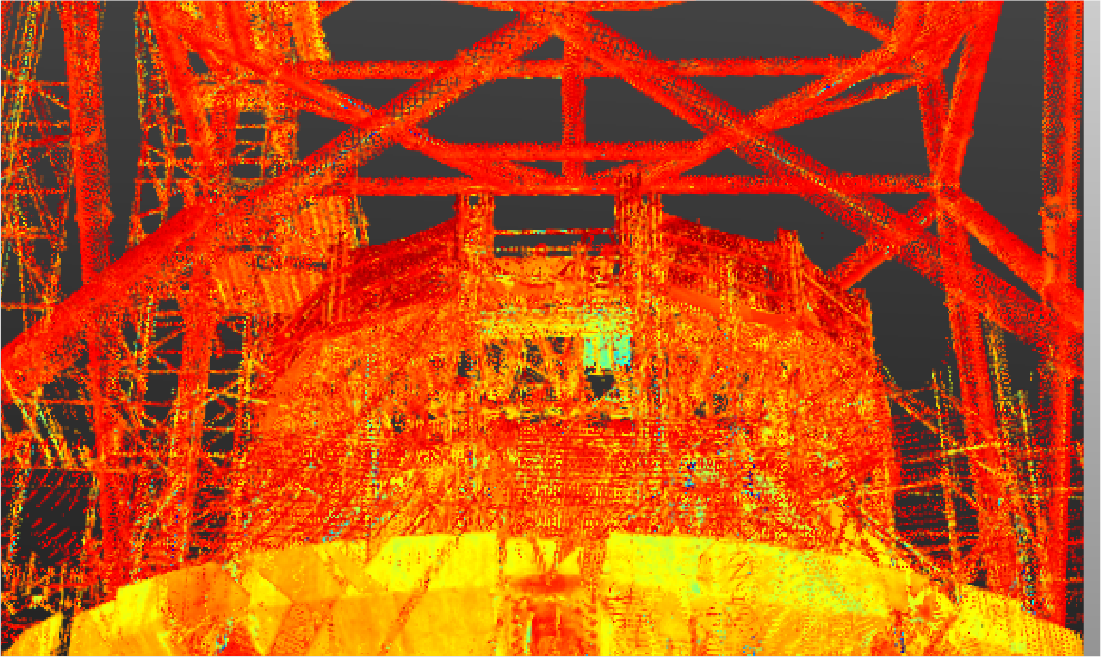
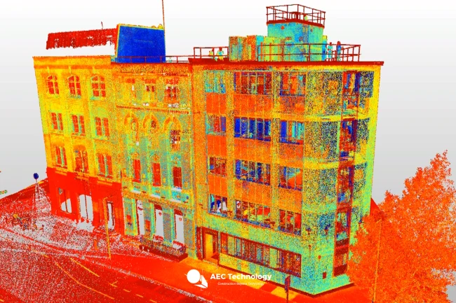
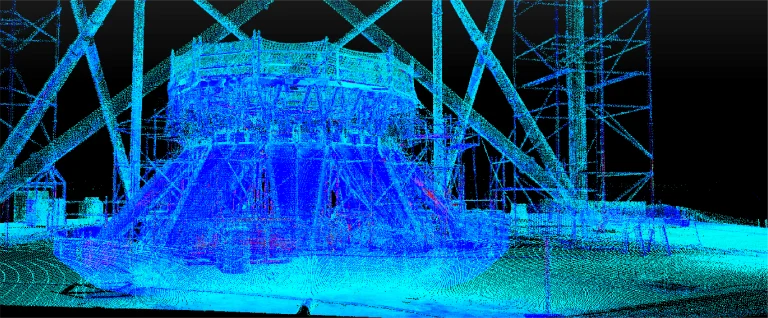
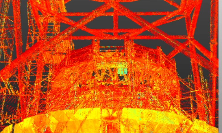
Terrestrial laser scanning captured a precise point cloud that recorded the geometry and layout of the metal structure. This information was key to ensuring accuracy in documentation and facilitating coordination in the airport’s construction.
Reality capture was conducted to accurately document the metal structure in the construction of an airport. This process provided detailed data to optimize project planning and execution.
REALITY CAPTURE
Terrestrial Laser Scanning
Terrestrial laser scanning captured a precise point cloud that recorded the geometry and layout of the metal structure. This information was key to ensuring accuracy in documentation and facilitating coordination in the airport’s construction.