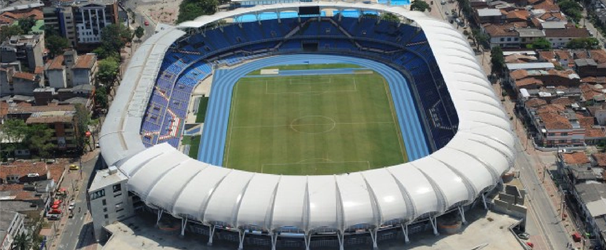
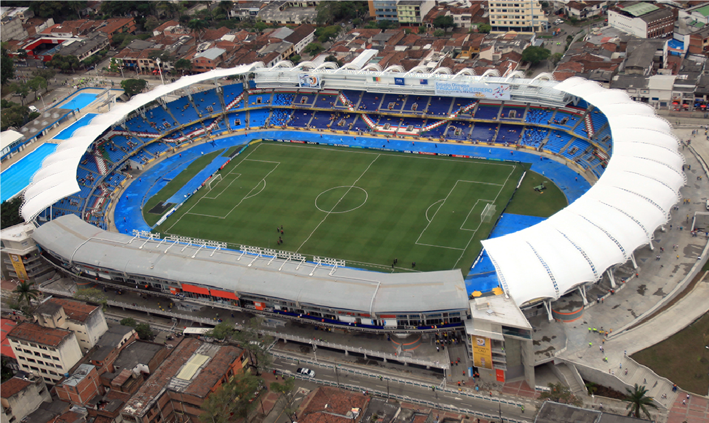
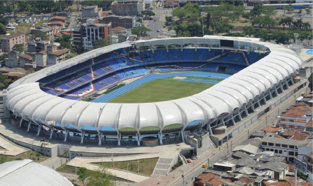
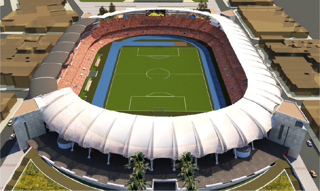
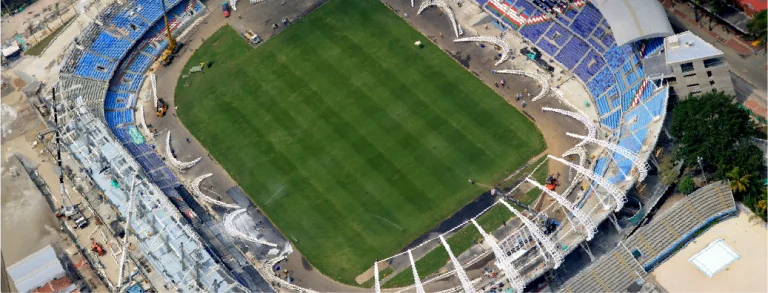
In the Pascual Guerrero football stadium renovation project, aerial photography was used for construction monitoring, capturing high-resolution images that documented project progress from a comprehensive and detailed perspective. Additionally, a BIM model was developed to integrate all relevant stadium information, facilitating the planning, coordination, and management of the various renovation stages, ensuring efficient project control.
Client:
Alcaldía
de Santiago
de Cali
Location:
Santiago de
Cali, Colombia
Year:
2019
REALITY CAPTURE
DIGITAL MODELS
Aerial photography
Aerial photography provided a complete view of the stadium and its surroundings, allowing for precise tracking of construction progress. The high-resolution images were essential for monitoring developments, identifying critical areas, and sharing visual updates with project teams and stakeholders.
3D MODELS
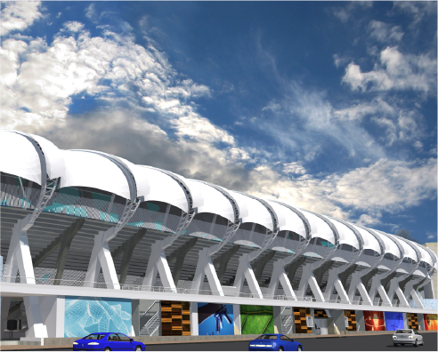
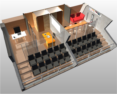
A BIM model was developed to integrate the stadium’s existing conditions with the proposed renovation designs. This model enhanced coordination between disciplines, enabled early clash detection, and ensured efficient resource planning, guaranteeing accuracy and adherence to the project schedule.
In the Pascual Guerrero football stadium renovation project, aerial photography was used for construction monitoring, capturing high-resolution images that documented project progress from a comprehensive and detailed perspective. Additionally, a BIM model was developed to integrate all relevant stadium information, facilitating the planning, coordination, and management of the various renovation stages, ensuring efficient project control.
digital photography
Aerial Photography
Aerial photography provided a complete view of the stadium and its surroundings, allowing for precise tracking of construction progress. The high-resolution images were essential for monitoring developments, identifying critical areas, and sharing visual updates with project teams and stakeholders.
DIGITAL MODELS
3D MODELS
A BIM model was developed to integrate the stadium’s existing conditions with the proposed renovation designs. This model enhanced coordination between disciplines, enabled early clash detection, and ensured efficient resource planning, guaranteeing accuracy and adherence to the project schedule.