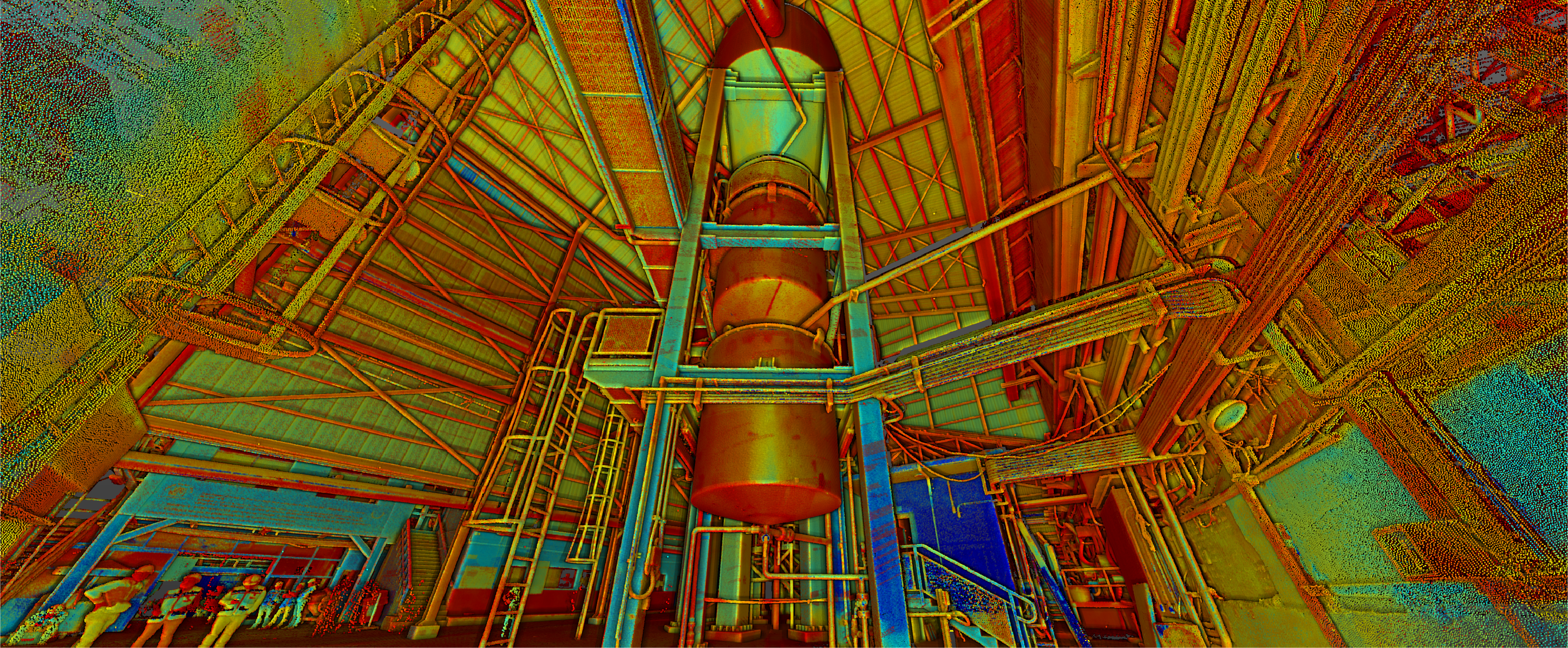
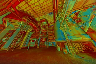
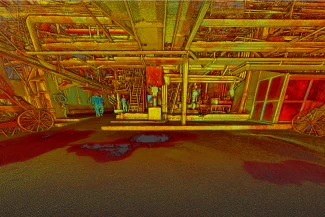
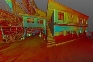
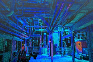
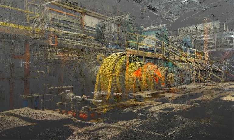
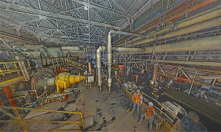
Reality capture was carried out at an industrial plant using terrestrial laser scanning, generating high-precision point clouds as the foundation for creating a detailed BIM model focused on facility management (FM). This model allows for optimizing the operation, maintenance, and planning of the industrial plant.
Client:
Ingenio
Tamazula
Location:
Tamazula,
México
Year:
2019
REALITY CAPTURE
DIGITAL MODELS
terrestrial laser scanning
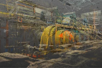
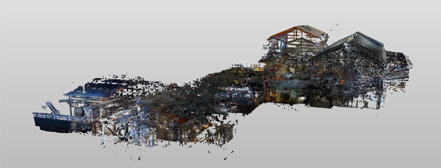
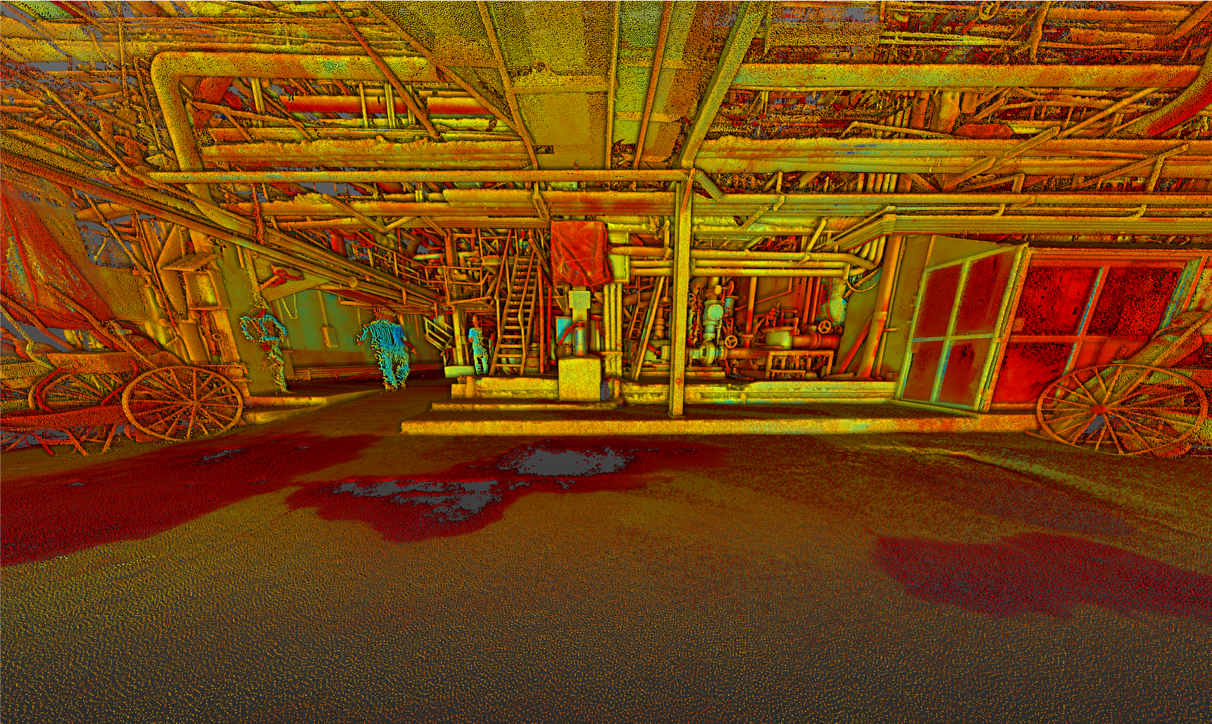
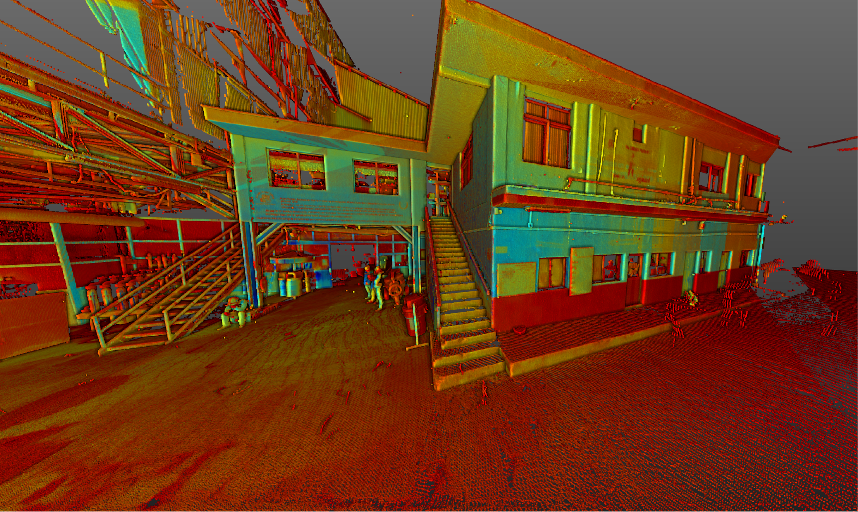
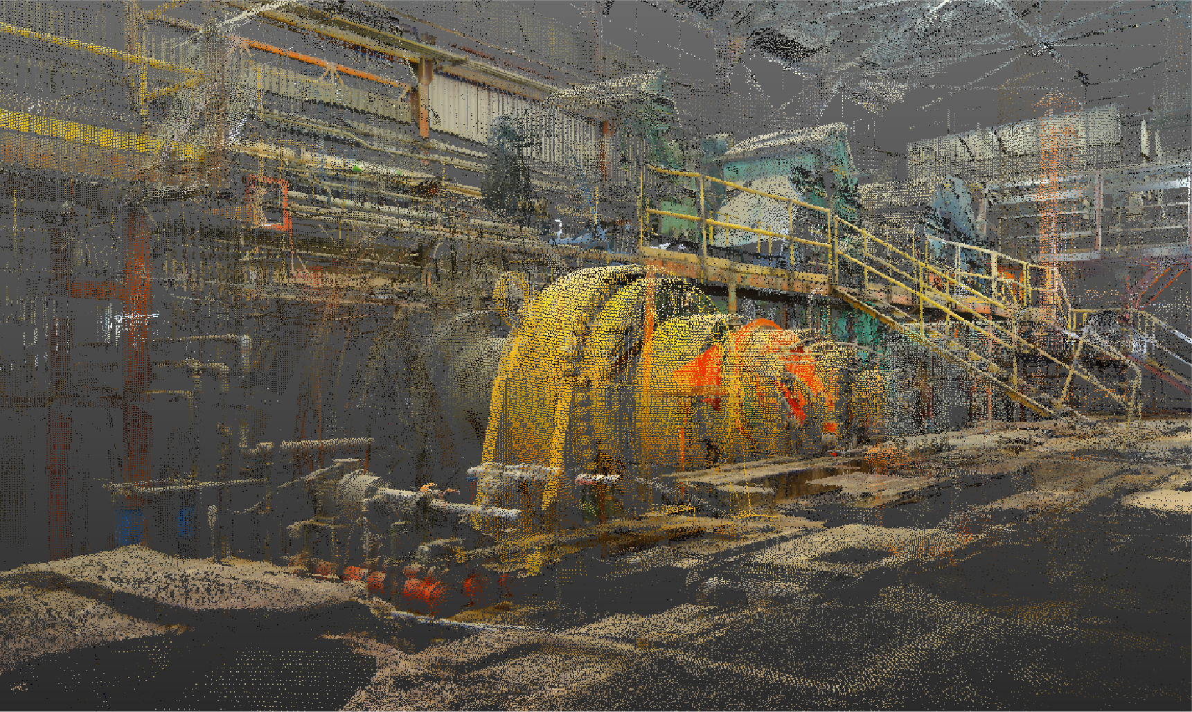
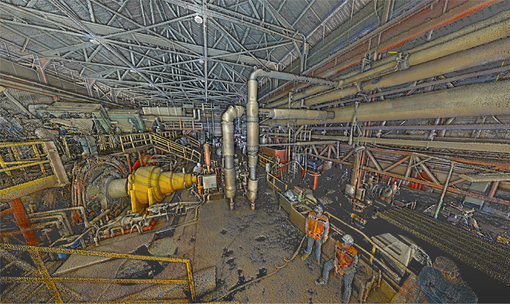
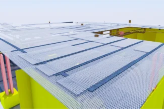
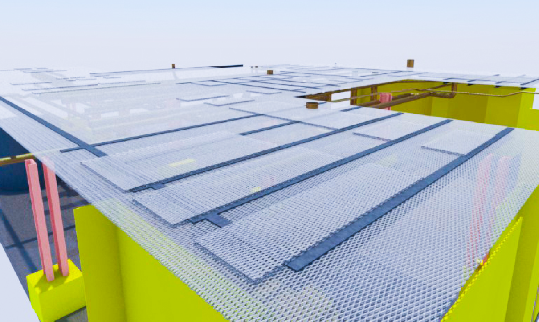
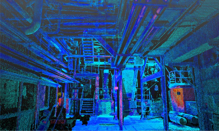
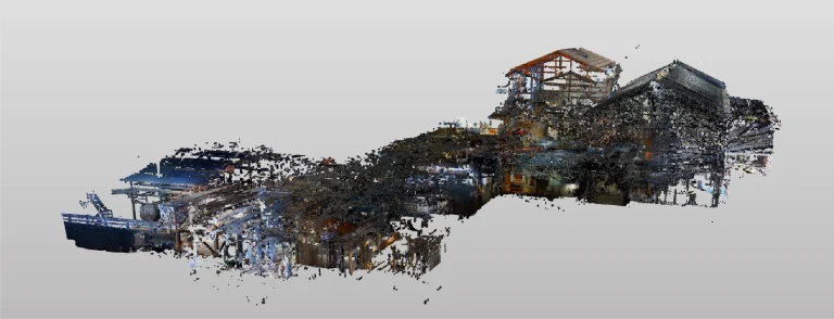
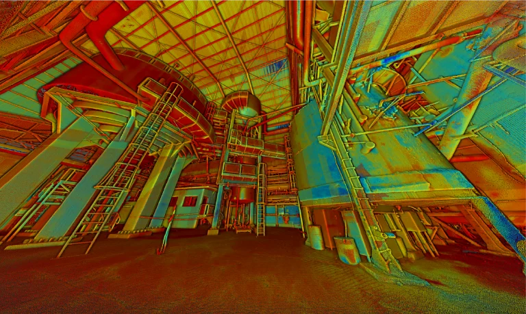
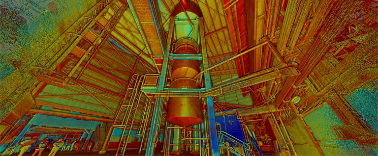
The terrestrial laser scanning captured millions of points with high precision, thoroughly documenting the architectural, structural, and installation conditions of the industrial plant. This point cloud provided a faithful and complete representation of the plant, serving as the basis for developing a functional BIM model.
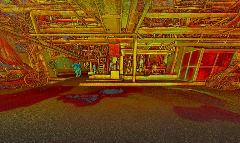
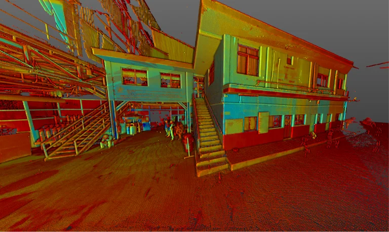
BIM
(Building
Information
Modeling)
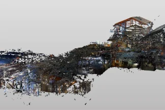
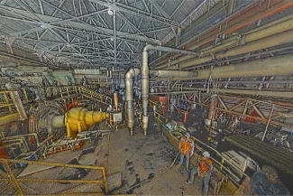
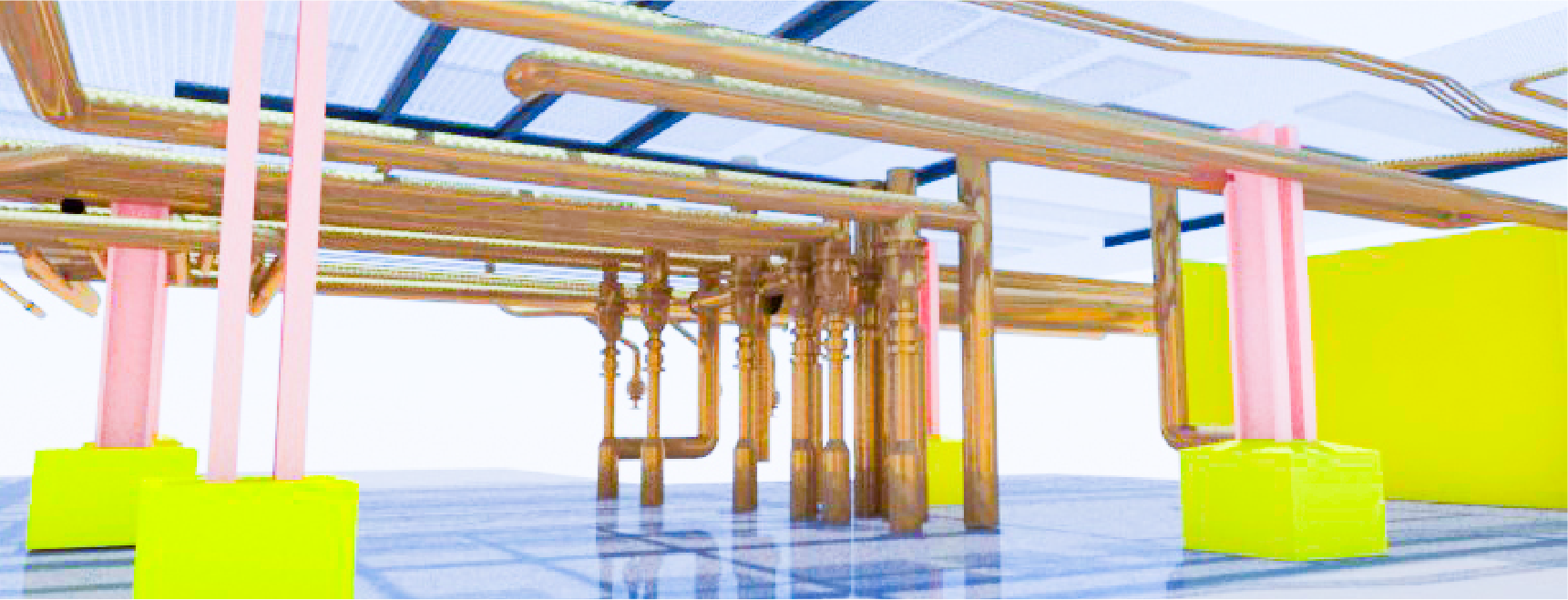
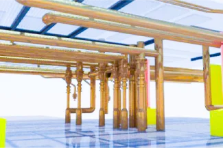
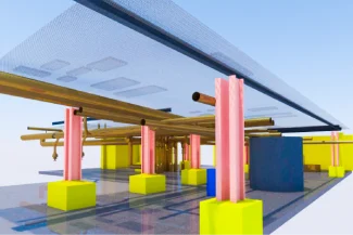
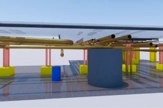
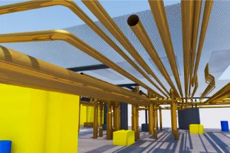
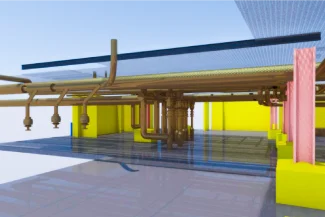
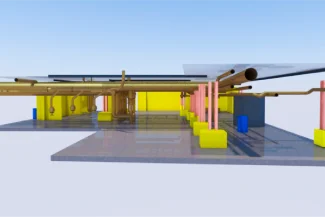
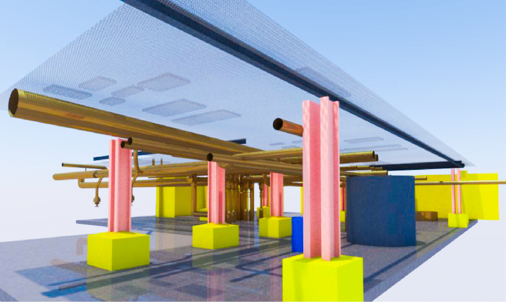
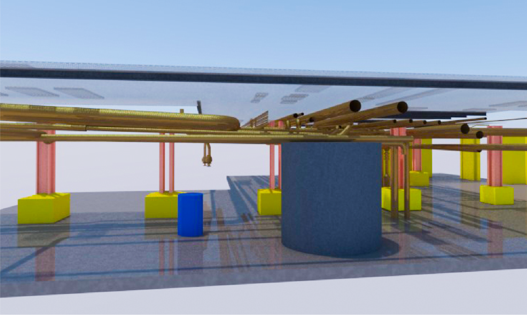
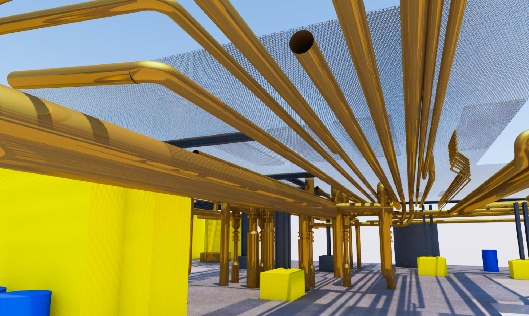
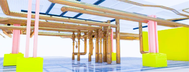
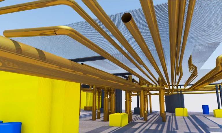
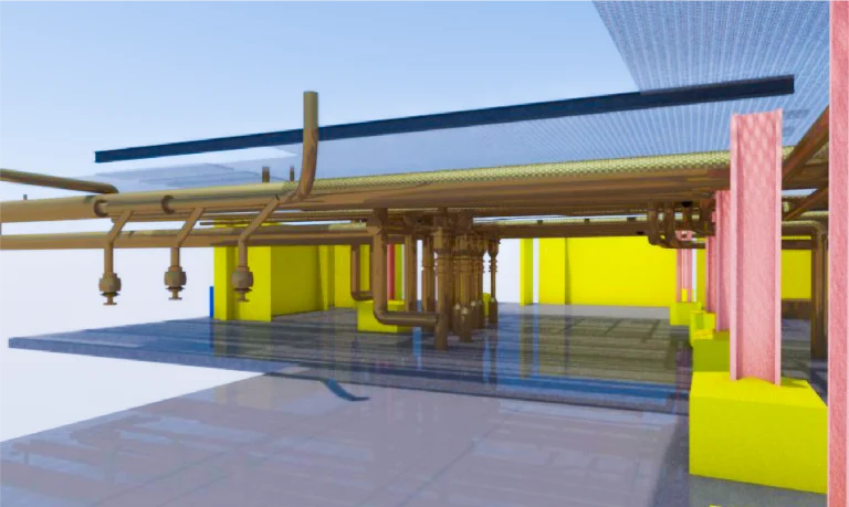
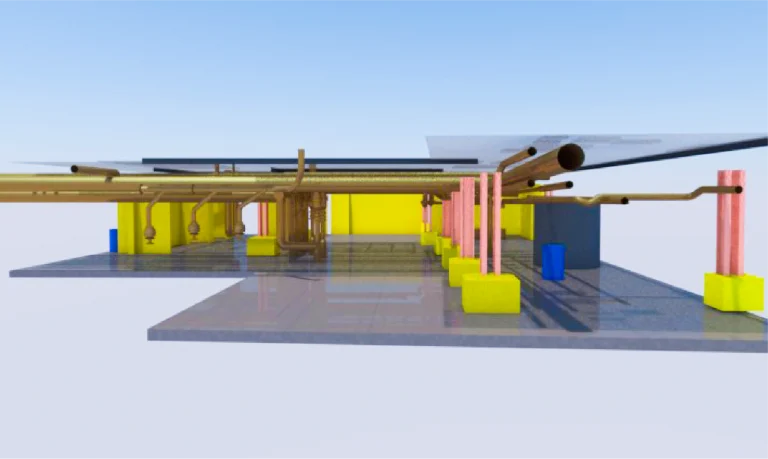
From the obtained point cloud, a detailed BIM model was developed specifically for facility management (FM). This model integrates key information for efficient monitoring and maintenance of the systems, equipment, and spaces within the plant, enabling a more organized and efficient operation.
Reality capture was carried out at an industrial plant using terrestrial laser scanning, generating high-precision point clouds as the foundation for creating a detailed BIM model focused on facility management (FM). This model allows for optimizing the operation, maintenance, and planning of the industrial plant.
REALITY CAPTURE
Terrestrial Laser Scanning
The terrestrial laser scanning captured millions of points with high precision, thoroughly documenting the architectural, structural, and installation conditions of the industrial plant. This point cloud provided a faithful and complete representation of the plant, serving as the basis for developing a functional BIM model.
DIGITAL MODELS
BIM (Building Information Modeling)
From the obtained point cloud, a detailed BIM model was developed specifically for facility management (FM). This model integrates key information for efficient monitoring and maintenance of the systems, equipment, and spaces within the plant, enabling a more organized and efficient operation.