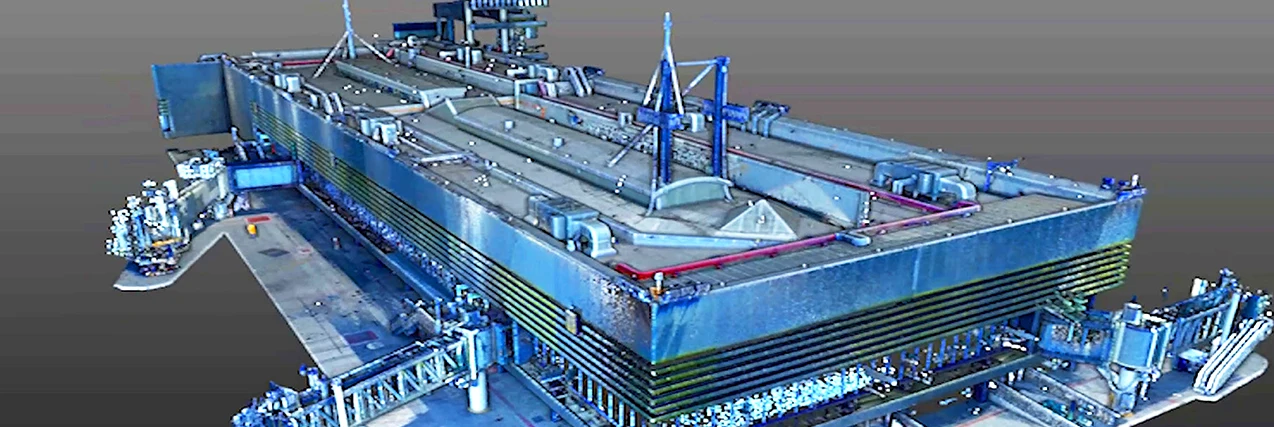
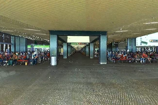
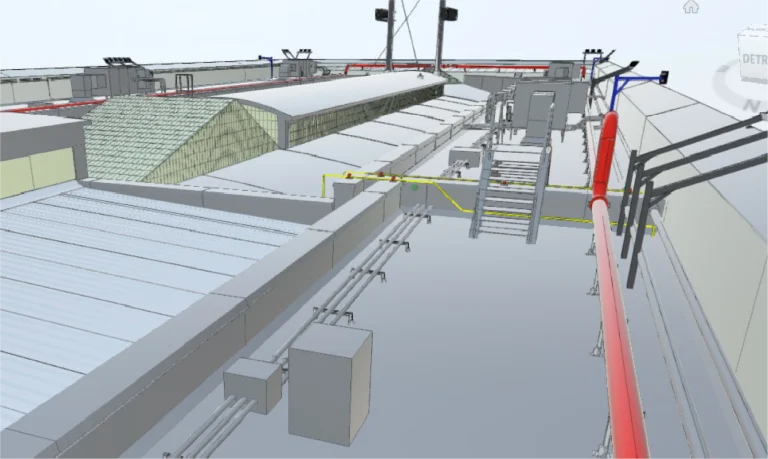
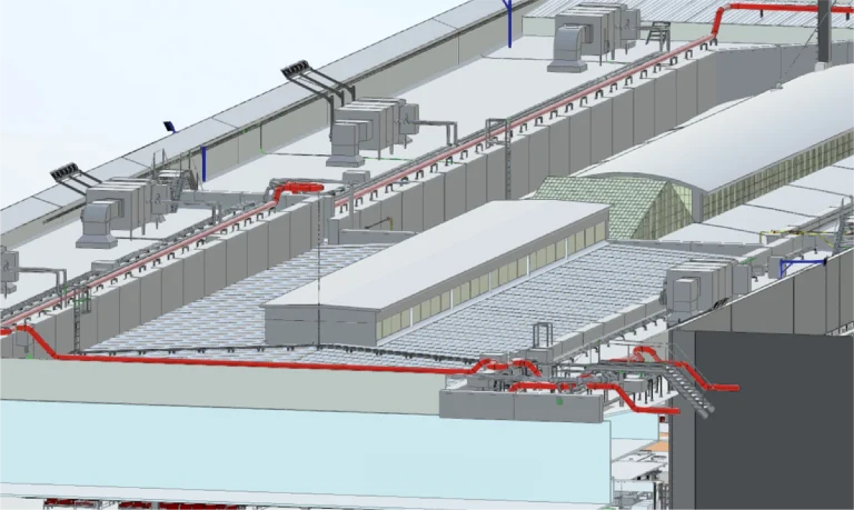
A survey was carried out using terrestrial laser scanning and the development of BIM models to document the existing structures and perimeter of Tijuana Airport.
Through this work, precise and detailed information was provided, facilitating planning, supporting analysis, and enabling comprehensive project management.
Client:
GAP
(Grupo
Aeroportuario
del Pacífico)
Location:
Tijuana,
México
Year:
2019
REALITY CAPTURE
DIGITAL MODELS
TERRESTRIAL
LASER SCANNING
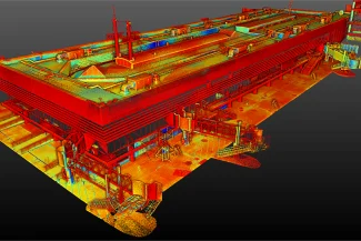
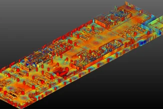
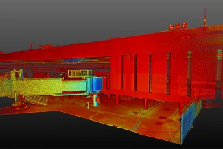
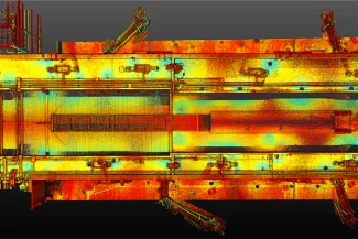
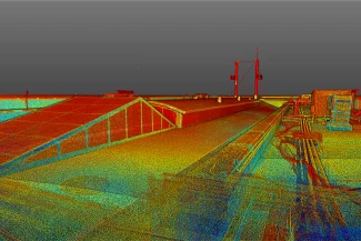
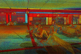
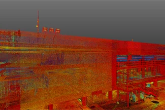
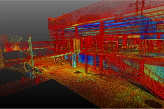
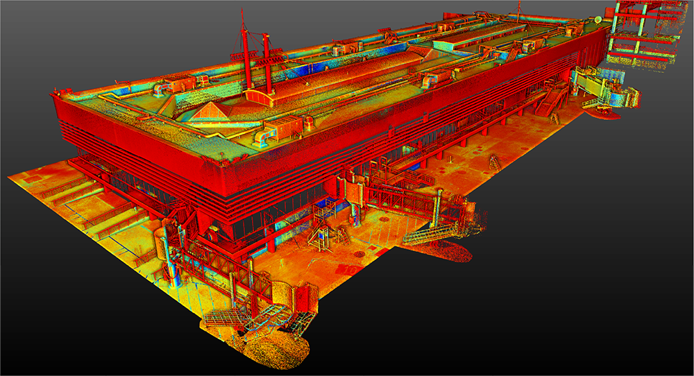
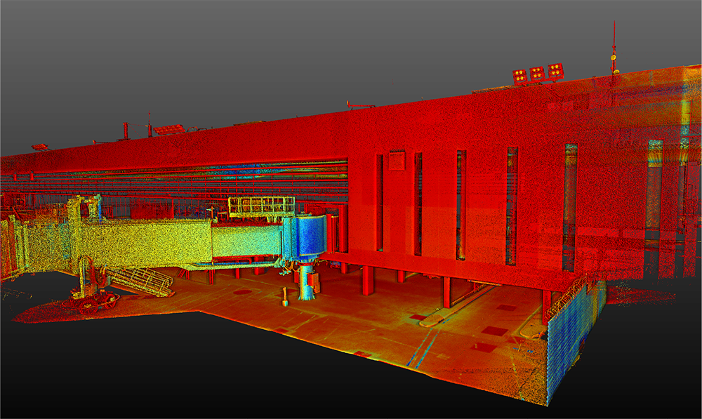
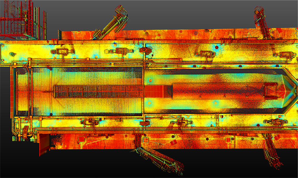
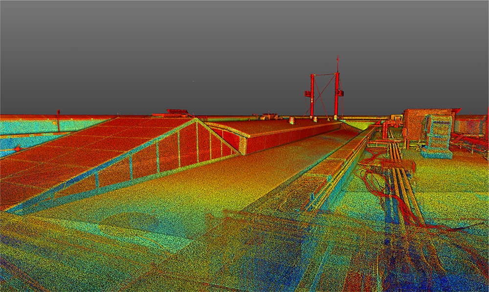
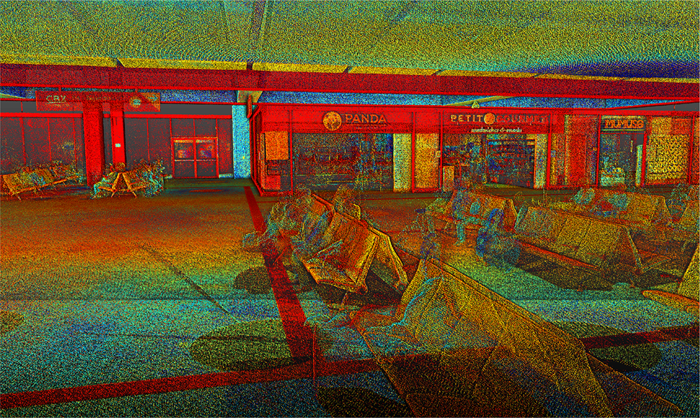
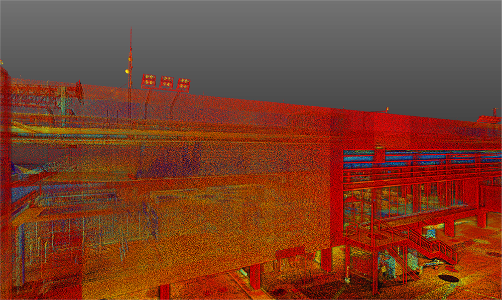
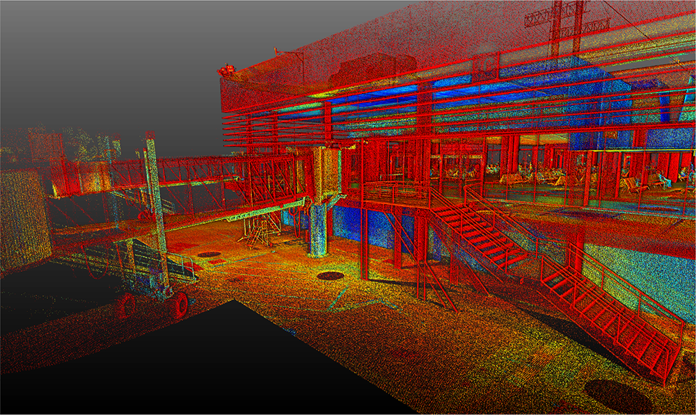
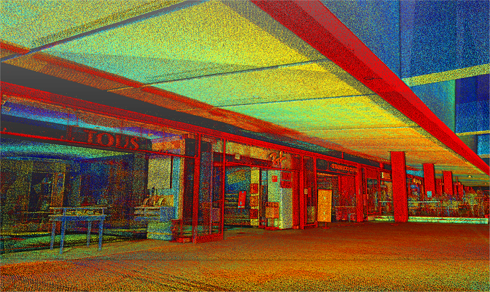
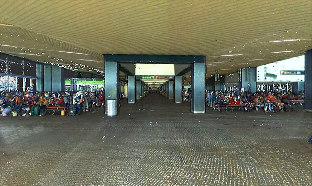
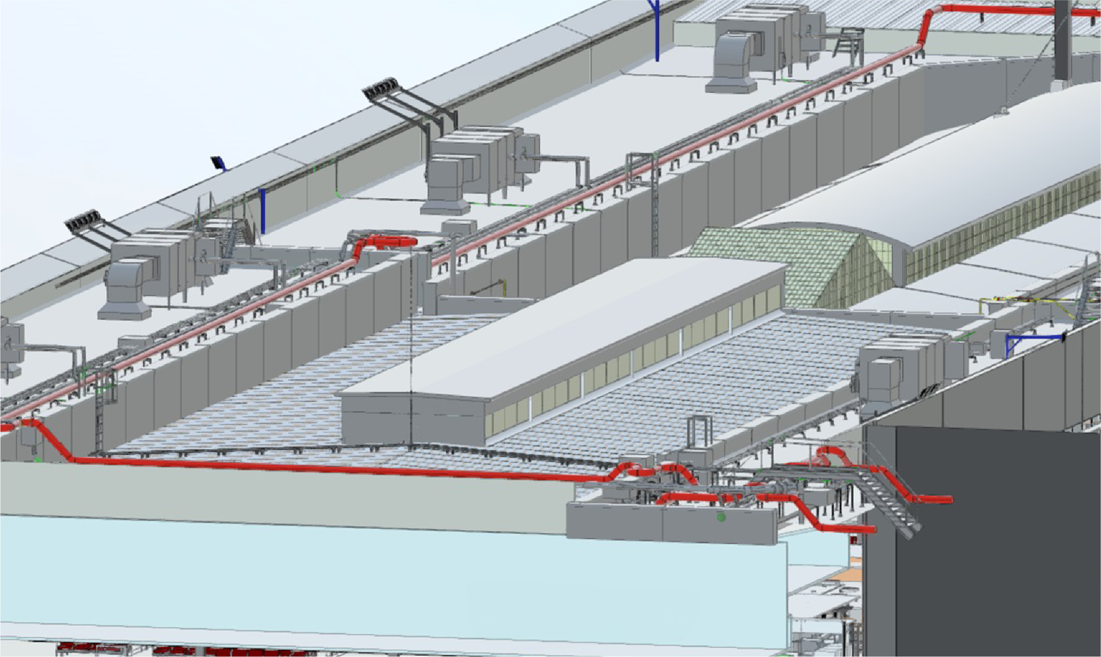
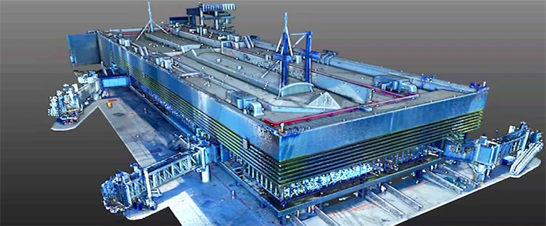
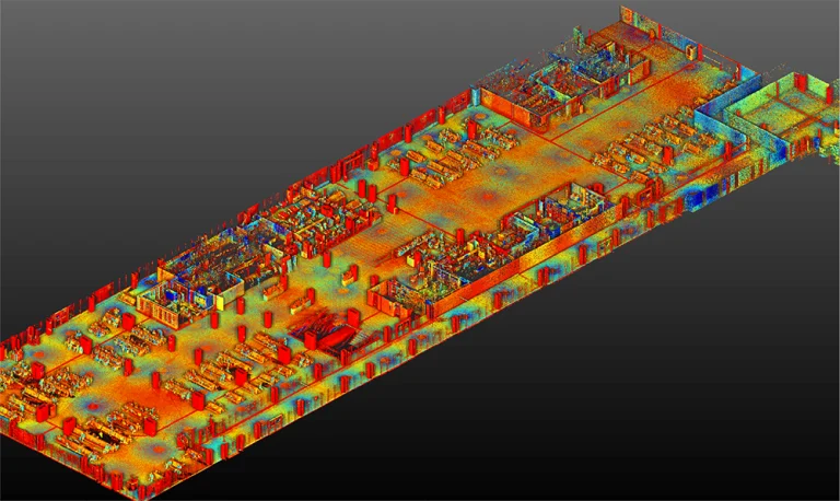
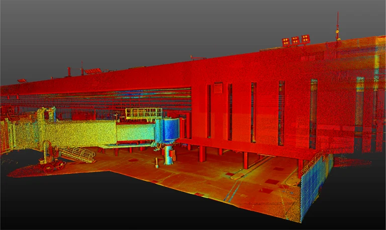
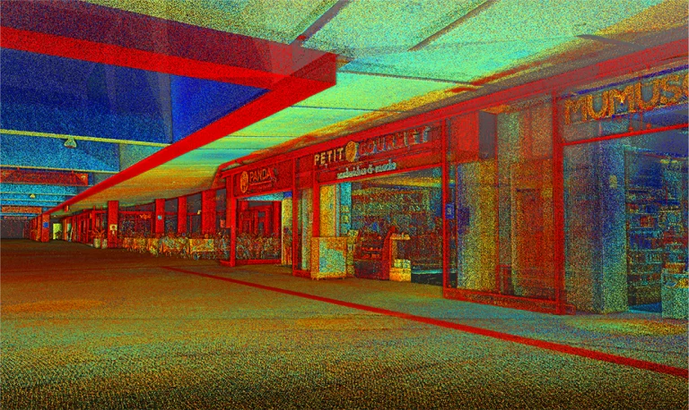
The terrestrial laser scanning captured millions of high-accuracy points, generating a point cloud that documented the structural characteristics of the buildings and the airport perimeter.
Thanks to this information, digital models were developed, and reliable technical analyses were performed, providing a solid foundation for project decision-making.
BIM
(Building
Information
Modeling)
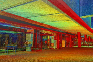
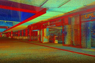
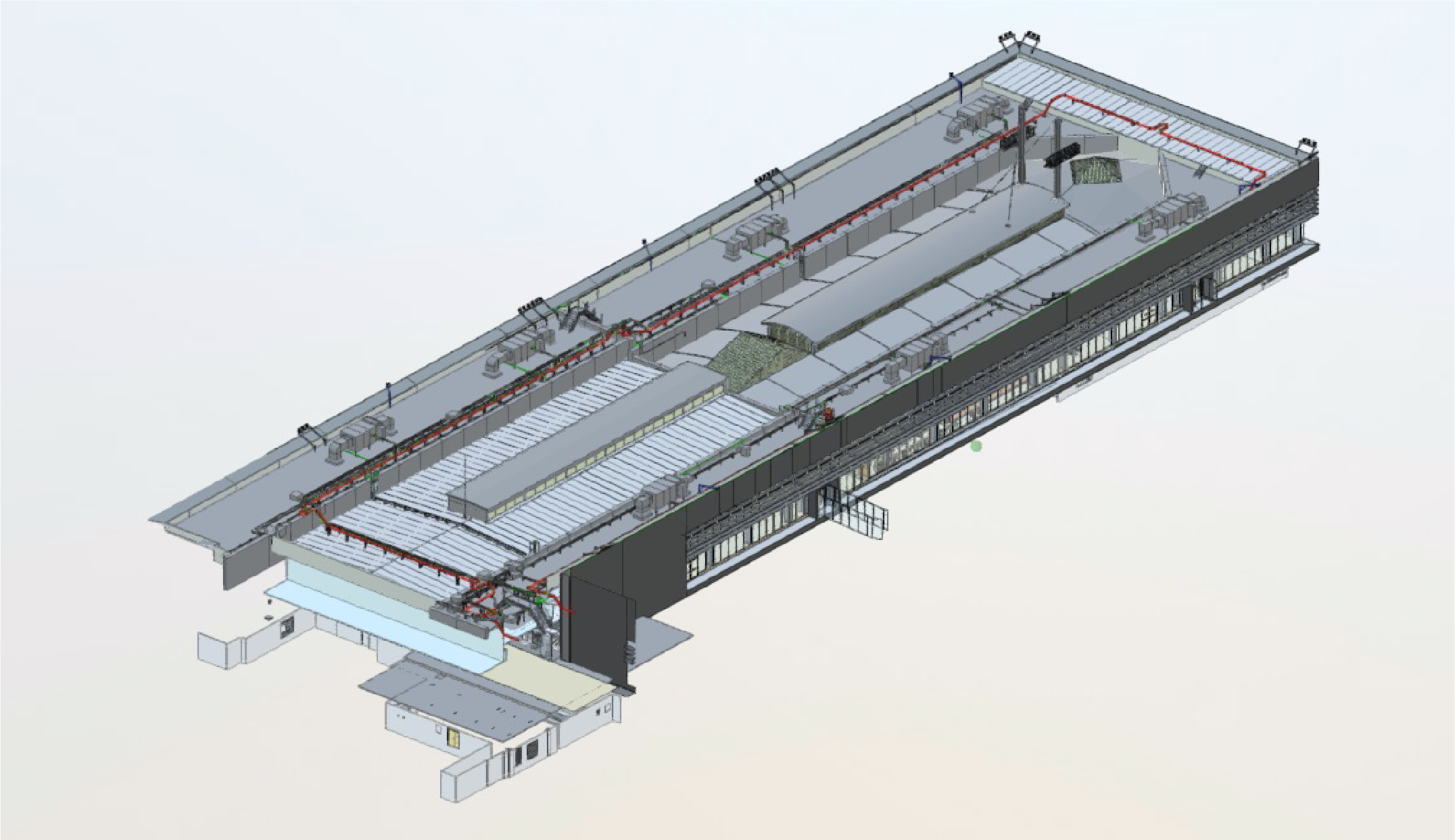
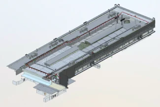
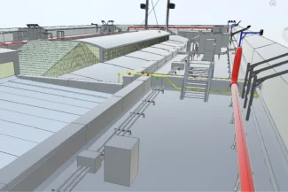
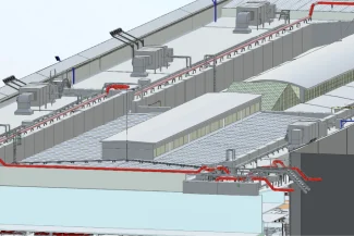
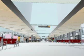
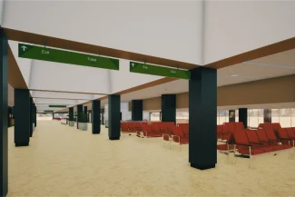
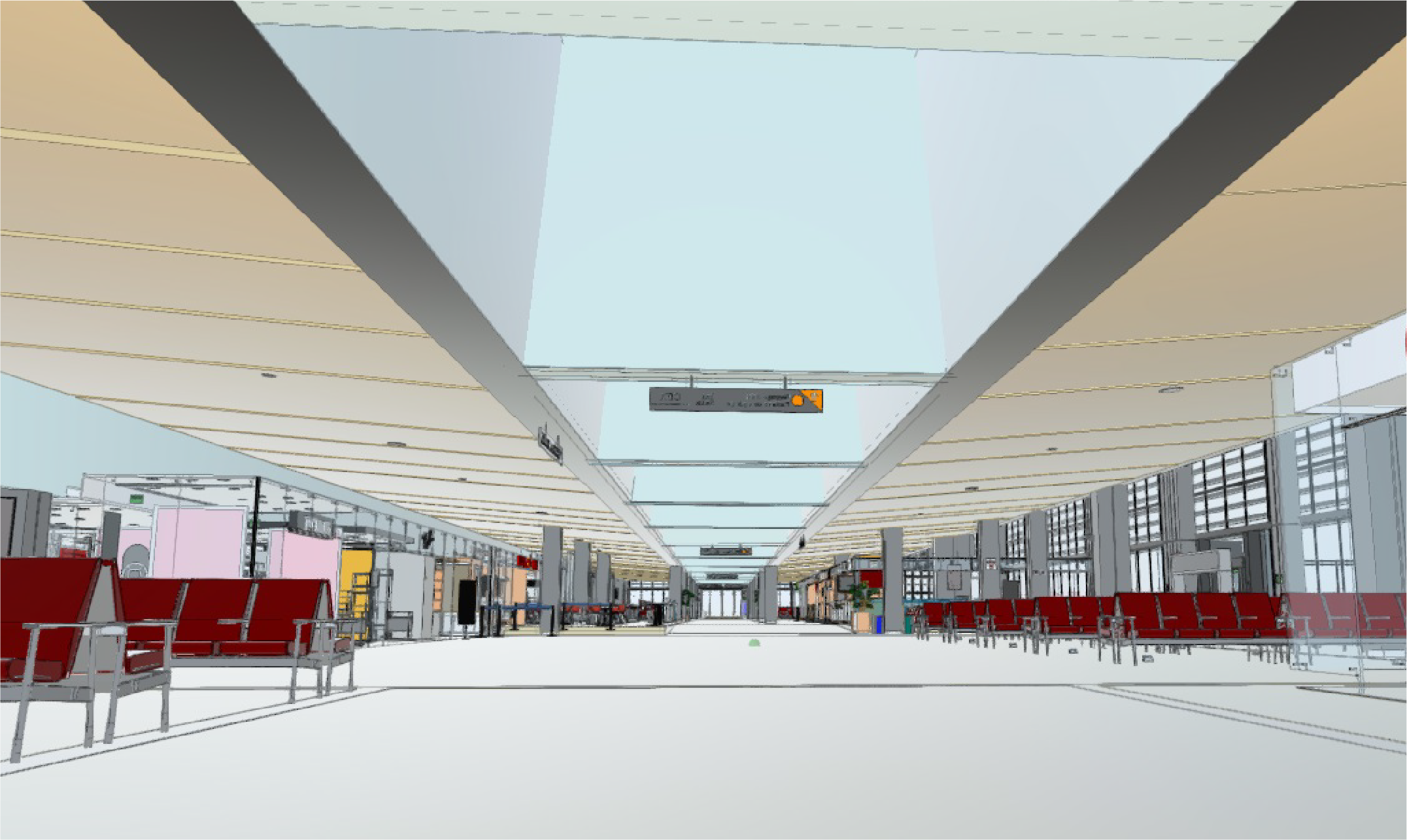
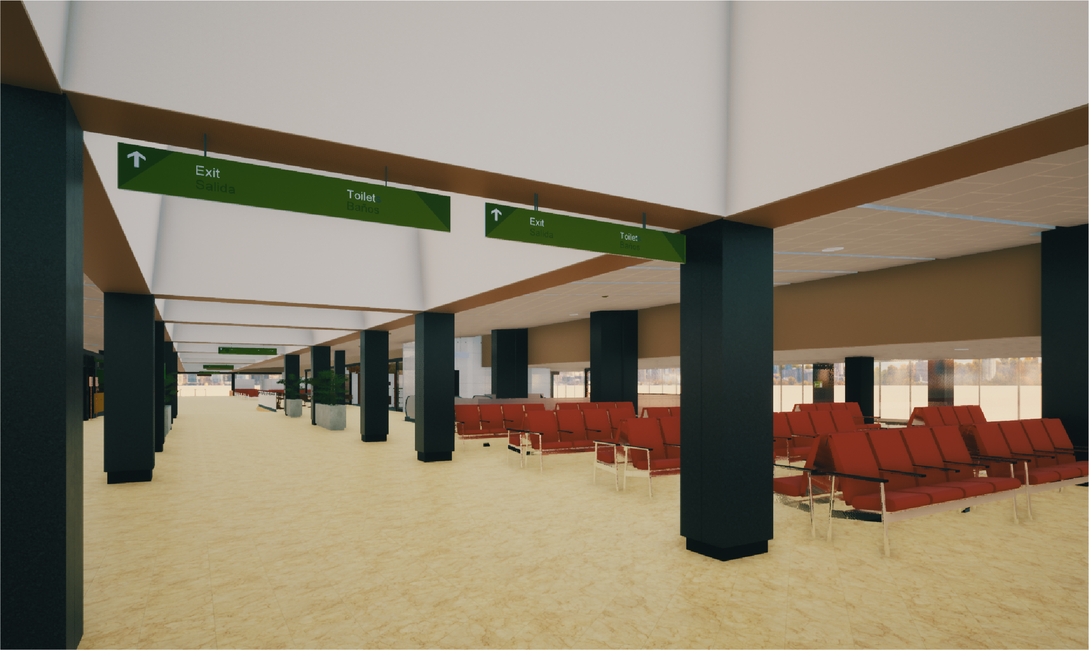
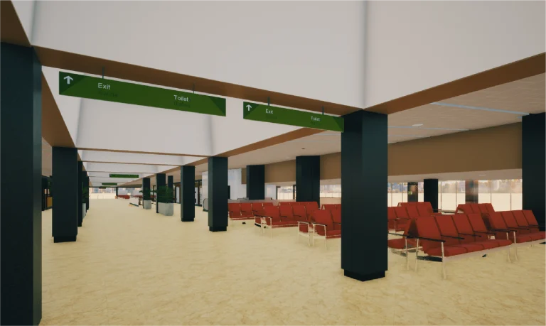
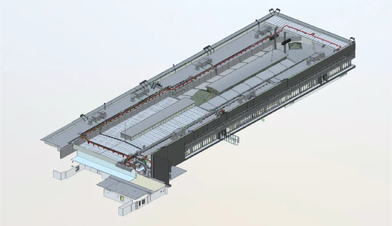
Based on the point cloud obtained, detailed BIM models were developed that integrated all relevant airport information.
Thanks to these models, planning was optimized, disciplines were coordinated, and the project was managed efficiently, ensuring accuracy at every stage.
A survey was conducted using terrestrial laser scanning and the development of BIM models to document the existing structures and perimeter of Tijuana Airport. This work provided precise and detailed information, facilitating planning, analysis, and comprehensive project management.
REALITY CAPTURE
Terrestrial Laser Scanning
The terrestrial laser scanning captured millions of points with high accuracy, generating a point cloud that documented the structural characteristics of the buildings and the airport perimeter. This information was key to developing digital models and performing reliable technical analysis.
DIGITAL MODELS
BIM
(Building Information Modeling)
Based on the obtained point cloud, detailed BIM models were developed that integrated all relevant information about the airport. These models allowed for optimized planning, discipline coordination, and efficient project management, ensuring accuracy at every stage.