Inicio » Projects » Residential Housing Development Corteza
Residential Housing Development Corteza
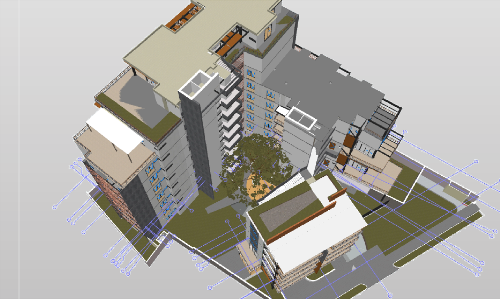
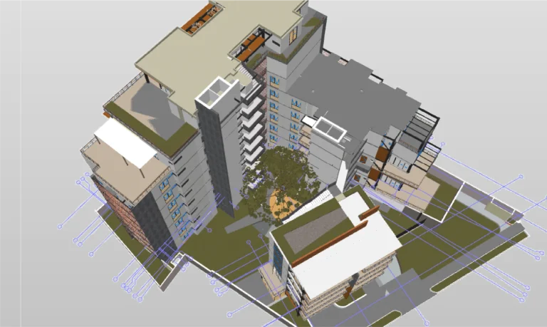
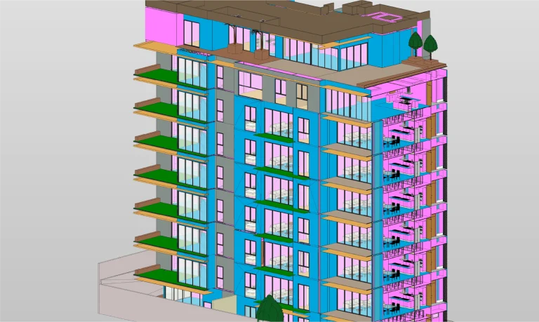
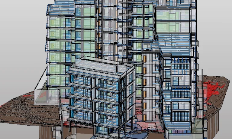
Technical coordination and construction supervision were carried out for a residential development project, implementing the BIM methodology and complementing it with reality capture services through terrestrial laser scanning and aerial photography. These technologies provided accurate documentation and advanced tools for comprehensive project management, optimizing planning, execution, and control.
Client:
Grupo
Axerta
Location:
Guadalajara,
México
Year:
2019
REALITY CAPTURE
DIGITAL MODELS
terrestrial laser scanning
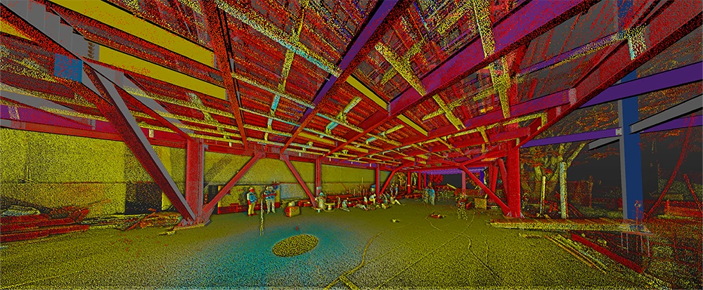
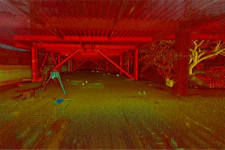
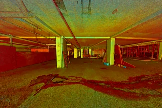
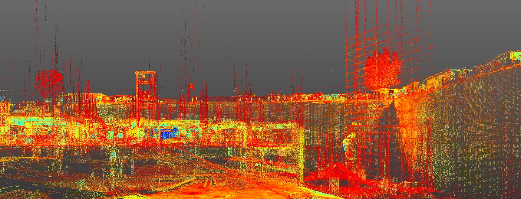
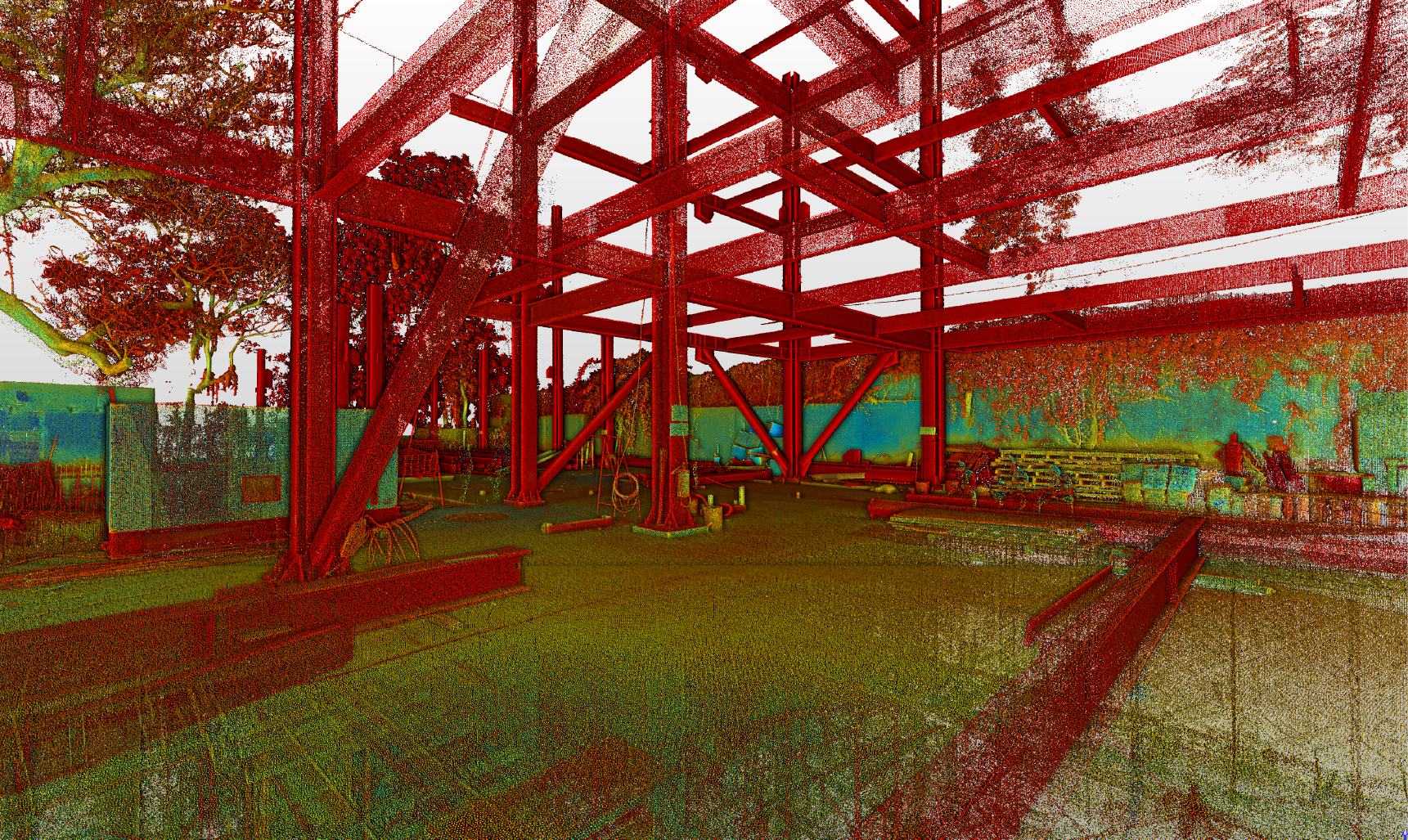
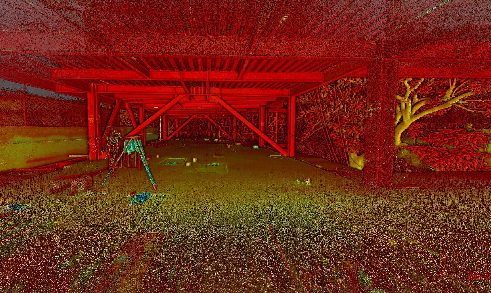
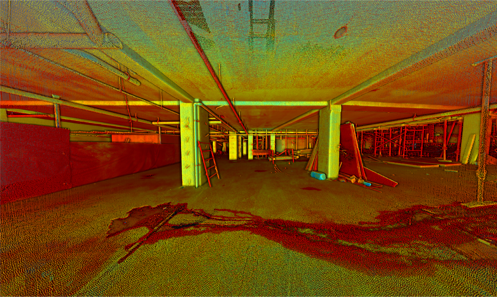
The terrestrial laser scanning captured millions of points with high precision, generating a point cloud that documented the architectural and structural features of the houses under development. This reliable data facilitated technical analysis and integration into digital models for more efficient coordination during construction.
BIM
(Building
Information
Modeling)
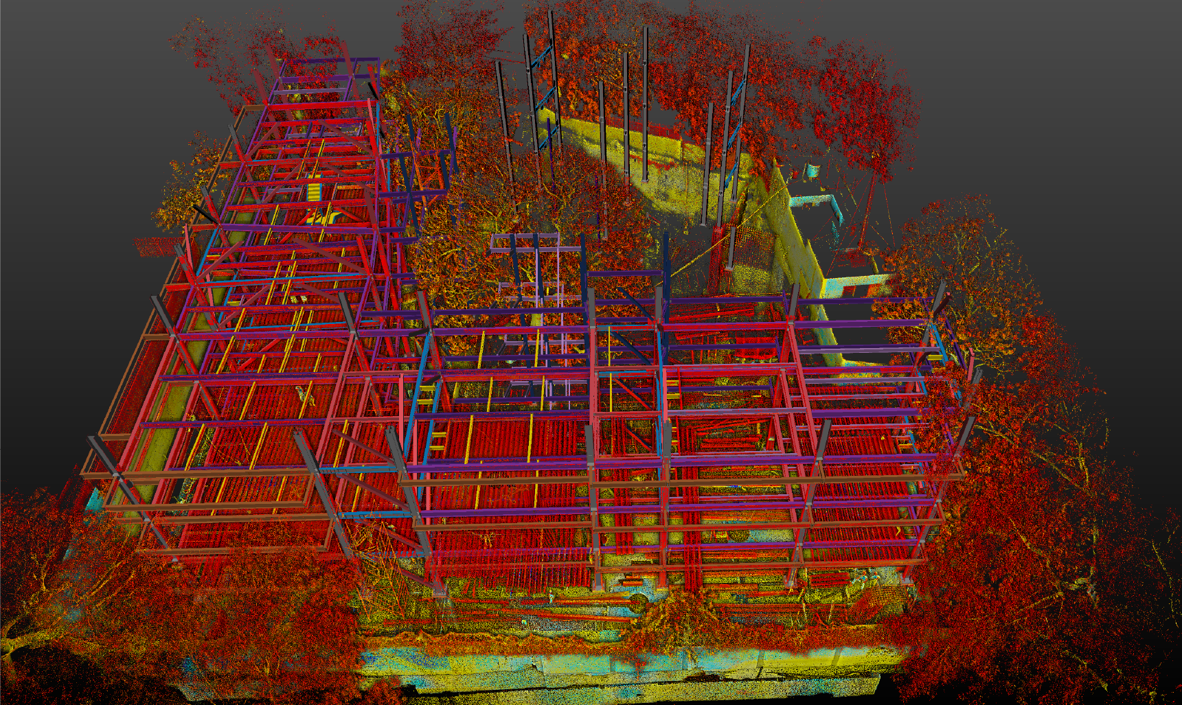
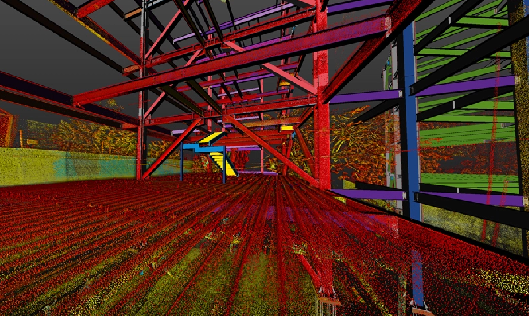
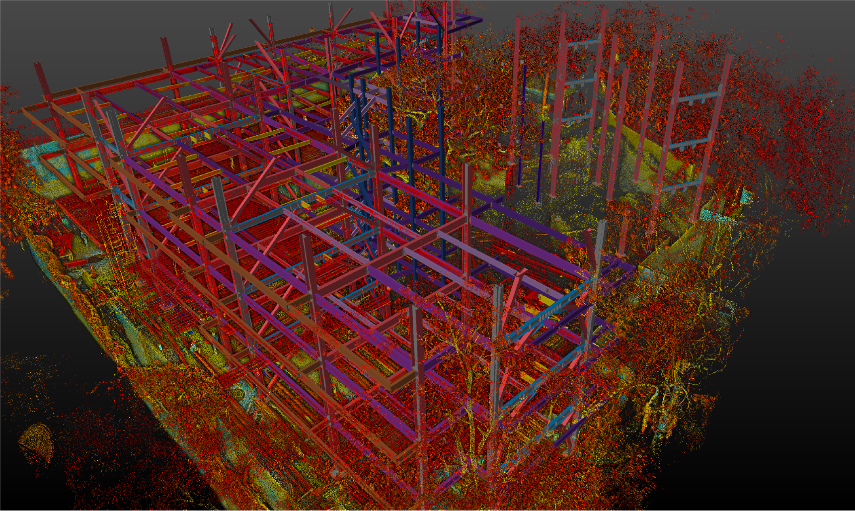
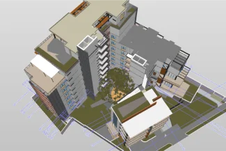
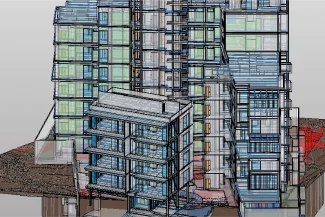
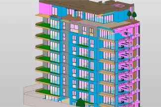
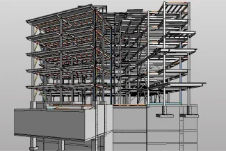
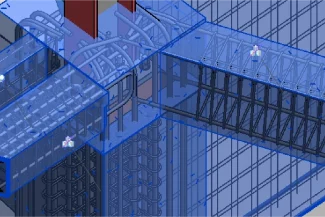
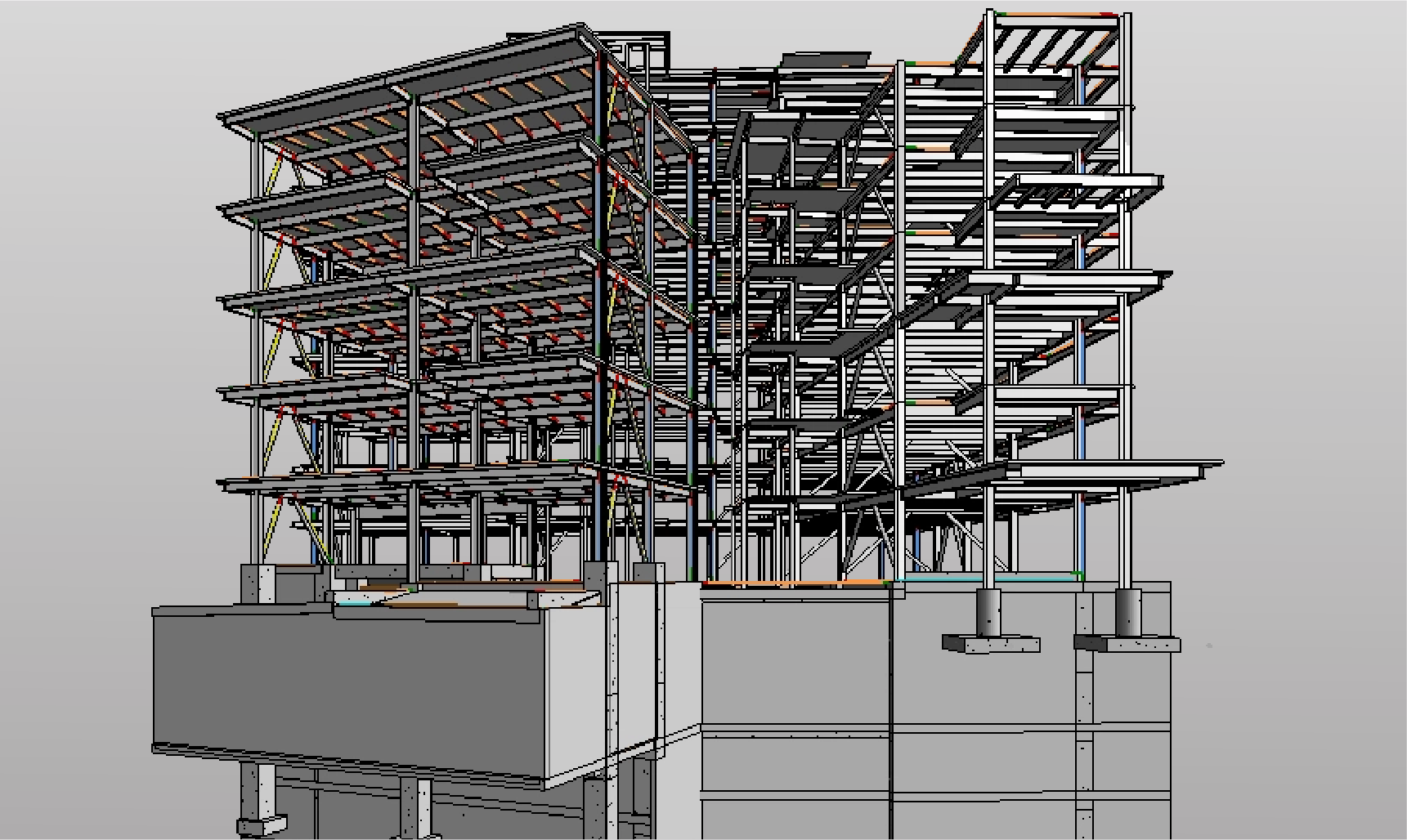
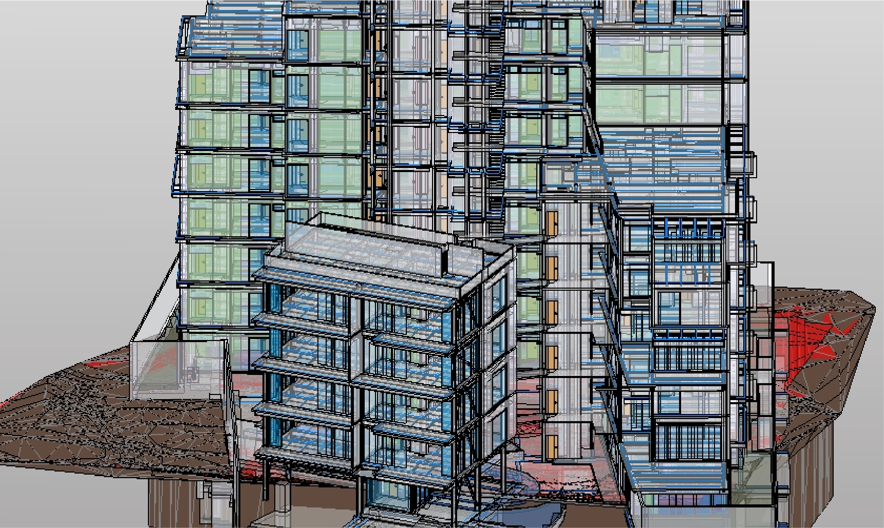
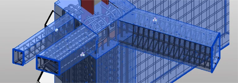
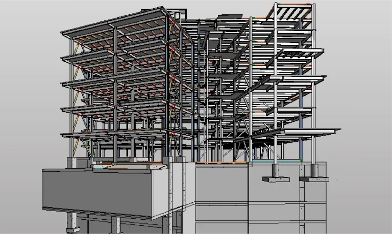
From the point cloud, a detailed BIM model was created for facility management (FM), integrating key information for the monitoring, maintenance, and efficient operation of the systems, equipment, and spaces within the residential development.
Technical coordination and construction supervision were carried out for a residential development project, implementing the BIM methodology and complementing it with reality capture services through terrestrial laser scanning and aerial photography. These technologies provided accurate documentation and advanced tools for comprehensive project management, optimizing planning, execution, and control.
REALITY CAPTURE
Terrestrial Laser Scanning
The terrestrial laser scanning captured millions of points with high precision, generating a point cloud that documented the architectural and structural features of the houses under development. This reliable data facilitated technical analysis and integration into digital models for more efficient coordination during construction.
DIGITAL MODELS
BIM (Building Information Modeling)
From the point cloud, a detailed BIM model was created for facility management (FM), integrating key information for the monitoring, maintenance, and efficient operation of the systems, equipment, and spaces within the residential development.