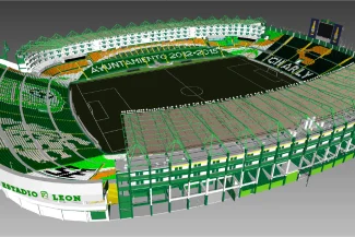
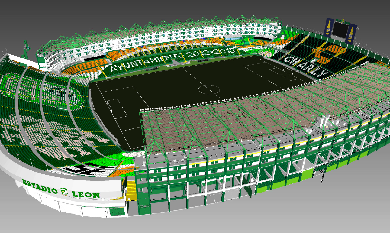
Reality Capture was conducted using terrestrial laser scanning to document the existing conditions of the football stadium. This information was complemented by aerial photography and orthophoto generation, providing comprehensive documentation of the facility. Based on this data, detailed BIM models were developed to support renovations and remodeling with precise and up-to-date information.
Client:
Grupo
Pachuca
Location:
León,
México
Year:
2019
REALITY CAPTURE
DIGITAL PHOTOGRAPHY
DIGITAL MODELS
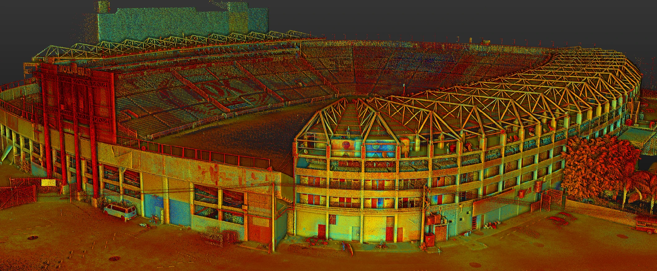
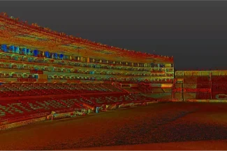
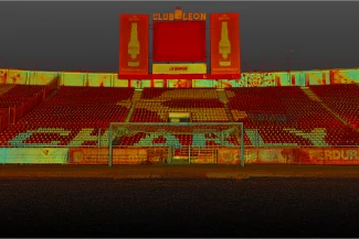
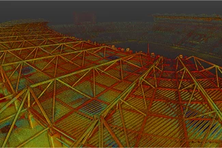
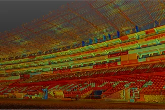
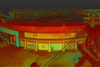
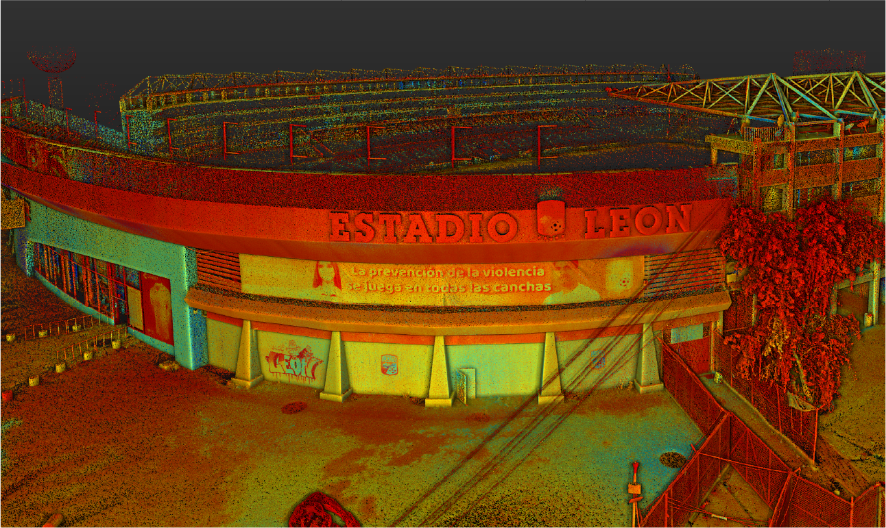
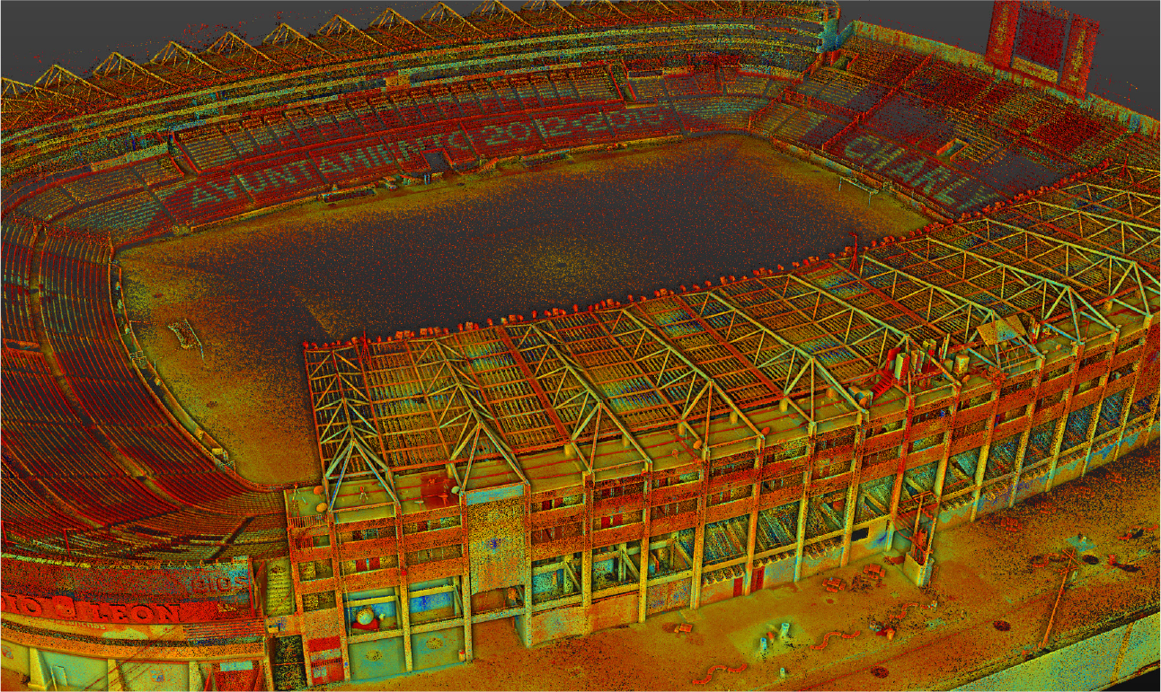
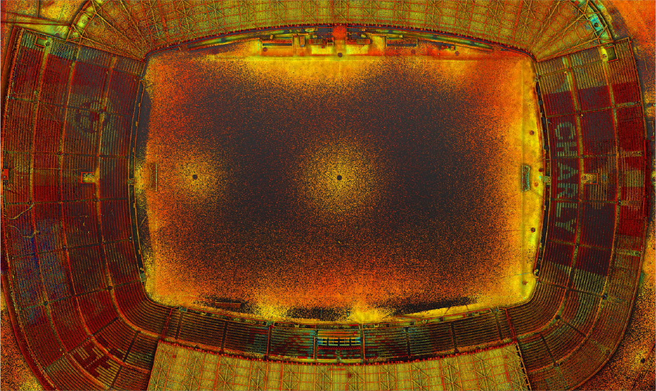
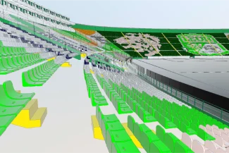
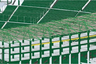
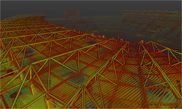
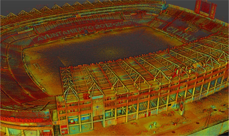
terrestrial laser scan
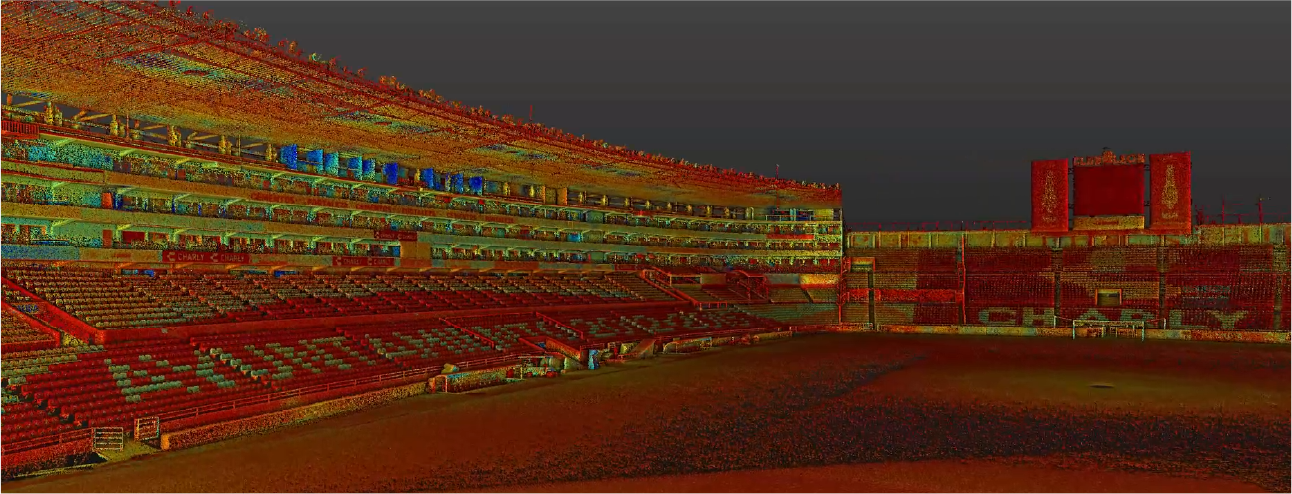
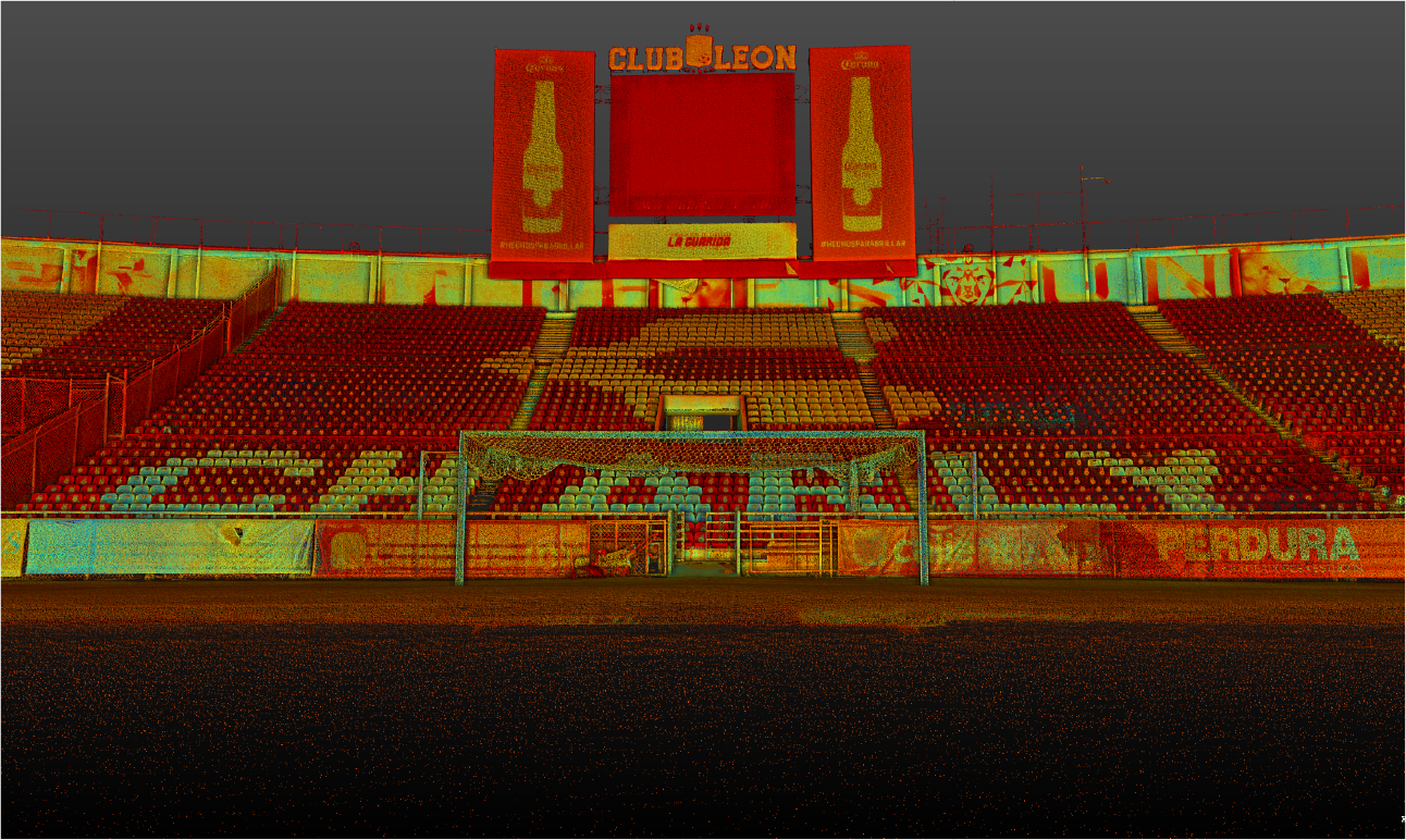
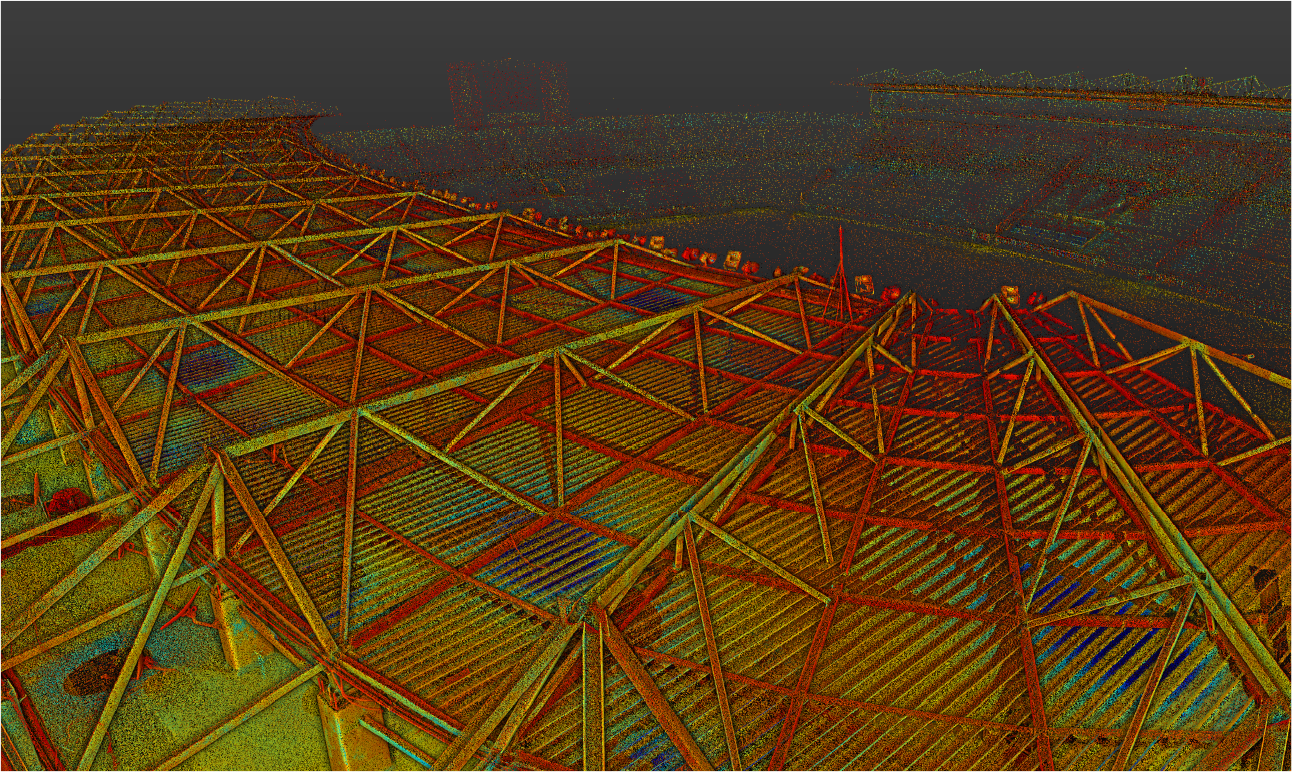
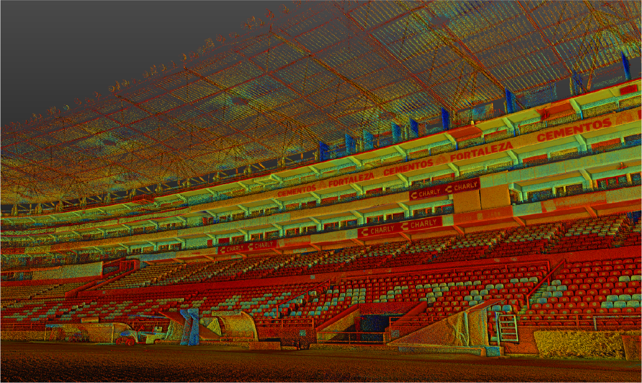
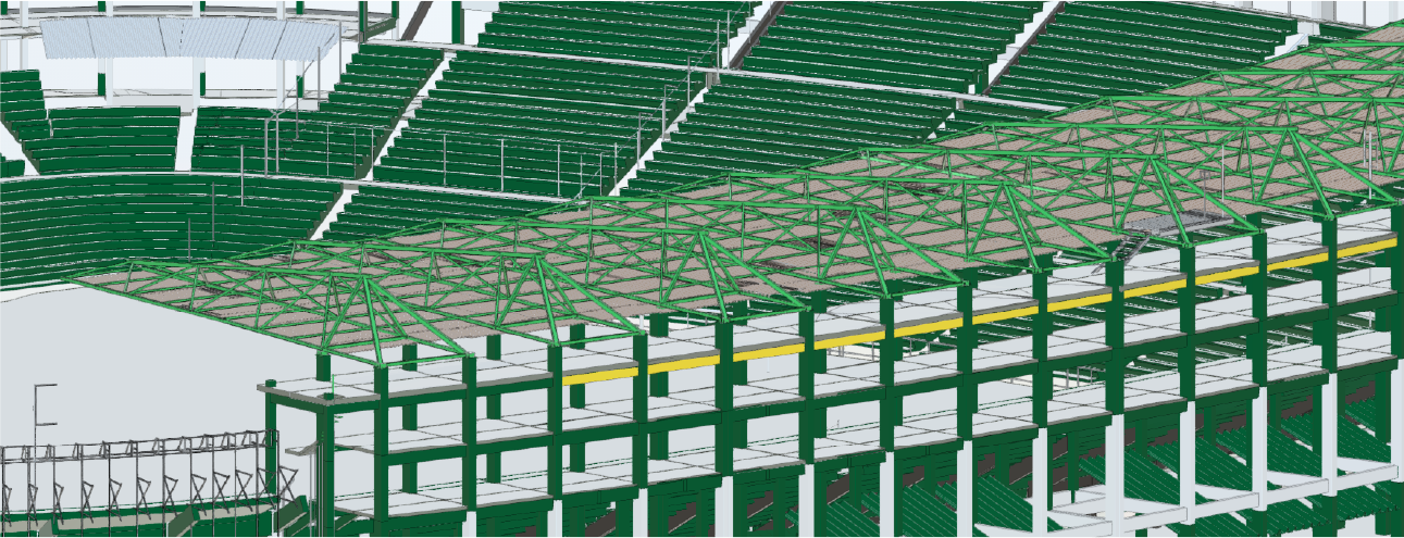
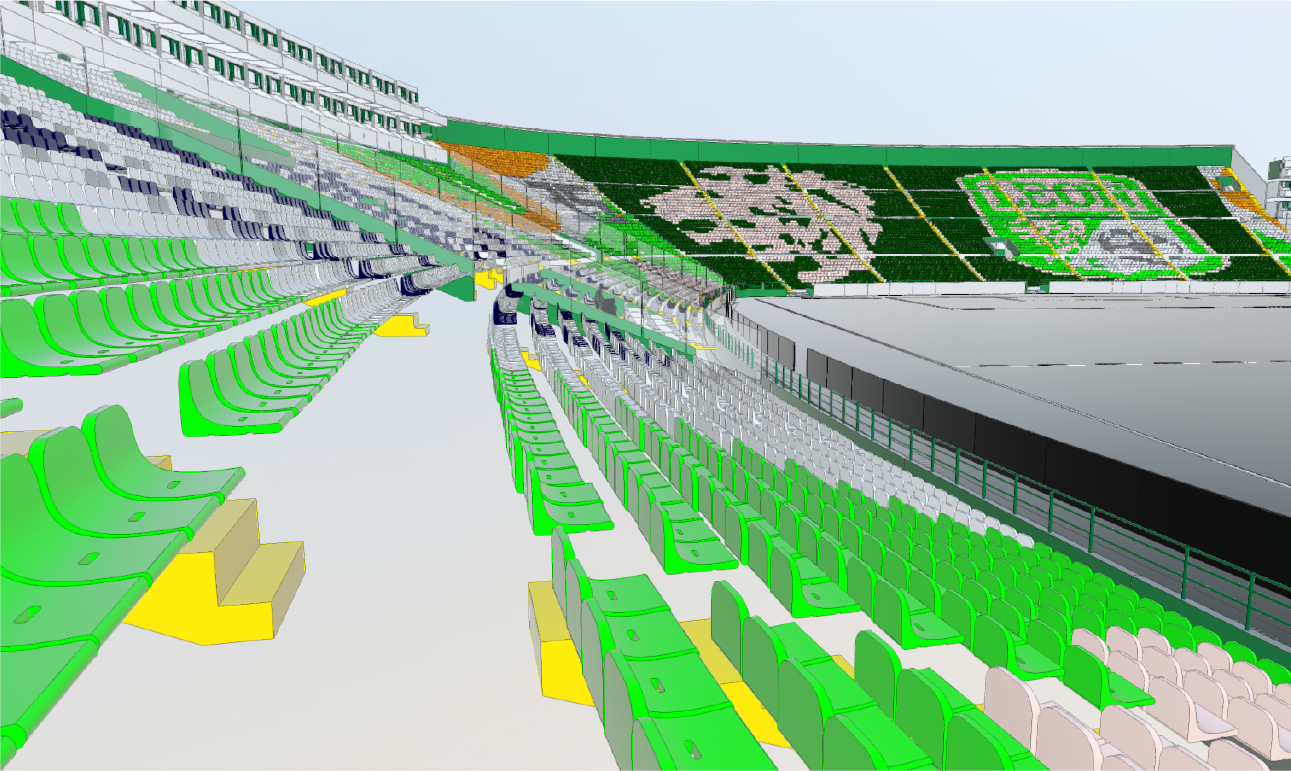
The terrestrial laser scan captured millions of points with high accuracy, documenting the architectural and structural features of the stadium. With 997 scan stations, complete and detailed coverage was ensured, serving as the foundation for developing highly accurate 3D models of the facility.
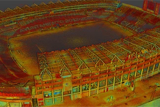
Photogrammetry
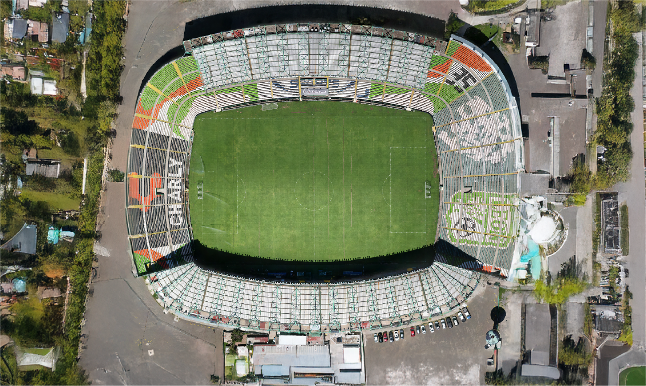
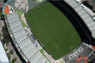
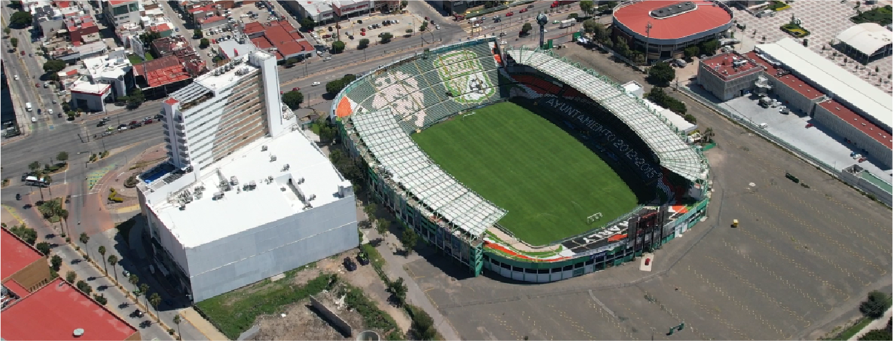
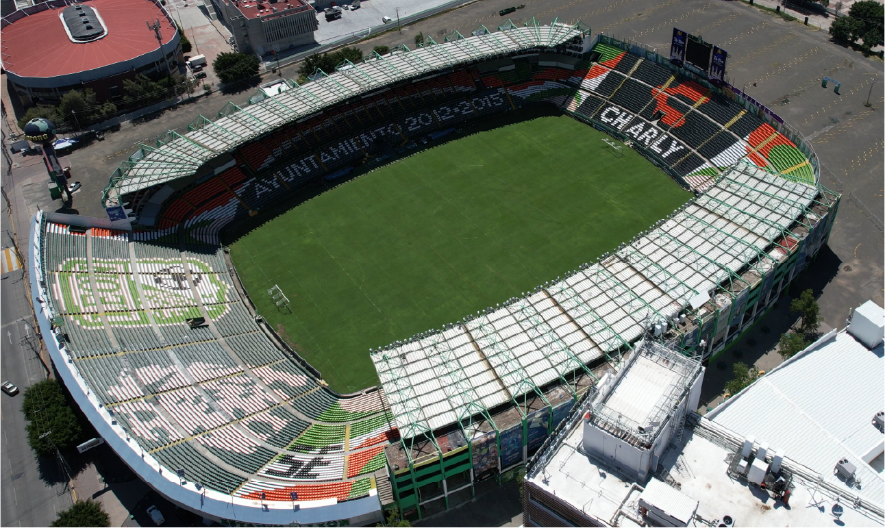
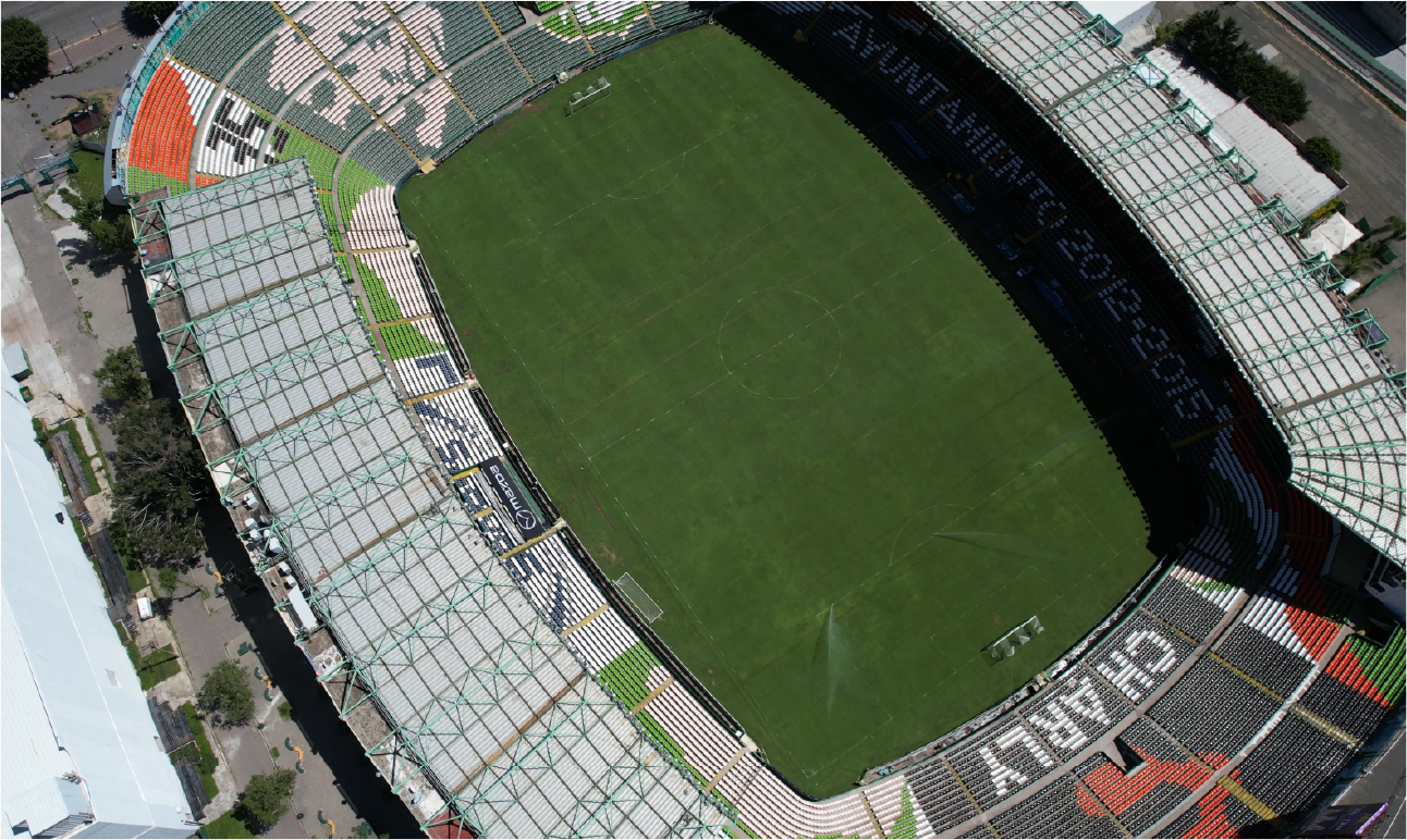
Orthophotos were generated from drone-captured images, providing high-precision, georeferenced representations of the stadium. These orthophotos facilitated the evaluation of key areas, serving as an additional tool for efficiently planning renovations.
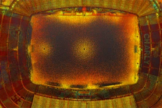
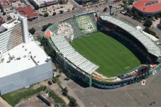
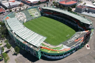
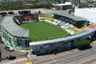
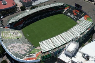
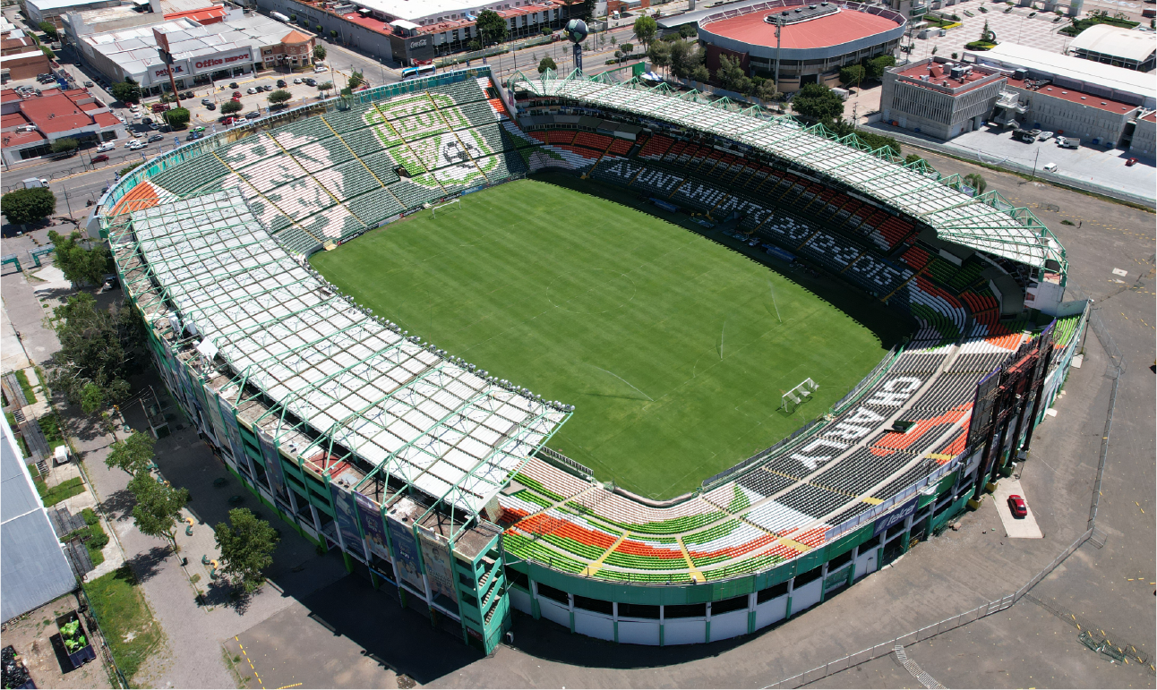
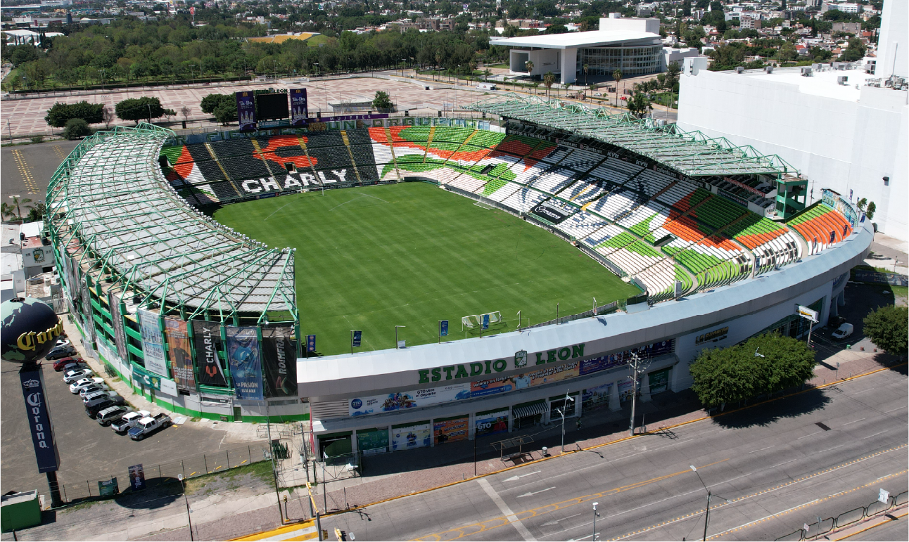
AERIAL PHOTOGRAPHY
Drones equipped with high-resolution cameras captured detailed aerial images of the stadium. These photographs provided a comprehensive view of the infrastructure and its surroundings, enabling visual analysis and complementing the laser scan data.
BIM
(Building
Information
Modeling)
With the data obtained from the laser scanning and aerial photography, detailed BIM models were developed, integrating all relevant stadium information. These models were designed to help the client plan and execute renovations and remodeling with precision, optimizing cross-disciplinary coordination and ensuring efficient project management.
Reality Capture was conducted using terrestrial laser scanning to document the existing conditions of the football stadium. This information was complemented by aerial photography and orthophoto generation, providing comprehensive documentation of the facility. Based on this data, detailed BIM models were developed to support renovations and remodeling with precise and up-to-date information.
REALITY CAPTURE
Terrestrial Laser Scan
The terrestrial laser scan captured millions of points with high accuracy, documenting the architectural and structural features of the stadium. With 997 scan stations, complete and detailed coverage was ensured, serving as the foundation for developing highly accurate 3D models of the facility.
DIGITAL PHOTOGRAPHY
Photogrammetry
Orthophotos were generated from drone-captured images, providing high-precision, georeferenced representations of the stadium. These orthophotos facilitated the evaluation of key areas, serving as an additional tool for efficiently planning renovations.
DIGITAL PHOTOGRAPHY
Aereal Photografhy
Drones equipped with high-resolution cameras captured detailed aerial images of the stadium. These photographs provided a comprehensive view of the infrastructure and its surroundings, enabling visual analysis and complementing the laser scan data.
DIGITAL MODELS
BIM (Building Information Modeling)
With the data obtained from the laser scanning and aerial photography, detailed BIM models were developed, integrating all relevant stadium information. These models were designed to help the client plan and execute renovations and remodeling with precision, optimizing cross-disciplinary coordination and ensuring efficient project management.