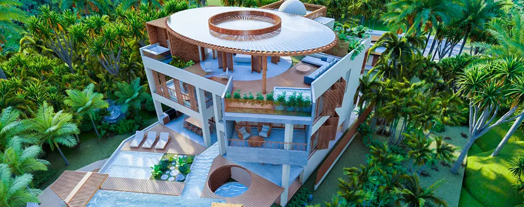
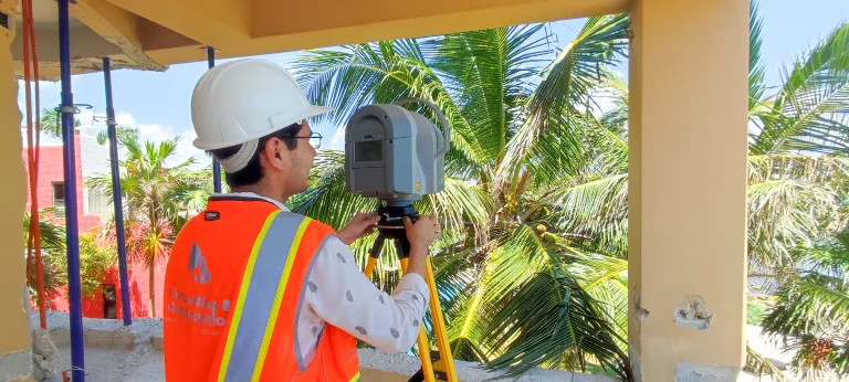
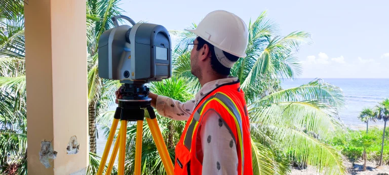
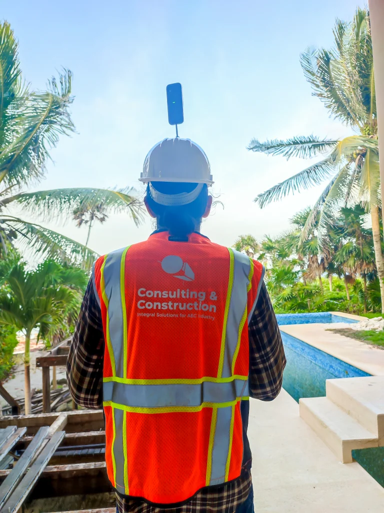
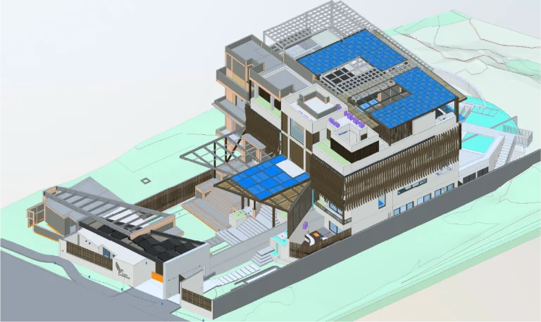
In the Casa Alebrijes project, focused on the property’s renovation, Reality Capture was employed through laser scanning, which enabled the creation of a BIM model and the execution of precise construction control.
In addition, this process was complemented with aerial photography to document the exterior areas and 360° walkthroughs to provide a detailed visual inspection of the interior spaces. As a result, these technologies delivered a comprehensive and up-to-date view of the construction, optimizing both the planning and the execution of the project.
Client:
Particular
Location:
Akumal,
México
Year:
2024
REALITY CAPTURE
PHOTOGRAPHY DIGITAL
DIGITAL MODELS
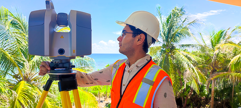
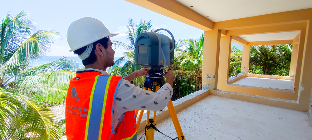
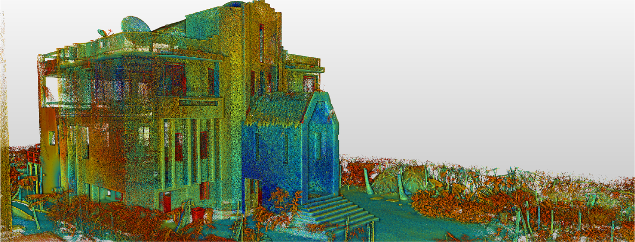
Laser scanning
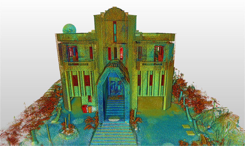
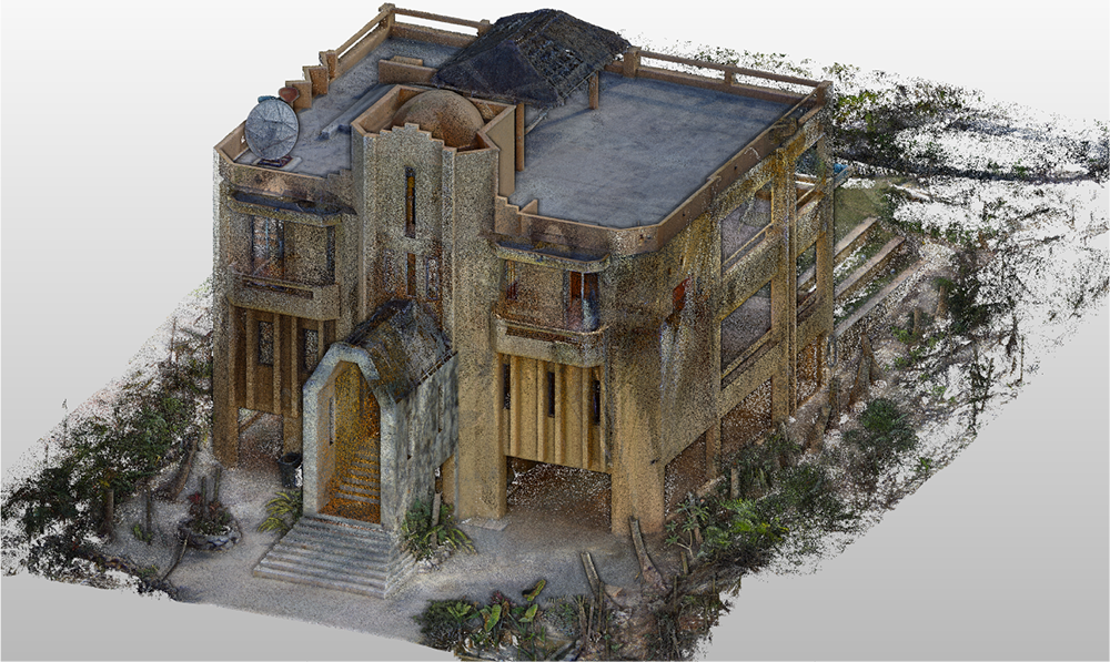
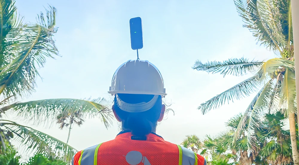
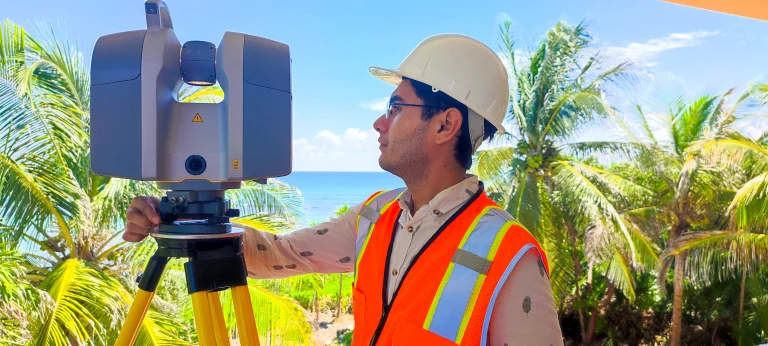
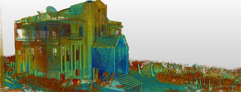
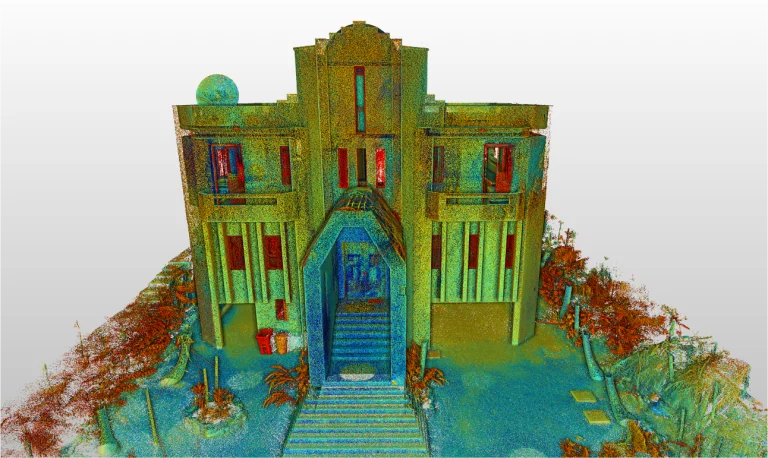
In this project, laser scanning was used to capture detailed data of the property’s existing conditions, generating a highly precise point cloud.
Subsequently, this information was used as the basis for the analysis of construction elements and the planning of necessary interventions. In this way, each stage of the renovation was ensured to be executed with accuracy and under greater quality control.
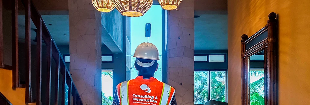
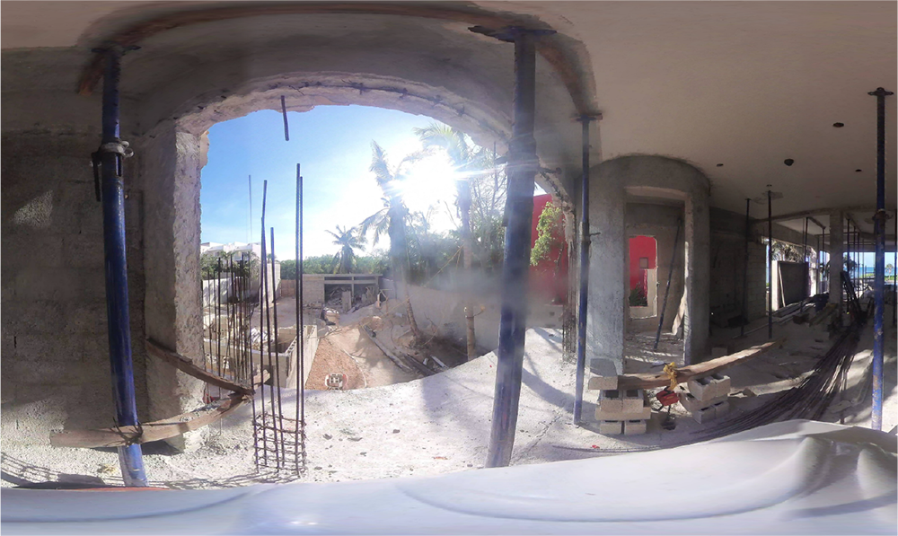
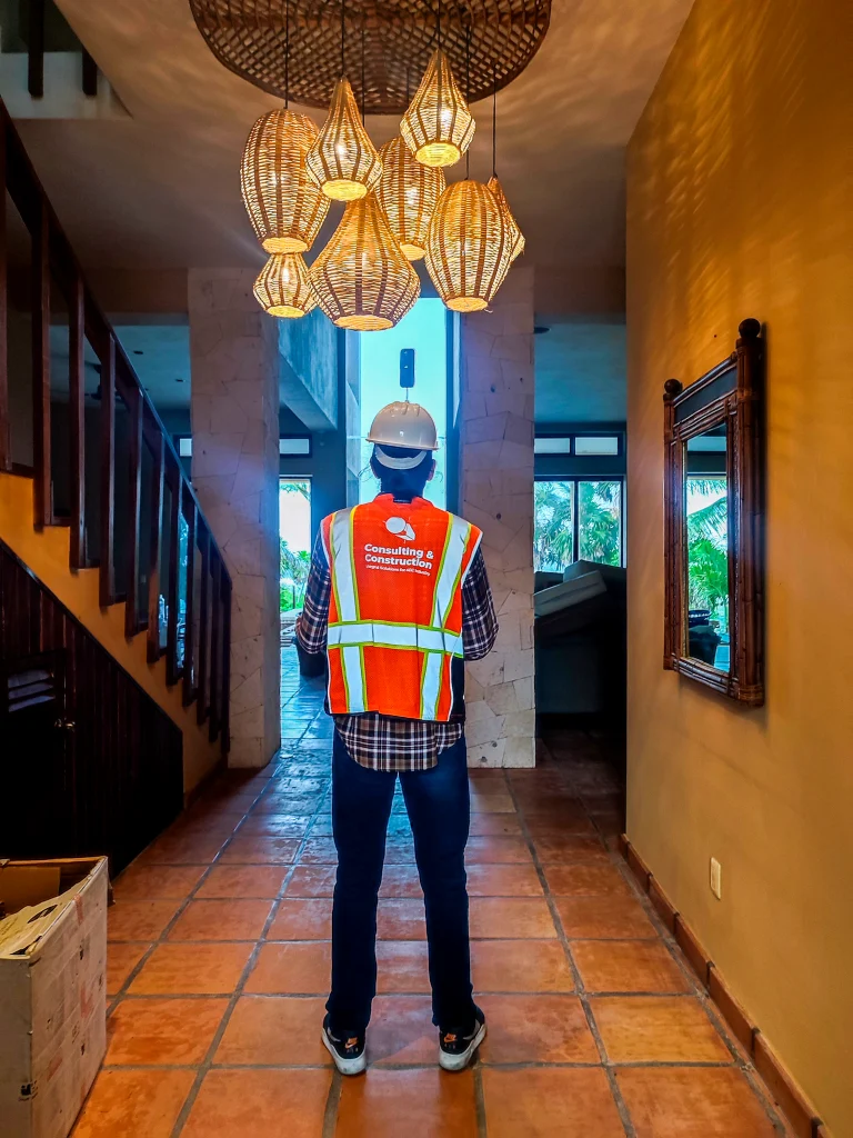
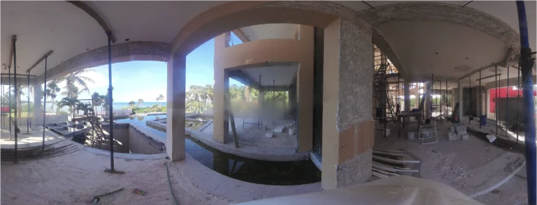
360 photography
In this project, 360° photography was carried out to visually document both the interiors and exteriors of the property, recording finishes, initial conditions, and the progress of the renovation.
Thanks to this material, it was possible to perform remote inspections and facilitate communication between the design and construction teams, ensuring comprehensive and continuous project supervision.
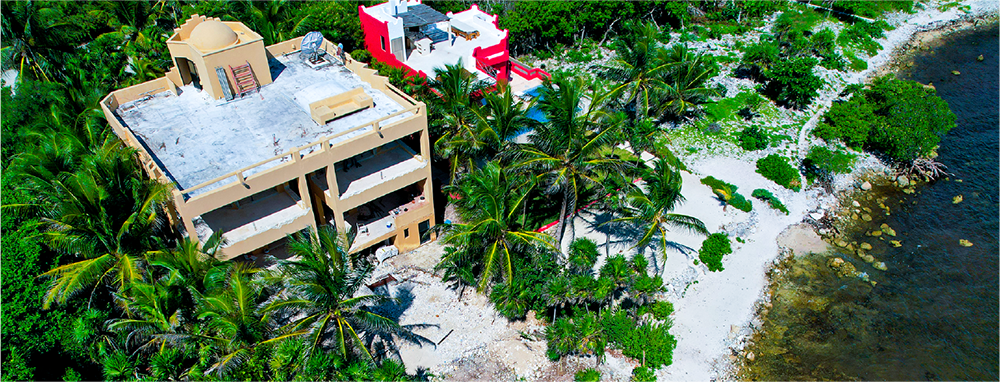
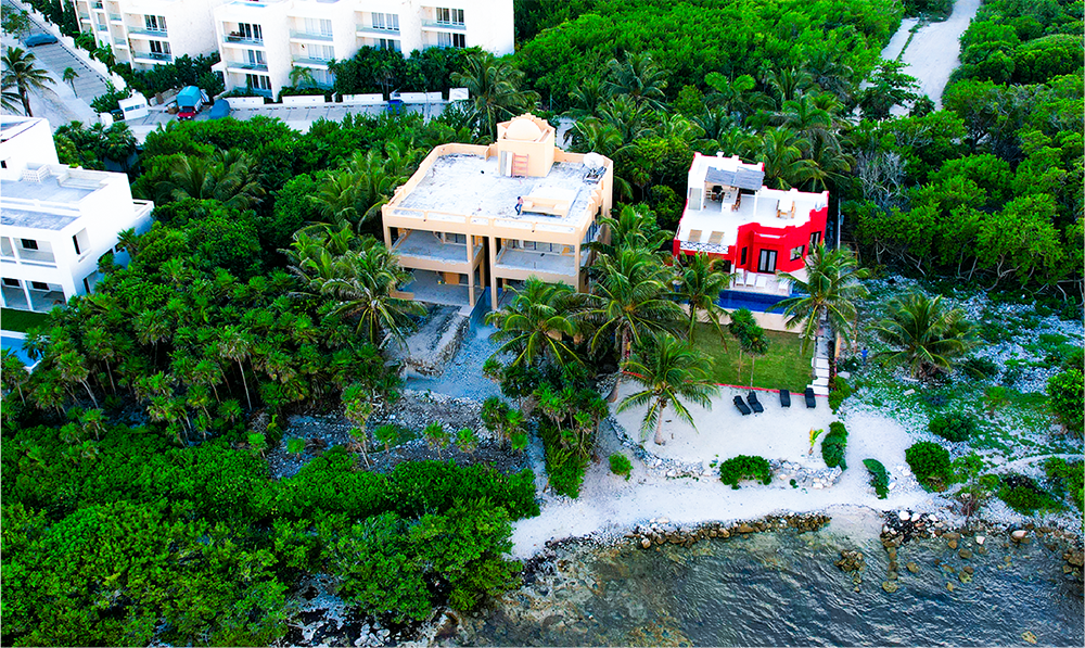
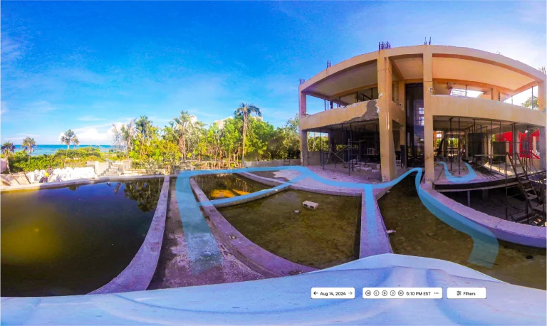
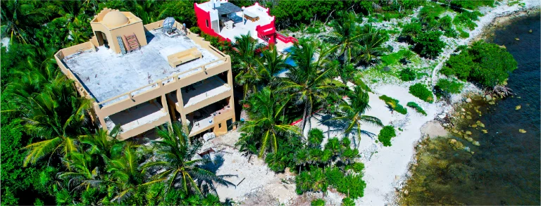
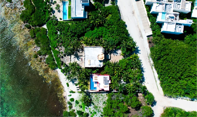
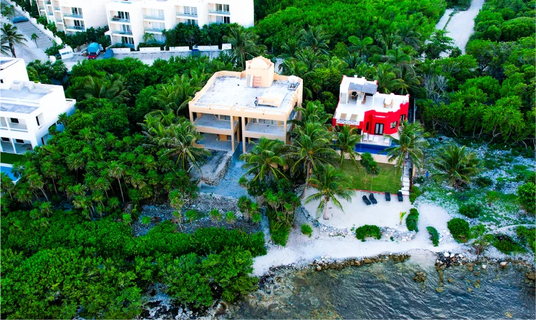
Aerial photography
In this case, aerial photography captured complete views of the exterior areas and the property’s surroundings, providing key information about land distribution, possible access points, and strategic locations for the movement of materials and machinery.
In addition, these images complemented the project analysis and facilitated site activity planning, ensuring better control of the construction process.
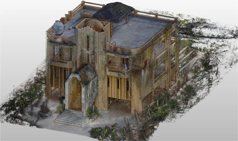
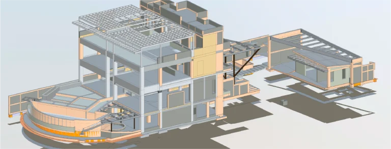
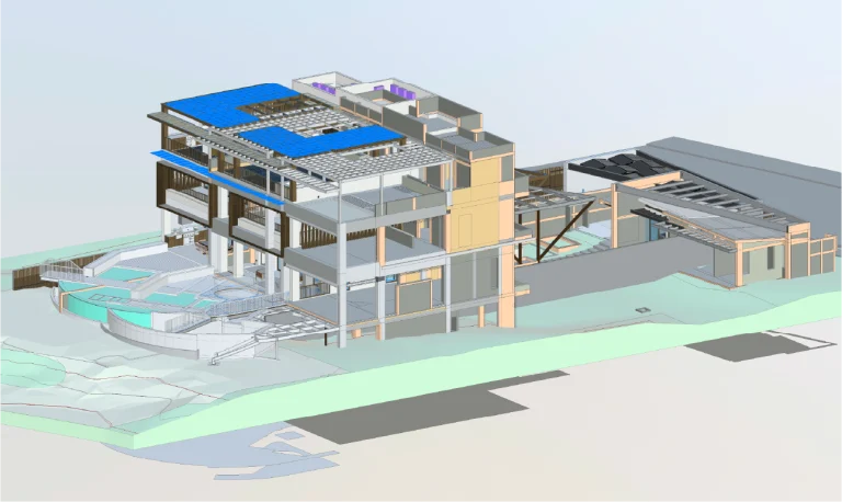
BIM
(Building
Information Modeling)
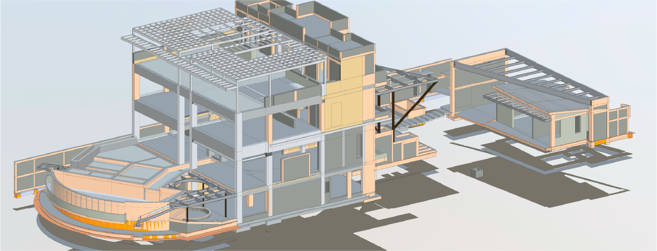
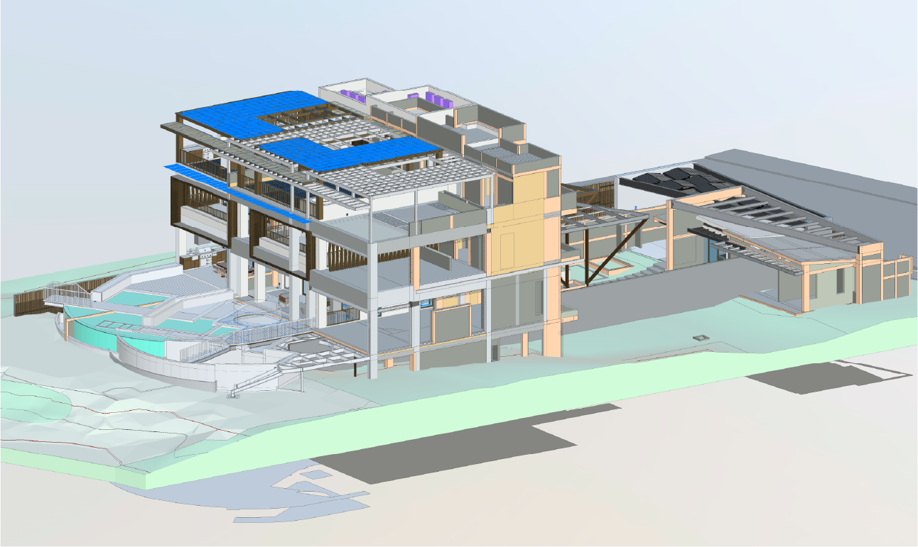
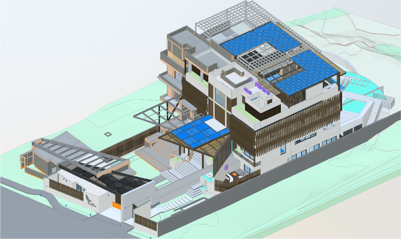
With the data obtained from the laser scan, the generation of a BIM model was proposed to integrate all relevant project information.
Thanks to this model, it was possible to coordinate the renovation work, optimize construction planning, and carry out detailed progress tracking, which enabled much more efficient management at every stage of the project.
In the Casa Alebrijes project, focused on the renovation of the property, Reality Capture using laser scanning was employed to generate a BIM model and ensure precise construction control. This process was complemented by aerial photography to document exterior areas and 360-degree walkthroughs for detailed visual supervision of interior spaces. These technologies provided a comprehensive and up-to-date view of the construction, optimising project planning and execution.
reality capture
Laser scanning
Laser scanning was used to capture detailed data on the property’s existing conditions, generating an accurate point cloud. This information served as the foundation for analysing structural elements and planning the necessary interventions, ensuring that each stage of the renovation was executed with precision.
digital photography
360 Photography
360-degree photography was carried out to visually document both the interior and exterior of the property, capturing finishes, initial conditions, and renovation progress. This material enabled remote inspections and facilitated communication between design and construction teams, ensuring comprehensive project supervision.
digital photography
Aerial Photography
Aerial photography captured complete views of the property’s exterior areas and surroundings, providing key information on land distribution, potential access points, and strategic locations for the movement of materials and machinery. These images complemented the project analysis and facilitated on-site activity planning.
digital models
BIM (Building Information Modeling)
Based on the laser scanning data, the creation of a BIM model was proposed to integrate all relevant project information. This model would serve to coordinate renovation work, optimise construction planning, and enable detailed progress tracking, ensuring more efficient project management.