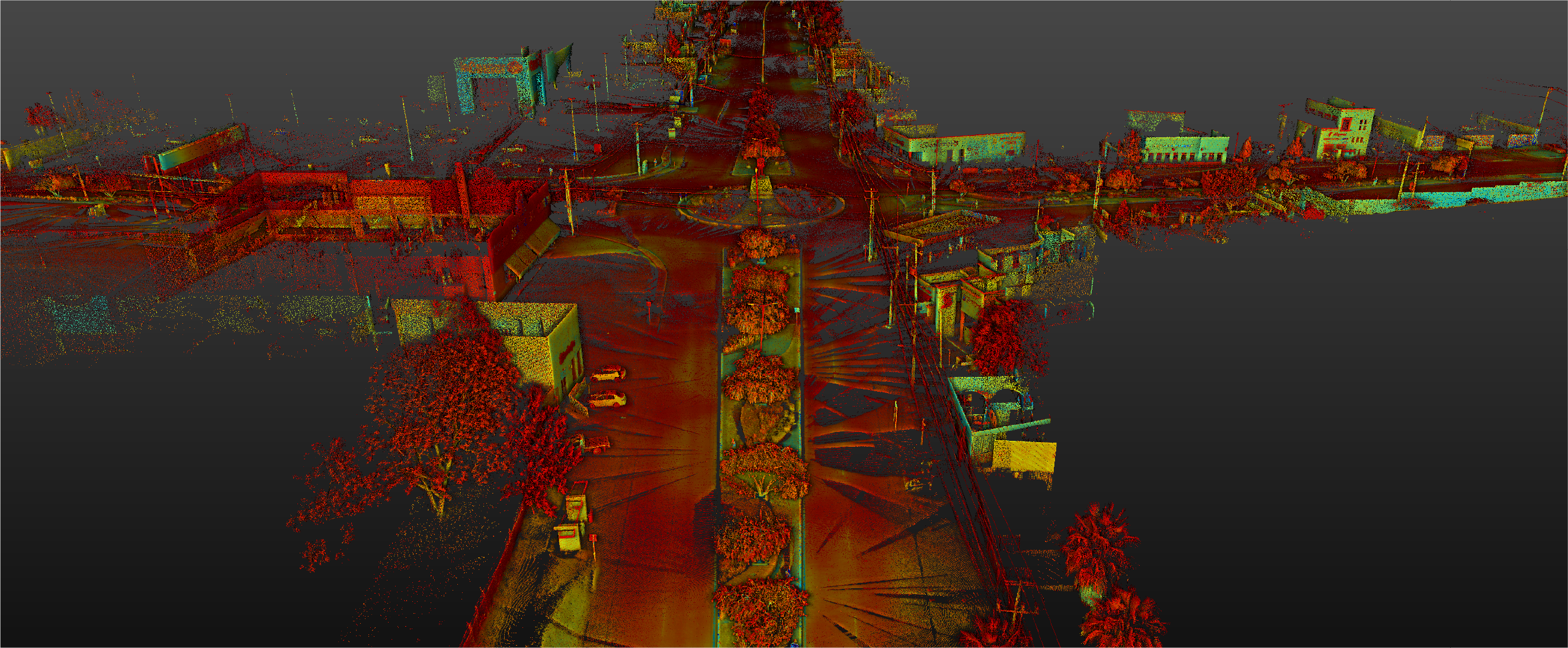
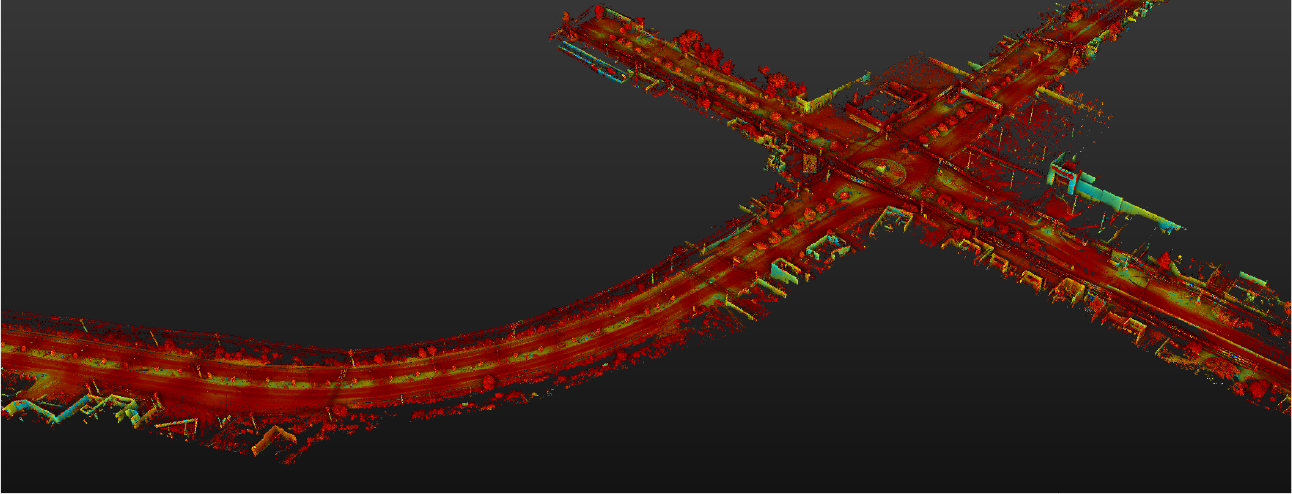
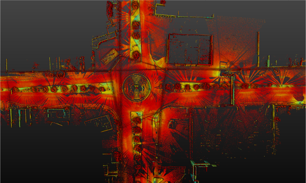
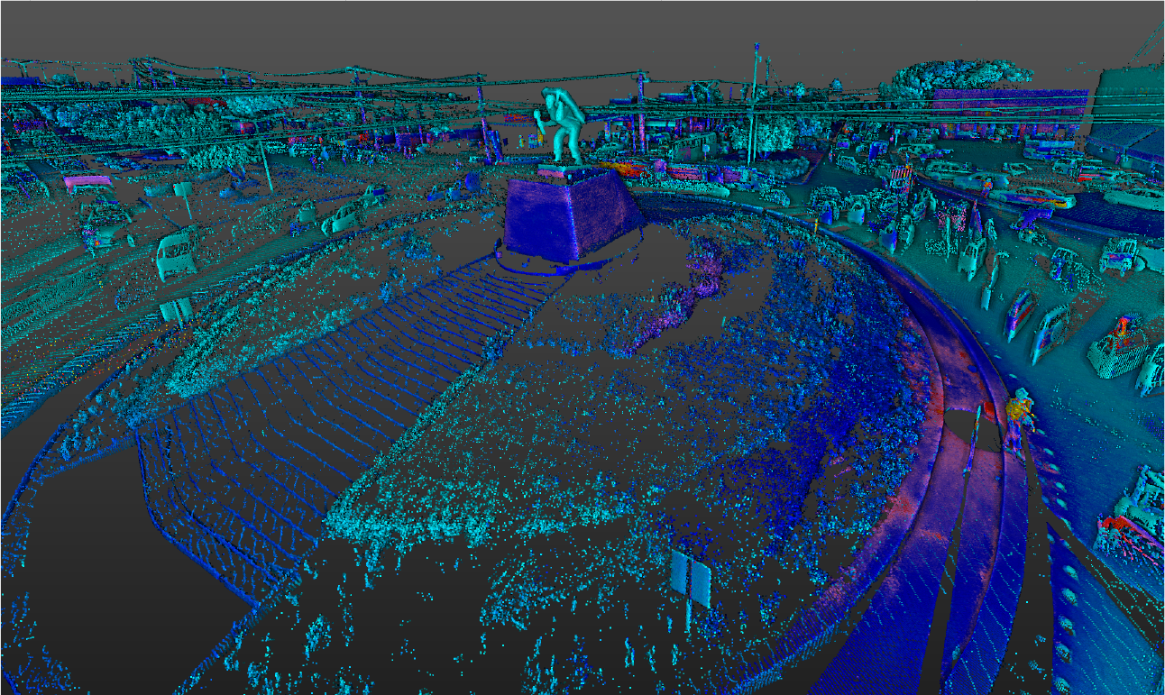
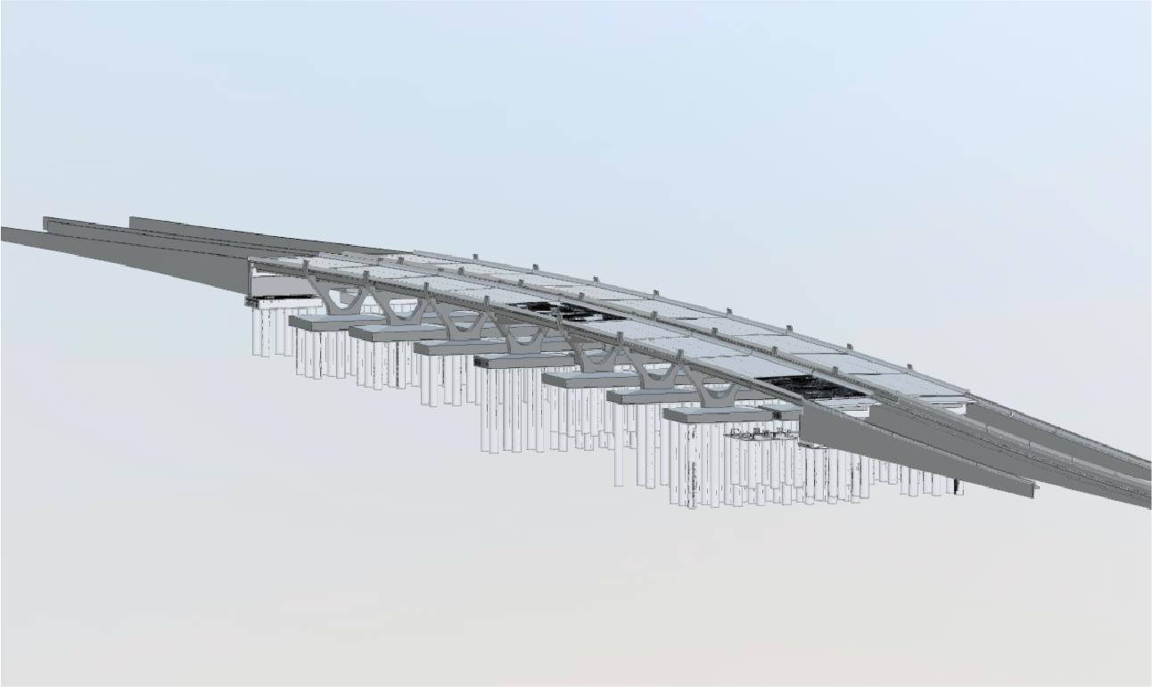
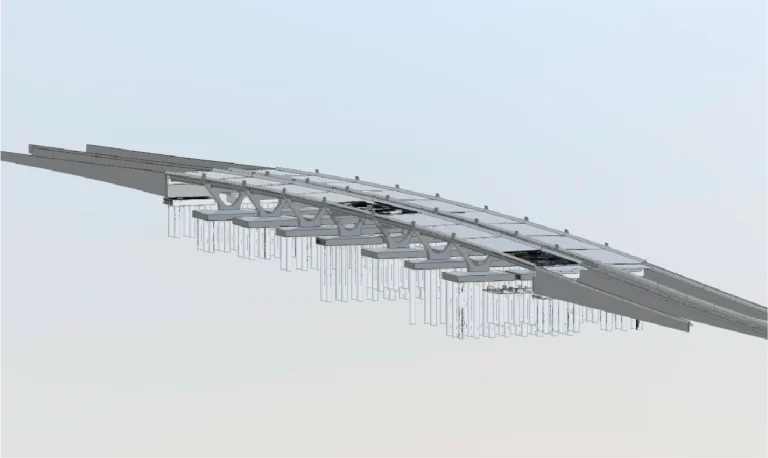
Reality Capture was carried out using laser scanning to accurately document the existing conditions of a bridge at a road intersection. The generated point cloud served as the foundation for developing a BIM model, enabling detailed planning and efficient management of the structure.
Client:
Grupo
CASS
Location:
Sam Miguel
de Allende,
México
Year:
2019
REALITY CAPTURE
DIGITAL MODELS
Terrestrial laser scanning
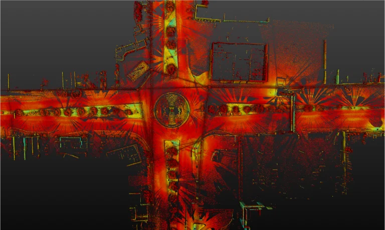
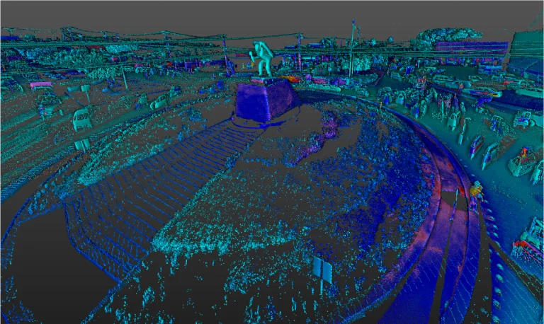
Terrestrial laser scanning captured detailed three-dimensional data of the bridge, generating a point cloud that reflected its dimensions and current characteristics. This information was essential for identifying structural conditions and providing a reliable basis for analysis and intervention design.
BIM
(Building
Information
Modeling)
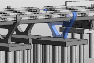
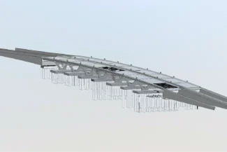
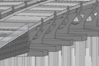
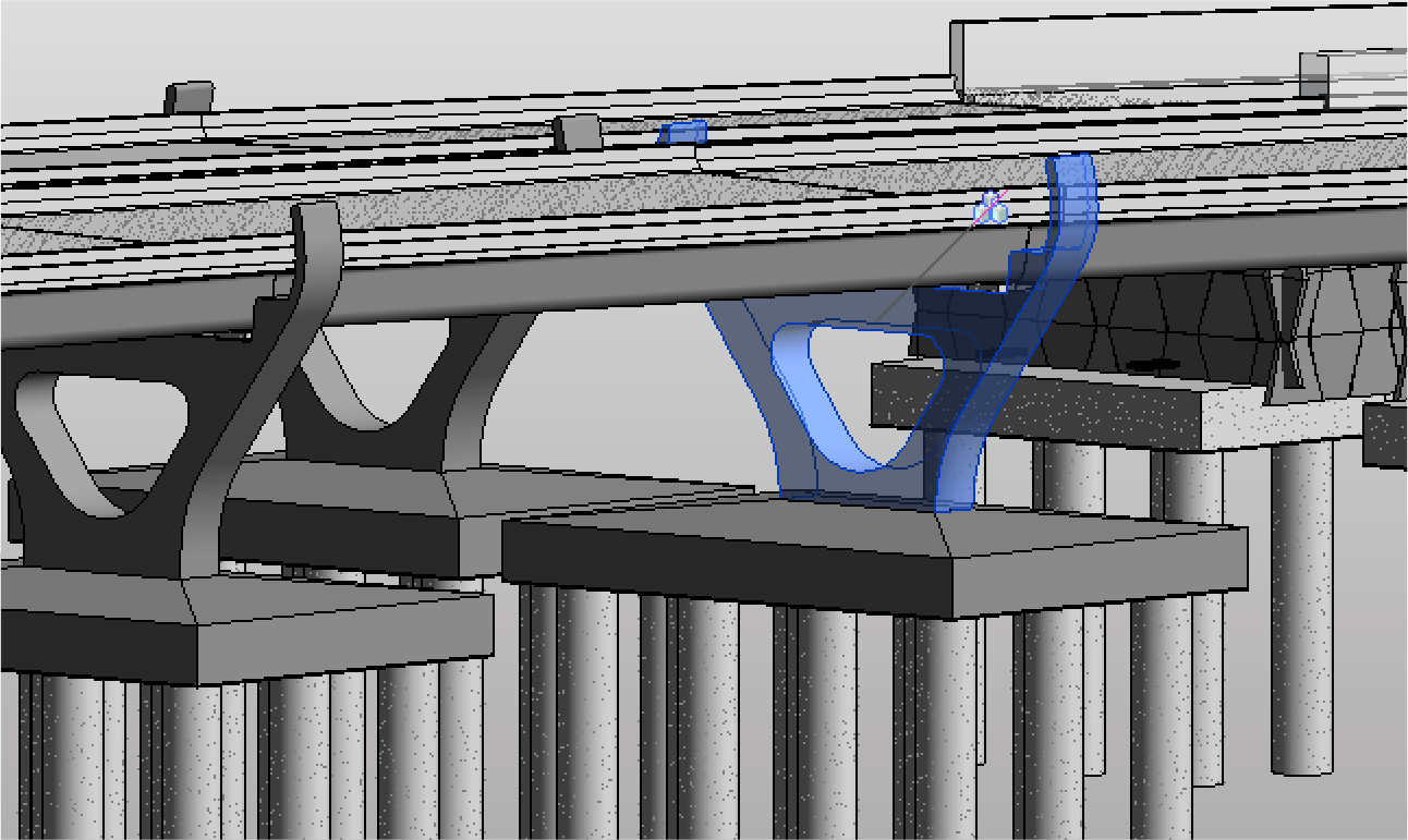
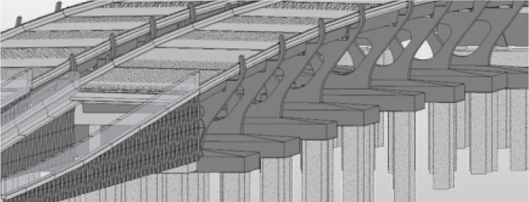
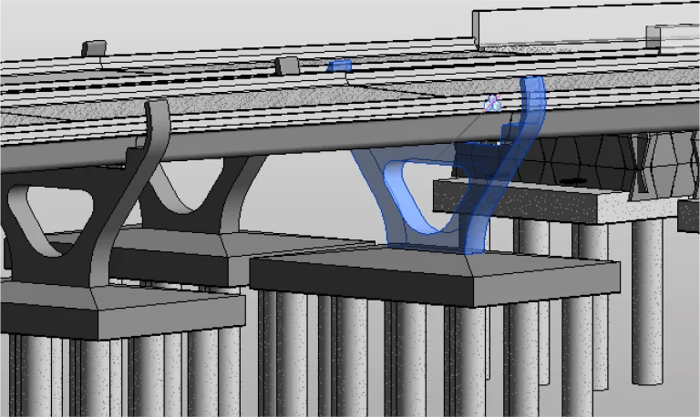
Based on the point cloud, a BIM model was developed, integrating all relevant information about the bridge. This model facilitated planning, analysis, and multidisciplinary coordination, ensuring efficient management and informed decision-making throughout the project stages.
Reality Capture was carried out using laser scanning to accurately document the existing conditions of a bridge at a road intersection. The generated point cloud served as the foundation for developing a BIM model, enabling detailed planning and efficient management of the structure.
REALITY CAPTURE
Terrestrial Laser Scanning
Terrestrial laser scanning captured detailed three-dimensional data of the bridge, generating a point cloud that reflected its dimensions and current characteristics. This information was essential for identifying structural conditions and providing a reliable basis for analysis and intervention design.
DIGITAL MODELS
BIM (Building Information Modeling)
Based on the point cloud, a BIM model was developed, integrating all relevant information about the bridge. This model facilitated planning, analysis, and multidisciplinary coordination, ensuring efficient management and informed decision-making throughout the project stages.