Inicio » Projects » Tecnológico de Monterrey – Guadalajara
Tecnológico de Monterrey – Guadalajara
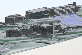
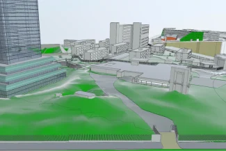
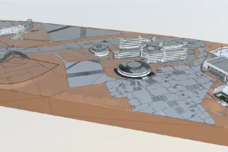
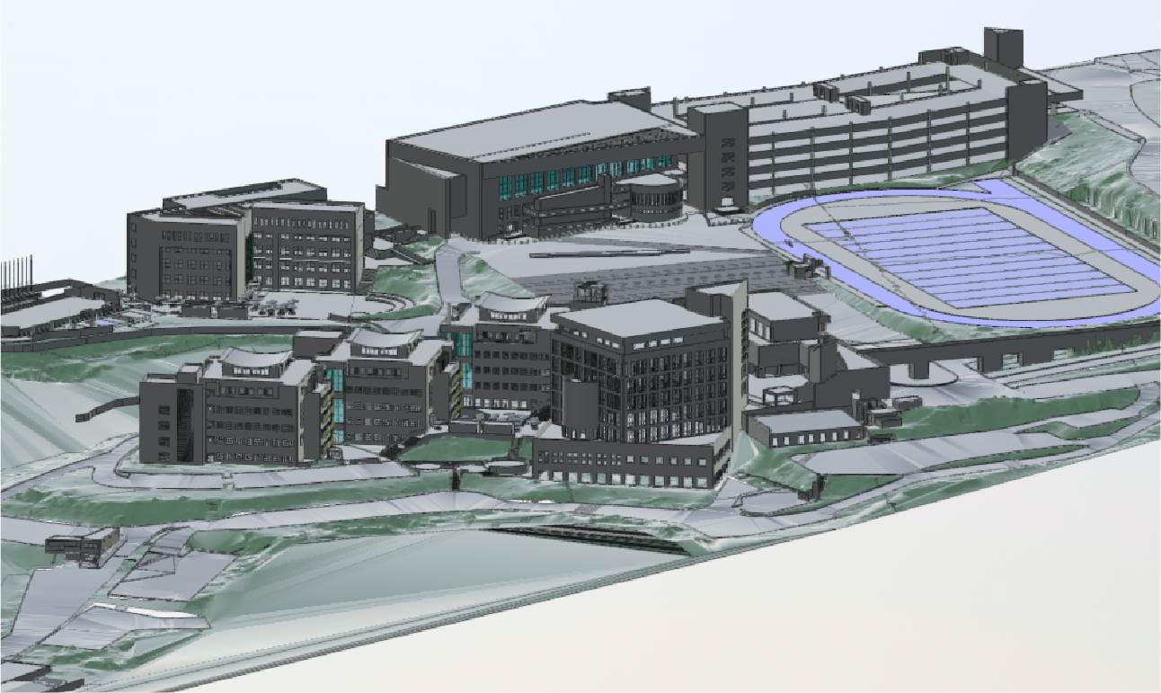
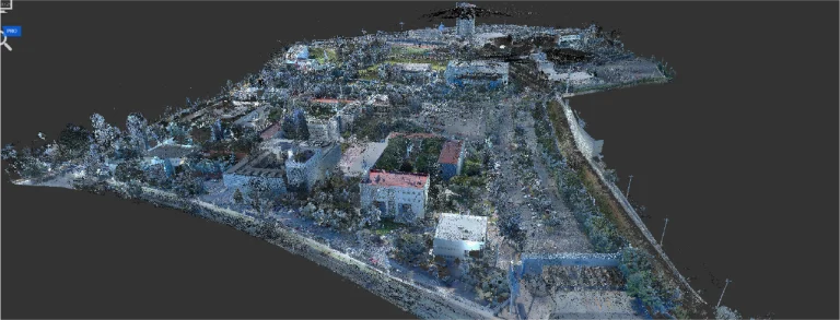
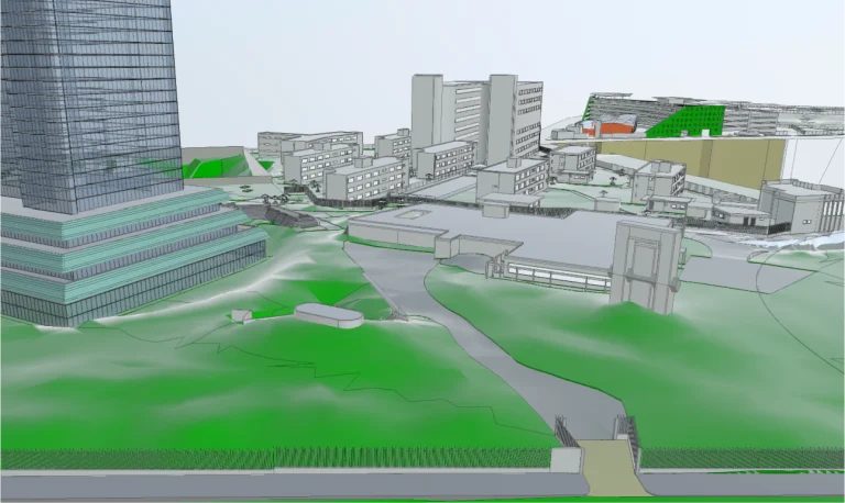
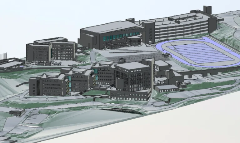
In the project for Tecnológico de Monterrey, Guadalajara campus, Reality Capture was conducted using point cloud surveys, accurately documenting the existing buildings and infrastructure of the campus. From this information, detailed BIM models were developed, integrating all the key characteristics of the spaces.
Client:
Tecnológico
de Monterrey
Guadalajara
Location:
Guadalajara,
México
Year:
2019
REALITY CAPTURE
DIGITAL MODELS
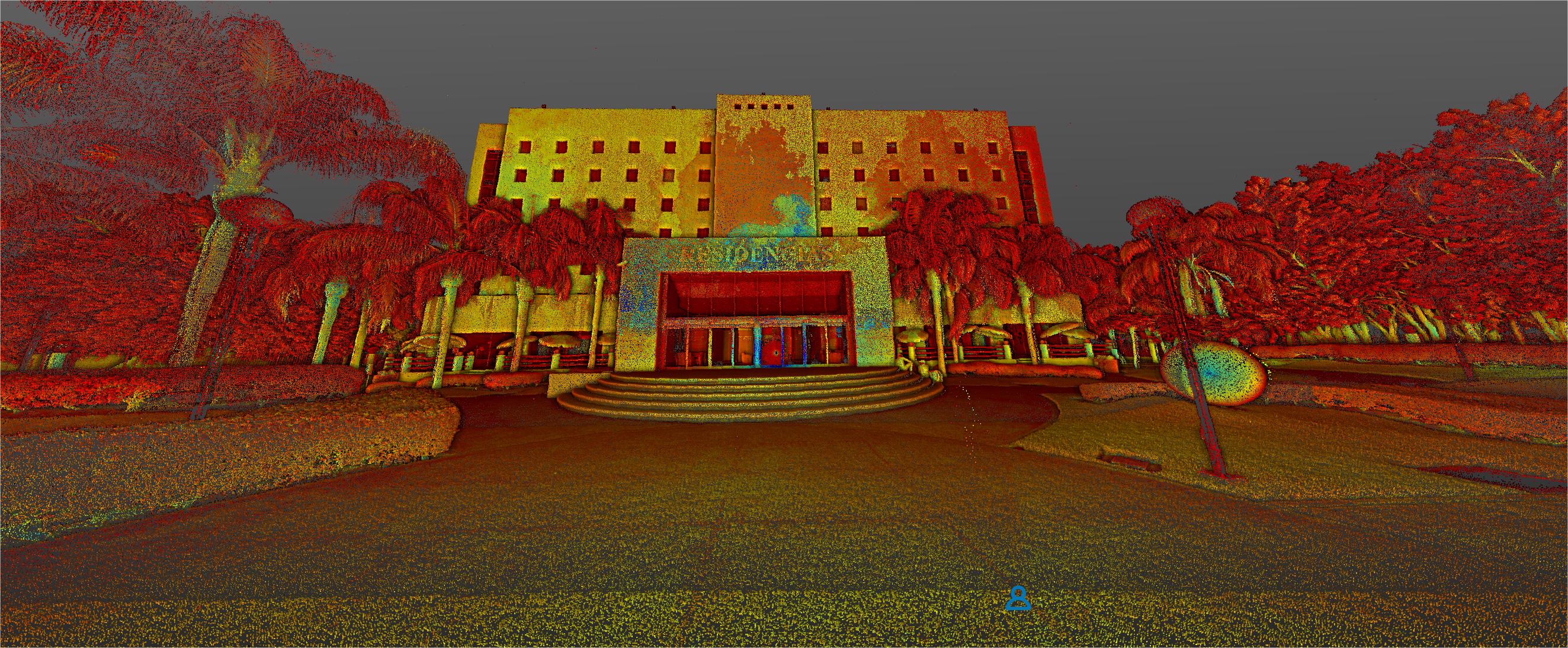
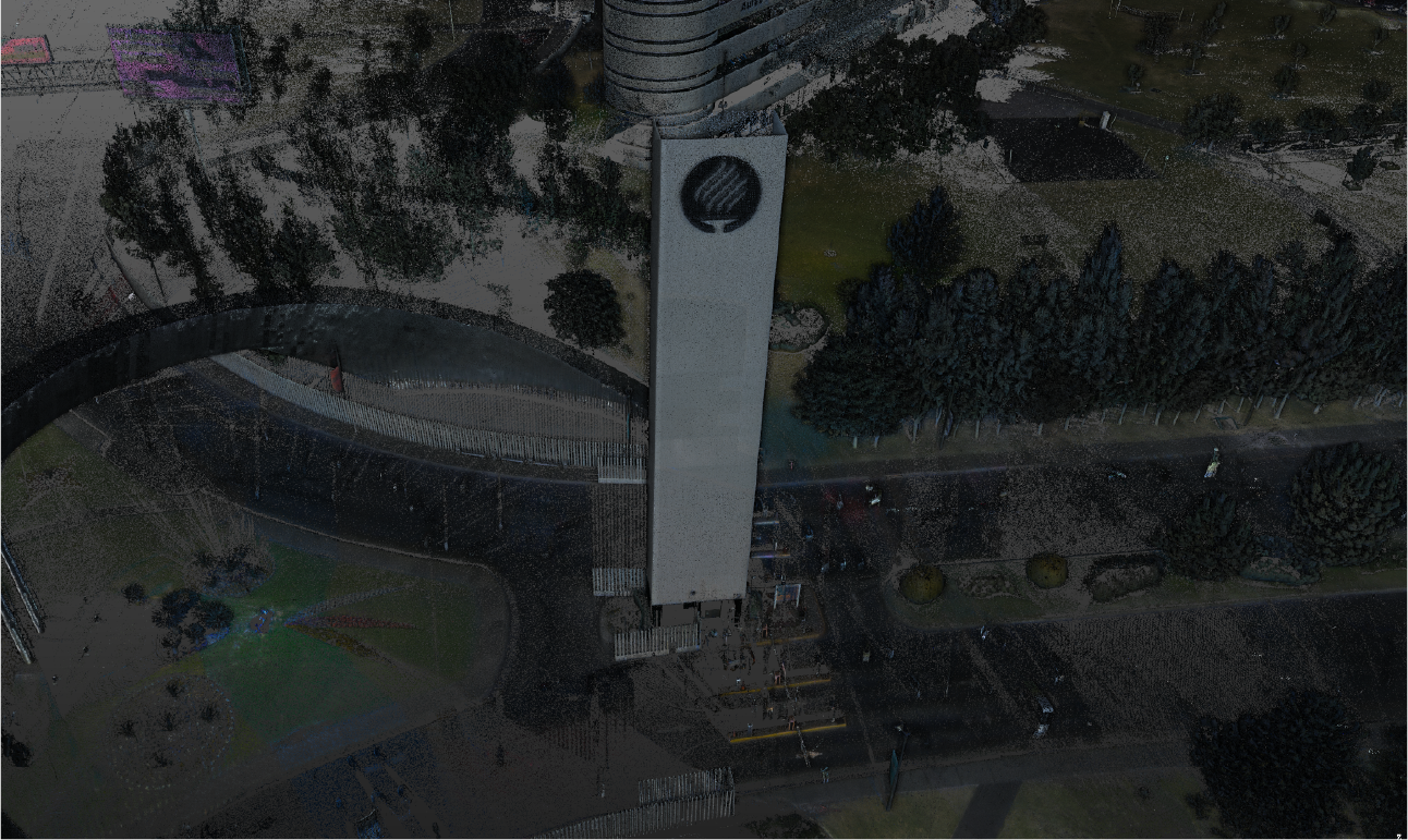
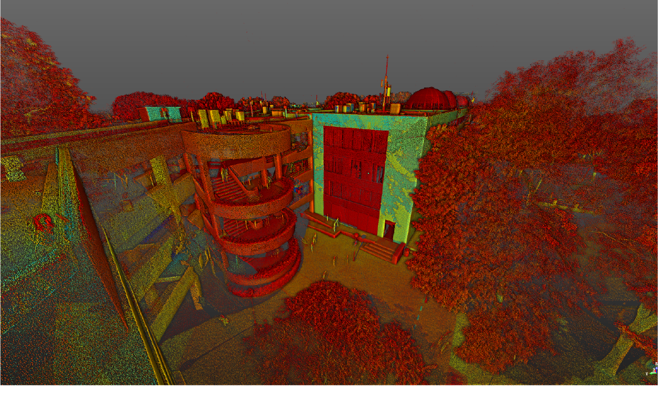
Terrestrial laser scanning
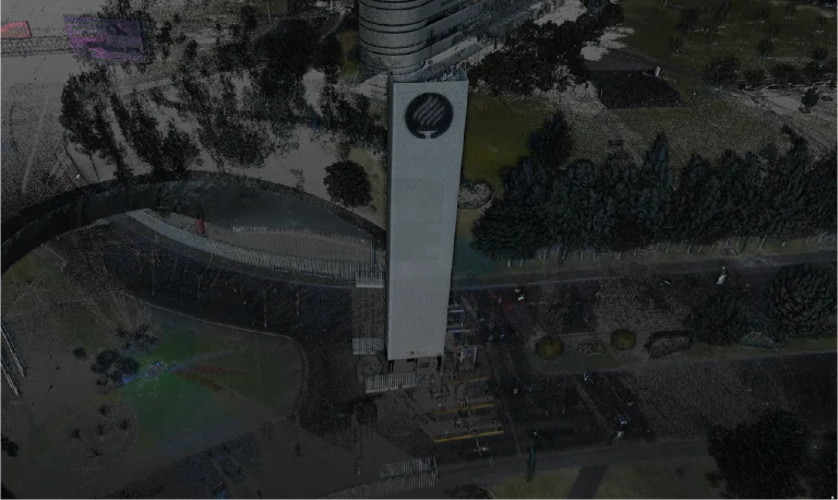
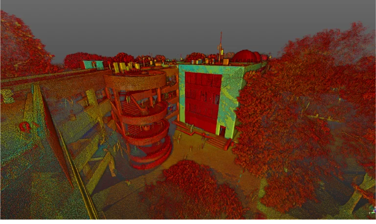
Terrestrial laser scanning was used to capture high-precision three-dimensional data, generating a detailed point cloud that documented the current conditions of the campus buildings and infrastructure. This process was essential for recording exact dimensions and key elements, ensuring a reliable representation of the existing spaces.
BIM (Building
Information
Modeling)
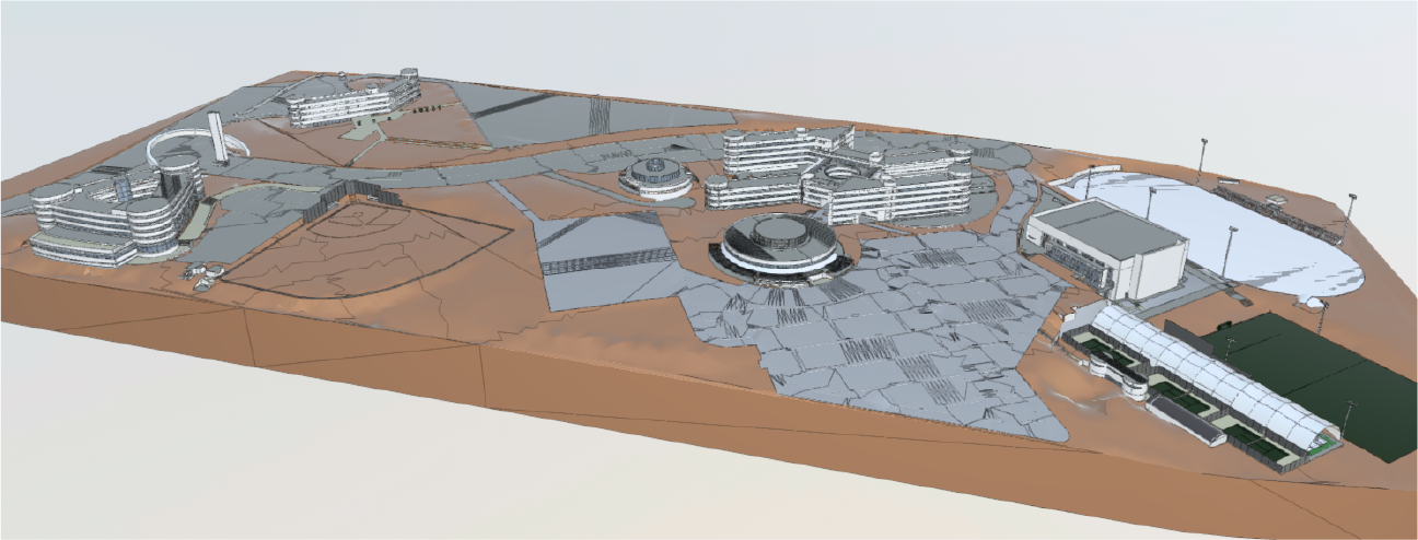
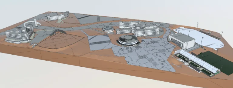
From the generated point cloud, BIM models were developed that integrated all relevant information about the buildings and infrastructure. These models facilitated project planning, inter-disciplinary coordination, and efficient resource management, optimising maintenance and the projection of future interventions on the campus.
In the project for Tecnológico de Monterrey, Guadalajara campus, Reality Capture was conducted using point cloud surveys, accurately documenting the existing buildings and infrastructure of the campus. From this information, detailed BIM models were developed, integrating all the key characteristics of the spaces.
REALITY CAPTURE
Terrestrial Laser Scanning
Terrestrial laser scanning was used to capture high-precision three-dimensional data, generating a detailed point cloud that documented the current conditions of the campus buildings and infrastructure. This process was essential for recording exact dimensions and key elements, ensuring a reliable representation of the existing spaces.
DIGITAL MODELS
BIM
(Building Information Modeling)
From the generated point cloud, BIM models were developed that integrated all relevant information about the buildings and infrastructure. These models facilitated project planning, inter-disciplinary coordination, and efficient resource management, optimising maintenance and the projection of future interventions on the campus.